
Three Sisters Loop – 9.1 9.2
November 1, 2024 § Leave a comment
The first part of this story went on a wee bit longer than I felt could be covered for a 5 day trip. I left off where we had blundered our way into a shortened day camping in a burn-out along Soap creek. I may have missed that we were the first ones to throw stakes into the soil, but as we the evening wore, others moved into the area as well, so there was quite the little community there by the time the sun set.
Will and I put our heads together, and using my paper map, and his online map, which basically looked like the same map, using the mileage between marked points, we were able to determine that it was 9.8 miles to Matthieu Lake, which was high up and right along the Pacific Crest Trail (PCT). We both felt that if we got up and didn’t dawdle, we could make the lake by noon, where we would take a nice long break, and then we would shoot for a water camp somewhere on the West side.
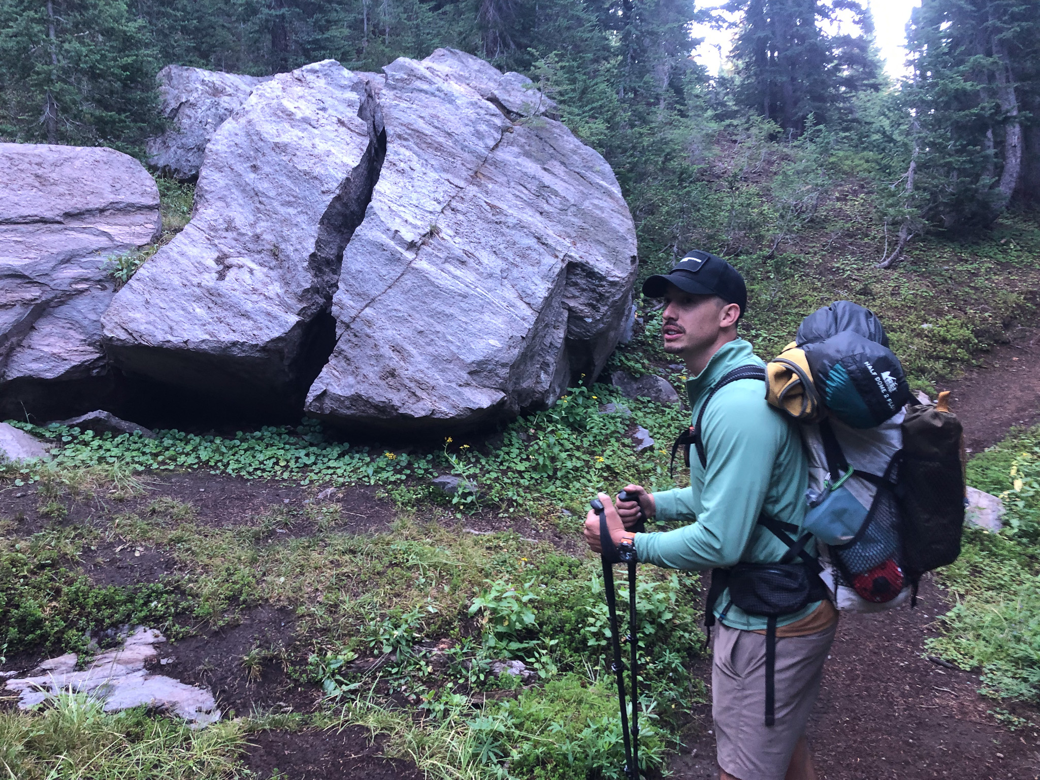
You’ll know that from my previous posts that my morning routine, once I decide to actually get up, is to immediately stuff my sleeping bag, deflate my mattress and stuff that, as well as to pretty much empty, empty out my tent so all that is needed there is the break-down. This morning was no different, and I was sitting in my chair, boiling water when I finally heard Will stir. He could hear me, but I didn’t rush him. As was the case our first morning out, Will’s first thought was “Coffee”, and that drove him out of his tent. He may have noticed that most of my stuff was already together, and I think that had a huge influence on him the next day, but he made some coffee, ate some breakfast, and packed up quickly and we hit the trail by 8:30 in the am at the latest. The other campers were up and about, and I don’t think we were the first to leave, but we certainly weren’t the last.
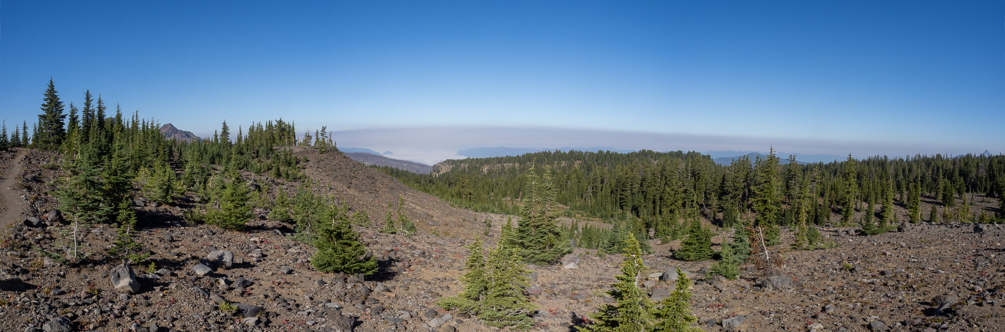
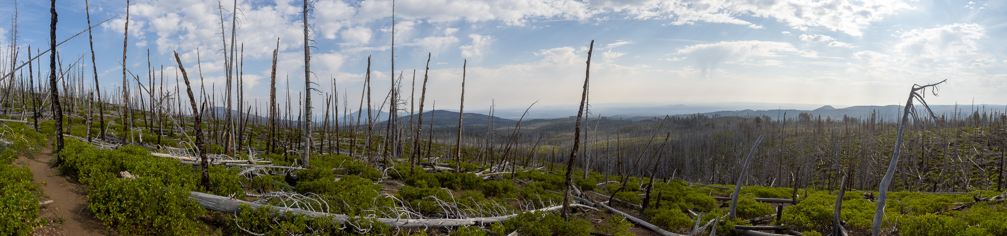
We were in the burn recovery zone, and the trail followed the contour fairly closely, never altering more than a hundred feet gain or loss. Most of the losses were to get around a gulley, and most of the gains, to get around a spine. Every time I thought we were getting closer to actual woods again, the trail veered back into the burn zone, and we continued on. There was no water at the next trail junction, and everything we walked over that looked like it did carry water at some point was dry, so on we went. We both had 2L or less of water, and we both drink like camels. So all was good.
We kept crossing dry creek beds, and eventually we finally hooked up with the Scotts Trail. Our miles on the Green Lakes Trail 1701, were at an end. It was all Scotts now. The map said, it would be fairly easy going for the first mile, maybe mile and a half, and then it would kick up. I just want to say, had we not camped where we did the previous night, I feel certain that instead of ascending the Scotts trail, we would have turned the opposite direction and descended until we came water. We would have been close to bone dry at that point, and we would have been super sore too. Further evidence that our blunder the day prior actually helped us.
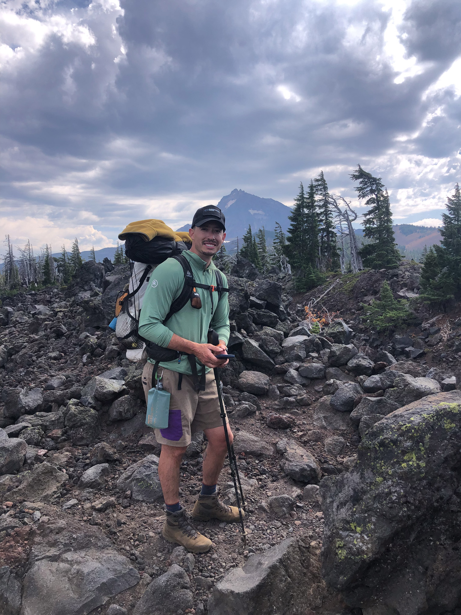
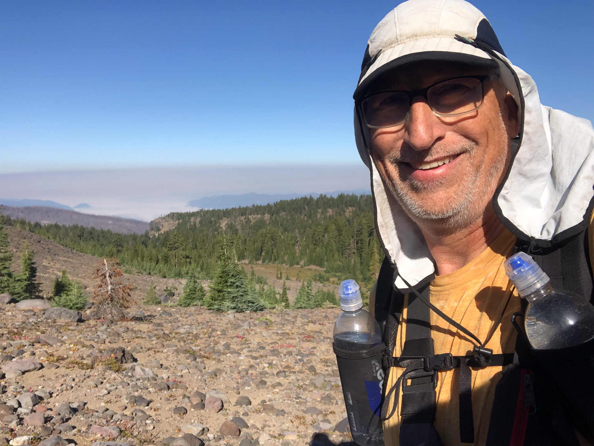
Ascending Scotts, there wasn’t any water to be had, and just like the map said, once he hit the section of the map where the grade lines were close together, the switchbacks began, and it was a grind to the top. I, again fell into my rhythm, while Will struggled to find his, going too fast, and then resting. During one of those rests, I passed him, and I didn’t see him again until I was atop the ridge and he came into view. We were both very happy to be on the ridge, and the Pacific Crest Trail sign was a beautiful sight to behold. At least for this seasoned backpacker. Matthieu Lake was only 1/4 click North, and when we arrived, it’s inviting waters called to us. They called to a lot of others as well, as we were not alone, but there was plenty of room for everyone.
First thing I did was to put my chair together, sit down, and remove my boots and socks and don my sandals. My feet needed a break! Then I gathered my water filters and walked into the lake. Lake water is difference than stream water. In a stream the water is moving, and you can fill up these squeeze type filters pretty easily, but in a lake, unless it is deep enough, and you can get the flaccid filter to submerge, it’s hard to get water in without moving the filter through the water. When you do that, it generates a current that disturbs the bottom, so to avoid getting that disturbance in your bottle, you swipe it across a different section with the same result. Eventually you have to move. My 750 ml squeeze bottle was one challenge, but the 3.5L gravity bag was a different monster. I tried to work it so that I could hold the base beneath the surface, and let water flow in as long as possible. That method may produce clear results, but it takes a long time and eventually I choose the hybrid approach and get the last amount of water in by dragging the filter through the water. The end result was I gathered enough water for us to enjoy a long hydrating lunch.
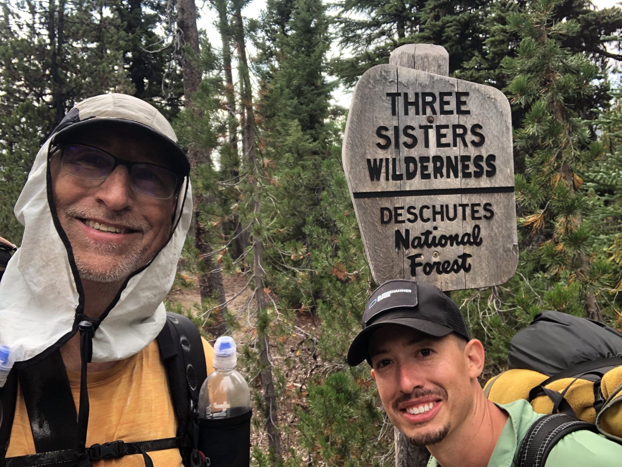
Will decided to take a swim and wash the dust off. I think he just wanted to feel like he took a shower and was refreshed. He borrowed my sandals so he would have a fairly firm footing in the water, and he did look like he enjoyed himself very much. The sun was shining, but clouds were forecast, and there was a 30% chance of late showers, so we felt it was time to water up, pack up, and get our boots back on the trail. While we were there some NoBos walked into the area and gave us some valuable information. While there was water at the next Spring, it wasn’t flowing really well, and our system of getting water would not benefit, so we had to shoot for either, Glacier creek, in the Obsidian zone, or push to the edge of Obsidian to Sisters Spring. Sisters was another 9 miles, while Glacier was 7-8, and so we pushed out for Glacier.
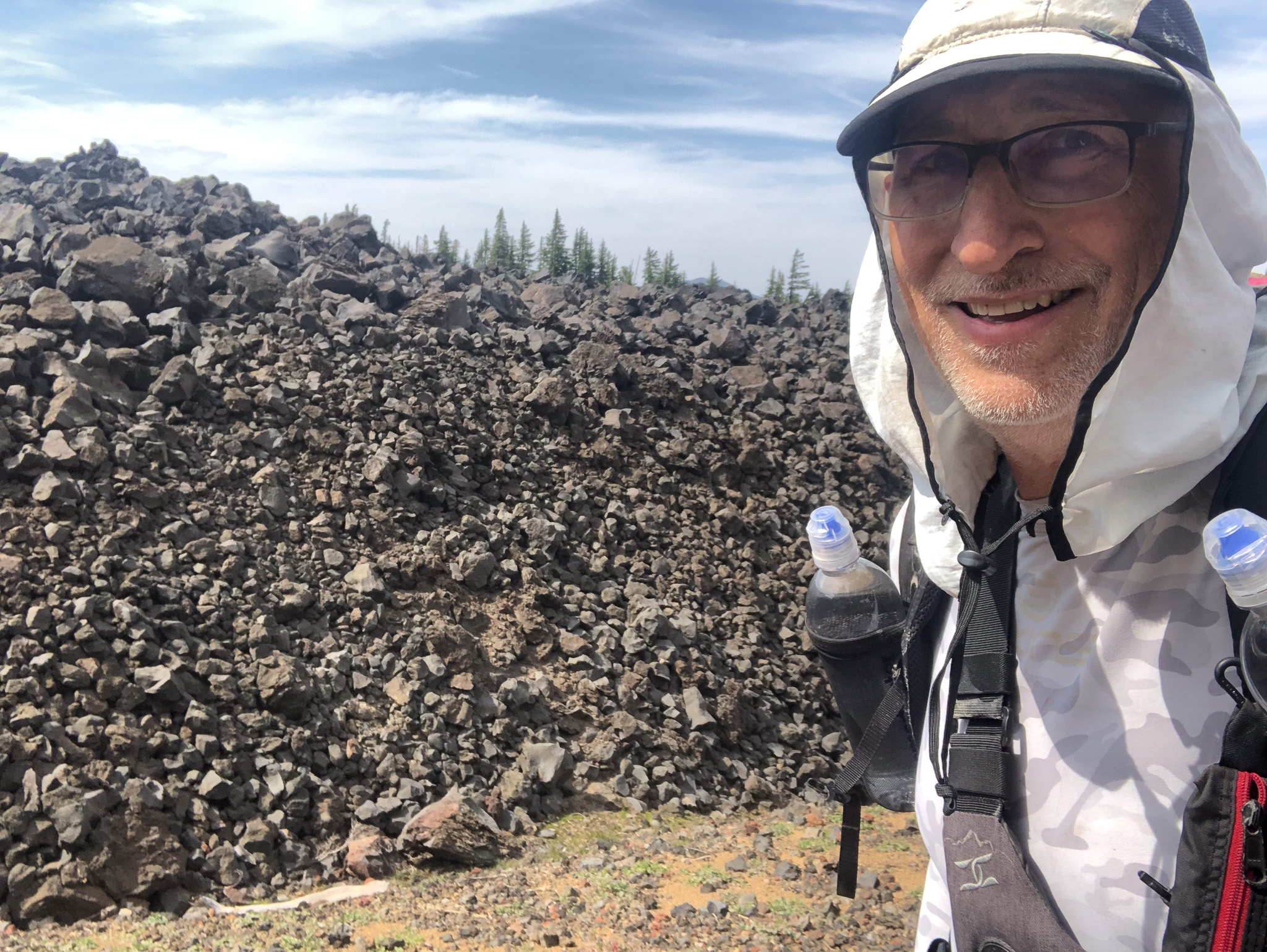
Almost immediately the terrain changed from a conifer littered woods to a lifeless old lava flow. Maybe not lifeless, but life was struggling to get a foothold in this old flow which yielded the kind of lava rock that I believe most people are familiar with. That reddish, holey rock, both big a small. You wouldn’t want to trip and smash your knee or face into it. As it was clouding up, that was a blessing, because this land was also about 10F warmer than what we had walked out of. The land was baking and the trail twisted its way through various nooks in the old flow eventually rounding and climbing another cinder cone structure. The main structure we had to get past was a pass named Opie Dilldock and the closer we got to it, the more rumbles we could hear in the far off distance of the coming rain. We were close enough to the top, that we both decided we could get over that, and down off the pass before the weather deteriorated further. The rumbles were still pretty far away, but the winds were picking up.
Once over the top, it was a switchback steep descent, so we lost elevation quickly, and on the way down the rain started, and we realized that one thing I forgot to tell Will to pack was a rain coat. It was a drizzle, so not that bad, and we could see some tree shelter on the other side of a small basin where there were some other hikers. When we reached that, I donned my rain jacket, and we hung out for a little while until the rain ebbed enough to continue. No, it didn’t appear that there was any local lightening, otherwise, we would have left the protection of the trees. Fortunately, my error in advising the need for some kind of rain protection did not prove a disaster since the rain stopped, and the clouds began to clear, and we continued on and into the Obsidian Limited Entry Area, where earlier I had surmised that there might be some camp-worthy sites as our descent did have some water down in a ravine. That surmising was wasted effort, as the steepness of the terrain yield no flat tent sites, and the ravine was too deep to access water, so on we walked.
I have to admit that when I read we were entering this area I expected that we would see a lot of obsidian rock. It’s not a very common type of lava rock, at least I remember it from long ago, but the usual lava is that slow moving Pa-a. Obsidian is created when lava is the right type and gets extruded and cools quickly, probably under water, and forms a glass, so I would expect the silica content of that lava to be fairly high. Like I was saying I was expecting to see it everywhere. I had seen some examples on the East side, but after a mile or two in the “zone” I hadn’t seen any. My guess is there is more to protect in this area of the Three Sisters, than just the rock.
We arrived at Glacier creek which was flowing wonderfully through a large meadow with signage. “No Camping Here” was posted in two very obvious locations. I looked at Will, and he looked at me, and we both saw two tired dudes who had just walked 17 1/2 miles and who were both done walking for the day. We dropped our packs; at the very least I was getting water, and while I did that Will investigated a well worn path that led away from the creek and up into a wooded area. He returned 5 minutes later and said that there were 3 sites up in the trees that had signs saying “Restoration in Progress No Camping” however those signs were right in each of those 3 sites, and further into the woods were two sites with no signs. We both concluded that meant those were usable, and we picked up our packs and took the nicest of the two sites and established a well deserved place to rest for the night. It was very sad that we had finished off our Bourbon the night prior, because both of us would have loved to sit down, remove our boots, and just have a nice little pull before setting down to the tasks that lay ahead.
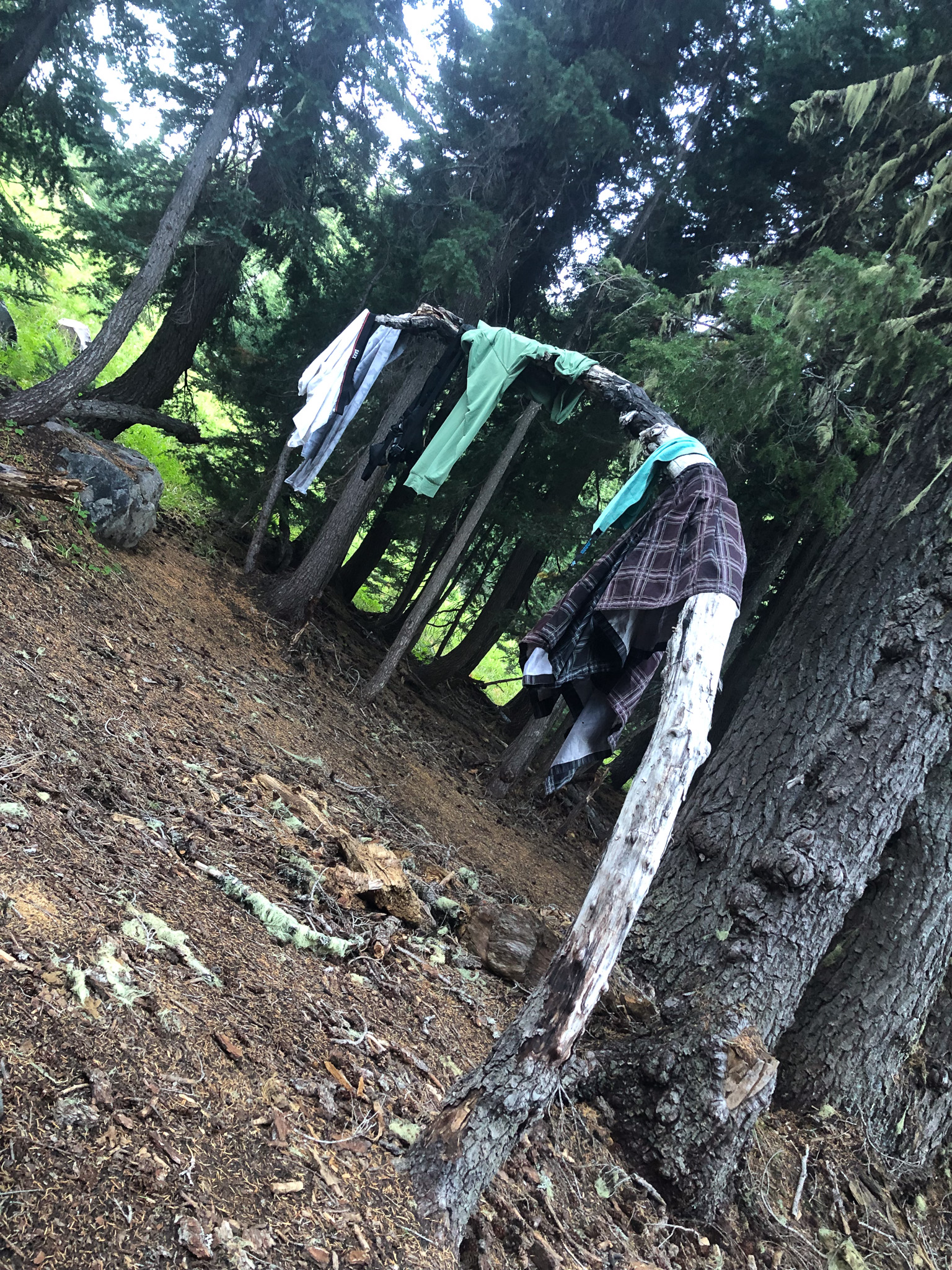
Giant Fir trees surrounded our site, each with a significant amount of bearded moss hanging from the lower branches. A small stunted example had bent and grown horizontally establishing a kind of clothes line to drape wet stuff over, which, both Will and I had examples. As we sat eating, I took out the map and investigated our next days objective, and offered up a slightly different plan than the one I had laid out. Since we made good mileage on this day, instead of camping where I originally dropped a waypoint, we could make for Moraine Lake and camp there, then we would have an easy downhill and Corinne could pick us up lunchtime on Tuesday. I put that question to Will, and he answered first with two questions. 1) How far would that be, and 2) How far to get out tomorrow. The answer to each was the same and was just about a mile less than what we hiked this day, so then his response to my posed question became “Or we could just hike out, go to Pizza Mondo have pizza and a couple of cold beers and turn this 5 day trip into a 4 day trip”. As much as I would have loved to spend another night under the stars, Will’s reasoning was hard to fault. We decided that we would get up early the next day, and not dawdle, and have as much of the day as we needed to knock out the remaining miles. By the time we were ready to turn in, the sun was long down, the sky had cleared, and what little of it could be seen revealed bright stars. I believe that was the first night I slept fairly well, and may have only gotten up once to pee.
In the morning I heard something that I hadn’t heard the entire trip. Will was already packing up his gear before I had even started. I was enjoying the warmth of my sleeping bag, as the chill had set in during the night, bringing with it the most cozy of sleeping bag coziness which is to zip it up and bury your head inside and enjoy the feeling. However, Will was moving, and I had better get myself moving. We had a plan, and there was a beer awaiting both of us at Pizza Mondo. We boiled our water, we brewed our coffee, and we ate our prepared oatmeal breakfasts, and then we finished the breakdown of camp and were ready to hit the trail by 7:30 in the am. We would not have to rush, we could take our time, and we should be out by 4-5 in the afternoon.
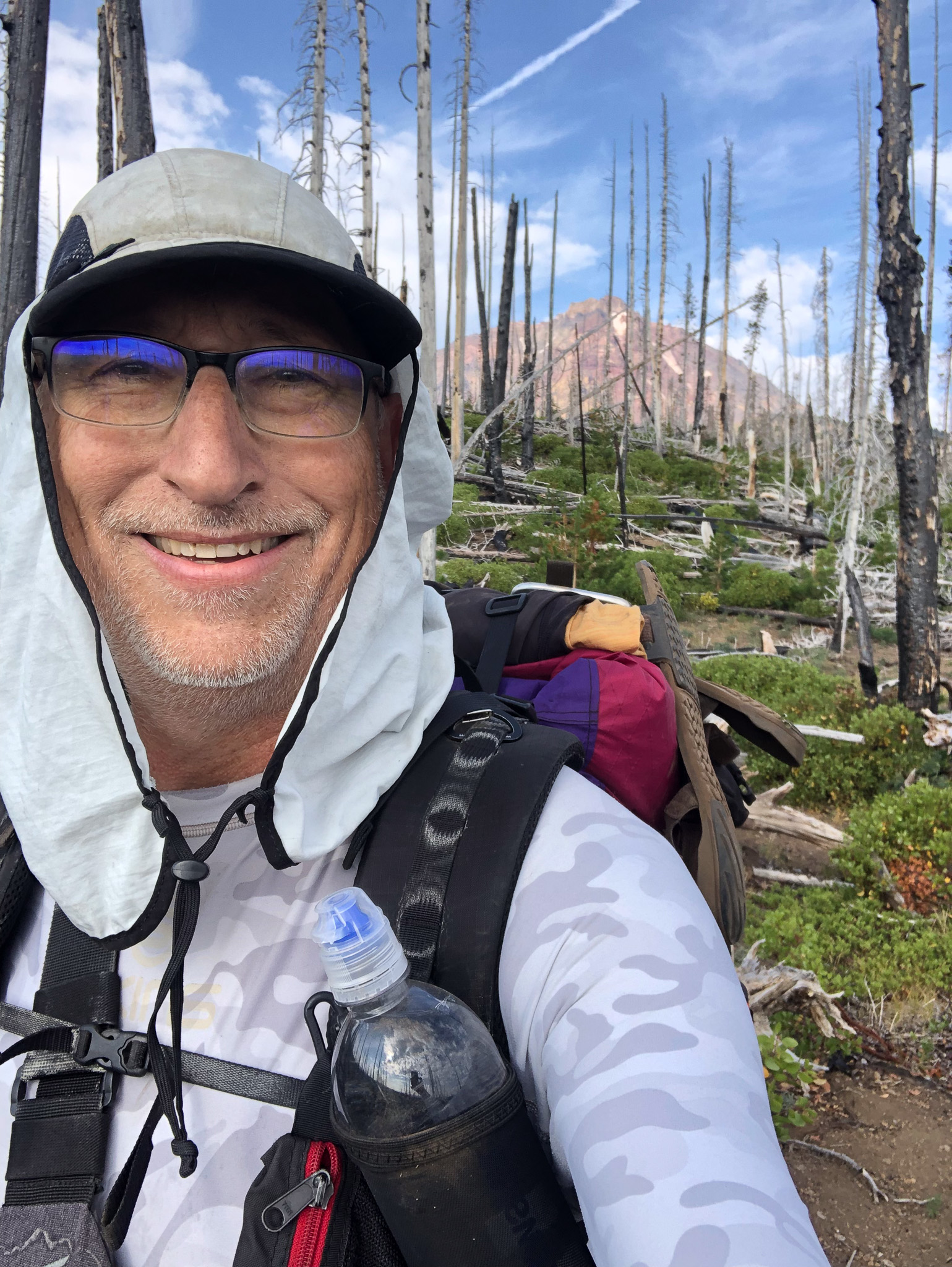
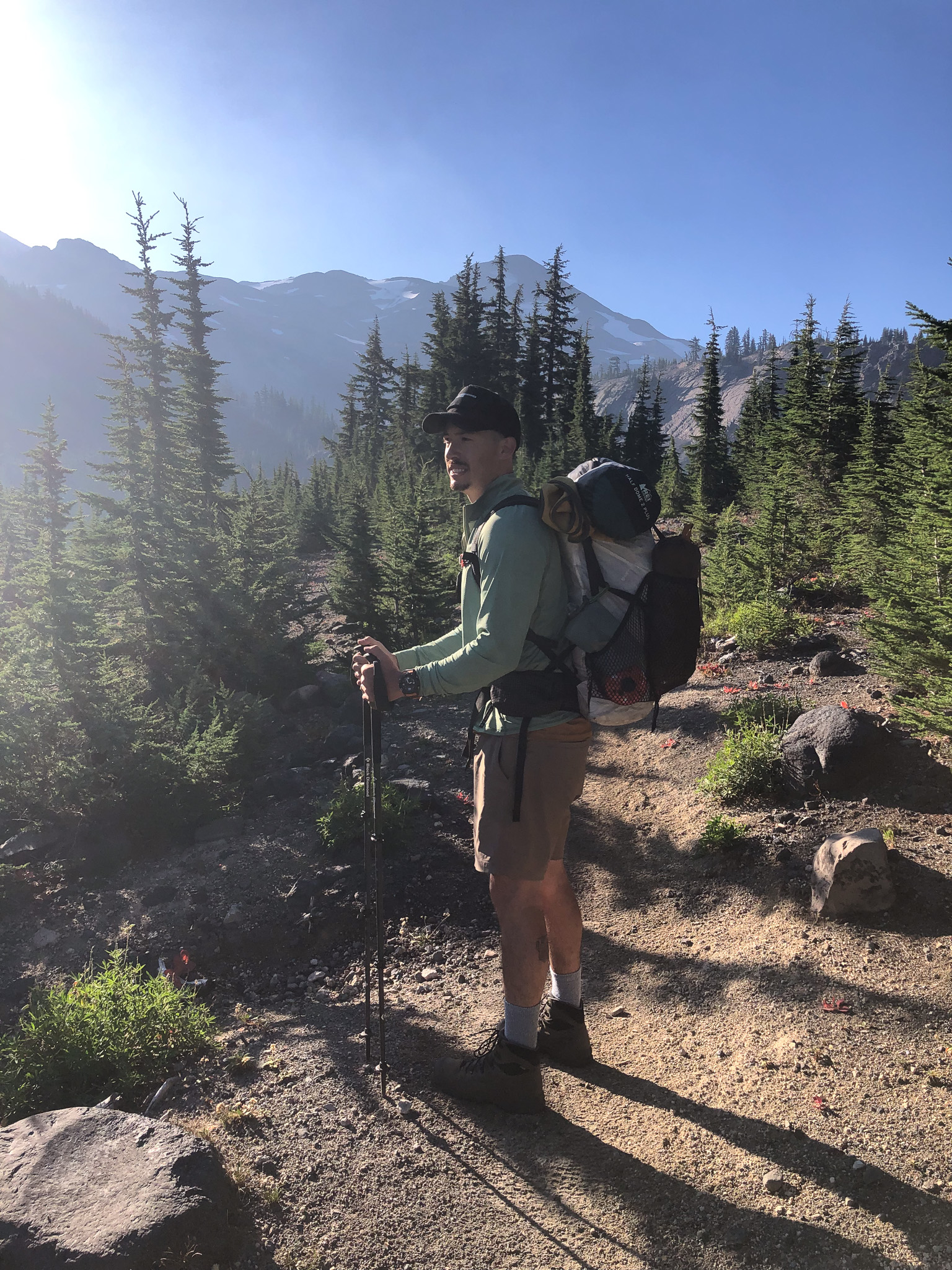
I said earlier in this post that I wondered about the obsidian in this “limited entry zone”. First of all it isn’t easy to get here, and even for day hikes in The Three Sisters you need to have a permit, so it is a limited entry area because they only issue so many daily entry permits for the only trailhead that provides a reasonable day hike to the area. Through hikers like us, they know aren’t going to hang around, so we aren’t limited and it wasn’t until this day, that we entered the part of the protected zone where all the obsidian lay. It was everywhere. By the time we reached it, the Sun had cleared the ridge, and was reflecting off all the glass on the North and Middle Sisters, revealing a vast amount of the rock across our entire field of view. At some points we were walking upon giant formations of obsidian. We came to Obsidian Falls, and the water was flowing with a decent enough force to make for a picturesque scene. We stopped to listen, but declined to descend to the base of the falls as we both knew there was a beer awaiting us. Maybe we should have dropped our packs and investigated. We certainly had the time.
Many more Northbound folks on the West side. Many of them were in fact through hikers who started at the Mexican border. In fact, someone I had been following all summer had just moved through the area before I got there. Shame. I would have liked to have met the Aussie. One NoBo we met was from Germany. Europeans aren’t keen to our sense of wry humor, so when I asked if her accent was Texan, she just looked at me like I was an idiot. I finally broke face and admitted I was simply breaking the ice, and we had a proper laugh. They were hanging at the Spring in Obsidian, and out of the sun taking a break, and we moved on. Beer.
We descended a wee bit into a Westside burn area where I realized that my fantasy that today’s hike would be all downhill, was indeed a fantasy as the trail tilted up for a mile. It didn’t feel all that bad, but I decided on this trip that my La Sportiva shoes were a 1/2 size too small, and that gave my feet a slight clostrophobic feeling, and made me very concious of my current foot condition. I wasn’t entirely sure at any moment that I hadn’t burst a blister, as there were some acute pain points. I did in fact stop, unlace, and removed boot and sock only to see a perfectly normal, though slightly ugly, foot. Socks on, boots on, boots tied, we moved on with me saying to me “It’s all in your head you git”.
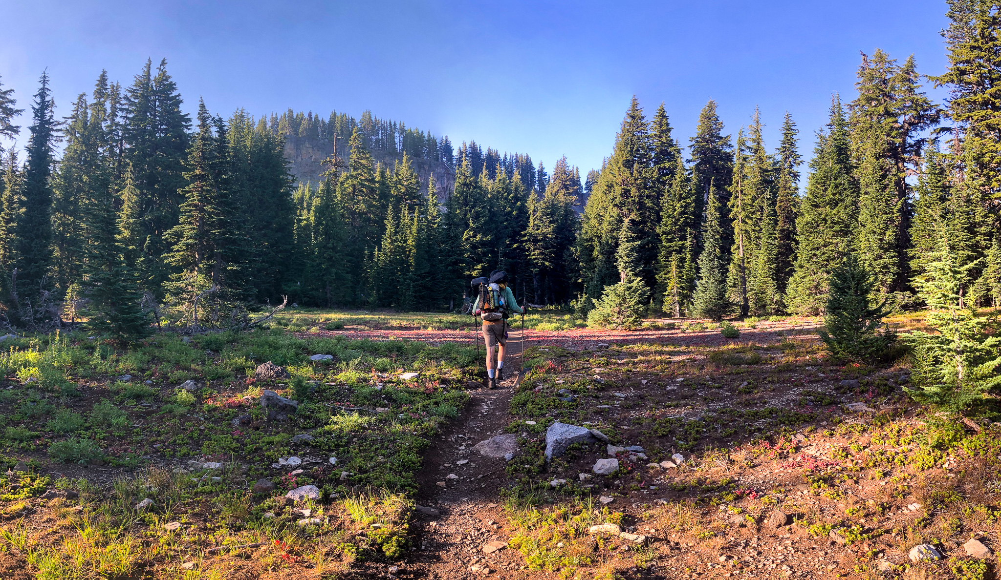
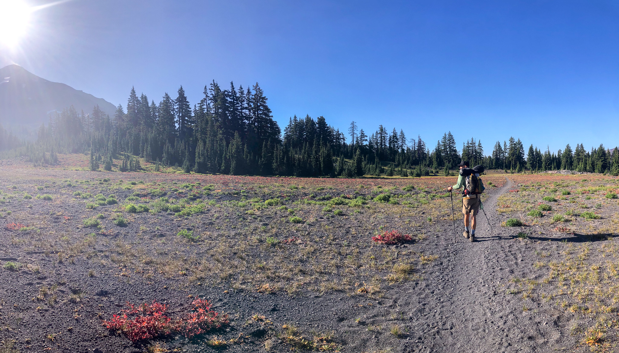
We turned a corner and left the PCT and emerged onto a HUGE open meadow that appeared to stretch for more than a mile. The trail stretched before us, and curved into a cleft in the rock where we left one giant meadow and entered an even bigger meadow. This meadow dropped before us, and then slowly gained back that drop far away in the distance where we could see the PCT spit off and go straight and our homeward trail go to the right. There were a couple of dots on the trail in the distance and we would meet. I should say we would meet again, because it was the same ladies that walked late into the giant Eastern burn area and camped where we suggested. They recognized us, and we them, and we chatted bit before departing in our own directions.
Eventually we reached our spur that continued the circumnavigation of The Three Sisters, and then again we came to another division allowing us to cut down to the parking lot. A left would have taken us to Lake Morainne, but as you have read, we were headed out and home. Beer bound. Surprisingly, we still had some distance to cover to get out, but as I understand it, Will had service, and texted Corinne that she should leave to pick us up.
We were chasing or rather running away from, what looked to be a gathering storm as we descended further and into the tree cover of the lower slopes of South Sister. The trail was not a trial as it wound in and out, and down and up as we crossed the dry creek bed the trail followed on its way out. Soon, the sound of the internal combustion engine, or rather the road noise from the tires of such vehicles, could be heard and our journey was coming to a close. The final decision point was whether we had come in from the high lot or the low lot, and Will said it was definitely the low lot so down to the low lot we went and no sooner than we emerged we saw Corinne emerge from their vehicle to let Penny the dog out. Perfect timing!
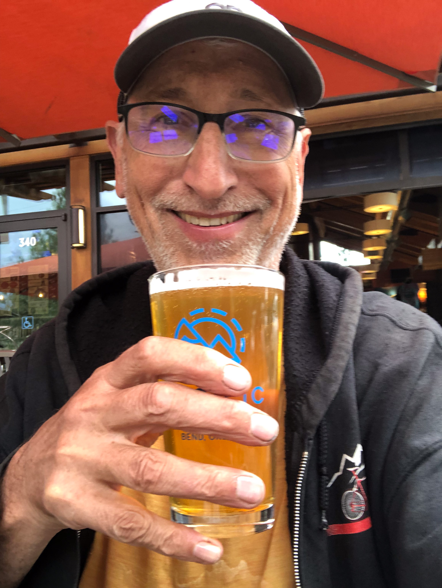
The pizza place Will wanted to go to was not open on Labor day, or because it was Monday, but why it was closed was unimportant, only that it was closed, so we chose a different option, Pacific Pizza Brew in the same shopping center as the Safeway. Outdoor seating, beer, dog friendly, a great way to unwind and relax, while still dirty, after getting off the trail. “Why didn’t you go home and get cleaned up and then go out?” is a question often asked. As long as I have been doing these, and we are going on 47 years now, the draw for non trail food and drink is so strong that it matters not how strong the odor of our own sweat and hard work, we simply want to sit down and enjoy a nice meal ASAP. It’s just tradition. We made it a point to sit at a table that wasn’t close to others, though we can’t stop others from sitting close to us.
Satisfied, we paid and left and returned home to a waiting shower, and clean clothes. Looking back, even now that it is months in the past, Will did very well on his first backpacking trip. Two back to back 17 mile days for a beginner is a tough field to hoe. Hell, it was tough on me too; I was ready at the end for the end. It was a pleasure to have these moments with my son-in-law in a one-on-one bonding moment. I look forward to many more.


Leave a comment