
Zion 2024 – Segment 2
November 10, 2024 § Leave a comment
Strava
Panoramas
Relive Video
Relive Interactive
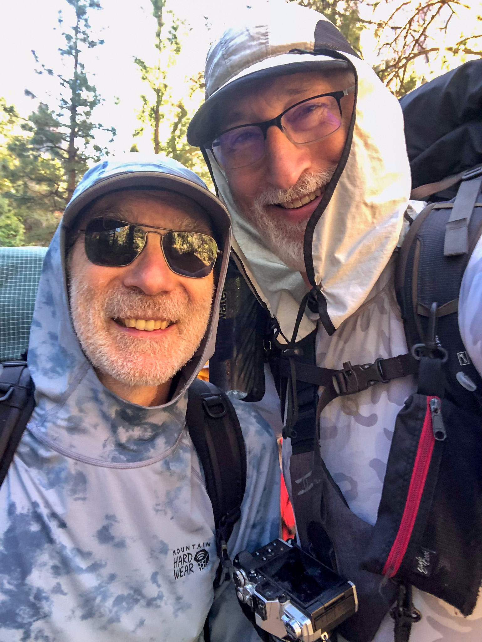
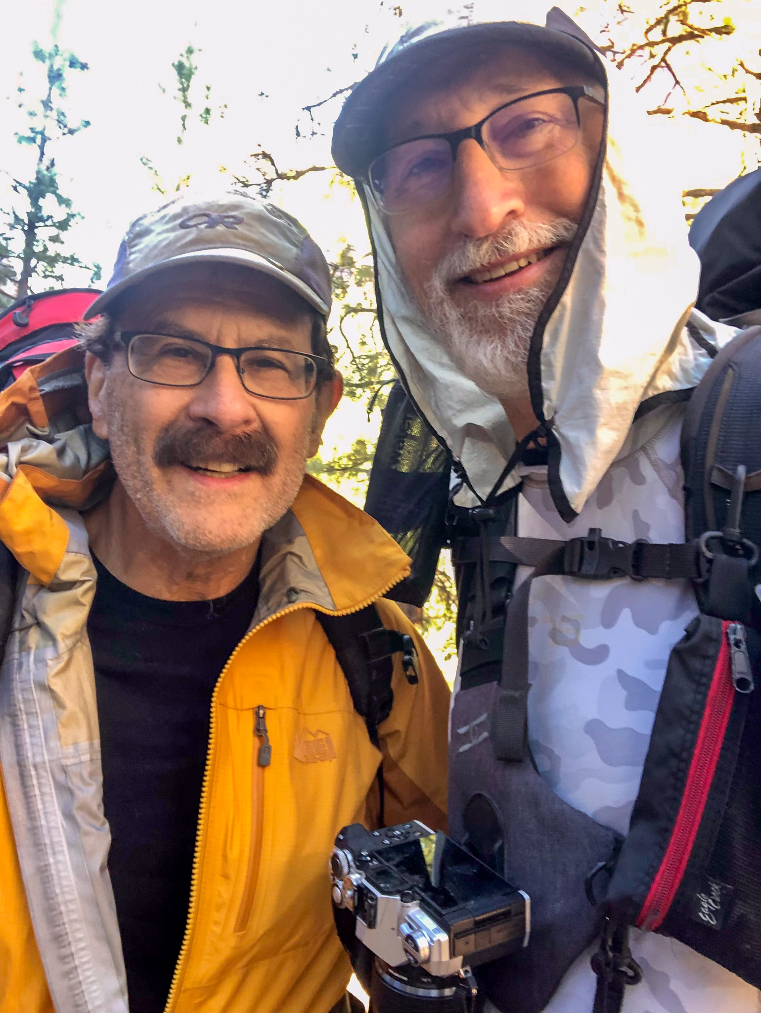
The second segment of our Zion traverse includes what I have called Death March 1, and Death March 2 based on how I felt at the end of each of those two days, which was exhausted. Just to be clear, this is not like a Solzhenitsyn march where you know from the start what kind of day it will be, but rather each day began just like any other day when you backpack and have to move camp pretty far along the trail. Don’t sleep in; Pack your sleeping bag, and deflate and stow your air pad before you exit the tent; Breakfast on oatmeal, and coffee drinks, water up, and pack the rest of the things; Groan while raise the potential energy of the pack, and start walking, a smile on your face, and nothing but happy “What will today bring?” expectations ahead.
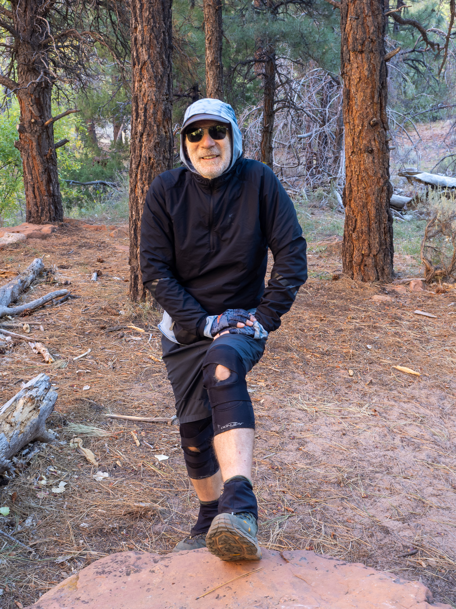
We compared “steps” at the end of each day, where Jed and Jim were scoring around 3-4 thousand more steps than me, who marks out a fairly decent stride. More, when I go up hill. The two “Death March” days were 24,951 and 28,985 steps, and I still backpack in fairly traditional leather boots made by Zamberland (“Zambies”) that weigh in around 4 pounds so 2 pounds per foot. Jed and Jim wear something more like trail shoes that are a lot lighter. Mike is also more traditional, and I can’t remember what Paul was wearing. I think you see where I am going here. Each step moves that 2lb boot further along the trail, and as they add up, fatigue starts to set in, so that by the end of the day, you just want to get those damned heavy-assed boots off your feet and let those feetsies recover.
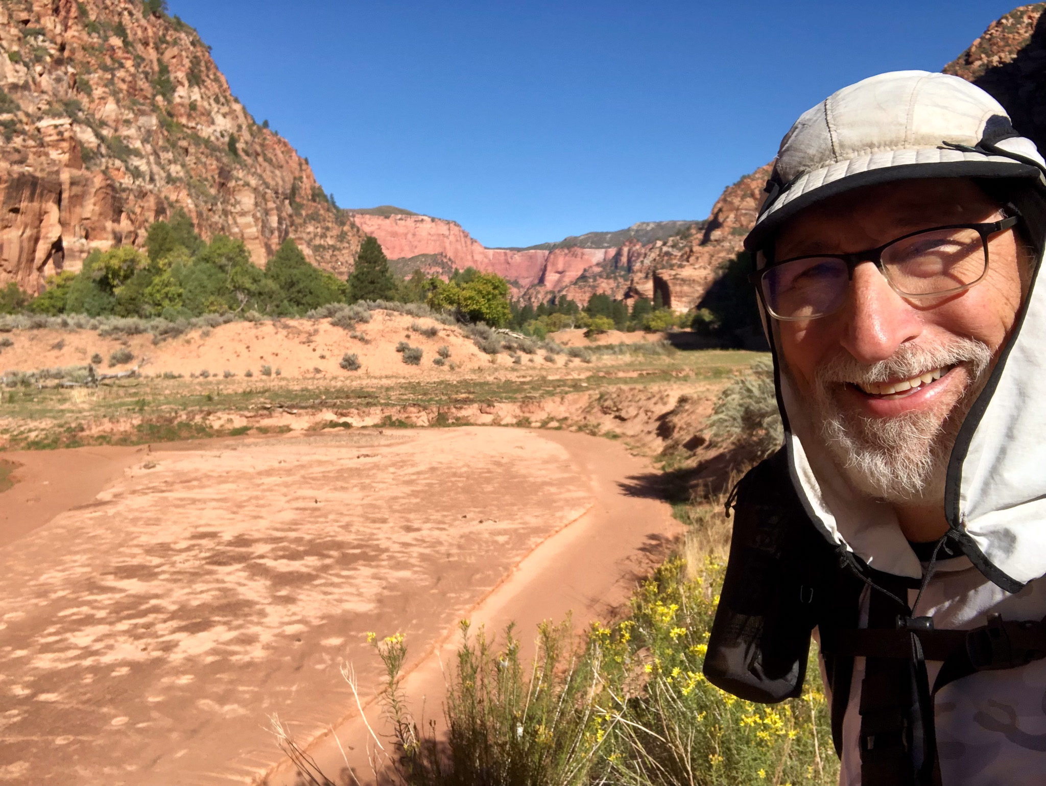
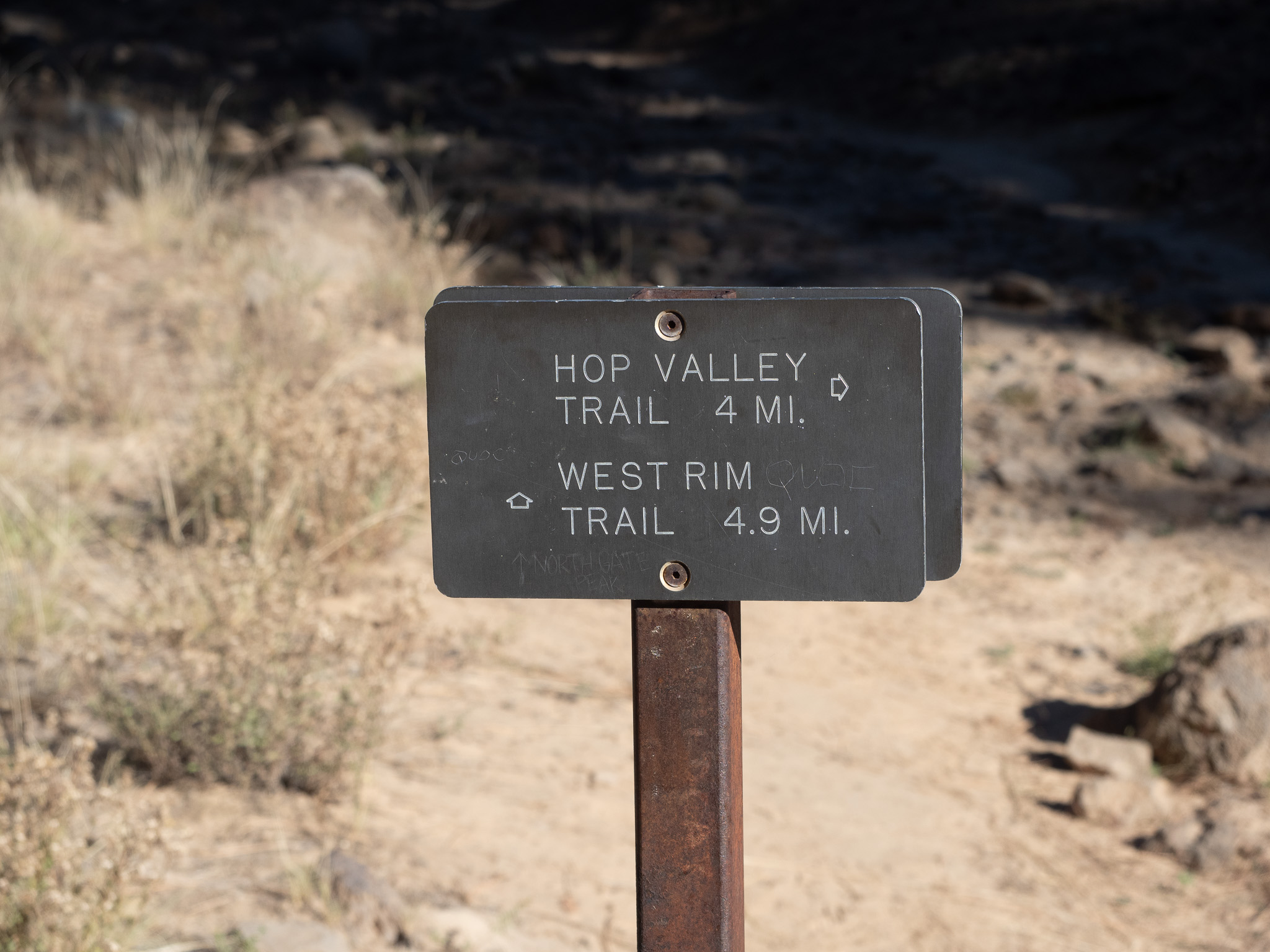
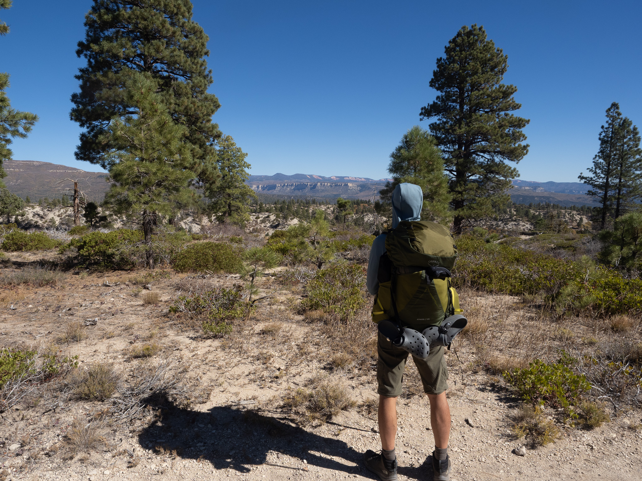
We start this segment still in Kolob where we had an easy morning, because our trek to Hop Valley Horse Camp A was less than 3 miles. We were not in a hurry, but we didn’t need to dawdle either. The morning went like a lot of mornings in the back country, and soon we were all ready hike. As I mentioned in the last post, Paul would join us later this afternoon as he hiked in from the Hop Valley Trailhead, and we would be setup and awaiting his arrival long before he arrived. The four of us set out, carrying enough water to get to our destination and to hold us over until we excursioned back for our full water gathering. Camp 8 was empty as was Camp 10, and soon we were on the switchbacks rising up and out of Kolob. Switchbacks make it possible to see your environs from different angles, and as each switchback gets you higher, the angle of the view gets better and better. You stop and take a picture (or pictures) thinking “this is beautiful!”, only to hike another 2 switchbacks and the view opens up even more. Repeat.
You have to go to my Panoramas to see what I mean, but I assure you as we kept gaining elevation, the views just got more and more spectacular. Everyone appeared to be doing well, maybe Mike was starting to show signs of wear, but I wasn’t worried because we were near the apex of the pass, and it was a short drop into the Hop Valley, and he would be fine. The last view off the pass included an egg-shaped sandstone boulder with a limestone cap that is probably in thousands of hikers image inventory, and now it is in mine.

A short traverse in shaded flats, and then a final up and over and The Hop Valley lay before us. We dropped maybe 150′ and emerged out on the flattest, sandiest section of the Zion wilderness. When I was here in 2011, the river was 30-40 yards wide in places, but only 2″ deep with a very hard compact silty base. Today the river was 4-5′ wide, and I guess once it gets to this point it cuts a slightly deeper channel, but easy enough to walk through with waterproof boots. As you look around you realize that this entire plain carries water at some point depending on just how much Spring runoff there is. Horse Camp A and B sit up bluffs that rise 15-20′ above the general flood plain. We crossed, and there on the opposite side of the valley, was the sign for Horse Camp A. The signs took us out of the sun, and up onto that bluff where giant Ponderosa Pines provided a huge flat campsite, where I am sure guides with clients in tow make horse camping trips throughout the year. We had the whole place to ourselves, the only blemish being the flat dried up remains of cow pies. I guess the cattle get in at times, and love the shade like we do when it is hot. They were all dry, and easily avoided.
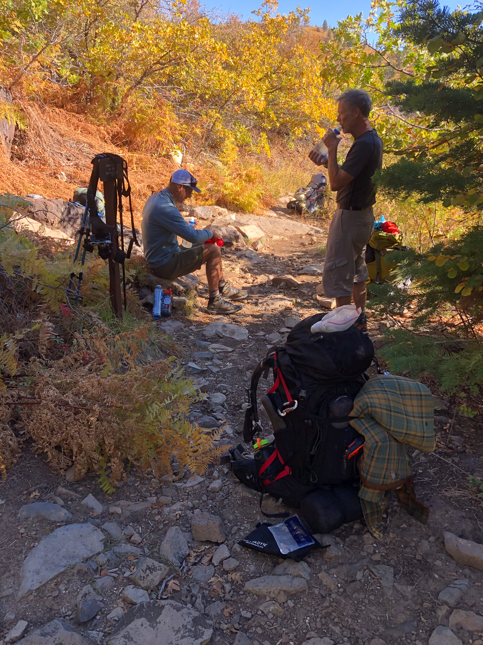
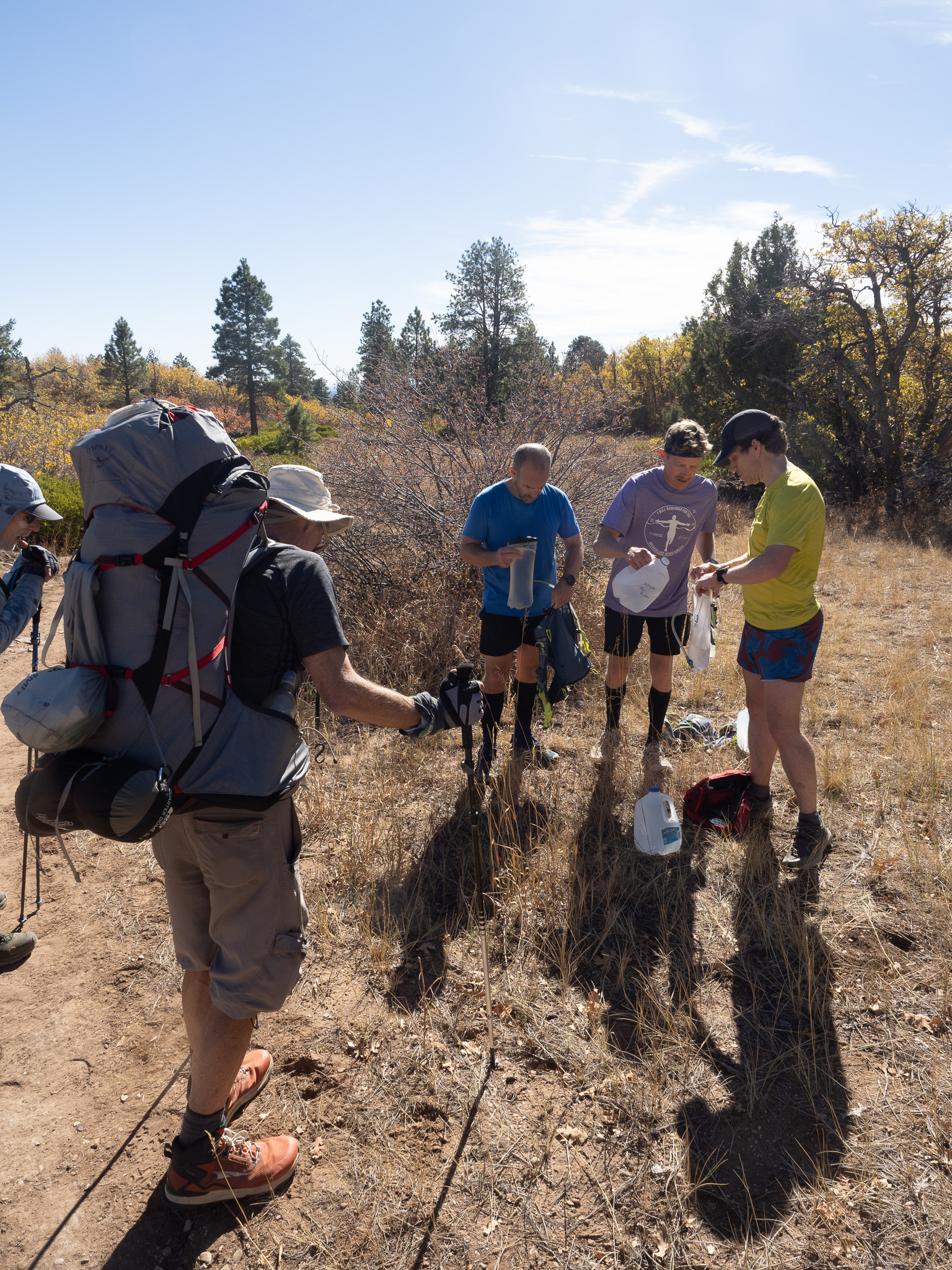
After dropping our packs, and setting up camp, we had a little snack, and then Jim, Jed and I left Mike alone, and went back for water. We grabbed every bottle, both 3 liter Katadyn filters, and my 6 liter dromedary, and walked back. As I write this I recall at first we were thinking we will get water when Paul arrived, but what I haven’t mentioned yet was I was getting messages from Paul. Luggage Checked! On the Plane! Then a long pause. Landed! Rental Car line is Slow. etc etc. The point here being that Paul was going to be lucky (loses an hour crossing from Nevada/Arizona into Utah), to be on the trail by 4 PM and knowing how easily distracted Paul becomes, he would not walk into camp until 630 earliest, so we had to get water without him. We set off at 4, and the last message from Paul was he thought he would be on trail at 420. With light packs the walk back was fairly easy, and of course by the time we got to the switchbacks, the light had changed significantly, so there were new photo opportunities. That image above was taken during the water trek. We zoomed down the switchbacks, and then spent at least 45 minutes filling our various Katadyn bags, and gravity filtering into our empty bottles and dromedary. Including the two 3L Katadyn bags we filtered about 22 Liters of water. I carried 10 or 11, and Jed and Jim split the rest. Now, if you remember your chemistry class where you used the metric system you may recall that 1 mililiter of water equals exactly 1 gram of water. So, 10 or 11 liters is 10 or 11 kilograms, which is about 24 pounds, so I was very glad that we decided to do it this way, because hauling that water back up the switchbacks was a chore.
Back at camp, Mike had greeted our return by waving to us when we emerged into the valley. There wasn’t a lot of daylight left, so we got started on our dinners, and awaited Paul’s arrival. I decided to send a message to Paul’s loved ones just to keep them in the loop, that I know they know he is out there alone and walking, and we are keeping an eye on the clock and anticipate his arrival any time. As we ate our dinners, and the light faded more, I will admit a wee bit of worry on my part, enough at one point to grab my head lamp and to venture out onto the trail to intercept him. I did test the echo nature of our Valley, and it was a very nice echo indeed, so there had been at least 3 “PAUL!” calls with no answer. To us, the echo seemed fairly substantial, but physics and 1/r2 probably doesn’t carry as far as you might think, so it was time to walk. Ha! I got only as far as Horse Camp B when I saw the lanky frame of Paul ambling towards me with a giant smile on his face. Contact.
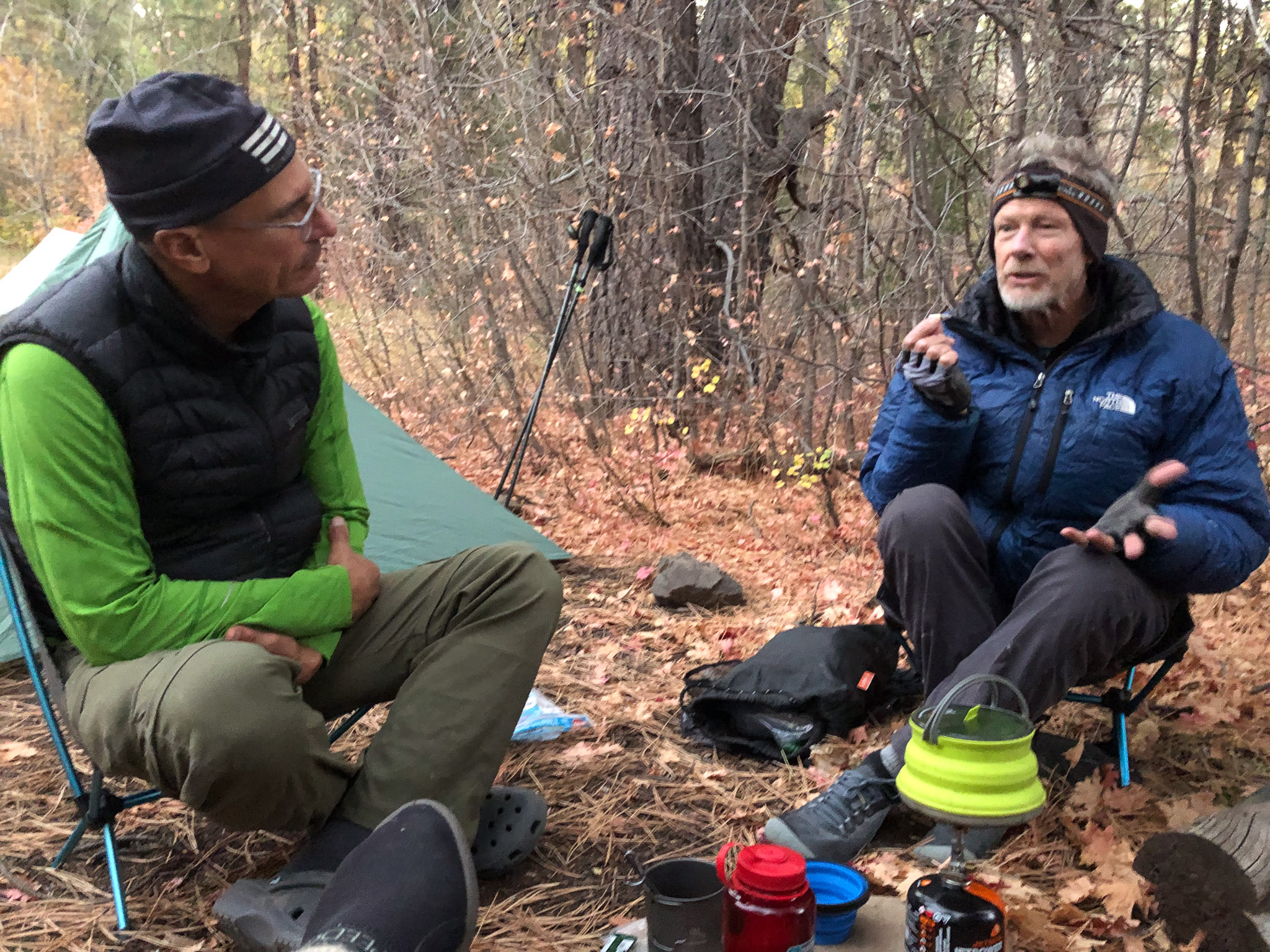
Paul got his tent setup, with some help from Jed as this was his first time with this tent in the field, and was soon sitting with us, and taking care of his own dinner needs while all the time chatting up his day. I updated, Alex and Anna as to his status, and soon the chill set in, and it was time to retire again. Food bags hung, canister stashed, Jed, Mike and I retired and I heard Jim and Paul talk for at least another hour before silence set in, replaced only by the occasional movement of sleeping bag on sleeping pad as we all adjust at night to find that next position that will let us sleep. The sky was clear, but access to the sky was blocked by the pines. The waning moon rising a little later each night eventually casts some light upon us, and we rested all night.
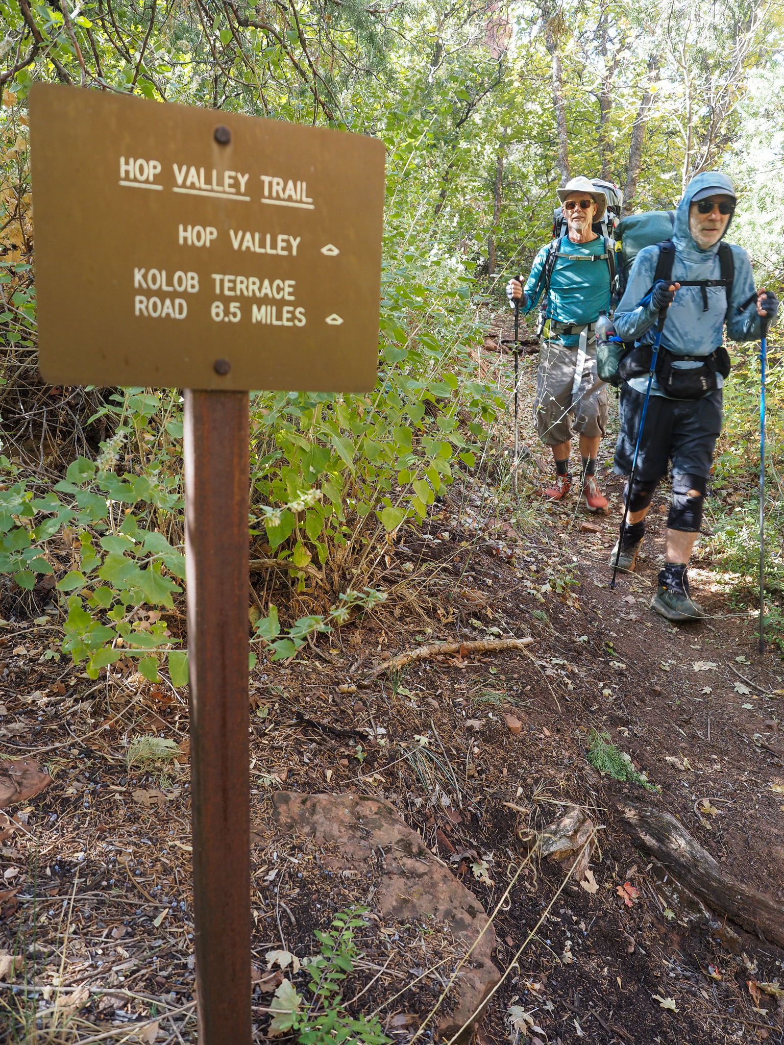
We had approved a first up, wake the others protocol, because we had a big day ahead. We had to hike the Hop Valley, and then climb out of it and onto the Kolob Terrace. That would be a flatish hike until the trailhead where Paul came in was reached, where we could take advantage of our water cache, and then onto the Connector trail, 4.1 miles of elevation gain until we join with the Wildcat Trail, and then at least 2 more miles until we reached the meadow that I remembered from 2011. That was what lay ahead as we breakfasted, coffee’d up, and packed. We all decided to carry about 2.5L of water to cover the 5 miles to the water cache, and we would use all that water too, but after we were all finished, we found that we had twice as much water as we needed still, so a little wasted work getting water the day before. Live and learn.
The sun was high enough to bathe most of the EW oriented valley in light by the time we set off. It was a cool morning, but that sun adds 10 degrees easily to the “Feel”, and we started early to drink our water. The Hop Valley is entirely sand, so as you beach goers know, walking in sand is harder than walking on dirt, so we were constantly looking for “firmer” sand to take our steps, and move ourselves just a little bit further along with each step. Rivers wind their ways through valleys, its part of the hydrology of a river to wander, and so the trail has to wander back and forth to maintain more or less, terra firma, and so we crossed the Hop Creek many times that morning. Yes, there were logs, to use, but the water was only inches deep, so I just walked through in my waterproof boots. Yes, that probably made the leather a little heavier, and I would pay for that later.
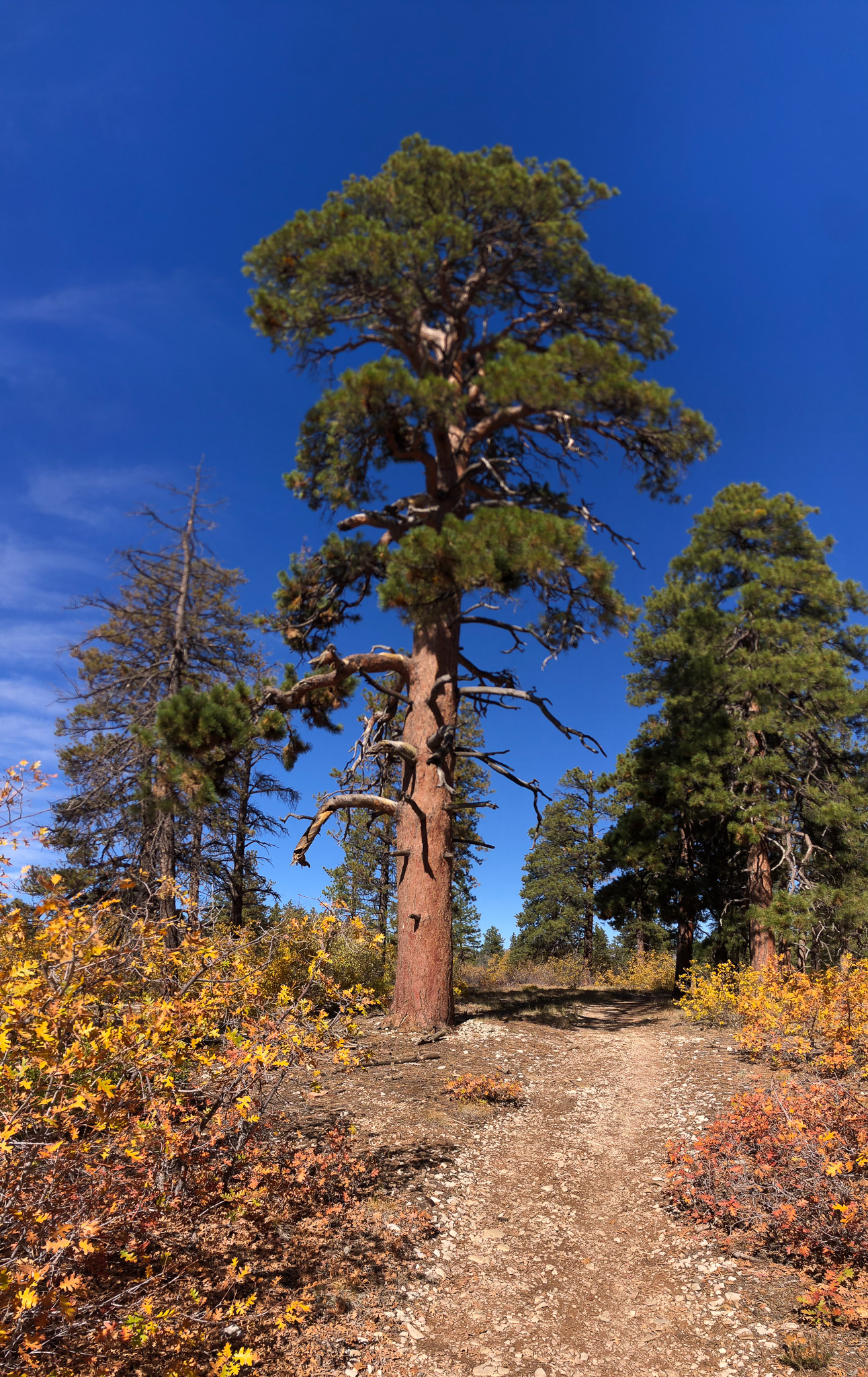
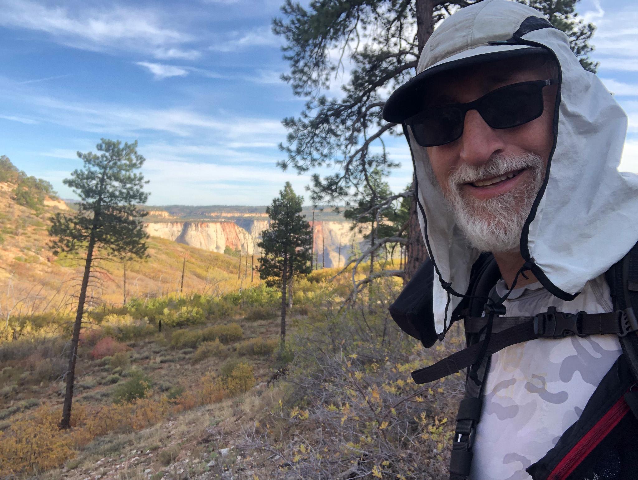
In big open vallies like that, the panoramas that you can make are really tremendous, and there are more than a few in the link at the top of the page including a staged one that I orchestrated with my friends. “Stop, line up”; snap; “Walk 20 yards and stop, stay in line”; snap; “Walk again”; snap; “One more time”; snap. You end up with a stitched panorama and the group is in every panel of the stitch across the full stitched panel. It’s fun. We stopped often for pictures, as the angles changed, the light changed, and our view to west showed Kolob retreating from view until we had what I thought was our last sighting of that beautiful wall, and then we crossed into some private land where the trail followed steeply, and exposed a roadcut from Kolob Terrace down to the Hop Valley. It was not easy, and there was little shade, but this was where Mike started to really suffer. We had at least 500′ to gain, maybe a little more, and every shelf was a fairly steep ramp. At least that wasn’t too sandy, but it was hard. Once on top, we were in the Kolob Terrace part of the hike, which was fairly flat, but was all desert scrub, and a few shady reprieves along the way. It was never quite clear where the trailhead lay, but you could see the road upto Lava Point climbing one of the nearby structures. The closer we got, the more each next tree grove looked like it would be the trailhead, and soon or later, that indeed came to be. I could tell, because I was following him, and listening to his sounds, that Mike was done, and he was going to call it “A day” and get out.
That is exactly what he said when he dropped his pack. Knowing what we still had to complete, I didn’t try to talk him out of it, because I knew that the afternoon was going to be tougher than the morning. The morning was fresh legs, the afternoon, tired ones. I tried to raise Bonnie, using the Garmin, but we found some ladies in the parking area that had just finished a day hike, and they graciously agreed to take Mike off the mountain, and drop him where he would have service to his phone, and he could call and make arrangements. In retrospect, I wish instead I had simply asked the ladies to drive him to the Wildcat Trailhead where he could have hiked in to the junction, and awaited our arrival. I believe that would have worked out for all of us, and Mike could have finished with us, but I wasn’t thinking that broadly at that time, and I let him go, hoping he would just stay there in Springdale and look for some other options.
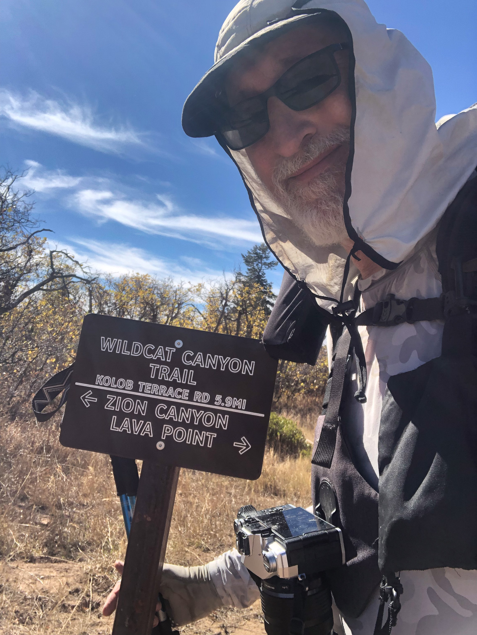
The ladies and Mike left, we took as much water as we wanted to carry, which would be enough for the hike, dinner that evening, and if we have enough left over, then morning breakfast. The last time I was here, we awoke on the Wildcat, broke camp and hiked to the water source and had breakfast there, so that was an option on this trip as well. With our hydration needs satisfied, our waste disposed of, and our tummies happy, we set off on the Connector trail. One giant relief for me personally was being able to utilize the restroom at the TH. A bag saved!
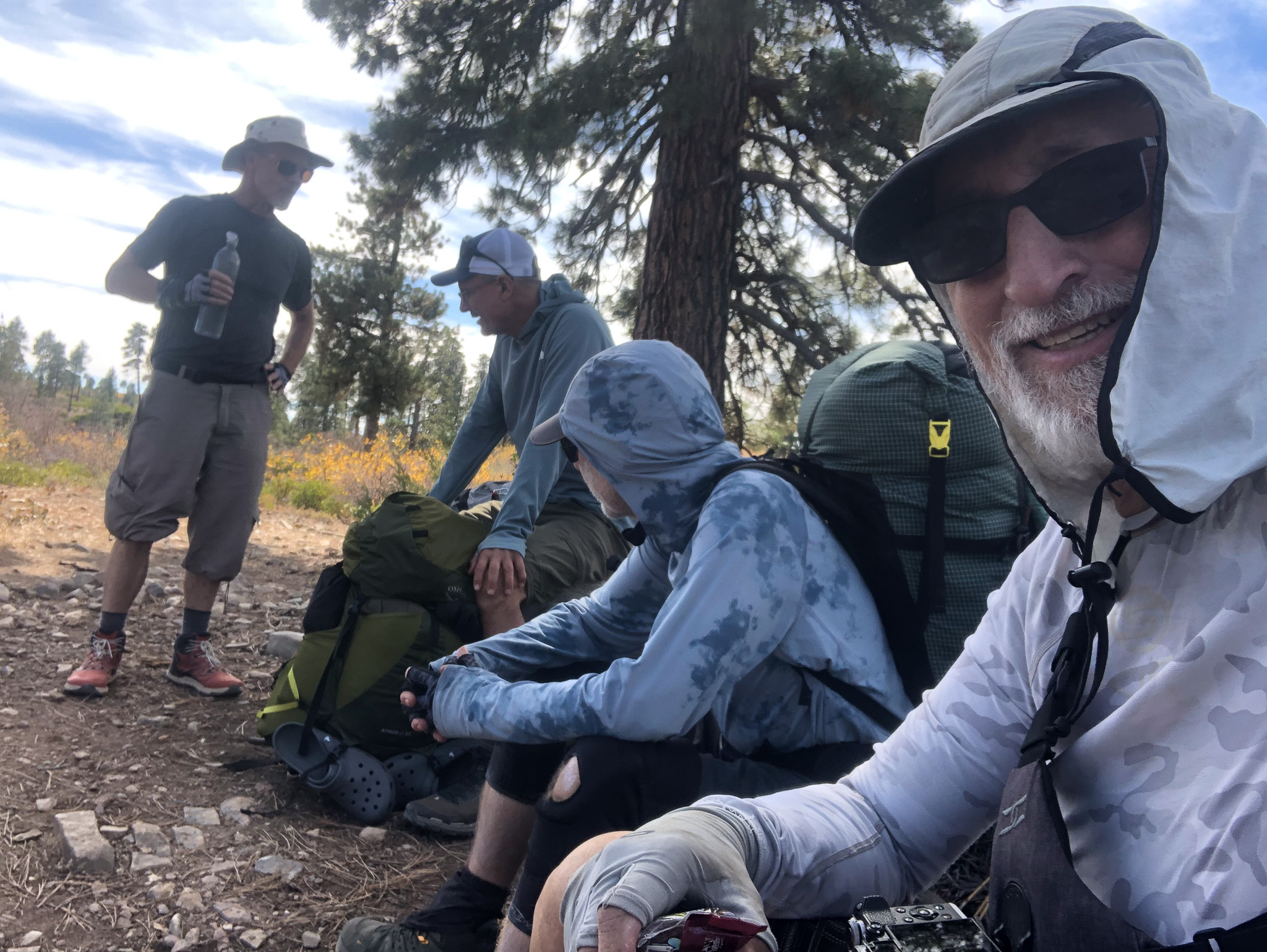
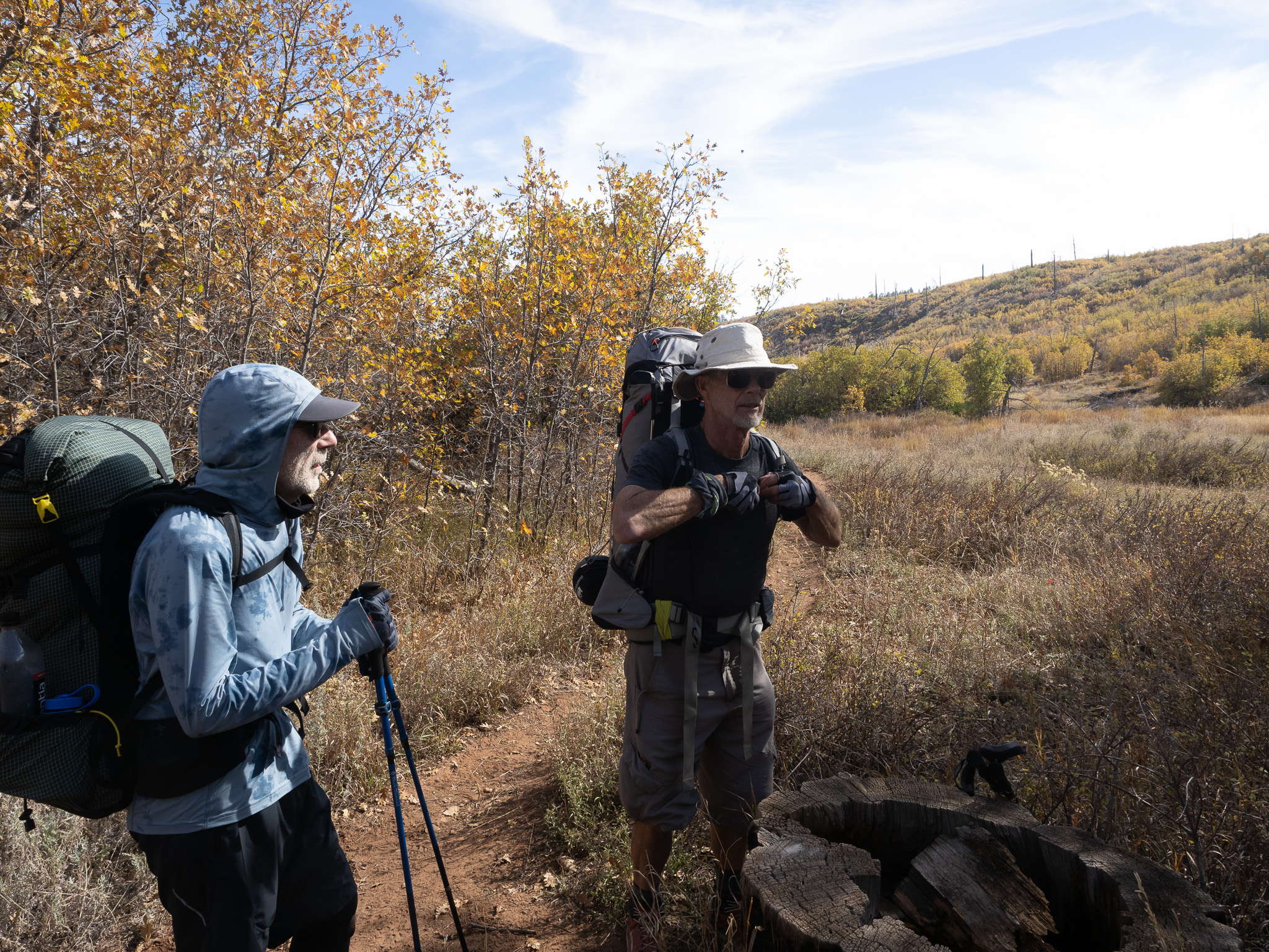
The connector trail was indeed hard to follow in more than a few places, those being areas of climbing slabs of exposed rock, however you can see that people put various markers along the trail to follow, so it isn’t as hard as you might think. The Connector Trail started out no different really from the HV trail on the Kolob Terrace, because we were still on the terrace, however the job of the Connector is to get us from the terrace upto the Wildcat Trail nearly 1000′ higher, so it wasn’t long before the scrub oaks of the Terrace gave way to the higher elevation Ponderosa Pines. As we hiked along, I was never sure exactly where we were going to gain the elevation. With so much exposed rock it wasn’t easy to see a trail scaling up that, but the closer we got then the more details you can see, and that there are indeed places for a trail to switchback and navigate the terrain. I think by this time we were all feeling the results of the rigors of the day. Jim admitted in his accounts on Facebook that he saw a huge reduction in the number of images taken along that portion of the day’s hike. I managed to snap a few composites with my Mirrorless, and my iPhone camera was getting worse in high contrast light, so few images from that device. Jim had announced “Don’t leave me too far behind, I am just going to go at my own pace”, which a few others echoed back as well. I led us through most of this, taking moments to pause, catch my breath and allow us all to gather again. After a couple of hours, we arrived at the junction with the Wildcat TH, where I wish now, we had made arrangements for Mike to be.
From here on, I must admit that my exhaustion at this point in 2011 impacted my ability to truly recall what lay ahead of us, as we walked it I kept thinking “I don’t recall this at all”, and leading me to think that they had re-routed the Wildcat. My memory had us emerging into an open meadow where we would be a mile maybe from the water source, and have a any number of flat camping opportunities, but as we hiked along, and up on what seemed like an old forest access road, none of that revealed itself. Instead we had rising land to our left and falling land to our right, though the land on the right was rising up toward us the further along we walked. The map showed a drainage crossing, dry this time of year, where that gorge finally met our level, and just past that I happend to stop and look off to my right and there down about 10′ was a small clearing that looked flat enough to accomodate us. “Wait here” and I descended down to it, and found it was indeed flat, and just large enough for 4 tents and a place to sit and eat. “This is it boys! We are done for today,” and the relief that swept over their faces was priceless.
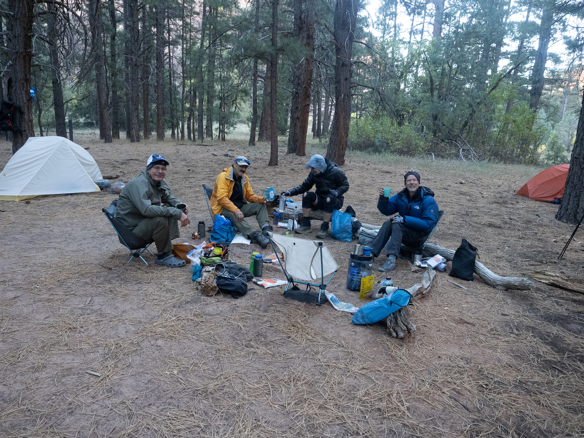
Four tents erected, chairs assembled, Jed had comfy rock to set has ass upon, we settled into the dinner and dessert routine that was customary of each night. I pulled the weather again, as I did every evening and every morning. 0% chance of Precip, and lows in the 40’s, high’s tomorrow in the 60’s, sunny. With the fading light, our teeth brushed, food stored safely, we retreated for the night, to rest for the next big day to the West Rim. We had enough water for breakfast in the morning, so we wouldn’t be rushing out. I think I got up twice to pee, and the stars were full aglow. I wish I had replaced my iPhone before the trip, the camera and software being able to capture these nighttime exposures, but that will be my next trip.
We were up at daybreak, with our tents broken down when we started to heat water for breakfast. It was cool but not cold, and everyone felt refreshed and ready for the day ahead. Other morning rituals completed, bags all packed, we set out again. Within 10 minutes we emerged into a high meadow, not as big as I remembered it, but it was the same meadow of my memories, and it wasn’t as accomodating as I recalled, but I did drop a waypoint where I believe we had camped 13 years earlier. The Wildcat Spring was flowing just another half mile ahead when we arrived. Flowing is a strong word, but with the use of my trowel we were able to cause enough water to divert onto the trowel, and thus provide an easier method to fill our Katadyn bags and filter the water we would need for the rest of the day’s hike. We had Cabin Spring at our next camp, so we only needed drinking water for the hike over. We weren’t the only ones using the spring. There were hundreds of bees that were there for their needs as well, and none of them paid us even the slightest attention. The bee dance that plays out in those hives is probably one that has been danced out for 1000’s of generations of bee hives throughout the years, as this is consistently a spring that flows year round. It is not a drainage, but a place where the water in the rock above us escapes out of the ground to provide living things with it’s benefits. There is a look that comes over the face of one who drinks a fresh drink from water like this. It is one of bliss.
Beyond the spring, the Wildcat Canyon, which is cut by Blue Creek rises up to the level of the trail as it winds around towards the junction with The West Rim Trail offering up views to the south bordered on both sides by the fall colors of desiduous trees. Beyond the Blue Creek crossing, the trail ascends all the way to the trail junction where we found some shade, to rest within. We were just out of sight from the trail, and heard some voices, which we came to find belonged to 3 trail runners who were watering up using their water cache. They were running the Trans Zion Trek in a single day. 37 miles, and they still had about 13 to go. I am going to say they just finished the worst part, and though the last 14 were not easy, they were way over the hump. It wasn’t long before they caught up to and passed us after we had left them. I remember the same sense of awe from 2011 when a larger group passed us, also on the West Rim Trail, doing the same run and having started their run at 4am. These two would finish before sunset.
The West Rim Trail, aside from the Narrows, is probably the premiere trail in Zion. The Narrows offers up the beauty of a slot canyon, and the hues of warm light reflected off the red canyon walls, while the West Rim Trail sits high upon a plateau, maybe a mesa offering up almost 360 degrees of viewing pleasure to the East and West. On the West side, you have Wildcat which joins the Left Fork (home of the subway), and even though you see the same gorge along the length of the WRT, you get different angles, and of course the sunlight is always changing. On the East side, you look out over the main Zion Canyon to distant points that look to be 30-40 miles away. It had’t occurred to me in 2011, but since I knew our car camping crew had driven to Bryce Canyon, which was a couple hours driving NE of Zion, and I recall a visit I had to Zion where I stood at 9000′ looking at a plaque that stated that looking the West and South all that lay before you to the other distant side 40 miles away was all one land mass and had eroded away over time, I now knew that what I was now looking at was indeed Bryce Canyon. Bryce was over there, and was probably the highest point on the far ridge, though the entire ridge extended South into Northern Arizona.
I live on the East Coast, and have lived here most of my life. unless you find a giant farm, or climb something that rises above the local landscape, like a mountain, you can’t see very far. Even if you go to the beach the horizon is only 15 miles away, so if that is your experience as well, then it might be difficult to imagine being on the West Rim Trail, and having the visuals to the left and to the right cover nearly 90 miles. Unlike the Appalachian Trail, there are not a lot of rocks and roots that keep your eyes anchored to the trail, so they are free to roam the horizons left and right, and bask in the warmth of the fall foliage, which covered the off trail portions as far as the eye can see. It’s almost a sensory overload, so much beauty. Occasionally the trail is out in the middle of the plateau, and then it moves closer to the Western Edge. The West Rim Trail, generally stays on the Western edge of the plateau that is the Western Rim of Zion Canyon proper.
It isn’t entirely a single plateau, as there were two significant dips, the second one being Potato Hollow where our original camp was located. By the time we reached Potato Hollow, my feet were in their “Get these boots off me” mode, and we still had come miles to cover, but I knew at that moment how lucky we were we didn’t have to walk 4 miles to get water and back. We only had to walk 4 more miles with our packs. Actually it was less. The 4 miles comes from staying on the West Rim Trail, where as, there was another route, using Telephone Canyon, that reduced the distance to 3.2, and when we reached the junction, my voice said loudly, “Let’s go this way, its shorter” and no one objected.
It didn’t take long before I regretted that decision as Telephone Canyon is not well maintained, and does not have the beauty of the West Rim Trail, so although it was 8 tenths of a mile shorter, I don’t believe it was any easier. Another drawback to Telephone, was that we hit our campsite from the North, and by the looks of the Cabin Spring icon on the official park pdf map, as well as where I dropped a supposed waypoint, and an area that kind of fit the description of the park ranger, as in “There is more green”, we had initial problems finding that spring after we reached camp and decided we needed to know where it was. Both Jed, and I had searched the area and came up empty, and we were hatching a stupid plan to use the next day to hike down to lower canyon, get water, and hike back up. Fortunately as we were considerering this plan, Jim wandered back from his scouting trip to find a nice Sunrise point, which he announced quite excitedly as “I found a perfect spot to watch the sun rise in the morning, and you know what else is great about the spot?”. We hadn’t a clue. “The trail to the spring is right there, and there is water!” to which Jed and I rejoiced happily. Of course, we had to see this for ourselves, and so we saw that where Jim said we would watch the sun rise, was also a junction of 4 trails: The one down to the Grotto (Our exit in 2 days), the West Rim Trail, The Telephone Canyon Trail, and the side trail to Cabin Spring 100 yards. Had we stayed on the WRT, we would not have had the fright about water, as the sign was very clear, and we followed the trail that 100 yards, and sure enough, it comprised two small pools that we would have scoop water out of, using a cup, and pour that into our filter bags to fill them up.
We did just that, and it worked out just fine. The water was cold, and delicious and we grabbed just enough for our needs through the next day, and retreated back to camp where I exclaimed that this must be one of the best sites in the entire National Park System, with it’s awesome East facing view, it’s proximity to water, and its flat level ground for tenting with giant Ponderosa Pines for shade. It was truly magical, and achieved a greater status as the setting sun cast the Eastern clouds (there weren’t many of them) a red glow that was beautiful. We took care of our dinner, and dessert needs, Jim and I sipped some whiskey, and then with our teeth cleaned we took care of food safety, and retired for a sunrise wakeup call the next morning. Death March 2 was over and everyone was hydrated, fed and happy.


Leave a comment