
Three Sisters Loop 8.30-8.31
September 5, 2024 § 1 Comment
Last time I was in Bend, which as it so happens was actually my first visit to Bend, I was here for 3 weeks staying with Daughter #2 and her husband Will. One day, Will mentioned that he would like to do the Three Sisters Loop, a local loop hike, in the Three Sisters Wilderness, and he’d like to do it with me. A little background. Will’s brother has done some backpacking, but Will has only done car camping, and knowing that I do a fair amount of backpacking, he wanted to give it go. I don’t think Will had any idea how big the loop was, but maybe it could be done in a weekend.
I love a challenge, and so I immediately brought up the area in AllTrails, and I quickly found a route that might be the route, and so I queried the loo[ and found this page which verified that the All Trails route was indeed the route. With the distance being shown as almost 48 miles, I quickly realized this was more than a weekend hike. More that is for me. Even with an afternoon start on a Friday, it would mean two 20+ mile days, and there was no way I was going to lead my son-in-law on death march weekend when I think it would be better for him (and me) to have a pleasant 5 day journey, and not hate backpacking when we were done.
I am not an AllTrails subscriber, so I move over to Komoot to plan out a potential itinerary. The nice thing about Komoot, is you input the entire loop, and save it, and the software then asks you to break it up into manageable sections. So, I input 5, and it just drops the end/start points for each section, and then you can step through each section and adjust the end point so that it is somewhere you think there might be water. For example, if you see a lake, then there are probably camp sites around the lake, so a little edit to move the end point to that lake, adjusts the next days start to be the same point.
In the Three Sisters there are a couple of lakes on the South Side, a couple of ponds on the West side, and some creeks coming off the mountain fed by what remains of the Glaciers that used to define The Three Sisters. Of course our warming climate has reduced these glaciers to just a fragment of their size 30 years ago, and in a few years there won’t be any, and then I suspect the creeks start to run dry some time in the Summer months.
This loop can be started from a lot of locations, but I initially chose to start it from Lava Camp at the North end, and to hike it Clockwise down the East side, around the South Sister, and then return along the National Scenic Trail made famous by Cheryl Strayed, The Pacific Crest Trail.
I took this to Will and said, here is a loop I think we can do, and that I would commit to coming back the following September and we could do it over a weekend, maybe Labor Day weekend, and knock it out in 5 days. He said “Cool”, and that was that.
Fast forward to March of this year, and the invitation came in for my Nephews wedding, and as it so happened, it was scheduled for the end of August, the 24th, so a plan started to take shape. I could fly in early, and get a place in San Francisco, I could work in the morning, ride my bike in the afternoons, then I could rent a car and take in the wedding in Half Moon Bay, and then afterwards, I could fly to Bend and spend 3 weeks in Bend, and Will and I could knock out this loop I had planned. Tickets were purchased, and the plan was made.
Initially, I was thinking we would do this loop over the weekend of the 7th,8th maybe starting Friday the 6th and finishing on Tuesday the 10th, however my daughter reached out and informed me that she had some friends that were targeting the 7th as the day to Ride the Rim at Crater Lake, and would I want to do that? Well, of course I would want to do that. I pushed back, to see if Will would want to do the Sisters Loop the weekend before that, which was Labor Day weekend. He confirmed that would work, and so we changed the plans. In addition, Corrine said that she would like to join us for the first day, and add to that the need to obtain a Cascades Overnight Permit, and I switched from the Lava Camp start, to a Devils Lake start at the South end of the loop. The advantage being one, it was closer to their house, but the main advantage being that when Corinne needed to hike out, it would be more manageable to hike out from a camp at Green Lakes than to have to hike back to Lava Camp, and so I set my sights on targeting the Recreation.gov site for an available permit when the permits for 8/30 went online in the morning.
I was successful getting a permit; I was online waiting, and as soon as the clock ticked to the moment they became available, a page refresh revealed “Available” for Devils Lake, and I grabbed it. 5 days, for 3 people, and I noted that 1 would hike out on day 2. We were set.
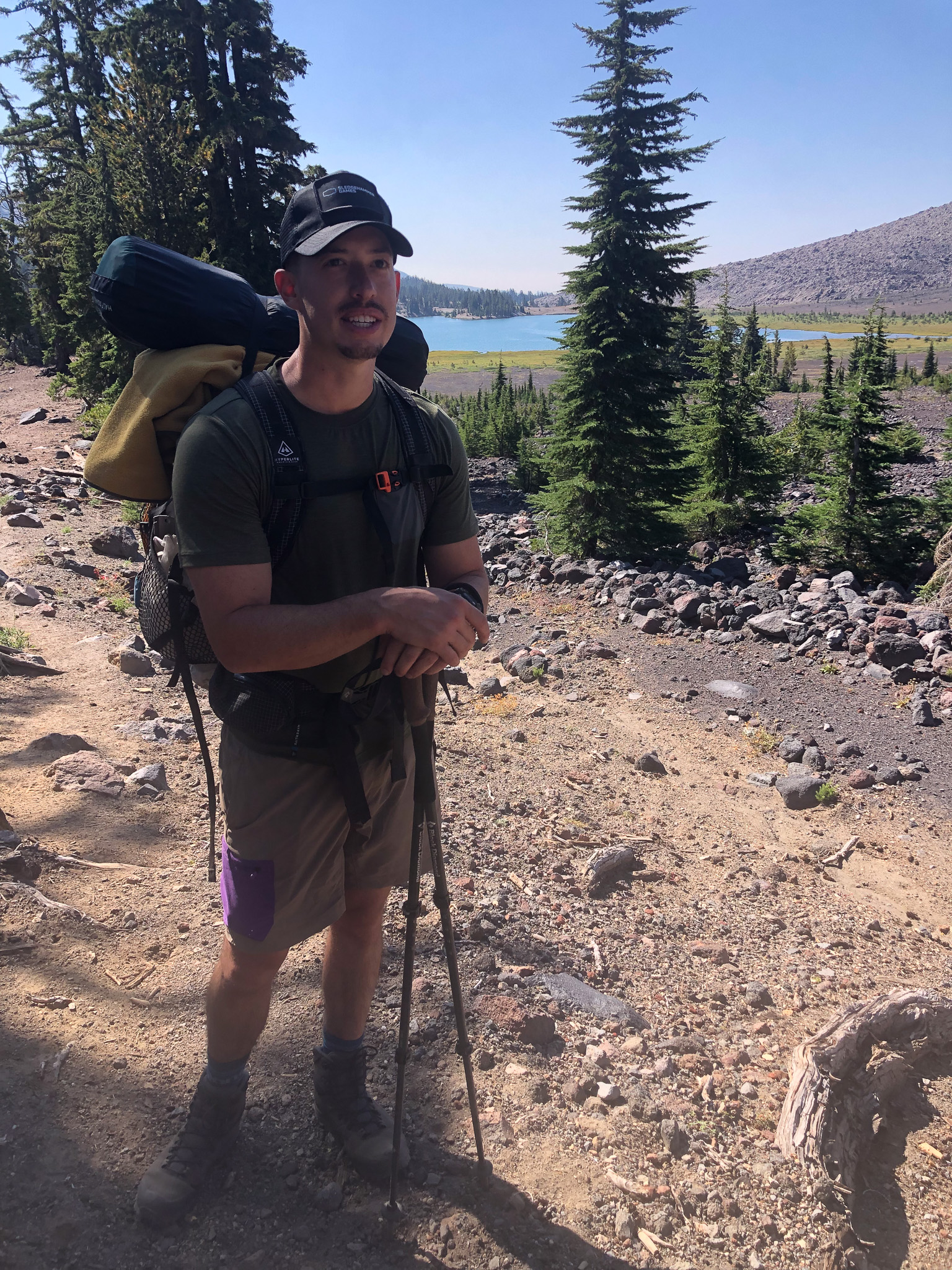
Fortunately Will had some lightweight gear already, and he had a friend that would lend him a Hyperlight backpack. Corinne also has something that would work for an overnight, so they didn’t have to buy anything for the trip other than food, so we went to the local REI to pick up the necessary fuel and food we would need. We loaded up on some dehydrated dinners, and I also loaded up on some plant-based snacks for lunches. We picked up each one breakfast oats meal so that we could re-use the package with our own Oats for the other mornings. Will picked up some Clif bars for his snacks, and the only other thing we needed was some kind of pour-over setup. Will got a single serving Varia setup and filters, and I picked up a re-usable insert that fit my coffee cup, and with that, we each ground enough coffee for our needs. Will a light/medium roast, and me a dark roast of Bali from Rook Coffee that I brought with me from my local supplier in Jersey.
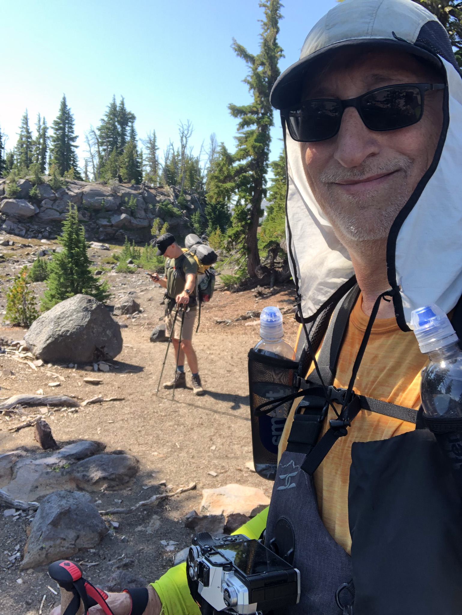
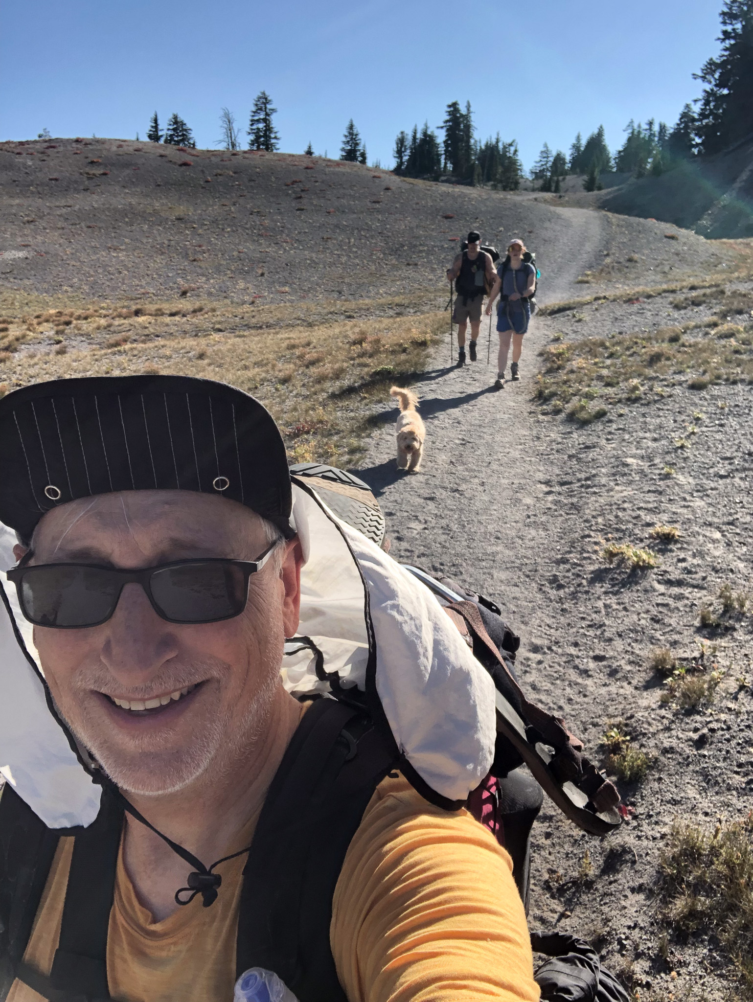
Now, the final obstacle was when we could actually start the hike on Friday the 30th. D2 had a morning meeting so we wouldn’t be able to leave until after noon, so maybe we get on the trail by 1 PM. Our goal was to get a camp at Green Lakes, but first hiking up to Moraine Lake first, and then hiking over to the basin that contained the Green Lakes. Will also had some things to wrap up, and so I decided to work the morning hours as well. We did at least get most of the car packed the night before so when the time came we only really had to pack up our food supplies and to go. I think we finally got out of the house at 12:30, and we were actually about halfway to the trailhead when I asked the most important question I should have asked when we were back at the house. “Did you pack some toilet paper?”. So, a 180 was done and we drove back into Bend and grabbed some TP at the Safeway, and then back into the Deschutes Forest we drove so that by 2PM we had the packs on our backs in what was a very hot parking lot, and the 3 of us, and Penny the dog were walking out on the Trail 17.1 for an alternate route to Trail 17.3 which would take us up to Moraine Lake.
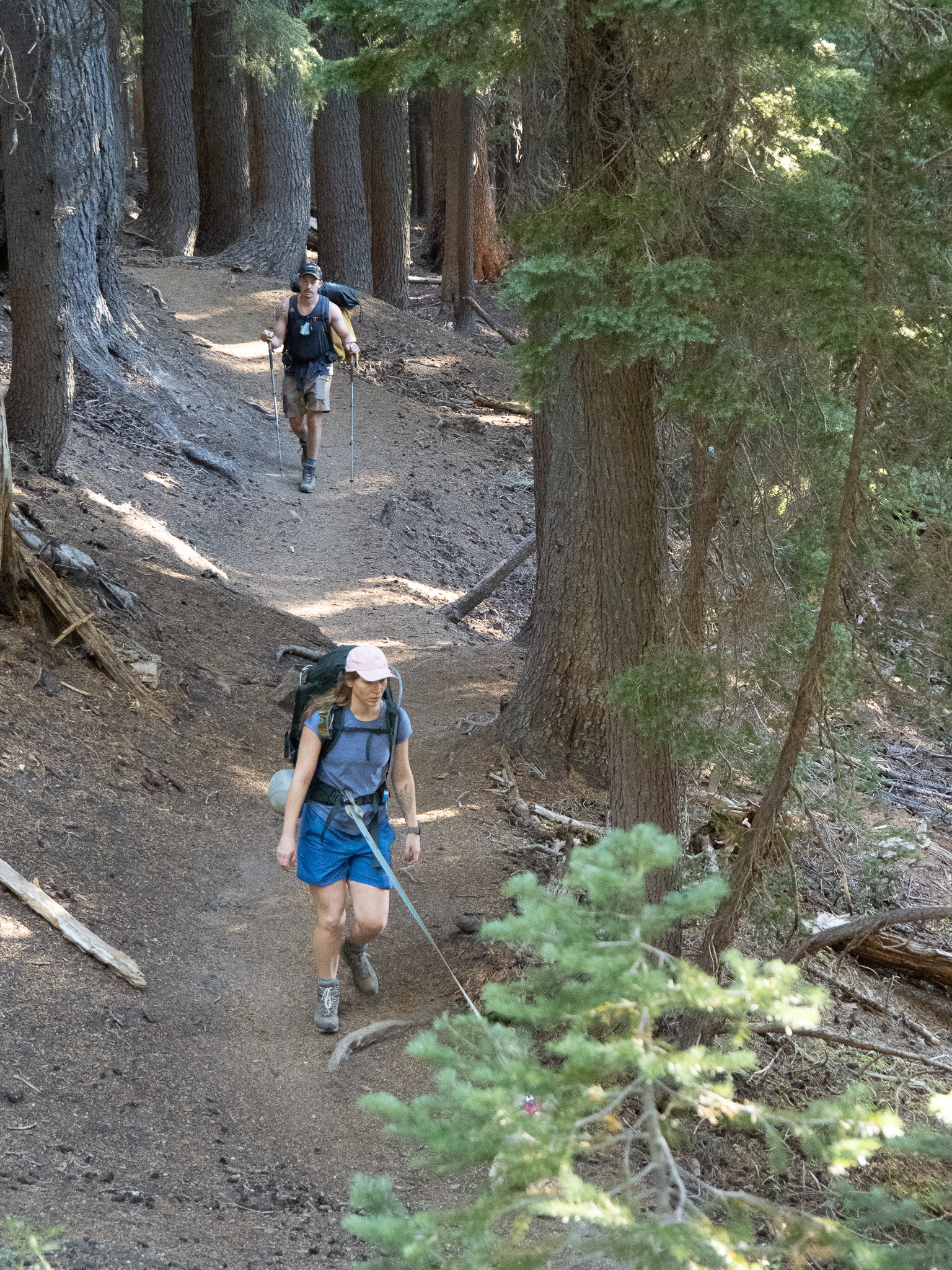
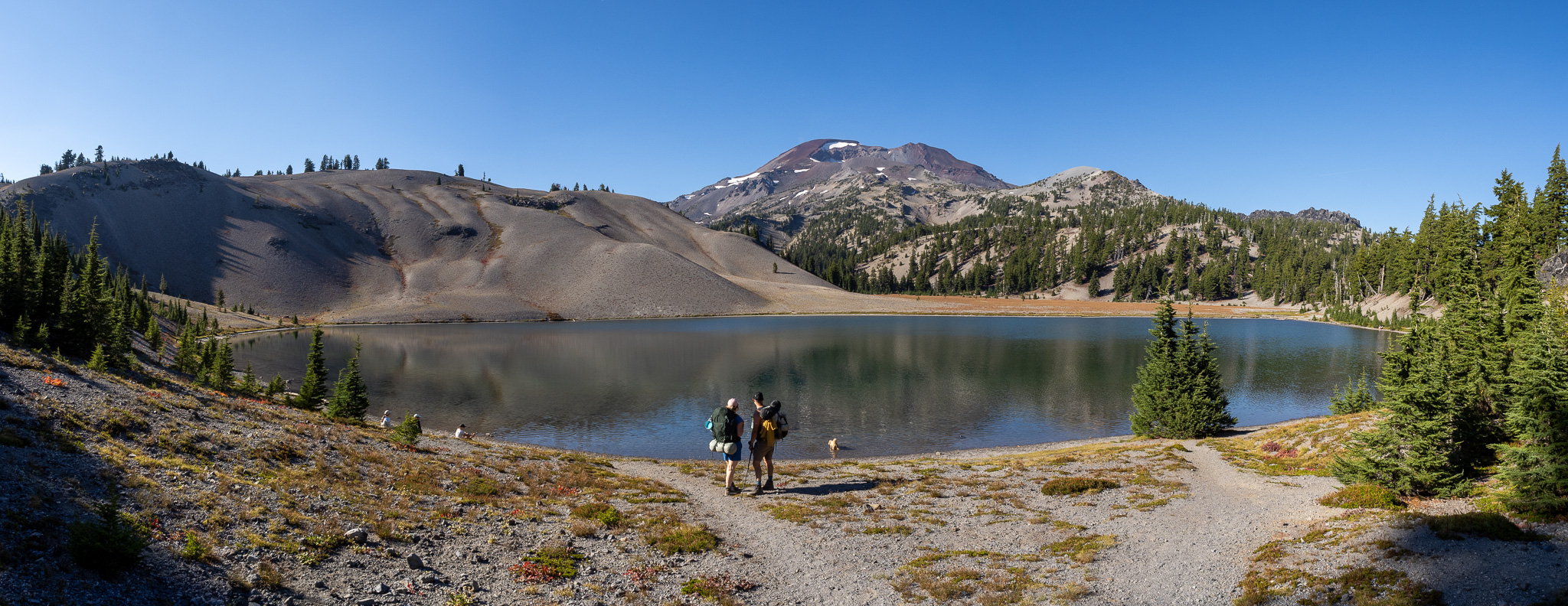
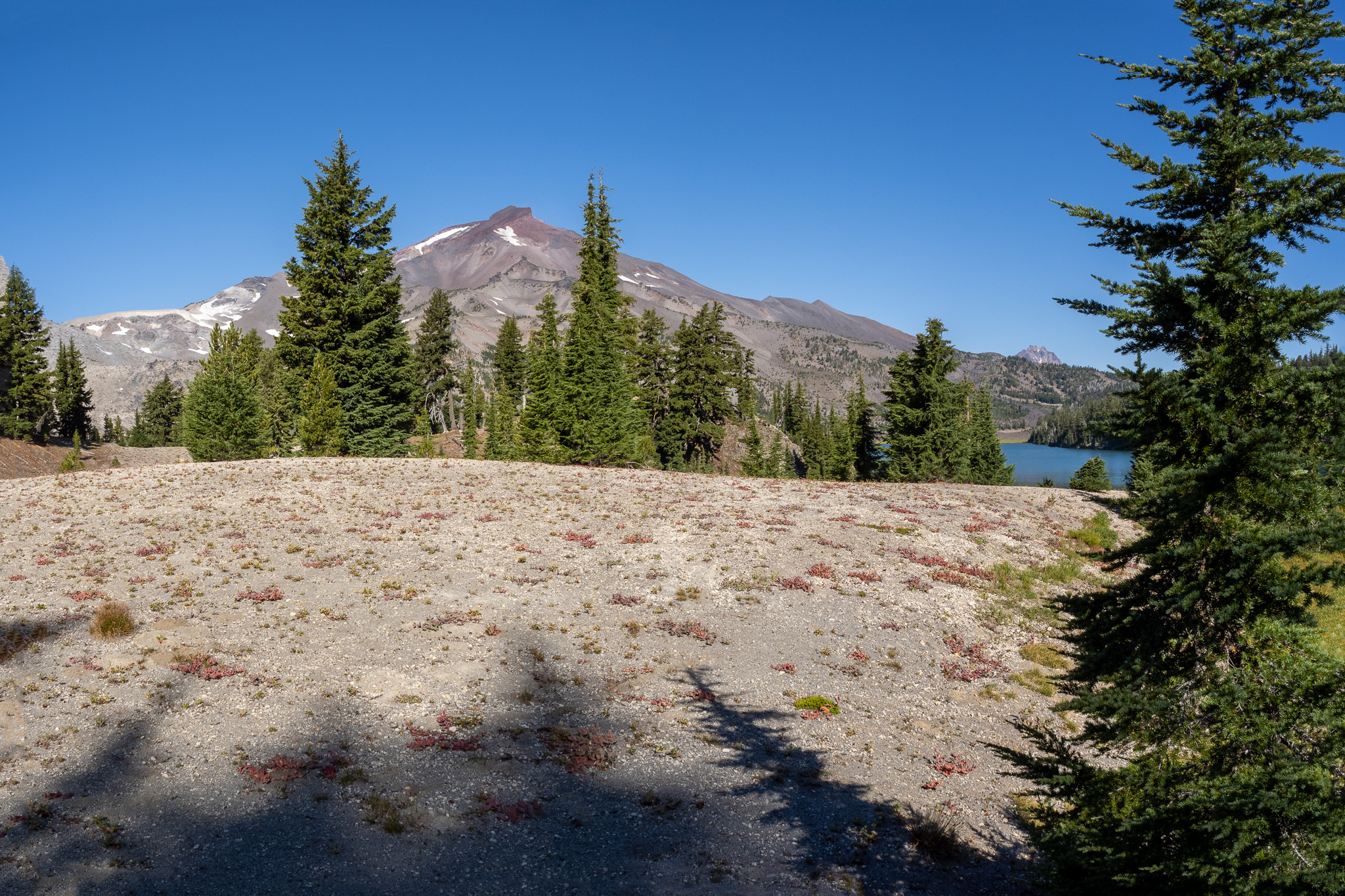
One of the things I like about trails in the West is that most of them are graded for Animals, so that makes it a little easier on us humans knowing that the trail will never get all that steep, however we reached a point on the access trail where “No Animals beyond this point” was on a sign, and as soon as we went beyond that sign, the grade of the trail seemed like it got harder. Bend sits around 3600′ and the Trailhead started at 5600′ and it didn’t take long before we were hiking through the 6000′ contour on our way to 6700′. Will and D2 being more used to their elevation, I was coming from Sea Level, but we all noticed the thinner air as we climbed. Personally I choose an ascent rate that allows me to breath through my nose as much as possible, however there were many times I was huffing and puffing large gasps of air via my mouth, and both Corinne and Will had their moments as well until we pushed through the last 150′ and met up with the loop trail that would take us to Moraine. It was a spectacularly clear day and I immediately started grabbing composite source images using both my iPhone as well as my Olympus, being careful to make sure focus and exposure were the same. The clarity of the sky was going to make for some fantastic shots if they all stitched together in Lightroom.
We walked down to Moraine where I got what I thought would be a great composite of Will and Corinne, and then we descended down to the Green Lakes Trail (17) where we hung a left and ascended up through a pass, following the creek draining the Green Lakes, until we emerged in the Basin with the lakes, and we were all ready to find a camp site by then. We had passed a sign that listed a rough idea of where the sites were, we snapped a photo, but we still had to find one that was unclaimed. I mis-read the map and where we had entered, so we actually walked past a site that would have been just a short hike away, and we descended down to the middle-sized lake of the 3 Green Lakes where I dropped my pack and decided to look around packless. The first site I shot for was in fact a “Day Use Only” site, and I had to retreat back, not seeing any other sites. Then I walked around the middle lake passing a site that two others had just grabbed until I finally came across an open site. I could see Corinne and Will where I had left them, and I whistled so that they heard me. I didn’t want to walk away from the site for fear that someone would take it.
They heard me, and started to walk towards me, where I could hear some voices nearby thus sticking me firmly at the found site until the voices revealed themselves to be some people who either had a site already, or were out for a late day hike and were not a threat to take my site. By this time I could see that Will was carrying his as well as my pack; I hadn’t left instructions to leave my pack as I would retrieve it myself. I was very grateful to Will for bearing that load. Once I was sure our site was safe, I did meet them on the way and take over my “That is a heavy pack!” pack from Will. I had the bourbon, and I had a few other things he did not have, so maybe it was heavy. I just think that since he couldn’t carry it properly, it just felt heavy.
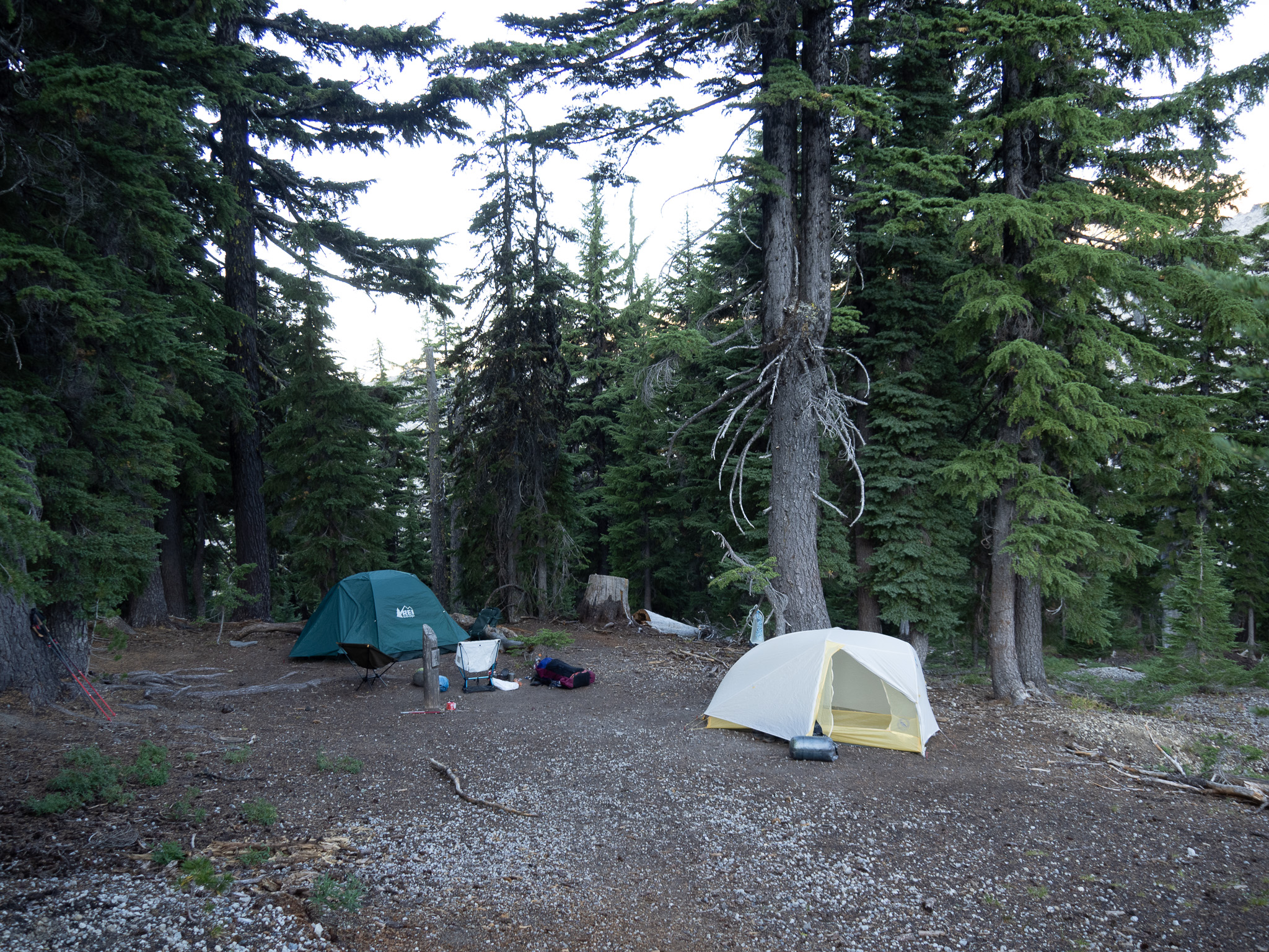
We made camp, Corinne and I went to get the water we would need, and then we set about relaxing and boiling the needed water for our dinners, and since I was also carrying two Creme Brule desserts (extra weight), I started one of them so we could chow on those easy calories later. For our water, we filled all our bottles, and my 3L Katahdyn gravity system as well, so I was rather perturbed to find that system leaking. I just bought that and used it only once, and it was leaking already. As great as the smaller handheld Katahdyn was working I couldn’t understand how the larger system was lame already. I didn’t have the energy that evening to figure it out so I hung it so that it wouldn’t leak, and we used the bottled water. We all hydrated our individual meals, and awaited our corresponding soak times, and so we ate at slightly different times. I had the risotto, which I had remembered being better. It was lacking in salt, so I need to remember that next time. I spiced it up a bit with a small bottle of green salsa we had, and that helped a lot. We were all hungry, and pretty well finished our meals, though I think Will finished Corinne’s. Penny of course ate her own food, and drank when needed. We sat around a little extra time before diving into the dessert. I knew it was a good thing, they had their reservations however those quickly evaporated when they took their first bites. “That is surprisingly a lot better than we thought it would be!”, a sentiment I expressed the first time I had it when Greg May brought it to the High Uintas in 2014, and now it has been on every trip since. Even my Vegan diet doesn’t keep me from indulging those calories. Add to that we cracked open the Bourbon, Jefferson small batch, and our night was complete.
I told them both, Anything that smells has to go into the food bag. Deodorant, toothpaste, your toothbrushes. all of it. Anything that can attract a bear has to be hung. They complied, and we made a terrible bear hang, but as I hadn’t seen any signs of bears, I figured we were really hanging for the critters, and our hang was fine. We had a very nice spot, and my tent was reasonably level. The odd thing when we had set up camp was that when I picked up some rocks to bang stakes in, it was all the kind of lava rock that was filled with air. Pumice stone. Looks heavy until you pick it up and realize that it just might break in your hand if you hit the stake too hard. No other rocks has been around.
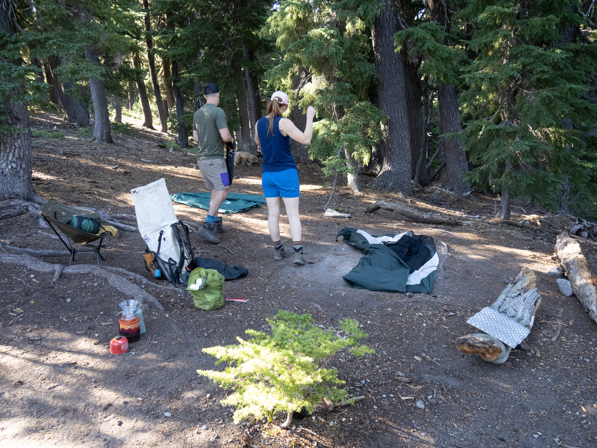
In the morning I awoke around Sunrise having only gotten up once to pee. I felt refreshed, so I packed up my sleeping bag and pad, and exited my tent to boil some water. This was when I spent some time with the 3L Katahdyn filter trying to figure it out. It seemed like the cap wasn’t seating in a piece properly, and no amount of trying to seat it worked, so I wondered if that part was needed at all, and removed it. Lo and behold the cap sealed, and we no longer had a leak. Ha! It wasn’t until later that day I remembered that the last time I used it I had thought that a Smart Water cap would fit, and didn’t realize that the Smart Water cap still had its safety ring attached, and that got left behind. So it was unneeded. All was good.
While my water was heating up I heard a noise behind me, and looking back I could see a Ranger who I knew wanted to see my permit, so I grabbed that and went to greet our guest, and horse. The horse was very affectionate and immediately wanted to eat my permit. Snatched from its jaws at the last moment I handed it up to the ranger. He noticed immediately “New Jersey!?! You are out of your element.” I replied how I needed to get some Western backpacking into my element, and I was giving my son-in-law his first multi-day overnight adventure in the wilderness. Everything was in order, and he went off to check in on others, while I returned to my now hot water where I could hear that Corinne, Will and Penny were astir. Penny of course could smell the horse, and was probably the “stir” instigator, and I welcomed their company to morning breakfast. I under spooned the amount of ground coffee I would need for my pour over, and so the final result was a wee bit on the weak side, but it was hot, and it was tasty, and it gave me comfort. I had added water to my oatmeal bag, and was waiting on that as well as Will and Corinne took care of their needs as well.
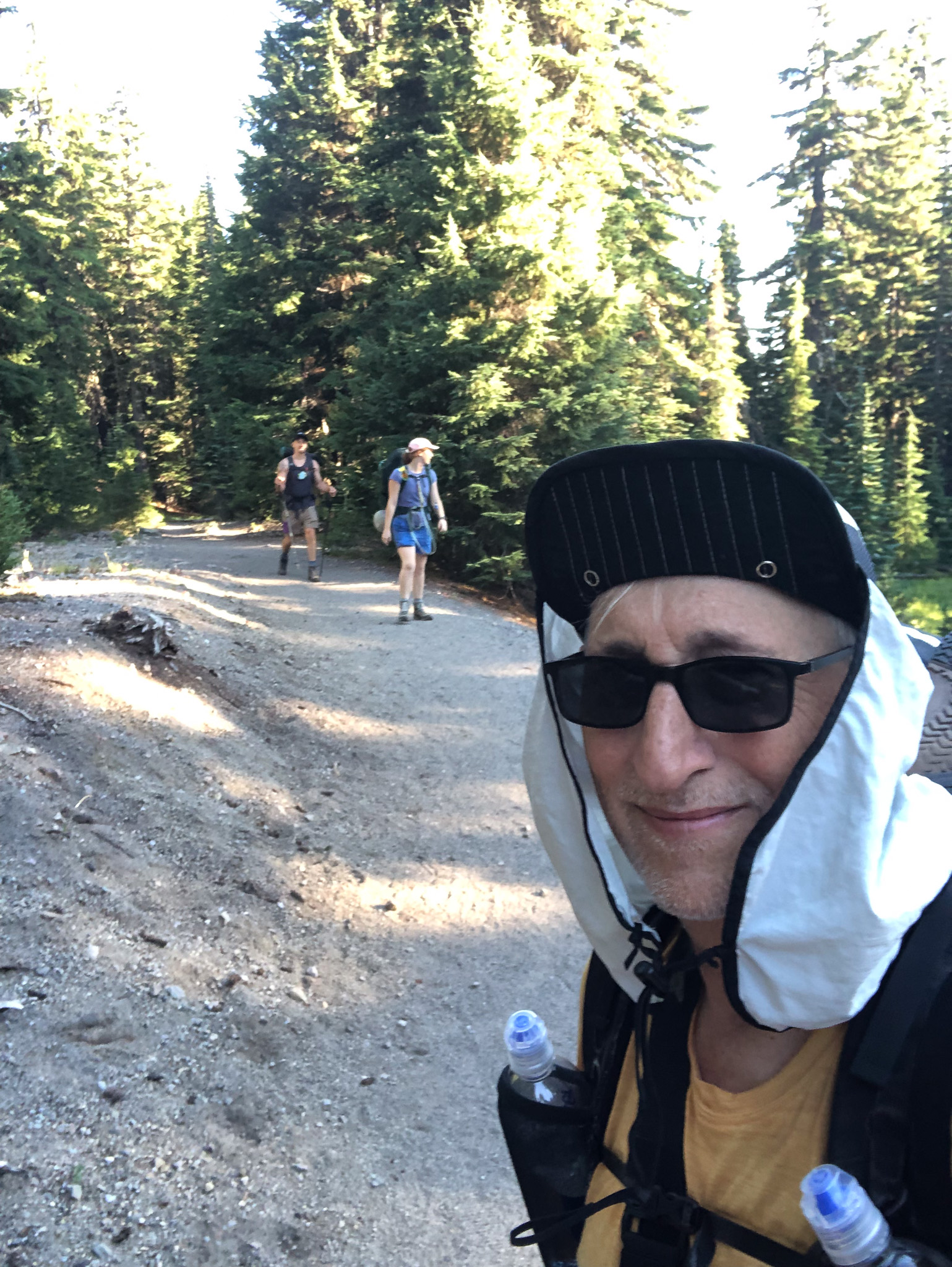
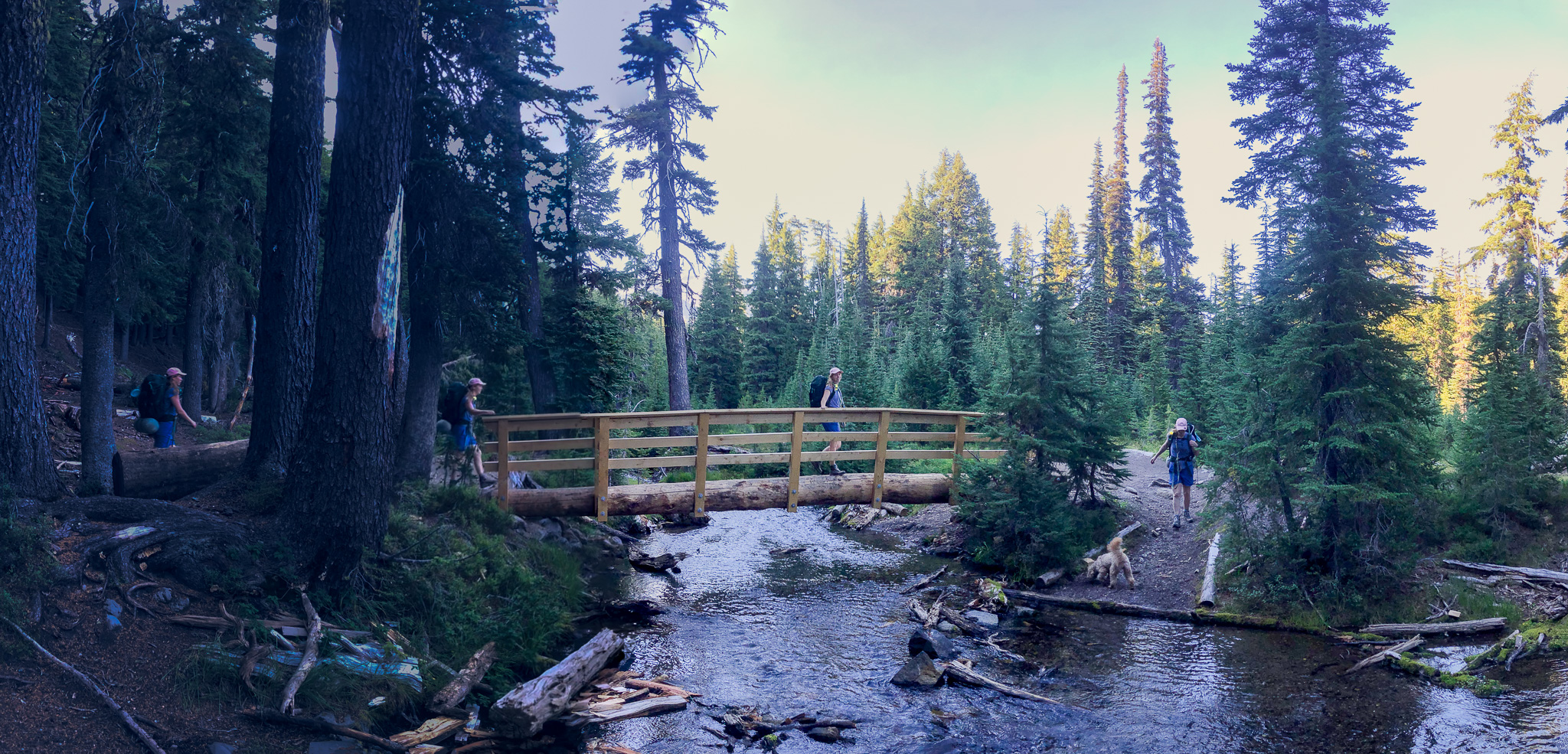
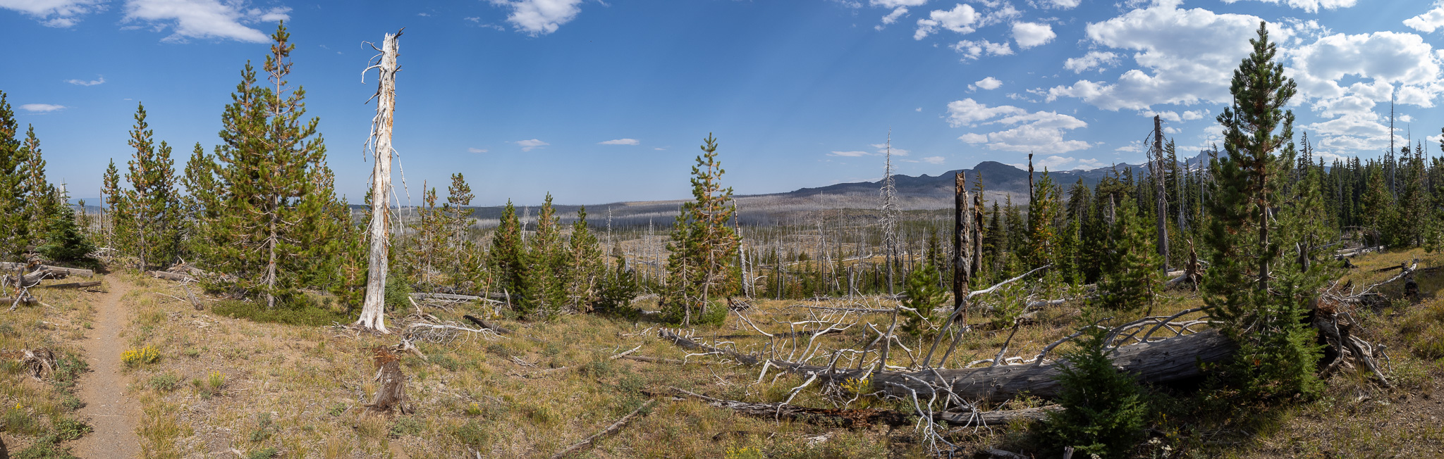
I won’t say it was a lazy morning, but we took our time that morning, but eventually we had everything packed back up and it was time to move on. Corinne did not immediately turn back, but proceeded on to a point where she had a better view of the largest of the Green Lakes and from there we said our “fare thee well”s and she turned back while Will and I pushed on. Both of us felt pretty refreshed by the nights rest, and were moving along at a nice clip. By the time we reached the Northern end of the largest lake, we took a break and waited to see if Corinne and Penny came down to the lake on the opposite shore where the “day use only” restriction sign had been planted and shortly they both came into view, unaware that they were being watched. They were having fun, with Penny jumping into the lake. We had our fill, and moved out of the Green Lakes basin up a fairly long climb that wasn’t too strenuous, in and out of tree cover until we crested and had a nice Eastern vista looking out over the landscape that stretched out to the area North of Bend that included Tumalo and Redmond. What we could also see was a giant burn area that we were going to enter. It was a beautiful day, and warming fast, but the skies were clear and we had clear views ahead, behind and where ever we looked. I stopped often for sweeping panoramas.
We ran into what I thought was another ranger, as I didn’t recognize him immediately, and he didn’t recognize me either as now I was in my hiking clothes and not my camp clothes, but eventually I did recognize him, and he remembered as well, so I didn’t have to find my permit again. When we told him we were thinking of Matthieu Lake, he frowned saying “That’s ambitious”. He mentioned a few places where water was running, and I think that is where “Park Meadows” got planted in my head as being “on our path/trail” because when we finally reached that junction I unwittingly and in a sense, negligently didn’t check the route, or the map. I did have that slight gut check feeling when it seemed like two alternate Green Lakes Trail segments came together, and Park Meadows continued on, but I didn’t think about it more. In any case, it was getting warmer, and no sooner had we walked 30 yards but there was a nice creek with running water, and it seemed like a perfect place to stop for a snack and to water up. While we were there a group of young Women hiked in with their backpacks and dropped them on the opposite side, and also proceeded to snack and water up. Our conversation was somewhat limited, we didn’t bother them, they didn’t bother us.
Mistake #2 occurred when we left that creek as I decided to fill my smaller Kathadyn filter bag, and I didn’t make the proper effort to secure it to my pack. It isn’t rigid, so the movement of the pack on my back, eventually led it to work its way free of my side pocket, and since I was behind Will when we walked on, I didn’t hear it fall, nor was he behind me to say “Hey you dropped something” and so we walked on until after passing some horsed up ladies I reached back to check and realized it was missing. We dropped our packs, Will stayed behind, and I walked back looking for it, not finding it until I got all the way back to the creek where the young women were and where it was returned to me. Now, this time I did talk more with some of the young ladies, and we exchanged our destinations and so confirmed that we were doing the same loop, however they never asked me “Why are you going off in that direction?” when I left them to go back to Will, or “Why did you both go that way if you are doing the Sisters Loop?”. That would have keyed me on to Mistake #1 sooner. They didn’t, and I still hadn’t realized my error, so after trekking back to Will, we continued on and into the burn area until we were about a mile+ in when we came to a creek where I was sure the trail crossed, but I decided to check my map for verification and that is when the question of “What the fuck?” first hit me. First, we were out in the open, so the glare of the sun made it hard to read the screen of my phone, so it was hard to see the route color crossing the creek. It seemed odd to me, since I thought I had chosen my daily route colors so that they would stand out against the glare, and so when I pinch zoomed out, that is when I realized Mistake #1. That junction back by the creek was where the access trail we were now on joined the Green Lakes Trail which we were supposed to be on, and where my nicely colored route line was. We were a mile+ off course, with no choice but to back track.
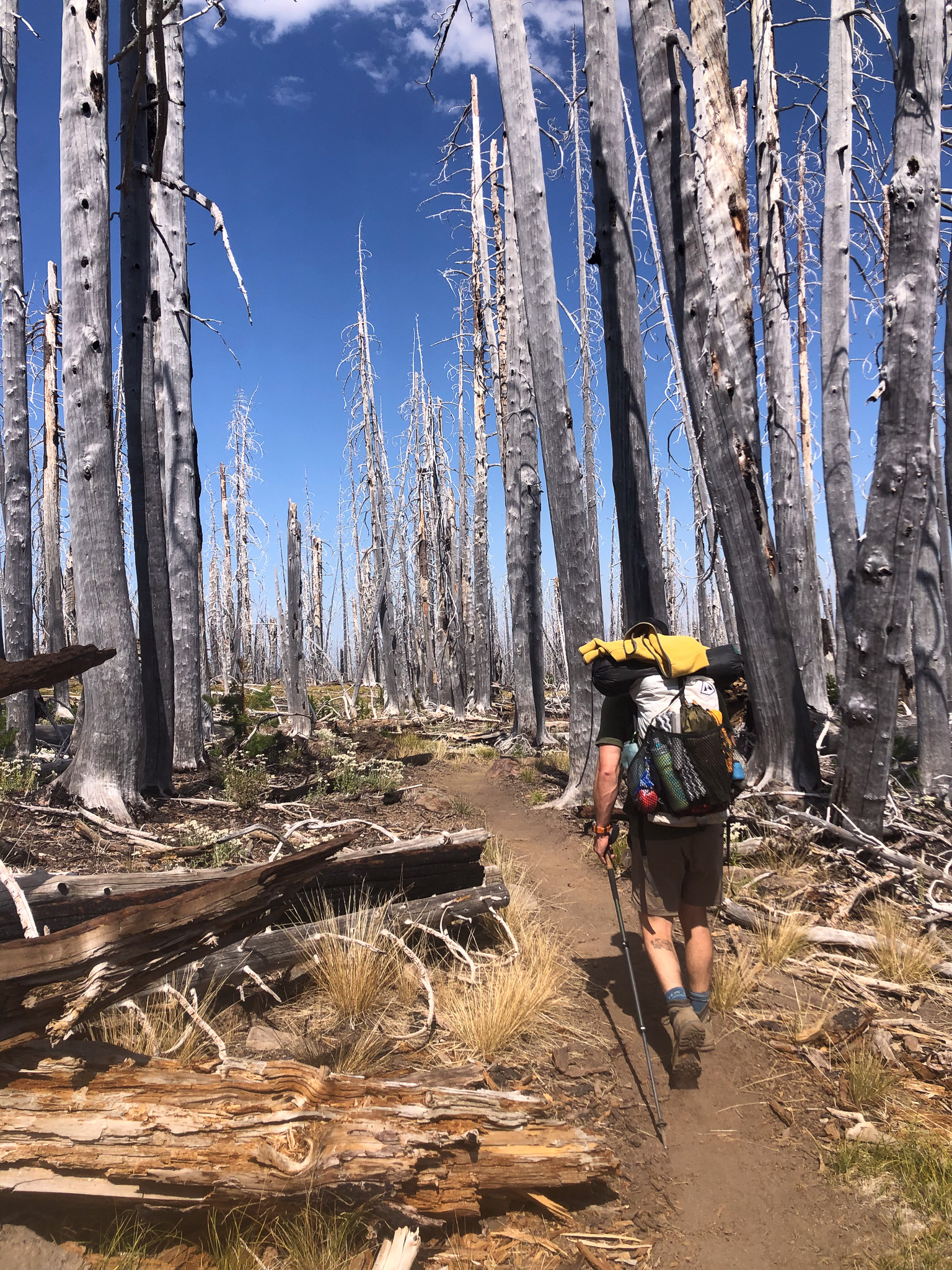
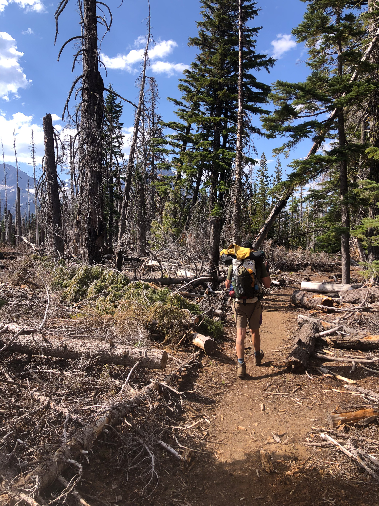
While it seemed like “Quite the Goof!”, that actually saved us from a bigger problem. Though hiking back to goof point did take us back into a wooded part of the loop, it wasn’t long before we re-entered the burn area, and we wouldn’t leave that burn area for good until the next day. There is something very apocalyptic in the landscape of a forest fire burn area. It just seems so surreal to see such death and destruction, and to be clear, there was a lot of destruction. This was a fire that burned hot, and and for a long time, so none of the trees escaped. This burn was maybe 10-15 years ago, and while there was a lot of low growth, it would be a long time before the area recovers completely, and in the mean time, there is so much fuel lying around, that it could easily support another burn. We are in the burn, which means there is no place to really hide from the sun. I was wearing a UV protected shirt with my OR hat that comes with a neck covering so I felt pretty well protected. Will was not wearing his sleeveless again, as he came to realize what a mistake wearing that the day prior was. He wasn’t really burned, but as we kept adjusting his loaner pack, he found his shoulders to be sore from more than just the pack.
On we hiked that afternoon. At some point I had looked at our route, and knew full well we weren’t going to make it to Matthieu Lake, and so I started scanning for the few creeks that were listed as coming off the Sisters. There were two forks to Squaw Creek, which turned out to be the next creek after Park Creek where we had lunch, but when we got there finally, both forks were extremely silty and didn’t present themselves as thirst quenchers, so we pushed on to Soap Creek. Prior to and after Squaw were some minor crossing, but all were dry, so by the time we reached Soap, we needed to fill our bottles again if we were to keep going. Let me admit first that my feet were feeling the miles, it was warm, and I was bit tired, and in my own head I thought “We could stay here for the night”. It wasn’t until after we filled with water, and crossed Soap Creek where we sat down and looked at the Map, and there were no more water crossings between us and Matthieu Lake, so I asked Will how he felt and that I thought we could just look for a flat spot here and call it a day. The look of relief on his face told me all I needed to know, so we dropped our packs again and set out in search of a site. Let me note that this was also the point at which the trail up to Camp Lake branches off, and while there may have been some nice sites on the South side of Soap Creek, we had crossed it already, and so we focused on the North side. Will found a spot almost immediately, but I ventured further along the trail until I found something that also seemed worthy of attention. Will’s site was maybe too close to the water, but I like the sound of the water, and if we had business to take care of we would walk away from the creek, however there was really on room for one tent, and so I took him up to the spot I found, and he quickly agreed that was the better location, so we hauled our stuff up there and went about the task of setting up camp.
One choice I keep making and then never use it, is to pack my portable lightweight camera tripod as I always think is would be cool to make my own “setting up camp time-lapse, and this would have been a perfect time to do it, except I am always too tired to make that my first task, and by the time I remember, it is too late to start. Not even in the morning when I get up. It would be cool to set it up, and time-lapse the entire breakfast, clean-up, take down phase of the adventure. One day. Anyway, we got camp established, and then I took off my boots and donned my xero sandals, thus reaching a new level of post hike comfort and relief. Sitting there we both decided it was time for some bourbon, and we poured out a wee bit more than a dram each and enjoyed the moment.
While we sat there others continued to wander by, both day hikers, and like us, backpackers. The day hikers stopped to chat and moved on, and the backpackers all resolved to go no further, so the junction became an overnight spot for many. A couple of women in their late 30’s, maybe early 40’s came from the North late in the afternoon and seemed relieved (just like us!) when we told them the water is good, and there was a nice spot just down the trail if they only had one tent, so that is where the established their camp, and while I kept layering up as the evening chill set in, I could see one of those ladies walking around camp in a stretch tank shirt almost until I decided to turn in for the night. She never looked chilled at all.
Before Will and I turned in though we had decided to finish the Bourbon, and really take a hard look at the map. Technically we were behind on our schedule, but there was still plenty of time to finish the loop in 4 days, but we decided to trust the mileage on the Nat Geo paper map, and we started adding up the mileage to Matthieu Lake and found that it was 9.8 miles to the lake. If we didn’t delay too much in the morning, and got an early start, we could knock that out by noon, hang out there for lunch and set our sights somewhere further South for our overnight. That would put us back on schedule and give the both of us a positive acknowledgement that we would finish this loop adventure and not opt out. Furthermore, I pulled the weather forecast and there was a 30% chance of evening thunder showers, so plenty of time to get to and make camp the next day. After the last drop of Bourbon was gone, we smiled and fist bumped our accomplishments for the day, and we each retired to our tent domains.
I will finish this discussion in another posting.


[…] 12. I was staying in Bend, OR with D2 and her husband Will, and you may recall my adventures in the Three Sisters the previous weekend, so I was an hour behind, and I set an alarm for 12:50 […]