
NJ AT Sectional Hike #3 – Culver’s Gap to High Point State Park
June 30, 2015 § Leave a comment
June 28, 2015
It’s been a month since our last hike (4 weeks technically), my oral surgery is still in recovery mode, but I am under no restrictions other than I am still on a soft food diet. Our plans of camping Saturday night, so that we could observe the Sunrise from Sunrise Mountain, were thoroughly washed away by a near tropical storm that came through late Saturday.

Getting Started Culver’s Gap
I awoke in a daze. I had fallen asleep in the chair I had last been sitting in watching another episode of The IT Crowd. (Episodes on Netflix!) I hadn’t done anything to prepare for my hike and I needed to get some bed rest before awaking for real at 4:30. I did take some time to put a lunch together and then retired to my bedroom. I wanted to get to bed, so I figured I would just put everything together in the morning and I crawled into bed.
First Clearing Without a View
Easier said than done. In a sense there really wasn’t much to do, but the weather was a big unknown, so should I take a risk and dress for an eventual warm day, or should I pack for the rain day that it did eventually become? I was already committed to my new Hiking Kilt, but what else to wear? I settled quickly on a wicking tee and a rain shell along with standard hiking socks. For an added bonus I found a pair of my compression calf socks to wear as well, recalling how much my calves hurt days after the last hike. In addition I gathered some dry cloths to wear after the hike and I packed everything into my day pack. I still had a lot of water from the last hike in my dromedary, so I was good to go. Downstairs I needed a cooler for the six-pack, my lunch, and also something to eat quickly when I got to the rendezvous point. I grabbed a Nosa yogurt tub, added some soaked oats and peanut butter, sealed it back up and got on the road.
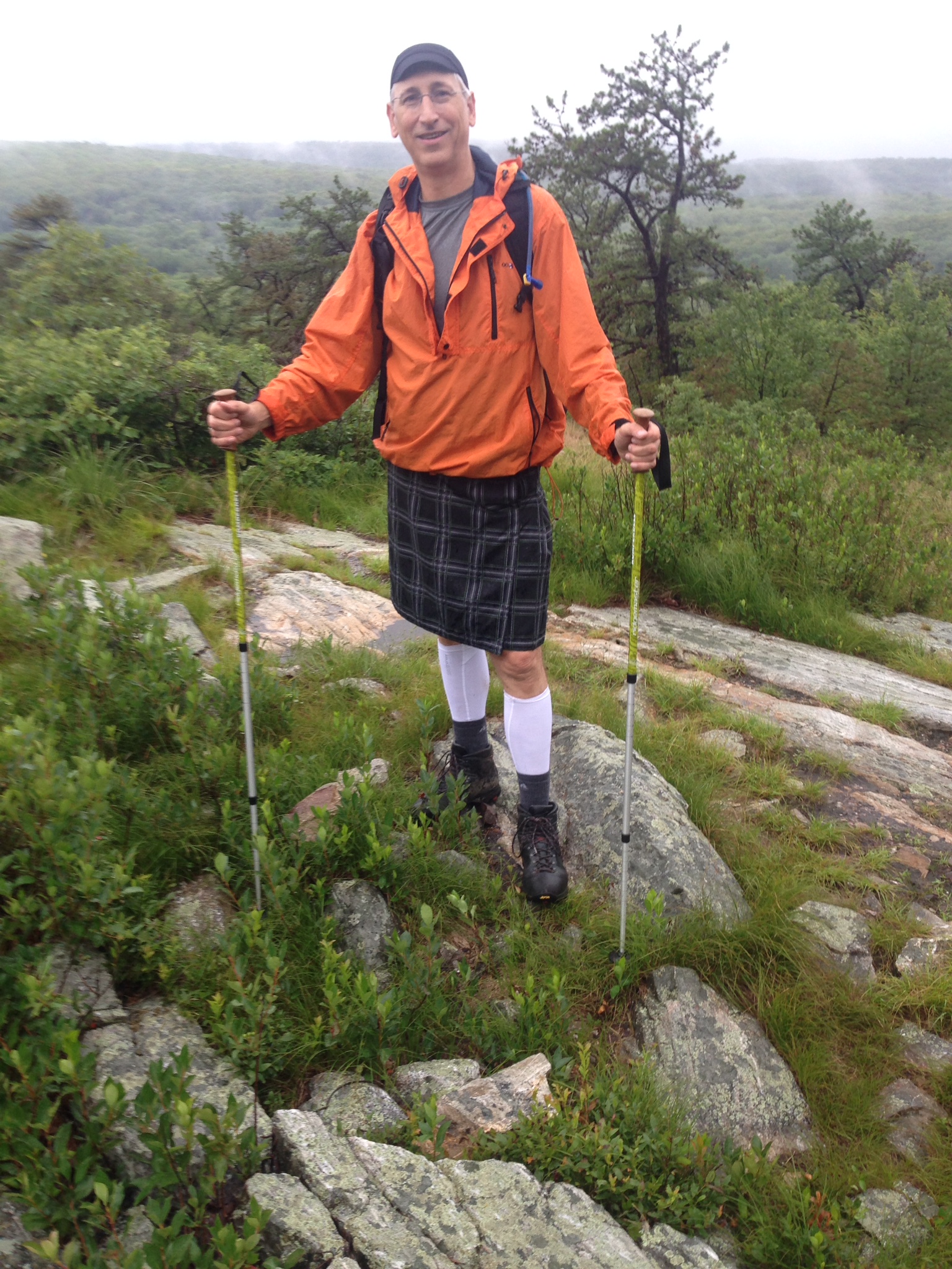
My first hike with my Sport Kilt
Time was tight; Had I planned better I wouldn’t be in a hurry to meet the others. Of course at 5am there is practically no one on the roads, anywhere, not on local roads, not even on the parkway. Other than traffic control signals, distance was the only obstacle that stood between me and my destination. Jed beat me there this time. I walked in, dumped my yogurt tub on the table, and headed off to Starbucks for a coffee and I heard Andy mutter something about my attire. Coffee and a spoon in hand I sat down with Andy and Jed and noticed one of the initial differences between pants and a skirt. My bare thighs could feel the immediate chill of the seat. Andy was smiling. It was going to be a fun day. Mike arrived and did what Mike does, and after Mike did what Mike does, it was time to go.
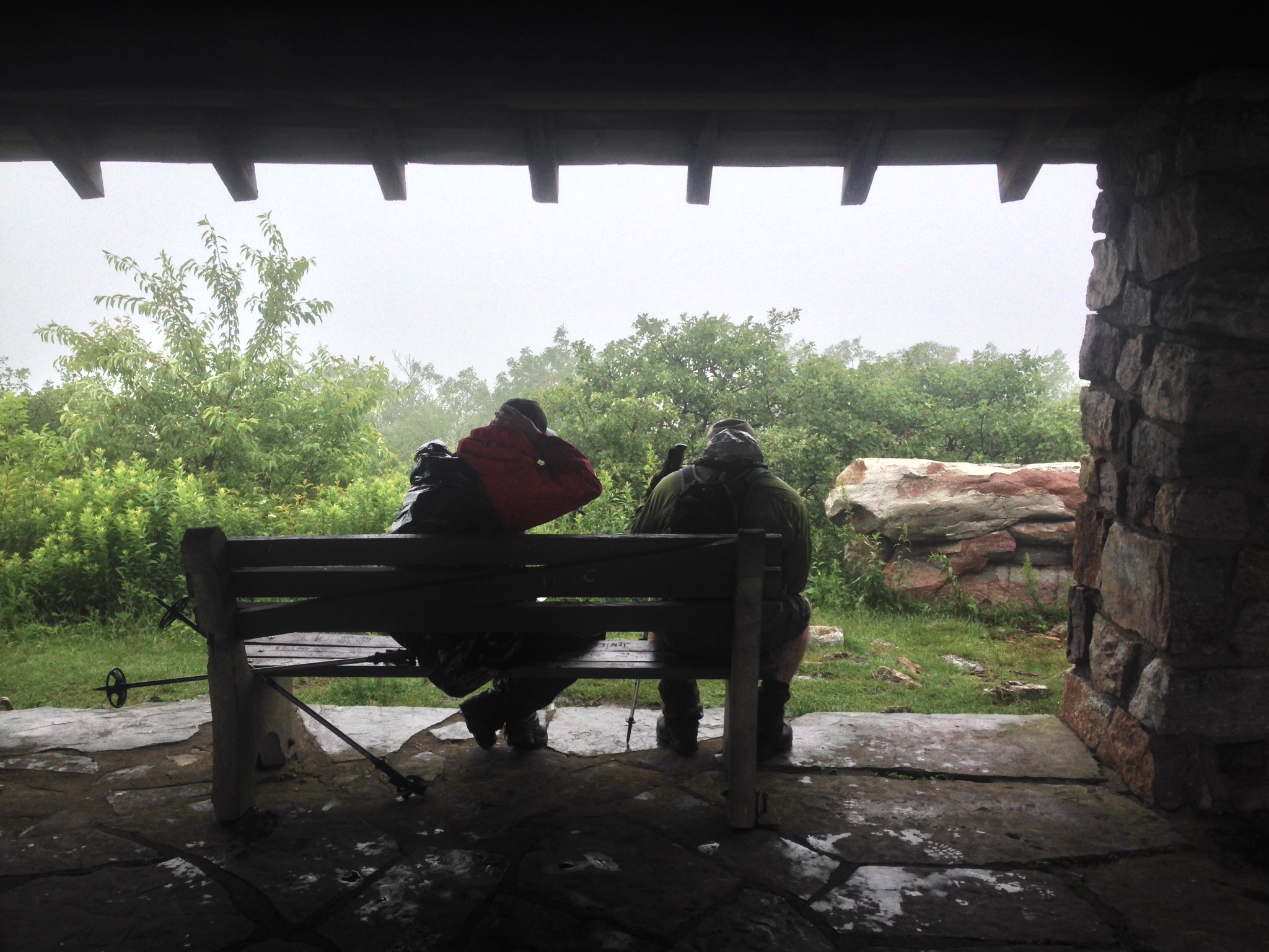
Sunrise Pavilion
For this journey I rode with Andy, and Mike went with Jed, and as we practiced the last trip, there really is no point in one of us getting to the shuttle point 15 minutes before the other, so we followed each other to High Point State Park. The trip was relatively uneventful; Andy and I caught up and conversed over topical current events and before long, we were pulling into the AT parking lot in Wantage Township. It was raining. Beer to Jed’s car, and everything else to Andy’s, and off we set, bound for Culver’s Gap. This is a good opportunity to mention that a benefit of doing these hikes, this way using shuttles, is that you end up driving on roads you never ever would have driven on before, and seeing the beauty that New Jersey has to offer in many of its off-the-beaten-path hide away places. Absolutely gorgeous country roads that pass by farms and homes and cottages and open fields, and forest and lakes etc. New Jersey may not have many (if any) dramatically beautiful features, but it does have a core beauty that is easy to find, if you simply go looking for it. I see it all the time on my cycling rides, and we see it all the time shuttling between the end points of our hikes.
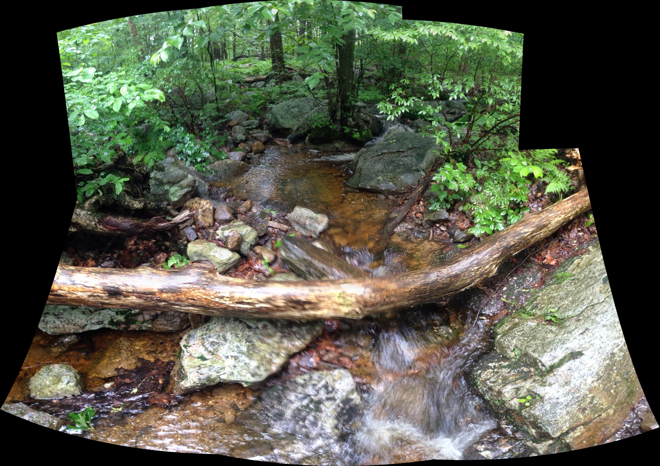
First water source we crossed in 5-6 miles
Had we camped, the plan had been to arise early and drive up to the Sunrise Pavilion, which was about 3-4 miles away. Watch the sun rise, and then return to camp for breakfast, and to break camp and move the car to the shuttle lot. Since we weren’t camping we simply started our hike and walked up to the Pavilion, which was a lot further along the trail than I had expected.
Along the way, we passed a junction for a trail shelter. We didn’t check out the shelter, and simply carried on. During one of our short breaks we were over taken by our first thru-hiker. A young woman who was hiking “alone” however alone is a relative term, as you tend to form a “family” where you for a while you end up in the same shelter at the end of the day, so in essence you are only hiking “alone”. When she caught us, we were just starting to go again, and I walked with her for a short while to chat. Her trail name was Sunrise, and she was hiking the AT as a “Flip Flopper“. This means that you pick a point to start, for her that was Harper’s Ferry, and you hike one half of the trail to the end. Get transportation back to your starting point and hike the other half in the opposite direction to the first half. This “Second Half” can also be done at a different time of the year.
So Sunrise was Flip Flopping and had been making decent time and was in good spirits. She wasn’t the only thru hiker we ran into, as she happened to start her hike later than thru hikers who started in Georgia, but the time frames overlapped, so she was in the crowd of Northbound thru hikers, and they were scattered along the train in the New Jersey area +/- a hundred miles. That meant we ran into about a half dozen of them.

Mashipacong Shelter for Lunch
It is funny how some adventures you think you remember very well actually are very different than you remember them. As I mentioned in my last hike, Mike and I had knocked out the entire Jersey section of the AT hiking North to South back in 1996 or 1997, and what I remember from that hike are fields of rocks that the trail traversed. I have mentioned it and warned others, who ask me, about it and I was dreading those fields. Well, they don’t exist! I thought maybe the trail had been re-routed, so I checked the satellite views and I can’t find anything there either. So I have been warning about complete bullshit! With a record like that I could be a contributor to Fox News.

We met Sunrise on Sunrise Mountain
There is another phenomenon that occurs occasionally on the trail, and it happens more often than you would think. It is the “You’re facing {insert direction of choice} when you are really facing {insert opposite direction of choice here}” phenomenon. It totally sucks, and it usually occurs on cloudy overcast days and the trail climbs to and takes in an overlook. This overlook isn’t part of the trail, and you don’t really observe that the trail markers take you out onto the overlook. You know you are heading a particular direction and when it is time to continue, there is usually a worn path off that many before you have taken, and you follow. We did that, and soon, 300 yards in the trail Peters out and you realize there are no blazes. Perhaps you are with someone, and you are conversing, so you aren’t really paying attention. It’s near the end of the hike and you say thinks like “1.2 to the car and a beer!” and so now you are thinking about the end, and here you have made a wrong turn. So, you back track to the overlook, and again you are thinking that you are facing a particular direction and you know that to go North you need to make a right and there are the blazes, and you convince yourself that you came from the left, and you start following the blazes. There are many things I could have and should have done right there to verify the decision, but in my arrogance, I “knew” I was right.
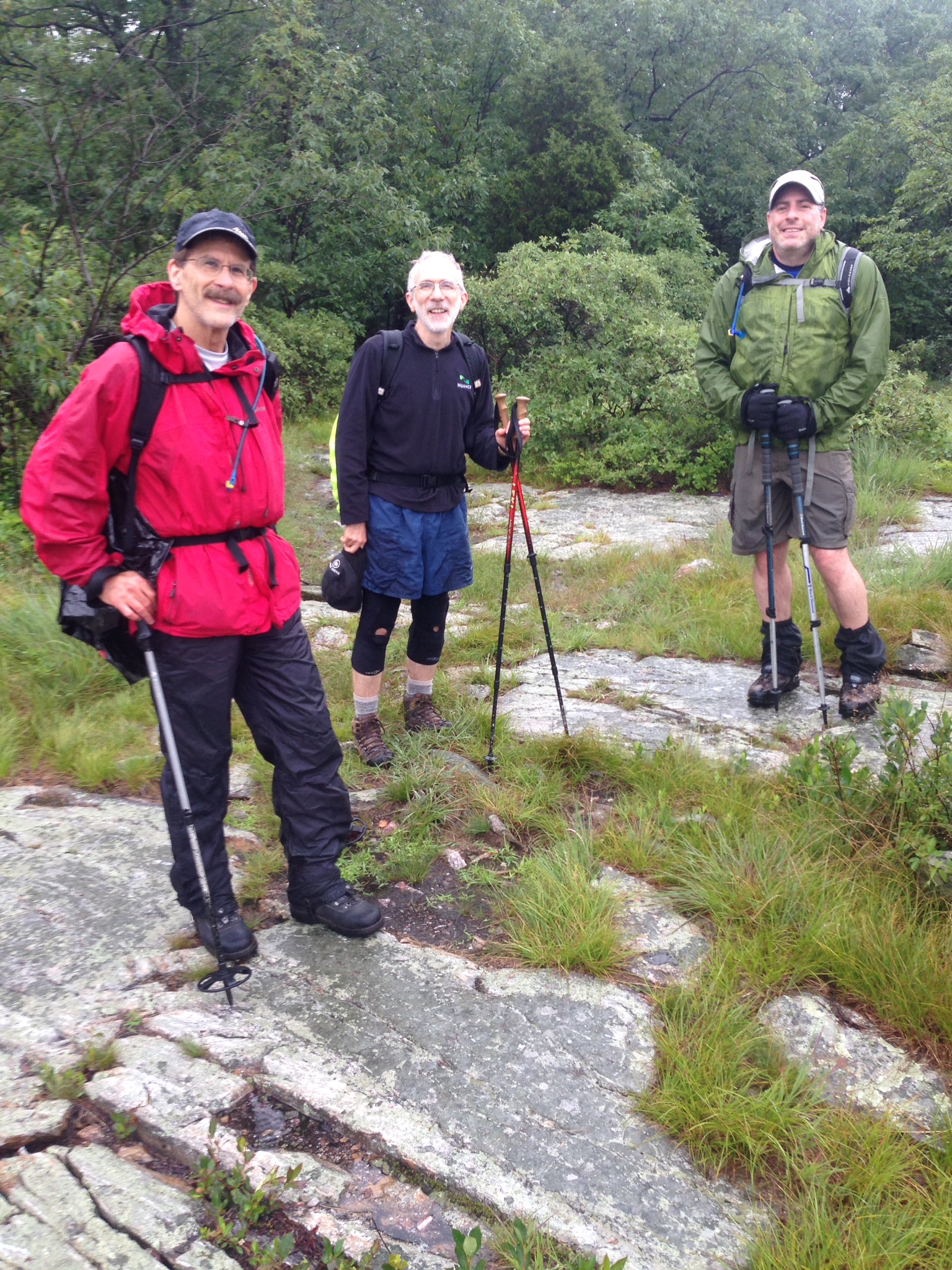
The Gang
The question now is “How far do you walk in the wrong direction before you realize it?”. In 1998 when I attempted the NY AT on my own, I walked 1.2 miles in the wrong direction. The same damn trail looks completely different in the other direction, and unless there is some key feature that you commit to memory, or simply happen to remember, you could walk an hour or more. For us, we could have run into Sunrise again, and THAT would have been completely embarrassing. Fortunately, we came to steep climb that as soon as Jed climbed 10 feet he stopped. I went a little further thinking that Jed was simply weak, and so I took the lead when he spoke up and said those fateful words “I remember this”. F@#$!!! I whipped out my phone which was tracking us and sure enough there were now two tracks over the same terrain. We shouted back to Andy and Mike to stop, and we turned around, thus saving ourselves from the embarrassment of explaining to Sunrise how 4 grown men with a combined age of over 200 years could be walking the wrong direction. So when we thought we were at an East facing view, it was really West.
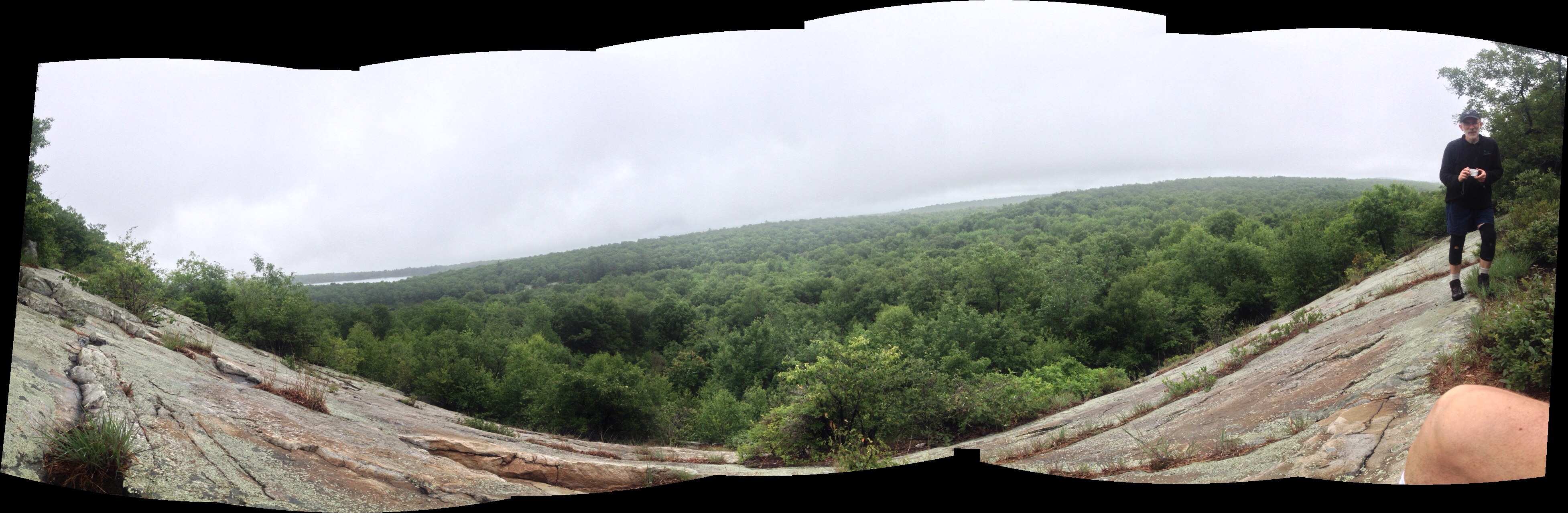
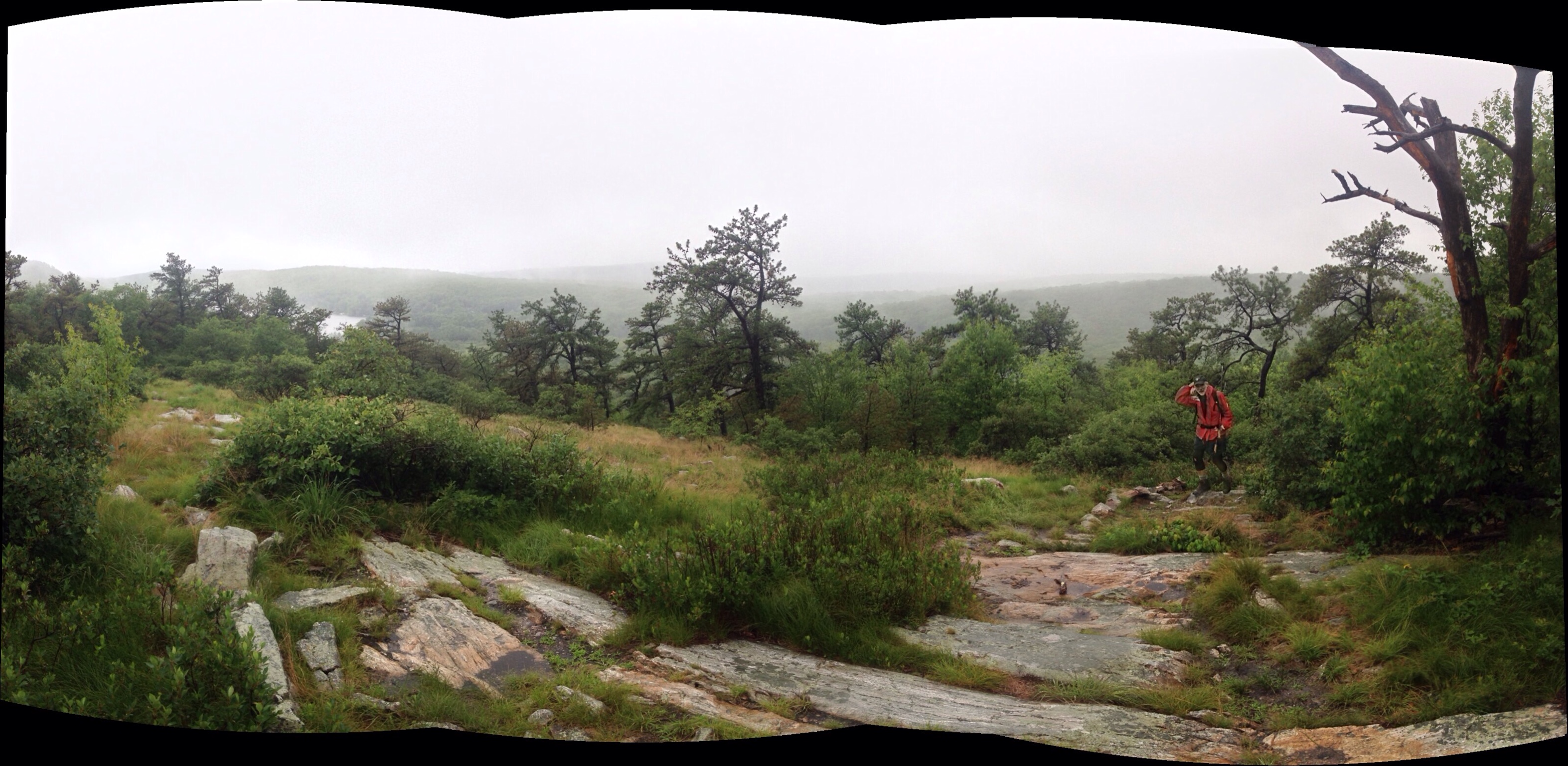
One of the many spectacular views
Straightened out, we once again reminded ourselves that it was 1.2 miles to the car and a beer. Our 13.3 mile hike was now going to be 15-16 miles, but hey, that’s the way it goes. I did apologize for my arrogance, and Mike and Andy learned a valuable lesson that when something doesn’t feel right, speak the f$#@ up and make someone look at a damn map. The moment I turned around and looked back down the descent, I suddenly recognized the root system I had noticed the first time I descended those rocks 30 minutes earlier. Like I said, the trail looks completely different in the other direction!

A Gas Pipeline Channel
I have another memory from even longer in the past. It was either December 1977 or 1978 and I was home from Penn State for the holidays and hanging out with my buddy Chris and he proposed that we go winter backpacking for the weekend on the AT section in High Point State Park. He, his brother and myself set off that Friday and had an adventure. I recall from that trip there was some kind of utility clearing that we stopped at for pictures, one included below, and I was on the look out for this clearing. Again, the memory of it was to me a wide open view, and when we hit this pipeline clearing above, I didn’t quite feel like that was it. I walked up looked over the edge, there was a home just below, and it just didn’t feel right, however, there was not another clearing North of this that we came across, so this had to be it. Looking at the picture below, of course you see that the foliage is all gone, so it has the appearance of being more open than it actually is, and the wall wasn’t there and we stood closer to the edge than the picture above and you can see the house in the picture below. It was the spot.
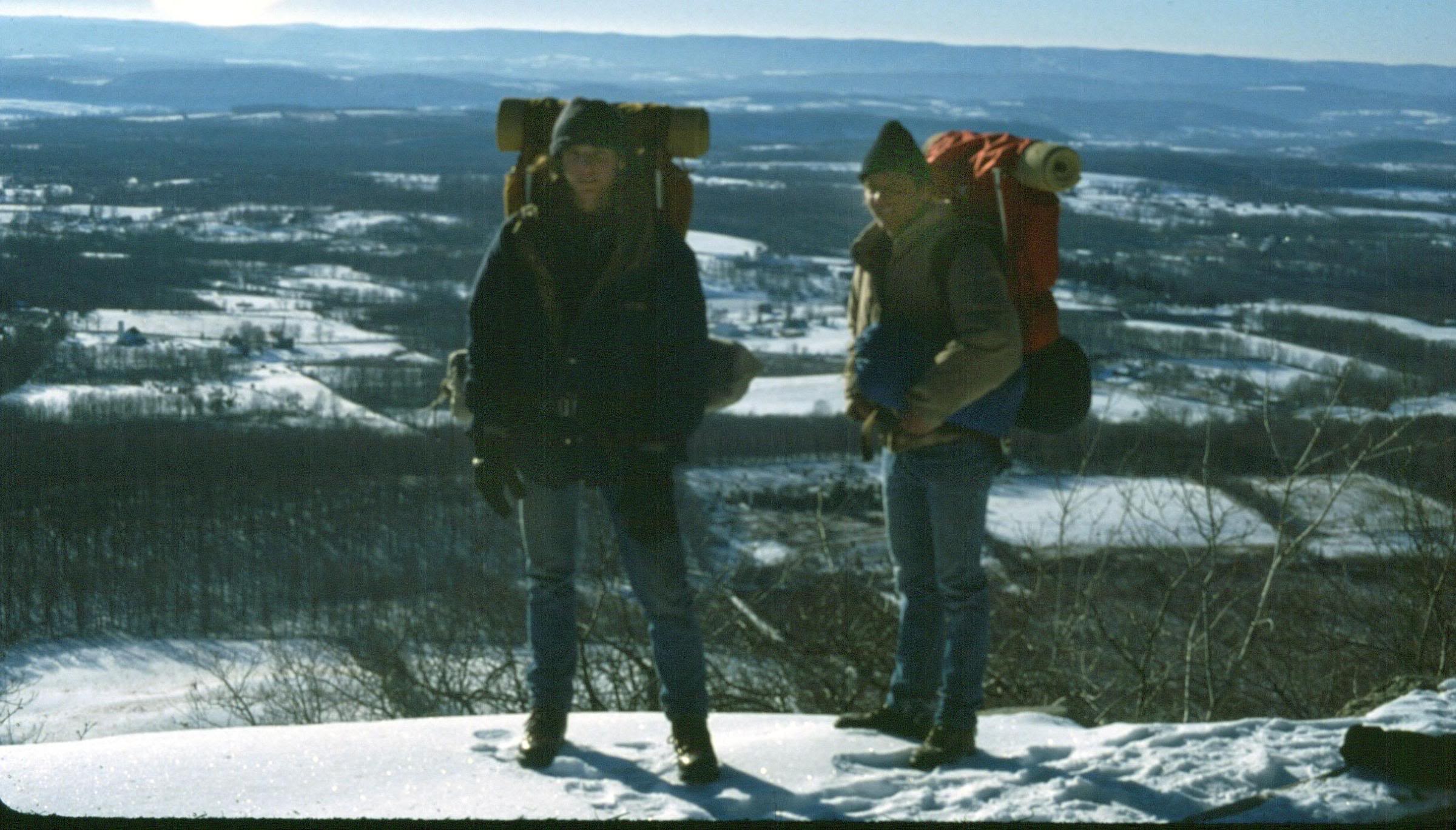
!978 – Same Pipeline Channel through the woods
During our last half mile Jed and I started to over take a Black Bear on the trail. Jed kind of jumped back suddenly and said “Bear”, at least that was how I interpreted it, so I started clicking my hiking poles together and the bear quickly turned off the trail and scrambled into the brush. Turns out Jed wanted to get his camera out to snap a photo, and I acted too quickly in scaring the creature off. Personally I don’t want to f@#$ with bears, so my instinct is to create noise and scare them away as quickly as possible. Gain the upper hand as they say. A picture would have been nice as well.
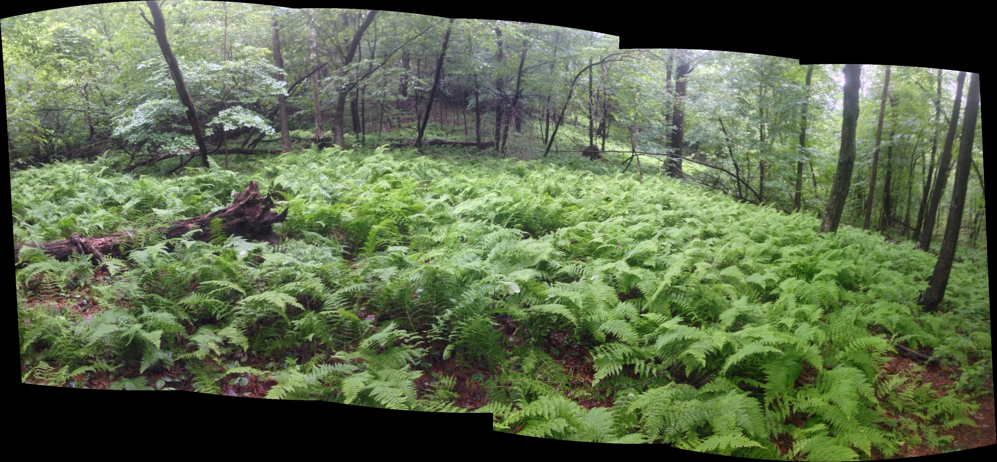
So Green
Not 4 minutes later a large group of “Leadership Gsomething Program” youth came hiking in the other direction. There must have been 20 of them, maybe more. I feel like groups that large shouldn’t be on the trail. That much concentration in one place is too much, but that is just an opinion. I hope they had a great time. We waited for Mike and Andy to catch up so we tell them about the bear, and we weren’t expecting the LGP group, so we didn’t want those two to surprise the bear, so we played it safe, and we walked the final portion of the hike all together.

The End is Near
The access trail to the parking lot was a creek, or at least it felt like it as it was draining all the rain away from the mountain and we were walking right through it. Nothing too deep and it will probably be dry when we have to hike back to the trail in August when we do the next section.
Our beer was still cold and waiting for us, and even Mike partook of it’s pleasure-inducing flavor.

Refreshing
I would say that was the end of the adventure, however on the drive home, Andy and I came upon a motorcycle accident at the junction of RT 24 and RT 78. It must have just happened, as the motorcycle was burning and really catching on. Emergency vehicles were just starting to arrive and there were plenty of people stopped to lend aid, so we inched past when the opportunity presented itself, and since I wasn’t driving I was free to rubber neck, and the motorcyclist was still alive and pinned under an SUV. Mike and Jed were stuck for much longer and didn’t get past it until the dude was airlifted out by helicopter. I don’t know anything more about it.

Leave a comment