
The Persian Prince and The Bird
October 29, 2020 § Leave a comment
Ali used his normal a.k.a. as his trail name, The Persian Prince, and I saw no need for yet another alias in my life, so I simply used my cycling nickname, Big Bird, or just Bird. It’s the culture of thru hiking to have an alias. One it gives you a little bit of anonymity, but in another it actually better identifies you. You tell your family you are going to “off the grid” (though that really isn’t the truth anymore), for a long period of time. You tell them where you are going in, where you expect to come out, and more importantly when you expect to come out, and if you are diligent, you sign all the registers along the way, so that should you not come out when you are expected to, then authorities can scan those registers and try and find the last place you checked in.
If you simply check in as Jim, or Eric or something that is not so identifiable, then it isn’t as clear which Jim or which Eric was there. If your family knows your trail name, then looking for “Bird” or “The Persian Prince” is a lot clearer to those looking for you. And these names bring easier recognition to your friends on the trail as well, because when you are thru-hiking, there are many times when you may have been ahead of someone, to then find you are behind them, and if you are trying to get together again, then the aliases help with that. I have read that a lot of times real names never get shared, however I think that once a full level of trust is achieved, and an agreement is made to make contact outside of the trail experience, then phone numbers and IG accounts are exchanged. Off trail, on trail names are continued among the trail community. In this day and age of the VLogger, many VLoggers who are thru hikers identify by their trail name in the VLogs. For example Rocket, though her channel does list her actual name which is of no importance here.
Now it was just Bird and The Persian Prince on the AT heading out of Tom Leonard Shelter. It poured the night before. We saw nothing of Rosie, but the father son pair came by a few times, once for the bear box, and the other times the privy. We discussed our plans for the day, and though the map said we had a fairly easy day, the father, also named Eric, said that we would be atop the Berkshire Plateau all day until we dropped into the Shaker Campsite.
We were the first be ready to go, and so we took off not really expecting to see father and son, nor Rosie again, since they had both indicated their plans for the trail had changed. We started the hike with our packs covered, and ourselves to some extent, but it was pretty clear in the sky, and soon it was too warm to continue without shedding layers. As Eric had said, the trail was plateau walking with minor dips for a couple of road crossings, but eventually we reached the edge of the giant dip that would take us to Shaker, thus completing a relatively easy 11.2 miles. If there was anything notable to say about those miles, it was early on in the morning when I realized that I should have stopped earlier to re-lace(tighten up) my boots. I think that was the period in which I allowed my ankles to move around more than they should have, and thus seeded the degradation of the integrity of the backs of both ankles. Sure enough when I did finally stop and de-sock, I could see the early loose skin, and then I made the next mistake. My foot dried out pretty quickly exposed to the sun and air, and rather than get the first aid kit out and start with a band-aid, followed by duct tape (yes duct tape), I went straight to duct tape. The reality is I should have started with duct tape on my ankles at Sheffield Lodge, and just accepted that it may not be needed, but waiting until it was needed was already too late. Anyway, hindsight acknowledged, there needs to be something under the duct tape once the blister has started, and I failed that test. Duct-taped up and re-booted, this time really anchoring down on the lacing, I continued. It felt better, but I could also feel the sensitivity in the area on top of my left foot where I really anchored that one in.
We pulled into Shaker around 3:30 in the after noon, so plenty of time to setup camp, and even better, because I could see all the source material, plenty of dry wood close by that we could harvest for a fire. Ali grabbed one platform, and I grabbed another, and he erected his tent, and I managed to set up my Tyvek over my platform, and then we set out to find water, which was just a short trip N on the trail. It was a reliable source, and better yet, someone had run a hose/thick flexible tube up the creek so that down creek it had some head, and water flowed out of the tube and into a container better than trying to find a pool deep enough to immerse said container. 5 liters collected we returned to camp and gathered enough firewood. As it was all dry, getting a fire started was not going to be an issue, but we would wait till later to start it.
It was about this time that Father and Son strode into the campsite, and because wife of Father and mother of son said, “I have to work, I’ll get you tomorrow”, they continued their odyssey another day. We apologized for taking both tent platforms but they relayed back to us that they preferred the ground. They noted the fruits of our wood gathering efforts and we extended an invitation to join us once we fired it up.
The next surprise was Rosie came walking into camp. She had talked to her sister and decided her exit point would be the next day, and so the Tom Leonard crowd was re-united for another evening. Rosie began by starting to set up her hammock about five feet from the fire ring, when I informed her that we were going to have a fire. She stopped, and examined the situation carefully before deciding that she was too close, and chose two other trees about 20 yards away.
I started the fire, and then boiled up water for dinner. The Persian Prince had a very strange diet on this trip. Some kind of high fat in a squeeze tube for breakfast, energy bars for lunch (not so strange), and bone broth from powder for dinner. I had to force some sour dough down his gullet, as well as Creme Brulet. That is what the Persian Prince packed. I packed:
- 5 packs of Creme Brulet
- 1 loaf of homemade Sour Dough
- 7 1/2 cup portions of rolled oats
- 8 oz dried cranberries
- 3/4 c dried milk powder
- 20 Starbucks Via
- 14 homemade chocolate sea salt oat nut fruity fruit fruit sesame almond honey crunchy peanut butter energy bars
- Hunk of Cheese
- 7 2 serving dinners 3 – Pad Thai, 2 – Katmandu Curry, 2 Chicken Risotto
- TJ Buffalo Jerky
- Makers Mark
In addition to what has already been written, The Persian Prince, from now on referred to simply as PP brought:
- Bag of almonds
- Coffee pkts with cream and sugar mixed in
- Giant bag of Cost Co Beef Jerky
- Bulleit Bourbon
- Vodka
I am not sure if it is obvious to the casual observer, but Ali packed like he was a starving child from an old Ethiopian children are starving only you can help commercial, and I packed like a well fed privileged white guy from New Jersey. I ingested a lot of calories.
With our fire in full swing, some more “Old Dudes” walked into camp and setup in another camp site. Invitations to the non-exclusive fire were proffered, and Father/Son, Rosie, PP and I enjoyed a terrific camp fire in the woods. Throwing off enough heat to be warm, though it wasn’t really cold, but, as anyone who has sat around a fire in the woods will know, it was very comforting and relaxing. It just is a fine way to spend an evening. For me I usually engage in my only non-alcohol vice and that is to carry rolling tobacco that I will smoke only on backpacking trips. Okay, only on camping trips. Okay, rarely not on backpacking or camping trips. That’s a fact and I am sticking to it! I have upgraded my camp seating hardware to the latest and greatest lightweight Helinox Zero with ground pad. This keeps an old guy like me up off the ground and in a position where I can stand erect when I need to get up. This is the latest evolution that began with sitting on rocks, then sitting on cut up ensolite pad on rocks, then sitting on pad on a tripod stool, to a sleeve mechanism for older Thermarest pads, which was awesome, to a light close to the ground chair, to the Helinox. I think I will make a separate gear evolution post, but for now let us run with this. Sitting in this chair, in the woods at night, with a fire, and a nice rolled loose tobacco cigarette and some Makers Mark is really a very nice treat.
As the evening dragged on, everyone made sure their food stuffs were in the bear box, and we extended one last invite to the other dudes who never came over to the fire. Ali and I had our big day ahead of us, and Ali turned in. Father and Son turned in, and Rosie looked at me and said good night leaving me alone with a bed of hot as F coals. I tried spreading them out in an attempt to burn them out quicker, but it just created a large warm glow that attracted nothing from the other tent. Finally, I decided that all the hot AF coals should be on one side of the fire ring, and the unburned wood on the other, keeping them as far apart as possible. I reasoned this would keep the coals from creating more coals out of the unburned wood, and the unburned wood without the coal would eventually burn out. It wasn’t windy, so there wasn’t that worry. Had the creek been closer, I could have carried a few pots of water to the coals, but it felt safe enough, so I turned in. Please don’t judge me harshly.
As mentioned Tuesday was our big 19+ mile day, and the alarm was set for 5am. Fortunately I slept fairly well, only getting up twice to take care of business. The last time up was at 4:45, so I simply enjoyed the last 15 minutes warm and snuggly in my bag. The alarm roared, I silenced it, and I unzipped my bag. Ali must have heard me, because I didn’t say anything to him, but I could hear activity coming from his tent.
This is the day that we learned “Don’t ever buy Coleman Propane Fuel”. Ali packed a pounder and it was a Coleman canister. I don’t think it was the same kind of gas as my MSR half-pound canister, but it was fuel, and up until this point it worked. It was a brandy spankin new canister as well, however, at some point after I had set up my stove upon his canister and get the water boiling a started, it petered out and died, so that after I wandered over to see how it was five minutes later the water was cold and the flame was absent. The stove valve was still open, but there was nothing coming out. Surprised was I, and I could feel that the canister was not empty, and when I opened the valve more, I could hear the hiss, and I sparked that, and it lit, and I set the pot upon it again and was about to leave, when I could distinctly hear that it was dying again. And as I sat there and watched it, the flame shrank to nothing and went out. I didn’t feel like we had time to continue this game, so I moved the stove head to my own canister and soon we had hot water for coffee drinks. No breakfast this morning. Get packed to get going, and drink a hot cup of Joe, and move along in the dark. We had a big day.

We would not see any of our camp mates again. We were going 19 miles, and all the ones going North were quitting this day. The crew that pulled in late was heading Southbound, so we definitely weren’t going to see them again. We had another reason for getting going quickly this morning. That was the weather. Yes, I said it rained the night prior, and while a localized event here or there was perhaps not that uncommon, Western Mass was in a serious drought, and rain that drenches the entire half of the state hadn’t fallen in nearly two months. That was forecasted to change on this day, our longest day. We had been monitoring all the weather apps we could, and of course, we liked the most optimistic forecast which that morning said we might make it till 2 PM before the skies began to cry. So let’s get our asses in gear and get as far along as we can to minimize the amount of time we had to spend in it. The reality is that once you get wet, you can’t get wetter. so if you are wet for four hours or one hour, you still end up wet, and depending on the wind, and the temperatures, you can stay pretty warm by simply keeping a brisk pace. Wind is a game changer, but you will find, and my mountain biking friends will confirm this, that when you are in the forest, you may hear the wind above the trees, but you don’t feel the wind in among the trees. On this day it wasn’t supposed to be windy anyway, and it was still unseasonably warm, so even if we got wet, there would be little discomfort. So let’s just see how much of our 19 miles we could knock out before we got wet.
Rain changes another dynamic. That is the dynamic of boot upon rock, and more specifically, places in the trail where there is a significant rocky face that slants either up or down. Generally, these faces have quite a bit of grip to them, and wet or dry, you find pretty decent purchase upon them, however, some faces are moister, in general than others, and on these moister faces, moss grows, and on moss you don’t get decent purchase when it is wet. Sometimes it is hard to tell just what you are looking at. Is it simply wet or is it wet moss? Wet moss climbing is not so unsafe, however wet moss descending? That is an M&M of a different flavor.
We left Shaker under in darkness, powered by our head lamps. Ali’s headlamp was a rechargeable USB plugin device while mine was a little more AAA old school. I should have changed out my batteries, as my light cast was not so bright, whereas Ali was lighting up the world! So, we made a change in our hiking lineup, and I would bat clean-up for a spell, and Ali would make sure we went straight on the trail. Shaker was in a notch, and so we didn’t really have all that much further to descend before we crossed the notch. Perhaps notch is a bit too narrow to describe the gap we were in. A notch implies, maybe, that you will be hiking out of the notch pretty soon after a short, if not instant moment of being at the bottom, whereas a gap implies that maybe there might be more between the descent and the ascent. In this case there was a marsh, some woods, a road crossing followed by a fairly large cow pasture, and then a wee bit more woods before we started to climb out of the gap.
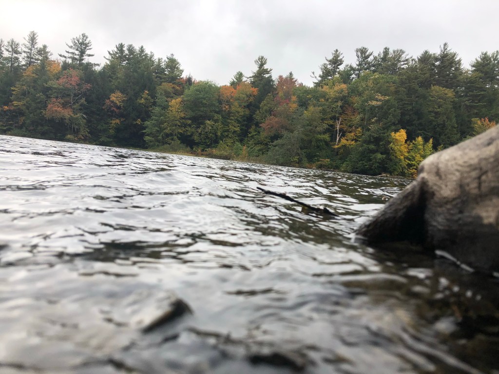
It was early, and perhaps we didn’t notice it at the time, but after three days on the trail, we were starting to get our legs. We did have to climb back up to the plateau, but I honestly don’t believe that was much of an issue. Soon we were upon the plateau and we were locked in conversation, and if you know anything about conversation you will know that if you are concentrating on what is being said, then you can’t really concentrate on a clock, or your legs, or most anything. The conversation rules, and everything else takes a backseat. Locked in conversation, we knocked out some large chunks of miles, and reached the halfway point before 11 am. This is where we came face to face with Massachusetts and their lake/ponds. Upper Goose Pond Lake. Is it a pond, or a lake? I suppose it was once a pond, and then a dam was added and it became a lake. Arguments then played out on whether to continue to call it a pond, when clearly it was a damn lake. After much ale was consumed, perhaps Sam Adams himself provided the brew, they settles on pond lake. Anyway, there was no point in stopping here, and we kept on motoring along. Might as well cross the Mass Turnpike, and then we could talk about eating up some grub.
While the Mass Turnpike was a little more than halfway for the day, it was a little less than halfway for the trip. Still it is a milestone to be past it. The trail, after crossing, feels like it encounters a wee bit of private property, and the though the trail hangs a left to re-enter the woods, there is a clear path straight to what looks like a farm house, and it was well worn. We would find out later that this house was a well-known Inn along the trail, and our to-be shelter mate that night was heading to this Inn the next day for a little R&R.
This was yet another place where the AT crosses civilization, yet doesn’t come into contact with anything useful. Sure the Inn has some use, but it isn’t really a place you stop in to grab a coke, or some other goodie. No, here the trail simply crosses the somewhat busy road, and there is nothing around other than a few private residences. Many road crossings aren’t even that!
The trail ahead for us was now less than what we had traveled that day, so that was a good thing. We had to get up and into the plateau, and we could see the ridge line, or the edge of the plateau ahead and above us. Many times walking on the AT, you get a glimpse of the hills in front of you only to find out those are not the hills you have to climb. The trail goes a different way. In any case, we did eventually get up the climb, bit it wasn’t that strenuous, and soon we were upon a pond that I thought might contain illegal campsites around it. If we were desperate for a site, and it completely sucked, and we were running late and could go no further, then sure, we could have made do there, but Ali and I had our legs, it wasn’t raining yet, and we felt very good, so push on we did. We were now committed to reaching October Mountain Shelter, and we were simply wishing that when we got there, we wouldn’t have to share the shelter.
We have all been walking this earth long enough to know what kind of rain to expect when rain is coming. In the summer when it is hot and humid, and a storm moves through, you can bet the bank that a gust front will come through, and then it will rain cats and dogs for some time, and then it will clear. You just know that. However, when the forecast is for something that lasts a lot longer, and isn’t a tropical storm, say, a warm front moving through, then more than likely, when the rain does start to fall, it will be very light at first, and as the heavier more laden clouds move in, then the volume of water falling increases, and it reaches a steady state. There are variations here and there, but nothing that allows you to dry out, but when it is falling it never is really all that bad. It’s never pouring. It might reach a steady soaking rate, but it is never a cats and dog scenario.
That is just what Ali and I found ourselves in that afternoon. The closer we got to October Mountain, the more excited we got that we might actually beat this rain to the shelter. How great that would have been! Well, it would have been great, but we stopped for a short break, drank some fluids, scarfed down some vittles, and by the time we started to move again, the early drizzle had started. This was a precipitation event that only increased over time. Not quickly, but an hour passed and it was not only still precipitating, it was actually raining now. We were fully in it, but, as described, it wasn’t really all that bad. I made the decision when drizzle was felt, to remove my kilt, and don my rain pants, and really regretted that decision immediately.
Why do I wear a kilt? Did I write about this already? If I did, I’ll keep it short and to the point for once. I like the freedom of movement that you just don’t get wearing anything else. Baggy shorts still hinder progress when they get sweat wet, and you (I) take large climbing strides. Not with a skirt. Sure, I could wear tights, and I do sometimes wear them, but they are certainly not for the warmer weather days. A kilt I can wear down into the low 30’s, tights I can’t wear above the low 50’s. Tights around camp at night, a kilt on the trail during the day. Anyway, I chose to remove my kilt and wear my rain pants, and I regretted that decision immediately, but I didn’t do anything about until we reached our destination. My stride was shortened as the pants simply restricted my movements too much. I reasoned that it would be better for my boots if I didn’t let water pour into them as it ran down my legs, and so the rain pants. At the end of the day, my feet were still pretty dry, though the outside of my boots were pretty wet, and so maybe it was worth it.
The last hour is always the same on every day, no matter how far you have walked. It may only be two miles, maybe even less, but it always seems to drag on when around every bend in the trail you are trying to espy the shelter sign. Shelter signs are actually pretty easy to spot. There is usually a little clearing where you can see that many people have huddled in the past. Most shelters are down a blue side trail, which in most cases, usually starts at its intersection with the AT, and so the first tree blaze for that trail is three blazes that form a triangle pattern. The shelter sign itself is also fairly large, in that in addition to the distance to the shelter, is the distances North and South to next shelter, and maybe some other significant location. The point here is that at the end of the day, when you are starting to feel every step, your eyes are looking ahead for that sign, and on this day, our eyes were peeled on the trees ahead.
October Mountain was our destination shelter. Sometimes you can pick out some details from a name. For example if we were destined for October Valley shelter, you might think it was set down in the valley. Pine Ridge Shelter, is up on the ridge. What does October Mountain shelter say? Well, the shelter resides in October Mountain State Forest, so it could be simply taking the name of its surroundings, and we shouldn’t fret that we might have some climbing to do. Well, fret not, because it was not on October Mountain, and we were lucky to find that the water source was right there just before the cut-off to the shelter. Also, this shelter was right at the trail, so there was no additional .2 down a side trail. The best news? It was empty! That, right there is Gold! Ali and I were so relieved that we didn’t have to impose on others to allow us to use the shelter in these covid times.
We dropped our packs, and began dis-robing immediately to get into some drier clothing. The rain had let up by this time, so we would be able to get water without getting wet again. Had it still been raining hard, then I think we would have stayed in those clothes, and gotten water right away. We toasted our accomplishment for the day with a sip each of Makers Mark, and then settled down to establish our camp, and begin the healing process for the next day. There would be no fire tonight, so all our wet stuff will still be wet in the morning. With some cord, we strung up some lines under the overhang, and at least hung the wet things on the line, so they weren’t simply piled up in a corner, and could at least drip excess moisture.
With no fire, it would also be an early turn in for bed, which we would really need anyway. We did awake at 5am, and we did just hike for 11 1/2 hours, so rest was sorely needed. We boiled up some water, and Ali had his fatty bone broth, and beef jerky, and I had the chicken risotto meal. With such a big day in our legs, I made up one of the Creme Brulet packets as well. Calories needed to go in our bodies. We also dined on some sourdough bread.
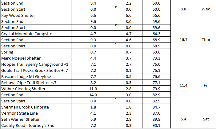
The next day would be a much easier day. Kay Wood Shelter would be our destination, and it was only about ten miles distant, and we stay mostly up upon the Berkshire Plateau the whole way. An easy day indeed.

Morning Portrait 
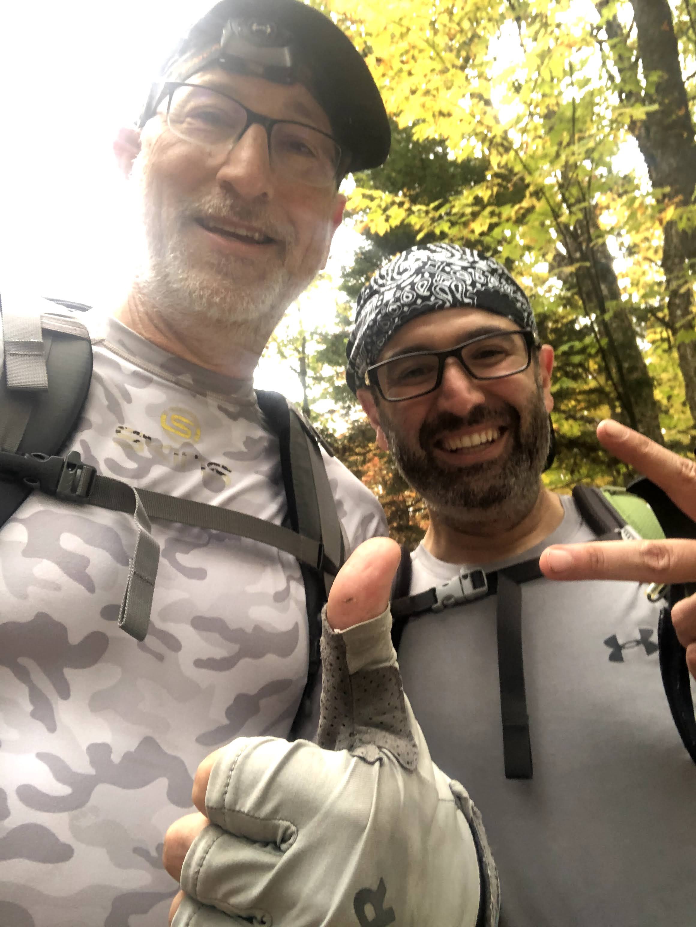
Morning Selfie 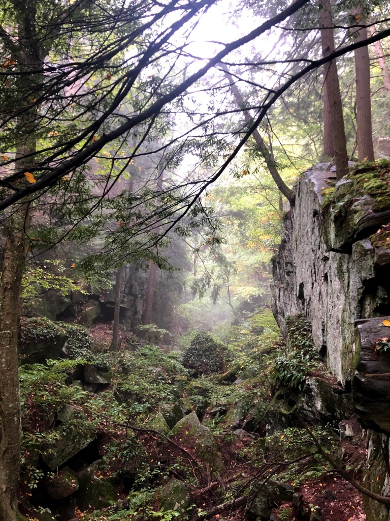
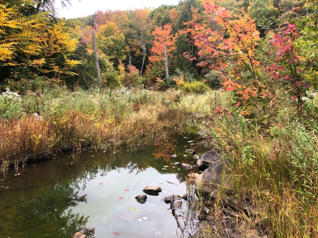
A Gorgeous Ravine in the am light. 
First Road Crossing this day 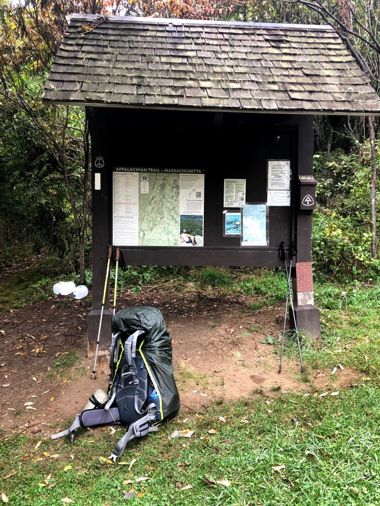
Information at every trailhead 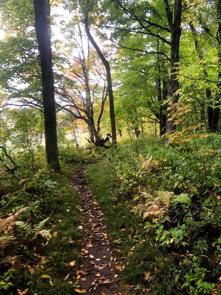
This was definitely the right time of year to be doing this. 

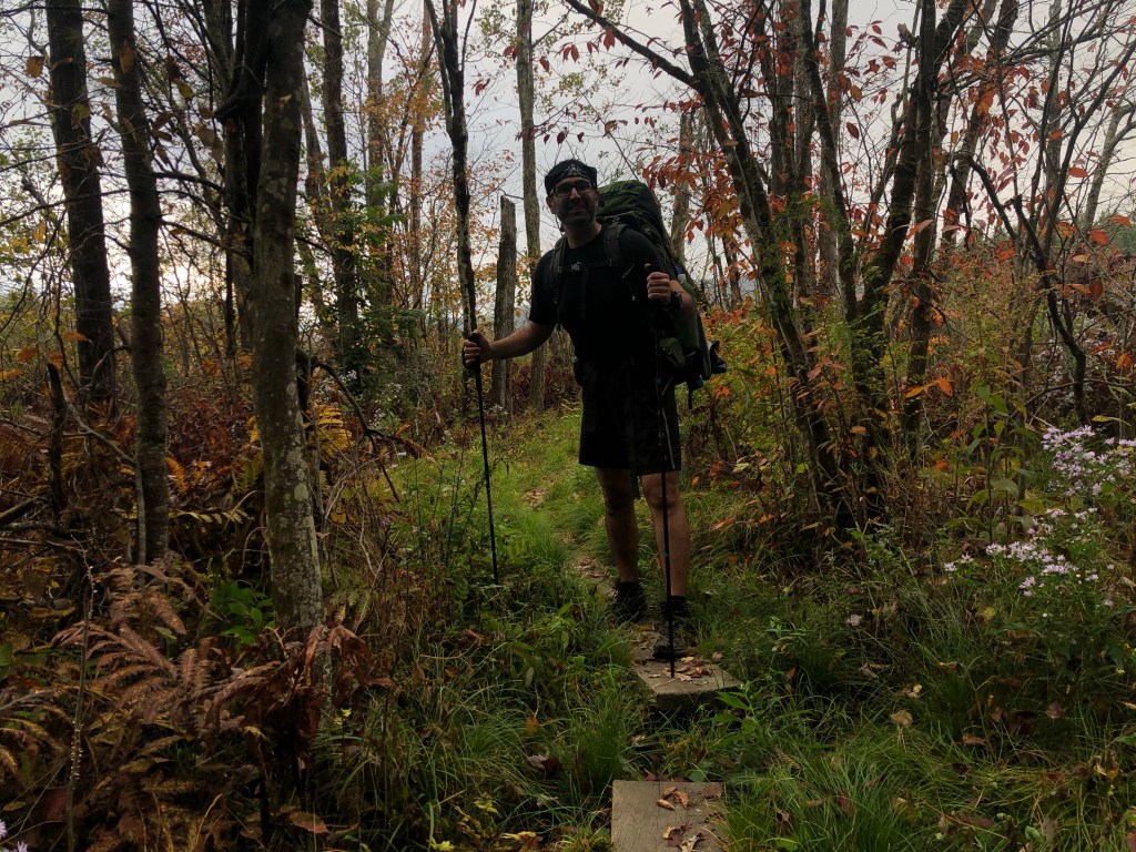
Ali in the color 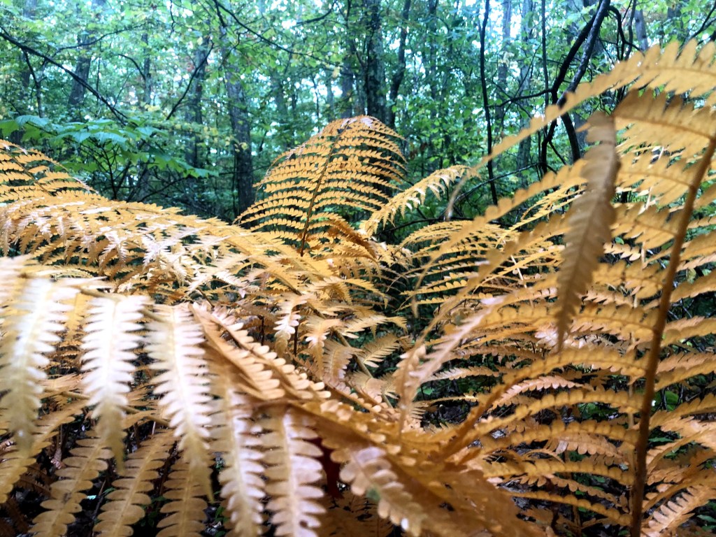

Little dude on the trail 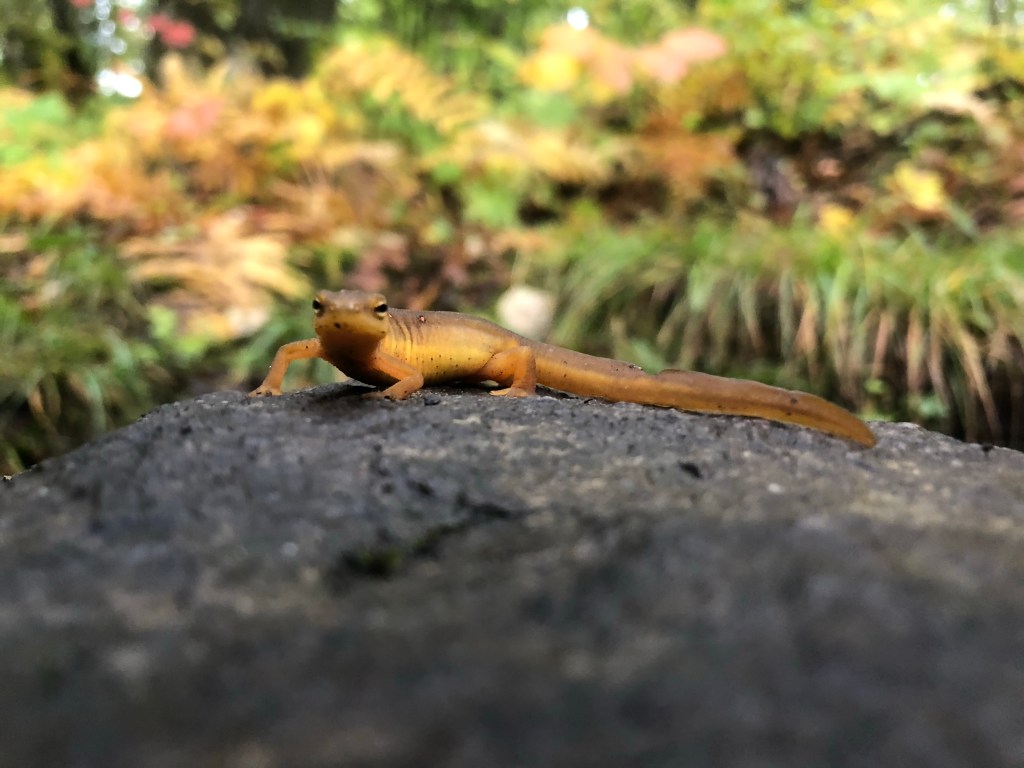
Another little dude 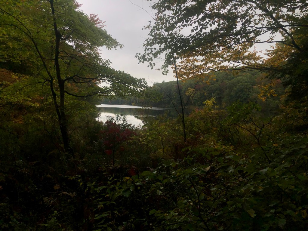

We can see 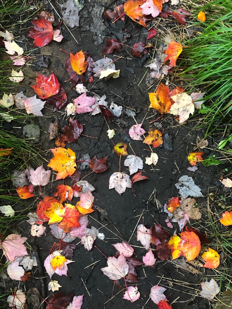
A melange of color 
We did not need to drink this 🙂 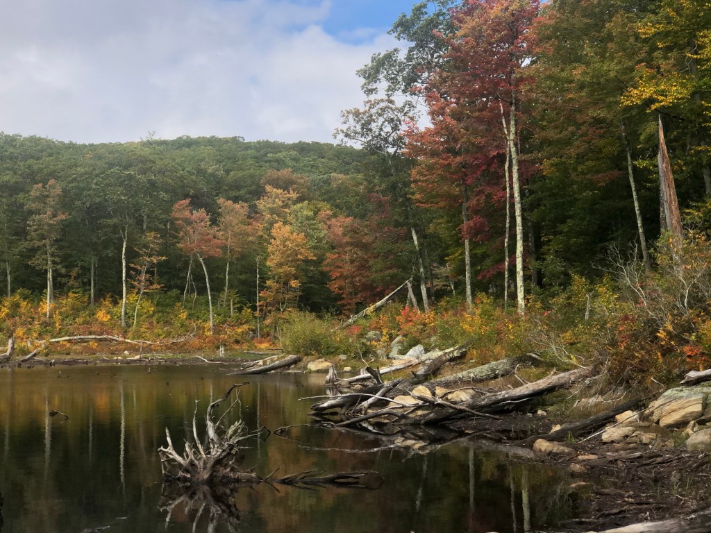


Ali using the DSLR 
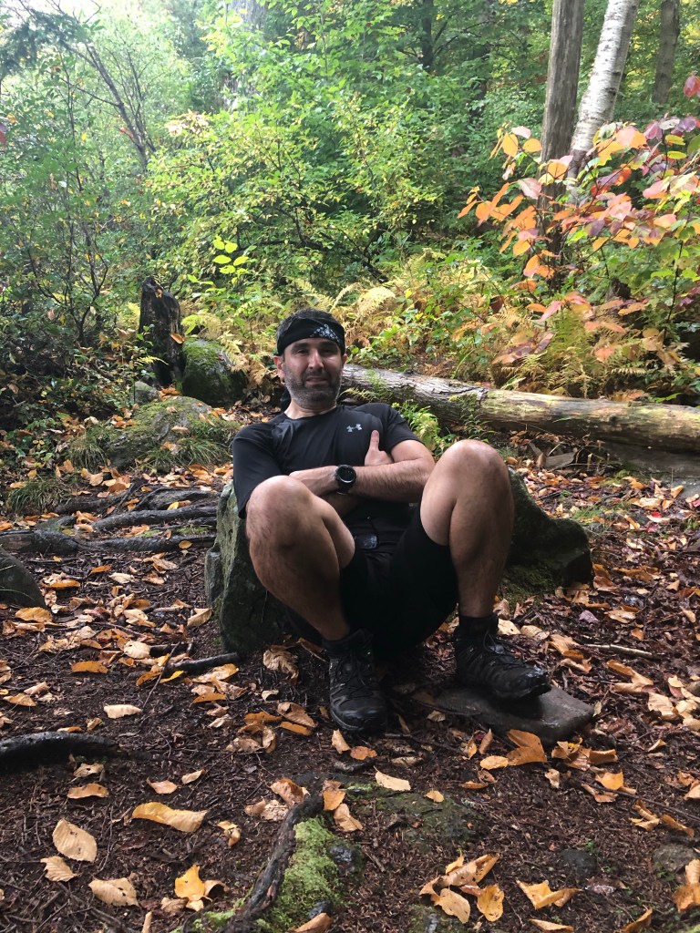
Destination Reached Selfie 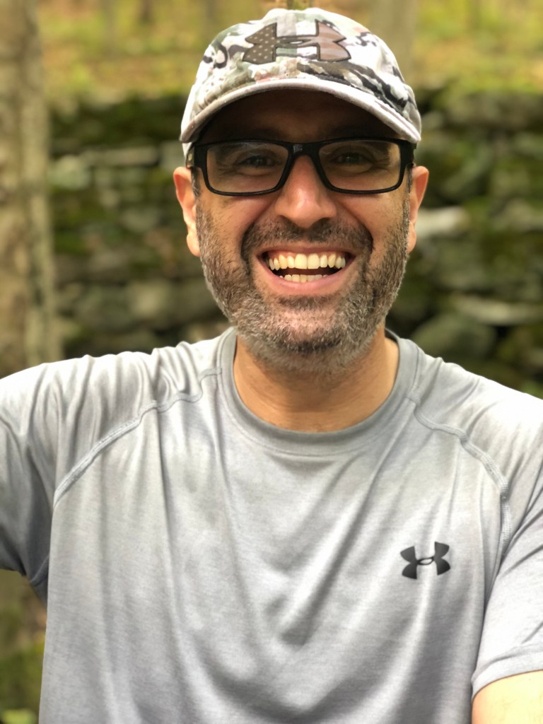
End of Day Portrait 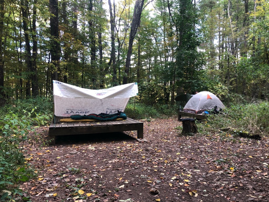
Tarping on the platform 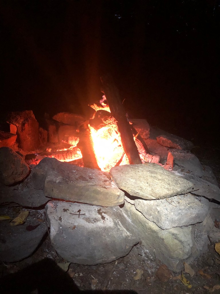
A pretty damn fine fire 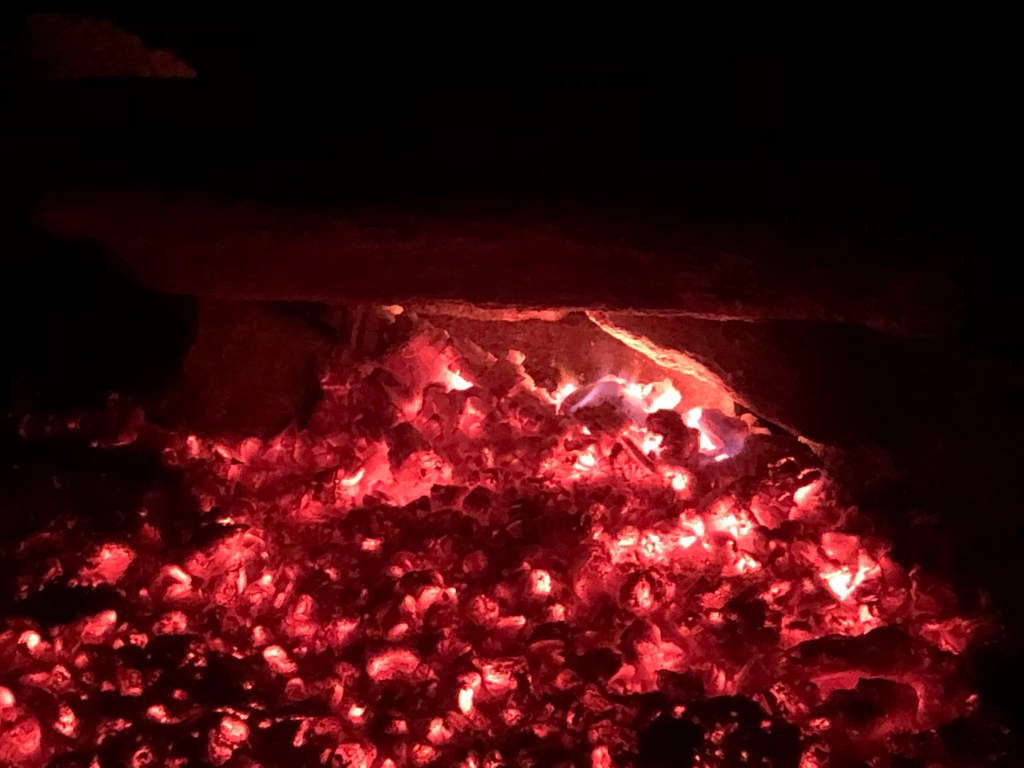
Hot coals = Happiness
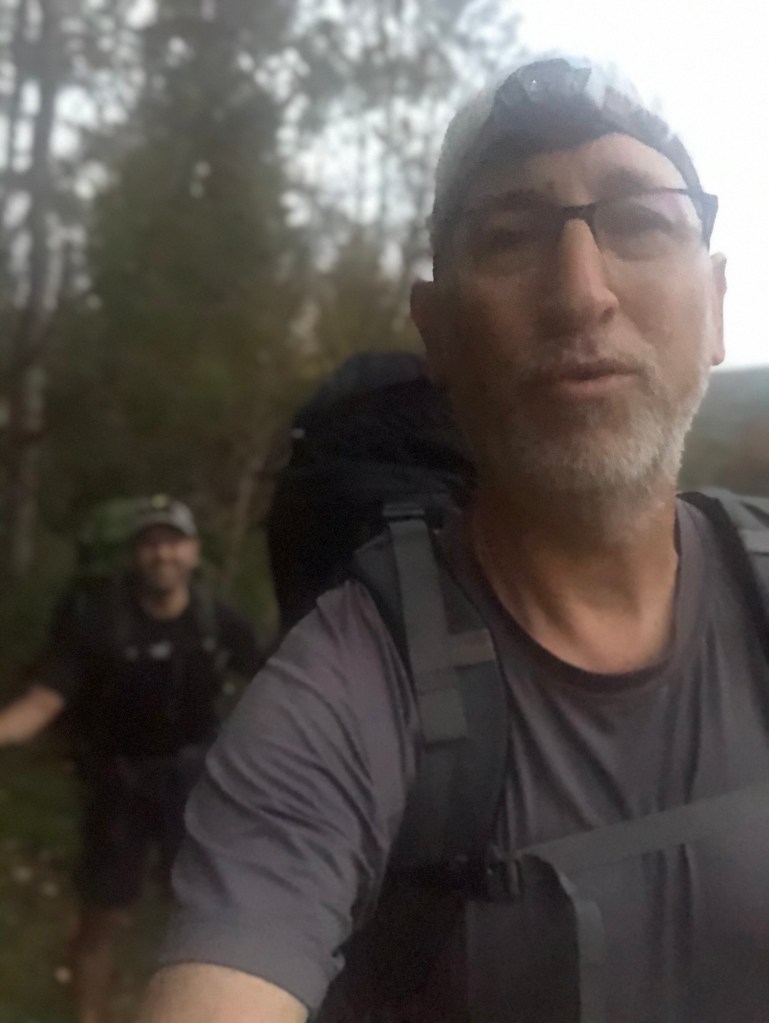
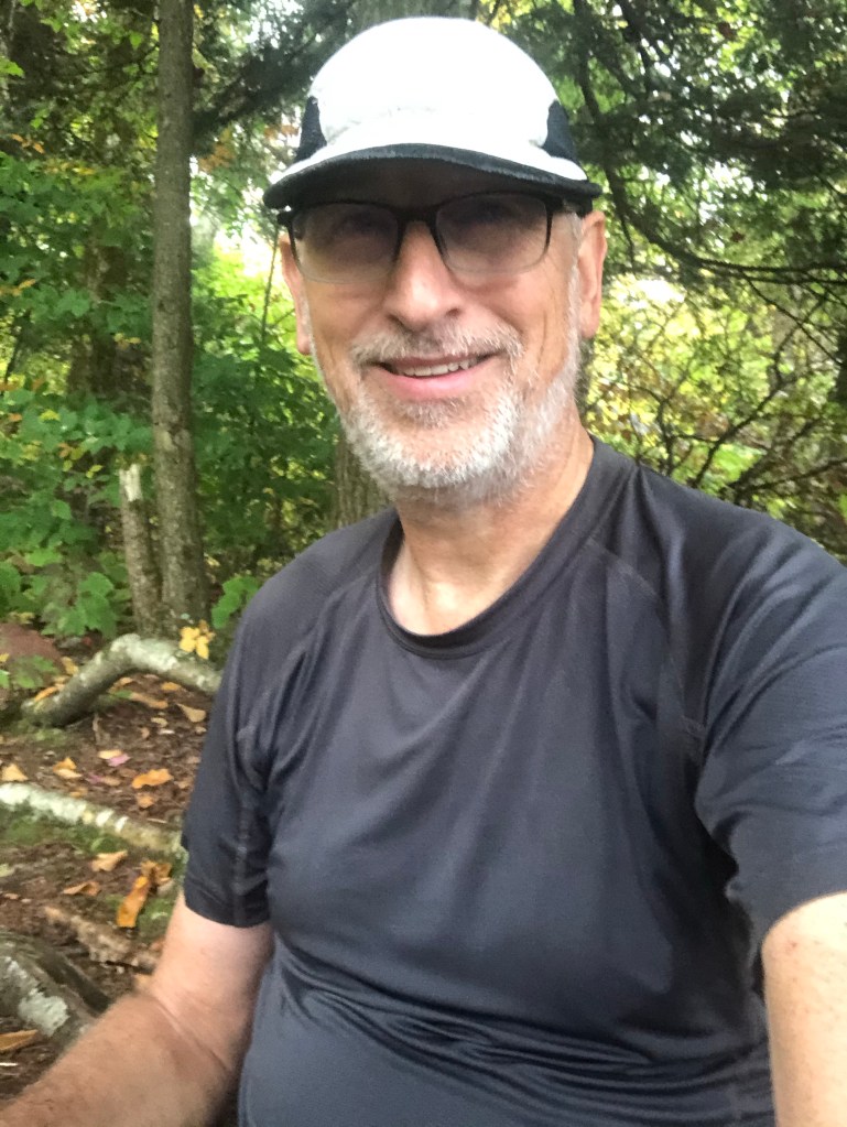
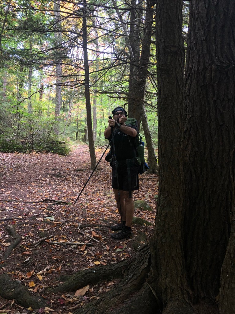
Early Selfie 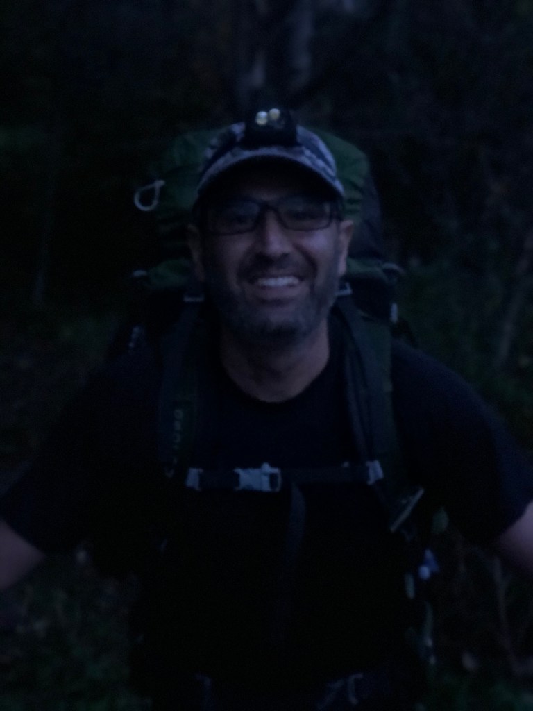
Early Portrait 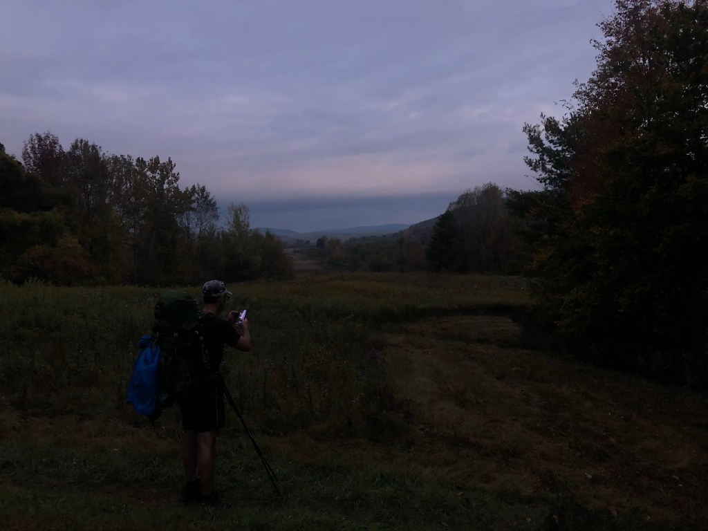

Daybreak is near 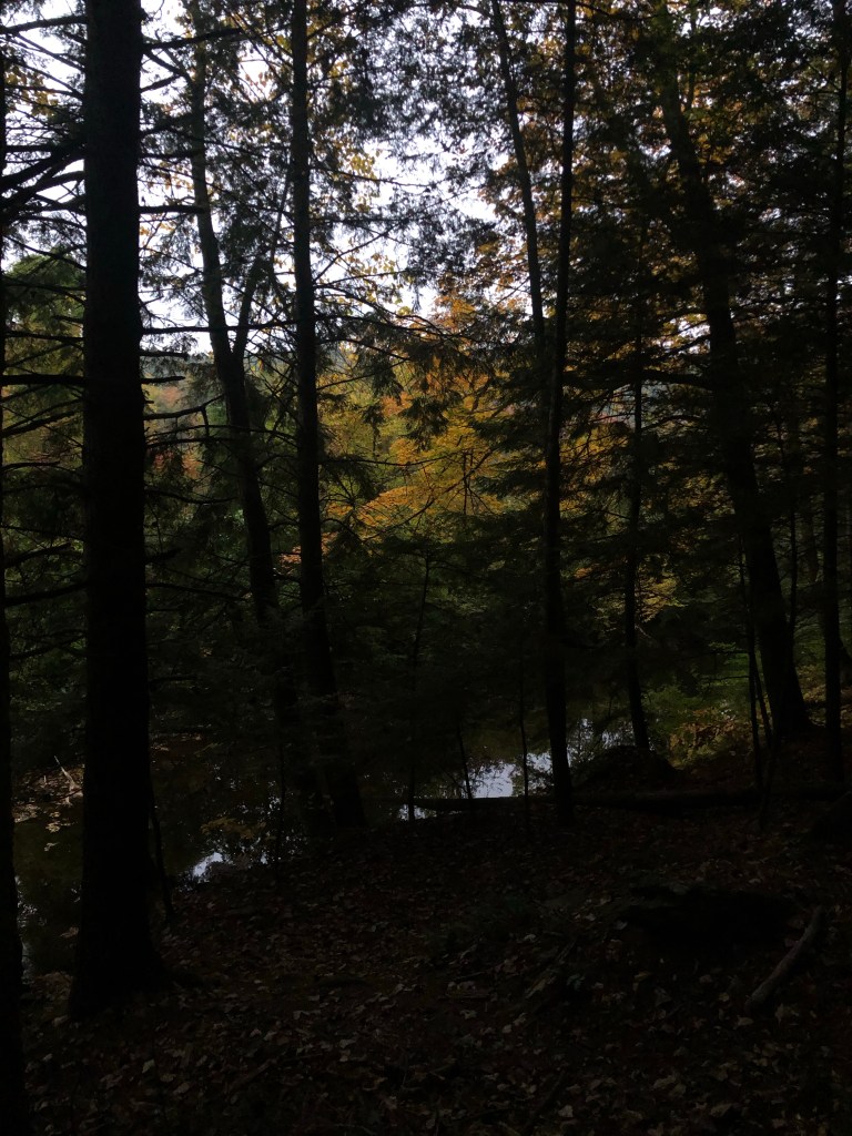

Muted Colors 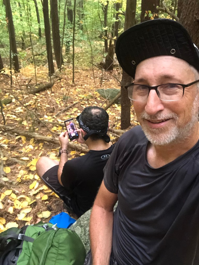
An interesting selfie of a selfie 
We are in the right place! 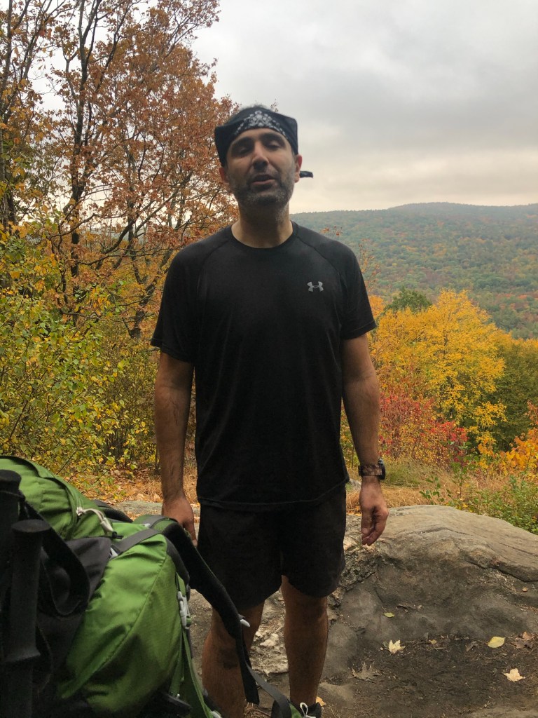
Rewarded with a vista 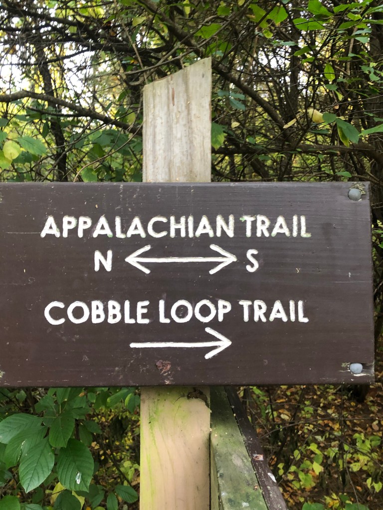
Always make sure you go the right direction 
Moobs 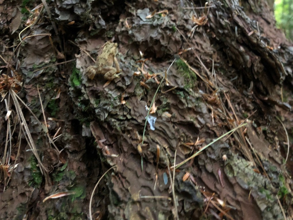
What lives in cow turds? 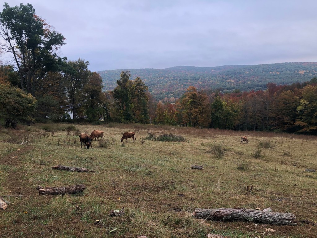
Mooo 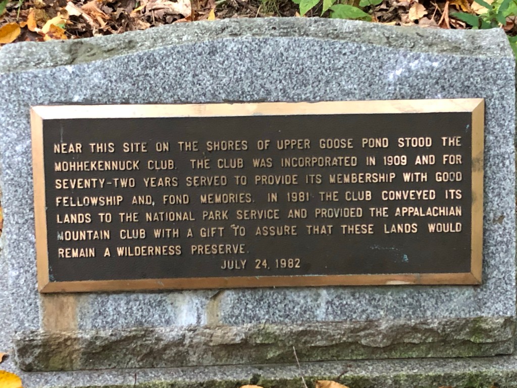
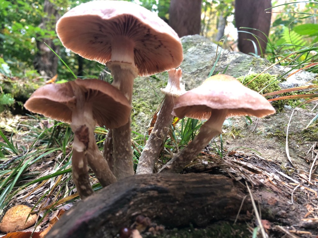
Fungi 


Crossing the Mass Pike 
Mass Pike Eastbound 
Mass Pike Westbound – Ace is the Place! 

A wall in the woods 

Boardwalks where it gets wet. 
Get water where you can 
Resting along the way 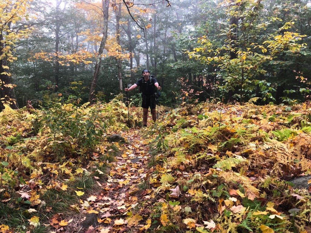
Almost there.

Leave a comment