
Weminuche Wilderness 2021 – Day 6 Wyndom
July 26, 2022 § 1 Comment
When I started planning out this adventure, I allocated two full days in the Chicago Basin for two days of 14er attempts. Even more ambitious was the thought that in those two days, we would bag 4 peaks over 14K! Ha! So naive!
Before going to bed we all agreed that we would NOT be targeting a 4:30am wake-up, but we did agree that we would arise at first light and make a go of it, conceding before we even started, that if we made the summit of 1 14er, then that was accomplishment enough for the day. We also decided that based on the descriptions of all the climbs that were possible, that Wyndom would be our goal.
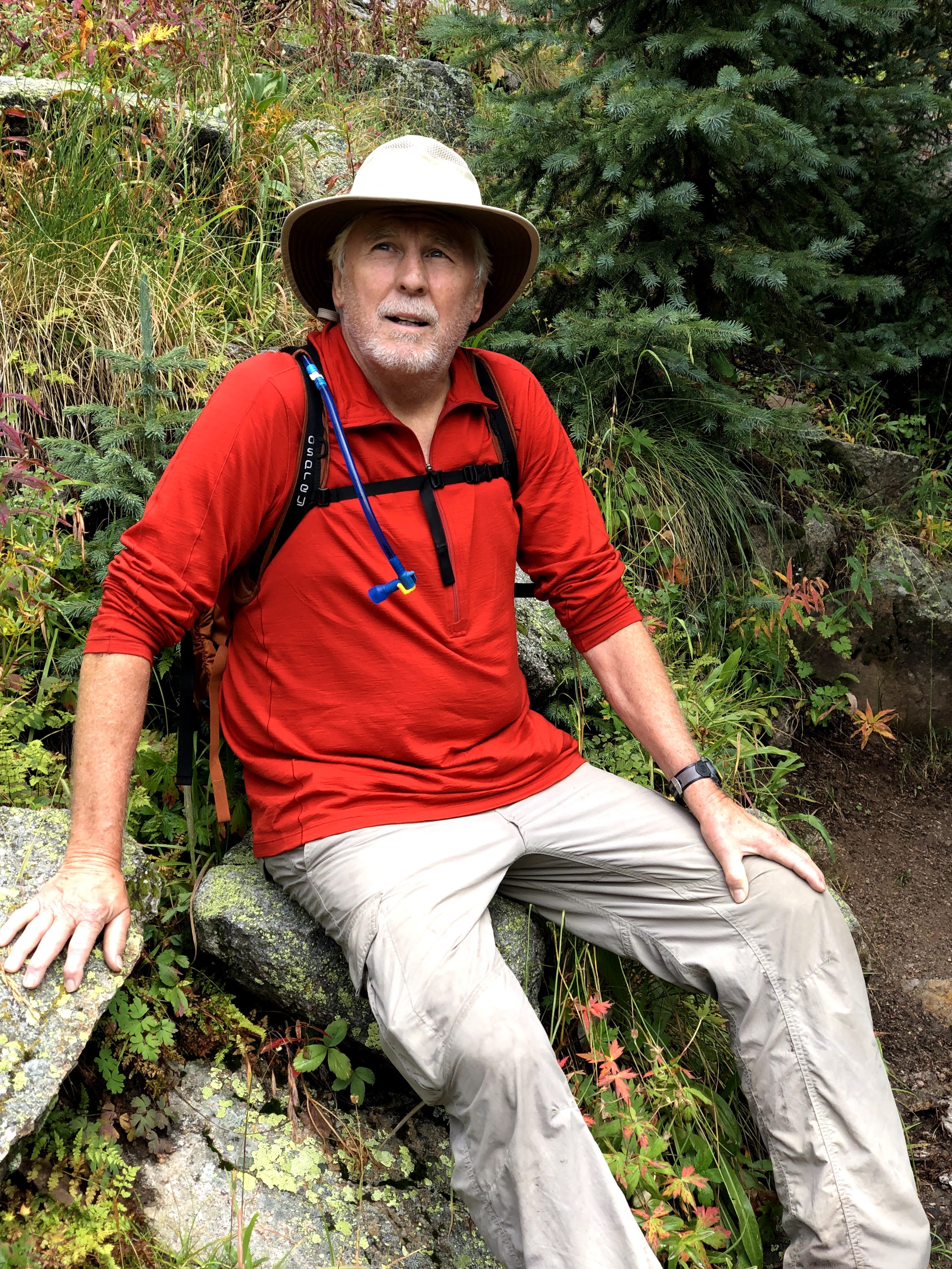
As per normal, Jim and Kevin were the first up and about, and true to our agreements, the rest arose quickly there after. We were up early enough that Walt saw an opportunity to catch the first train, and hurried his camp breakdown, grabbed some coffee elixir, hoisted his pack and gave hugs all around, and set off down the trail.
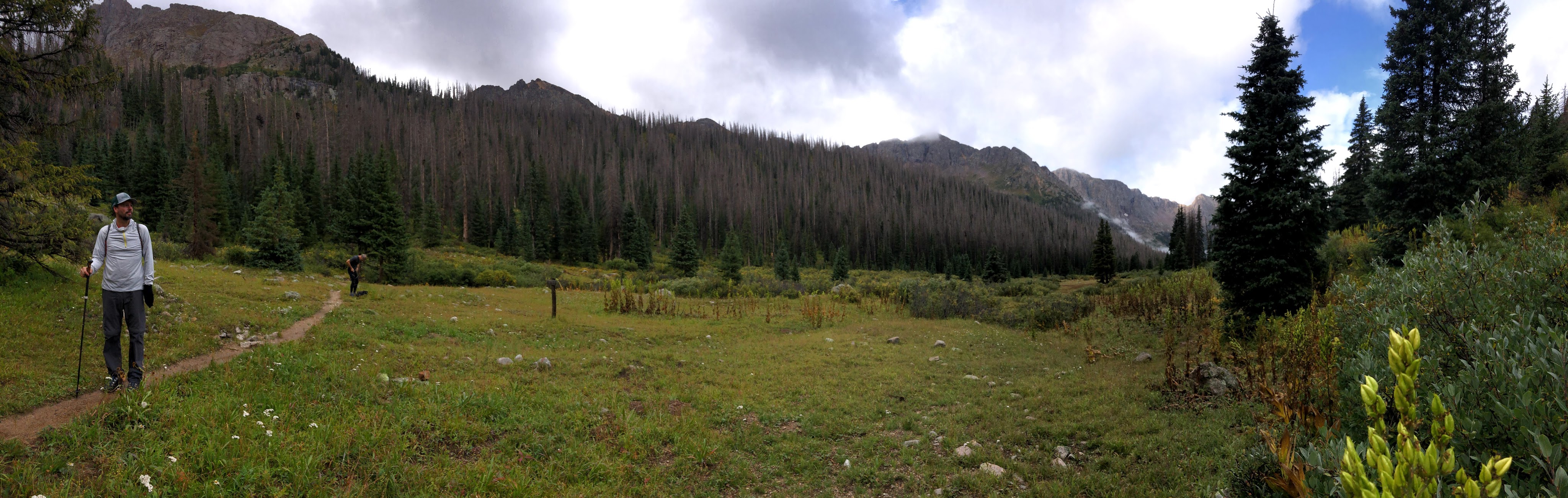
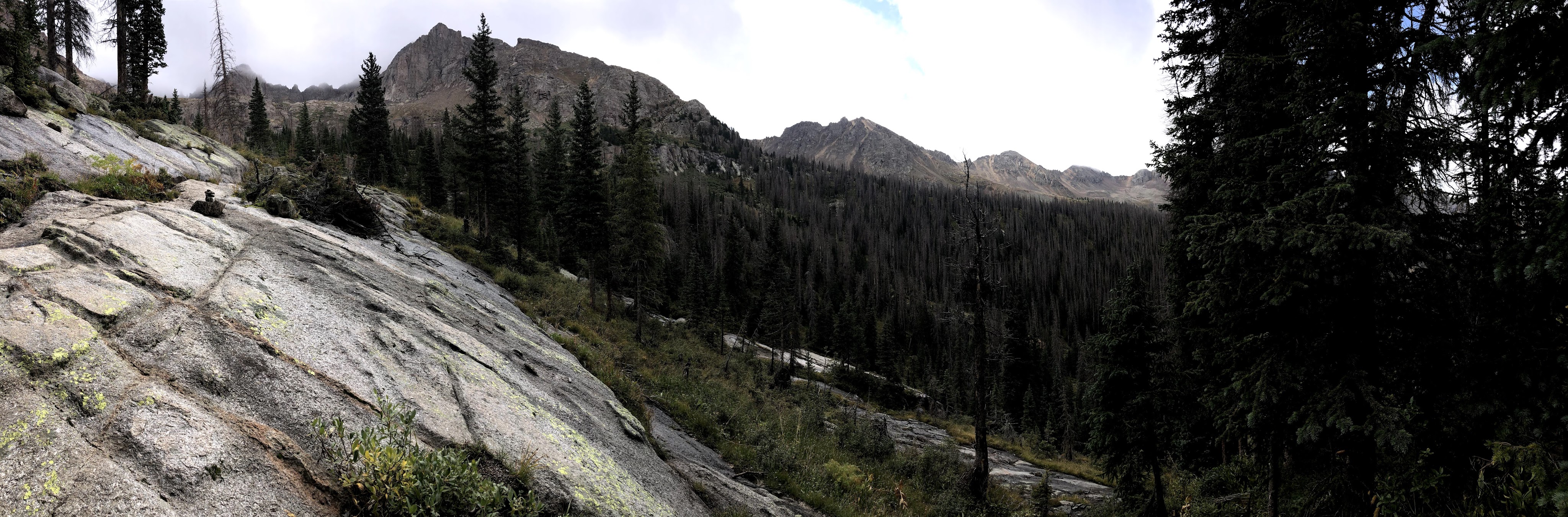
The day began as a fine morning with pretty clear skies, and mild temperatures. The forecast for the day included some afternoon precipitation, but nothing like what we had already endured on day 5. With our breakfast consumed, we provisioned ourselves with what we felt was needed for the day. That included some food, water, a Steri-Pen to acquire more water, rain/wind protection, and at least 1 warmer layer just in case. With all that packed into our day bags, and our food hung out of reach of the little critters, we embarked to descend to the ascension point where the trailhead up to Twin Lakes branched off. How much descent was needed, we really didn’t know for sure, but it was on the order of 450′ of loss before we could begin our ascent. The branch being at 11,250′ that would leave 2,824′ to gain over the next 4 miles. In other words, we could be climbing for the next 4 hours, and then we would have to shed that elevation before we would climb again back to our camp. I can see another reason why people who hike in from Needleton don’t camp where we were camped.
The hike down to the branch point offered no short-cuts across the grade. The main obstacle was a series of rocky cascades that drained the Twin-Lakes, and the other was that no-one had a cut a trail, so down we hiked, past yet another old abandoned mine which did provide a beautiful unobstructed view of the basin, followed by the only water crossing in the entire trip that didn’t look so easy to navigate and offered up the most likely wet foot opportunity to date. I think, but I am not sure, that one of our party continued our ascent with one wet foot.
I remember passing a sign that said “No Camping in Meadow”, and looking out across the meadow to spot at least 3 tents. Now, were they actually in the meadow? I am going to give them the benefit of the doubt and say no. They were on the edge of the meadow, and maybe that doesn’t count. In addition, unless there was another sign further down the trail, how would you know you weren’t supposed to camp in the meadow if you didn’t hike up to this sign to find out?
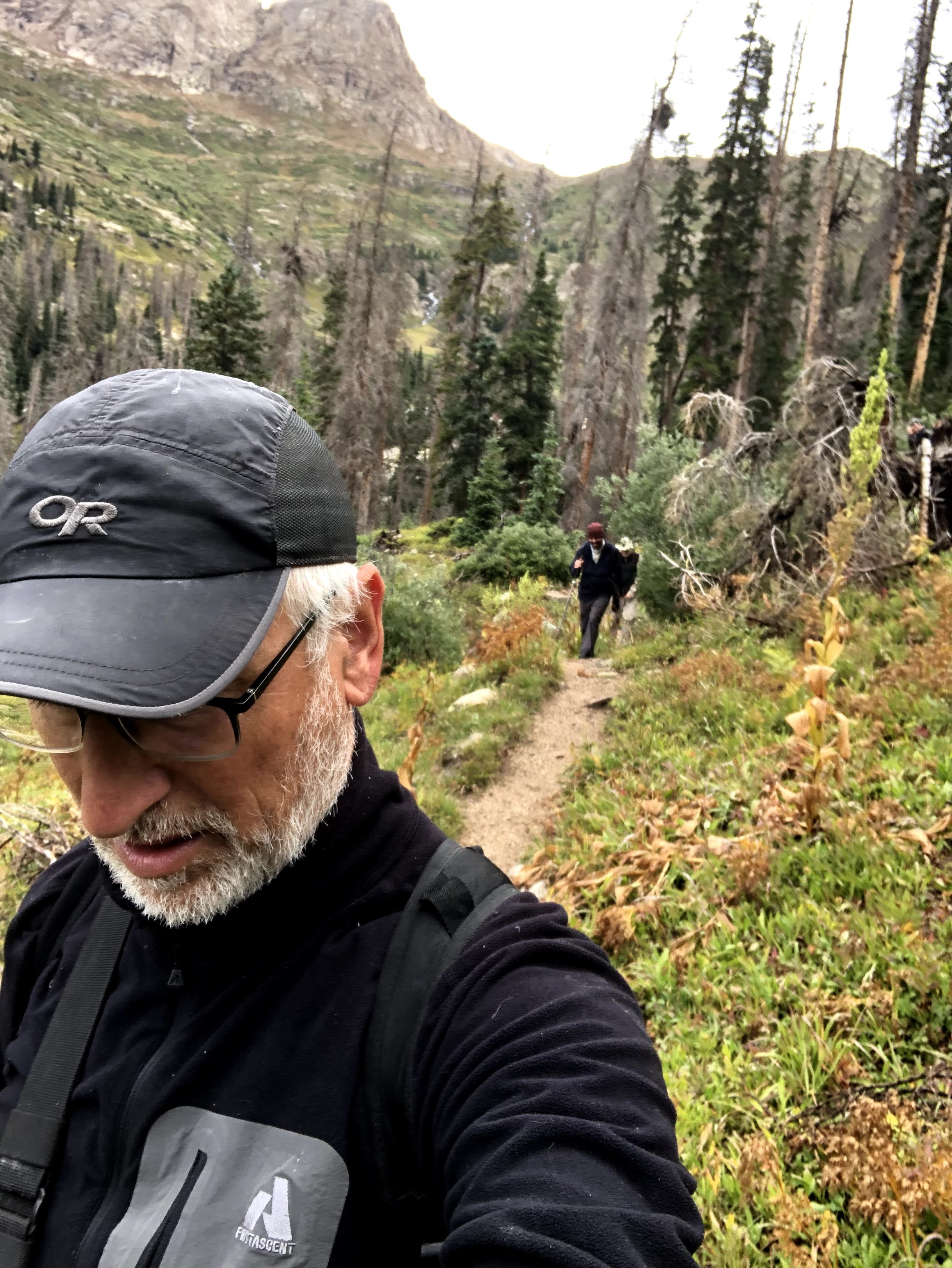
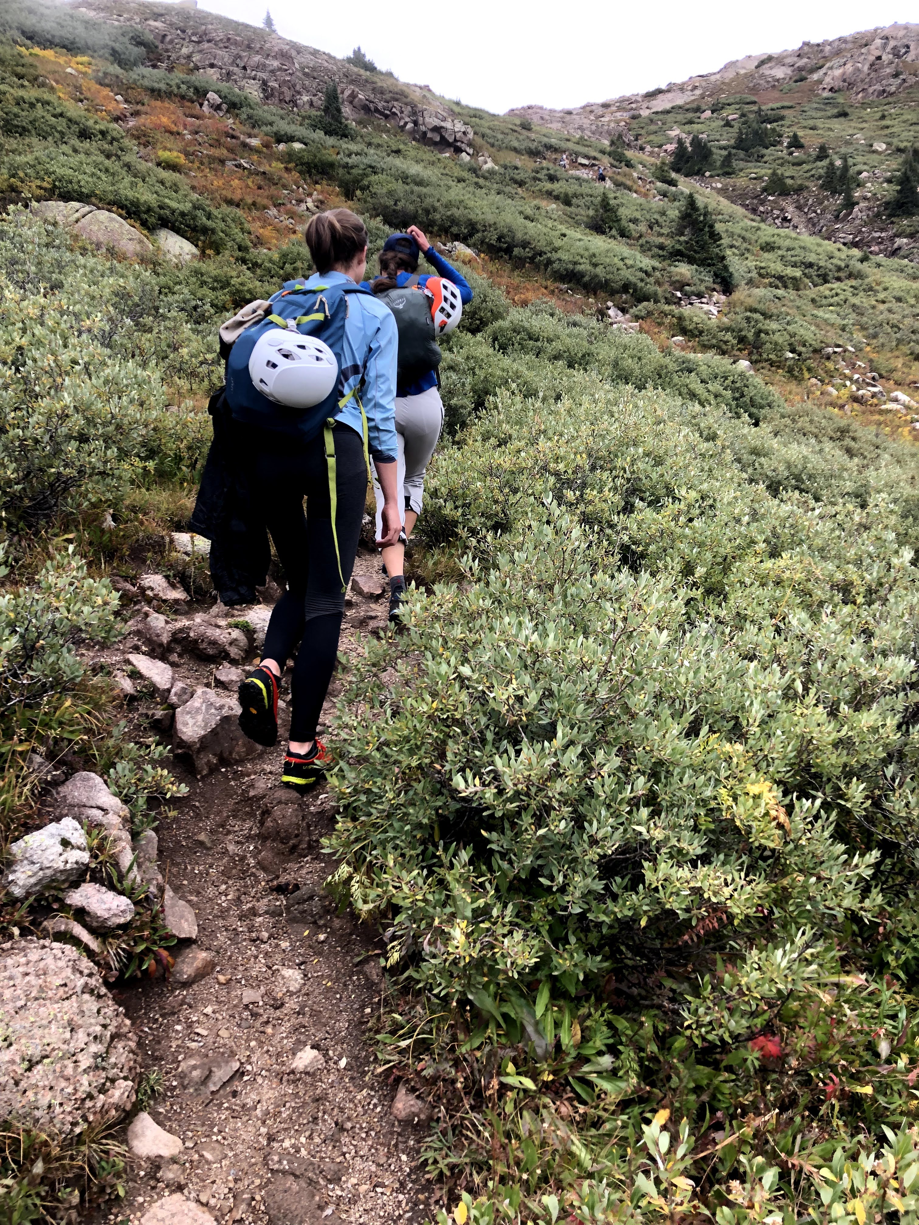
We waited at the branch for everyone to gather, so that no one missed the branch, and our assault on Mt Wyndom commenced. The assault begins with an immediate gain of elevation that almost never really let’s up all that much. Looking back, there were few flat places in the entire ascent. The only places to stop and grab one’s breath were in the switchback corners. It was in one of these corners where I spotted two young males behind us. At every juncture, they closed a lot more distance than I covered between observations, and soon they walked past me on their way to at least a two peak day. I also espied two young females that were also knocking out a decent pace, over-taking my team members one-by-one until they passed me as well. Two sisters, from where I cannot now recall, but their goals for the day included Sunlight and then Wyndom. I was able to keep up with them for a short while, and we talked about the day ahead and how their trip was going. They were here for all four peaks. They educated me that technically because the two Eolus peaks were so close to each other, they only count as 1 14er. That doesn’t stop people from climbing both. When they had tired of an old man following them, they added a little extra to their efforts and soon I was one and then two switchbacks trailing.
Kevin was my shadow on most of this climb, never more than a switchback behind me. Dan was often next in the queue with Paul and Jim bringing up the rear. I never got too far ahead that we couldn’t always see the entire team covering more than a couple of switchbacks, and I took frequent (as in needed) breaks. Hike at your own pace is how we go. Rest when you need rest.
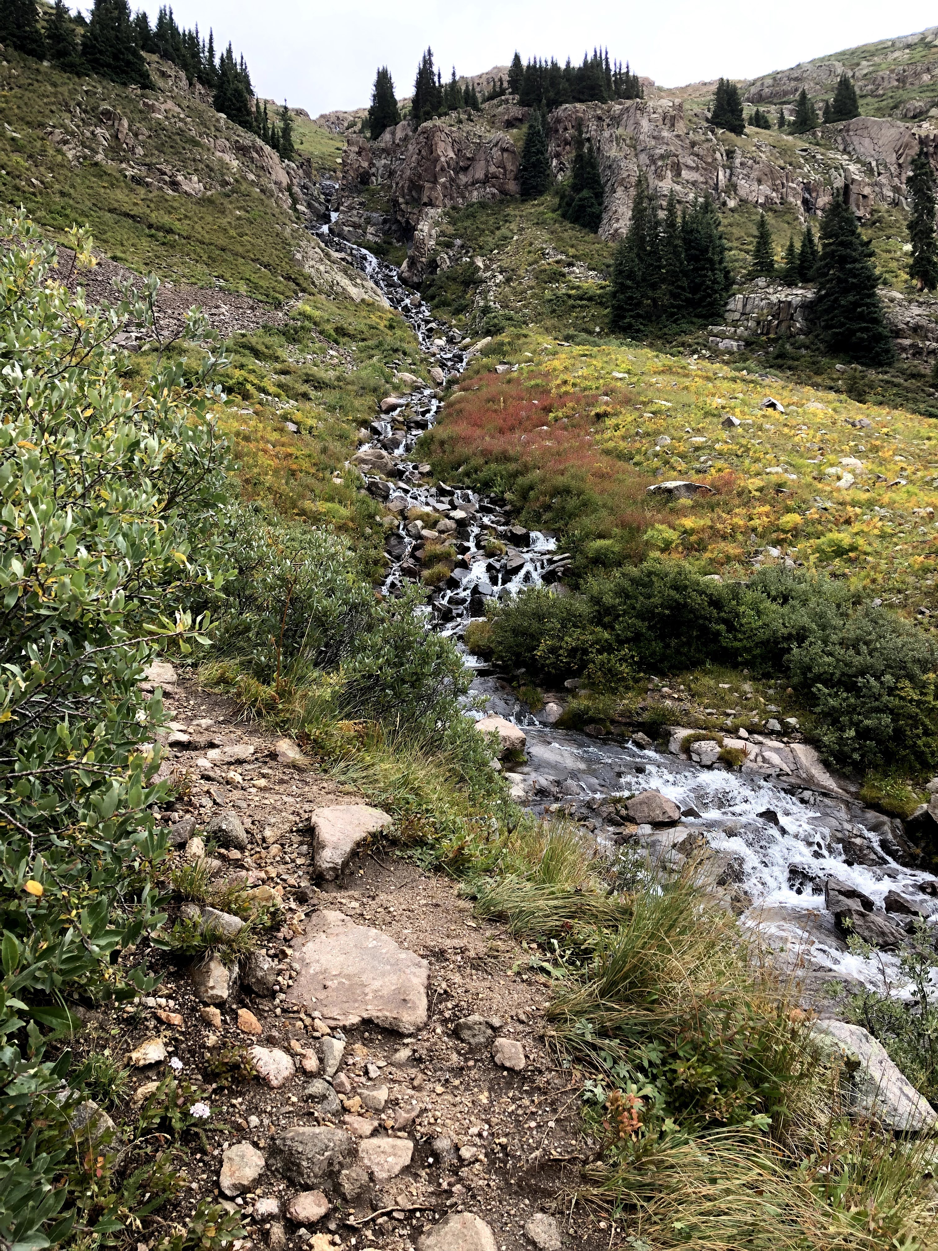
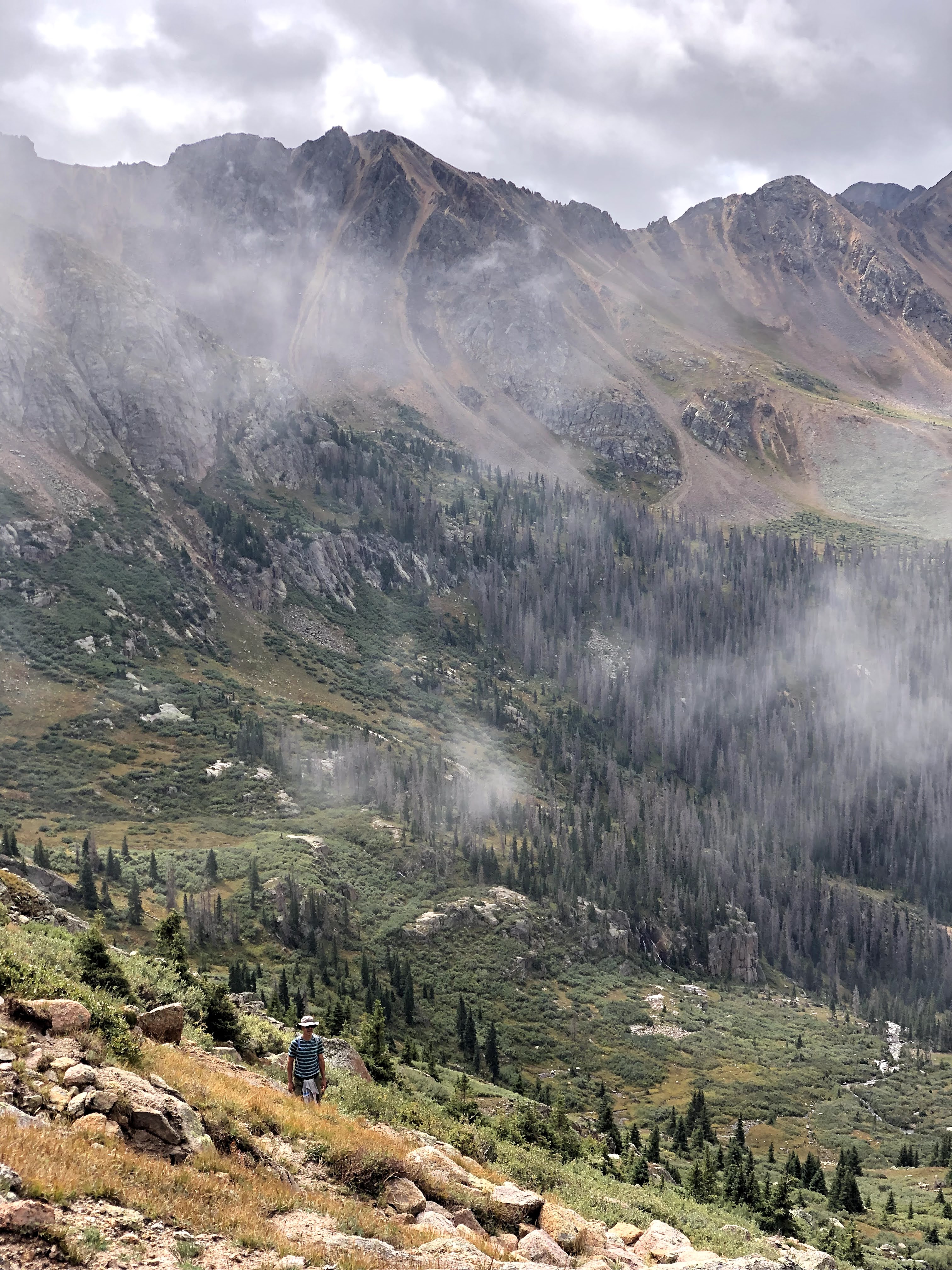
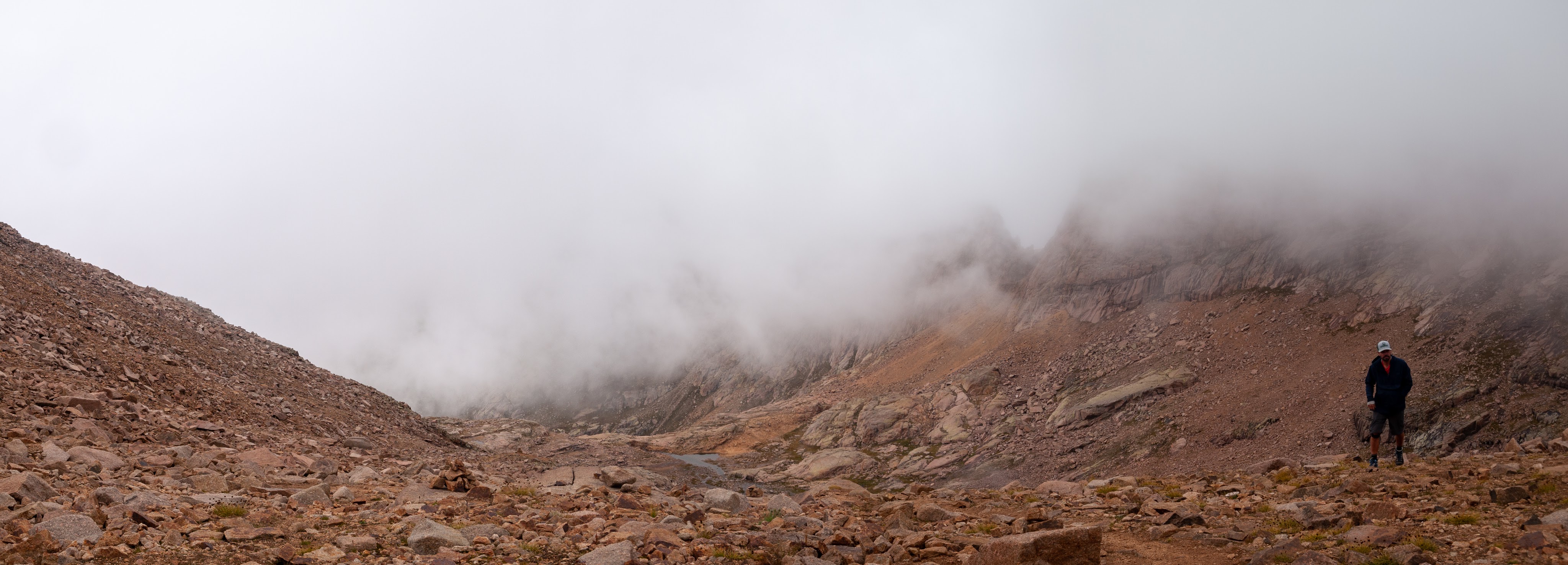
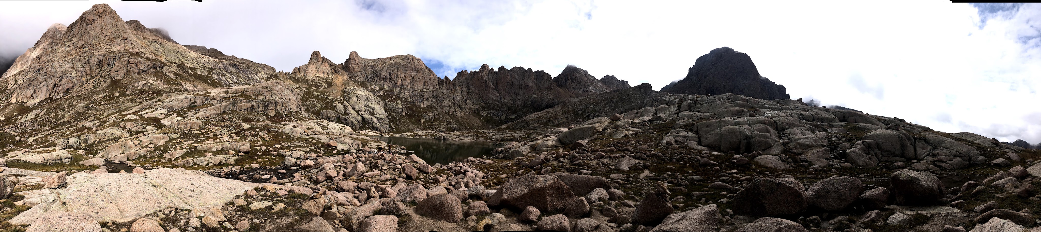
A benefit of switchbacks is you are always perpendicular to the slope, so to catch the view, all you have to do is turn your head a little and the sweeping vista fills your entire gaze. The footing wasn’t ever all that bad, so having to stare at the ground for foot placement left plenty of time to enjoy the view. The higher we got the better the view. Clouds were gathering, but nothing looked all that threatening as we continued up. We hit a shelf that crossed Needle Creek (drains Twin Lakes) to the East side for the final ascent to the lakes. Another 100′ and we were at the first of the two lakes. This provided an opportunity to do a few things. We could observe where others went so that we could assess our path up. It provided a place to rest until we were all gathered together again, and lastly we could take in a little bit of food that would get us to the top. Breakfast was fading fast at this point.
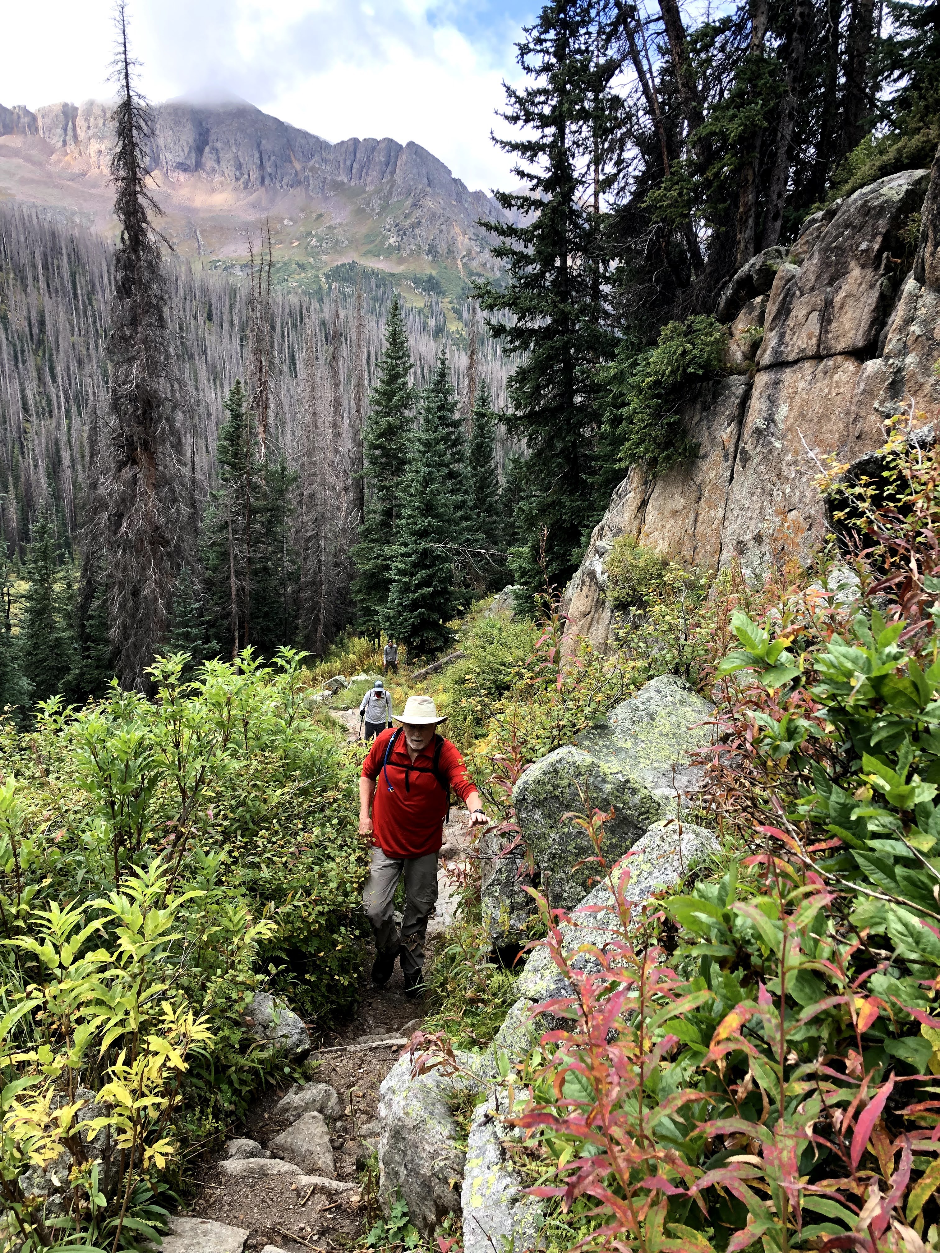
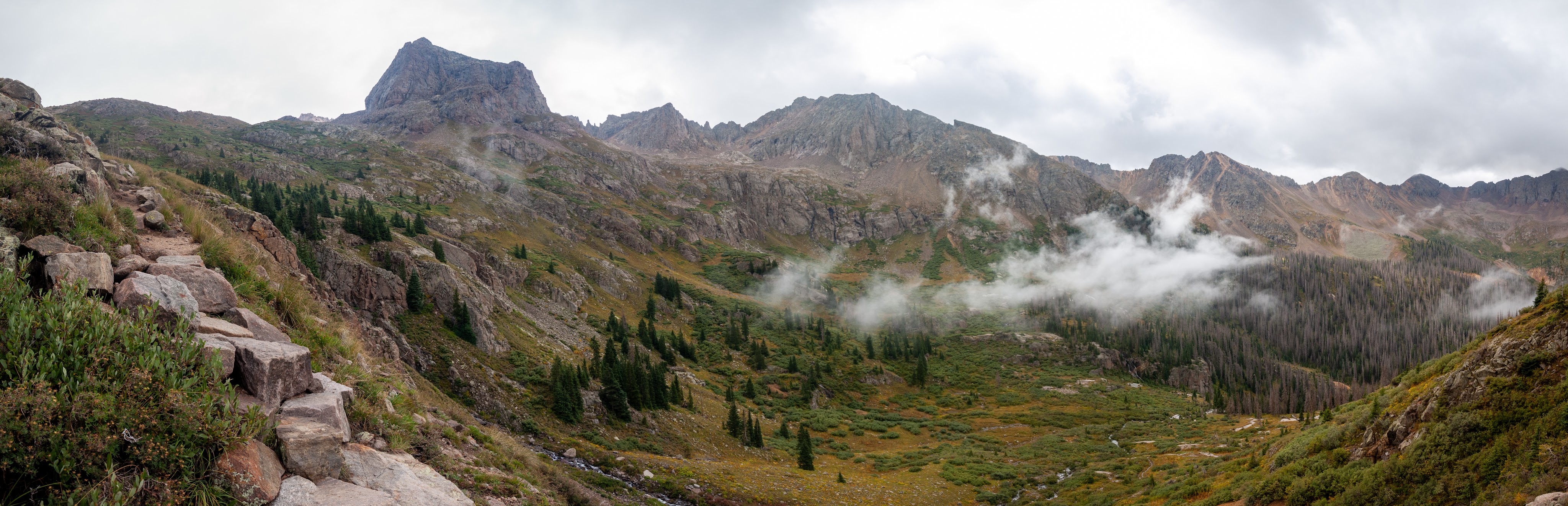
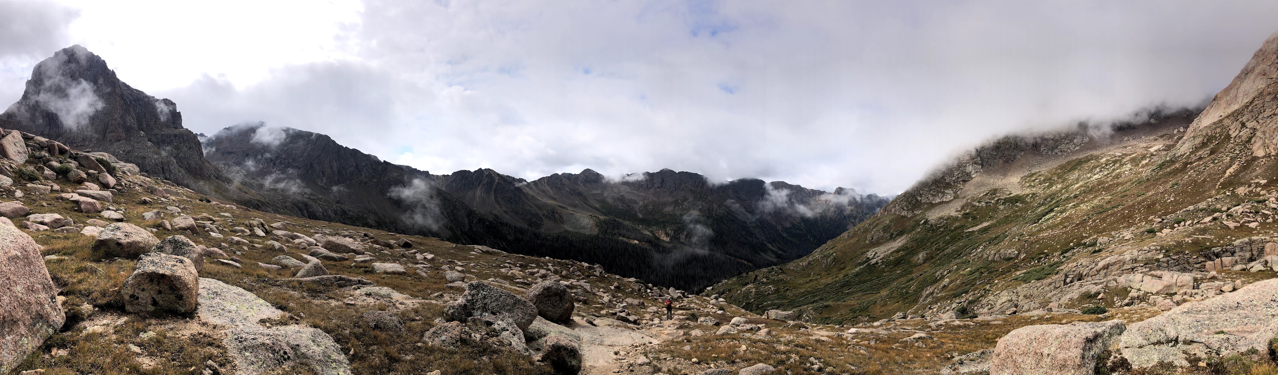
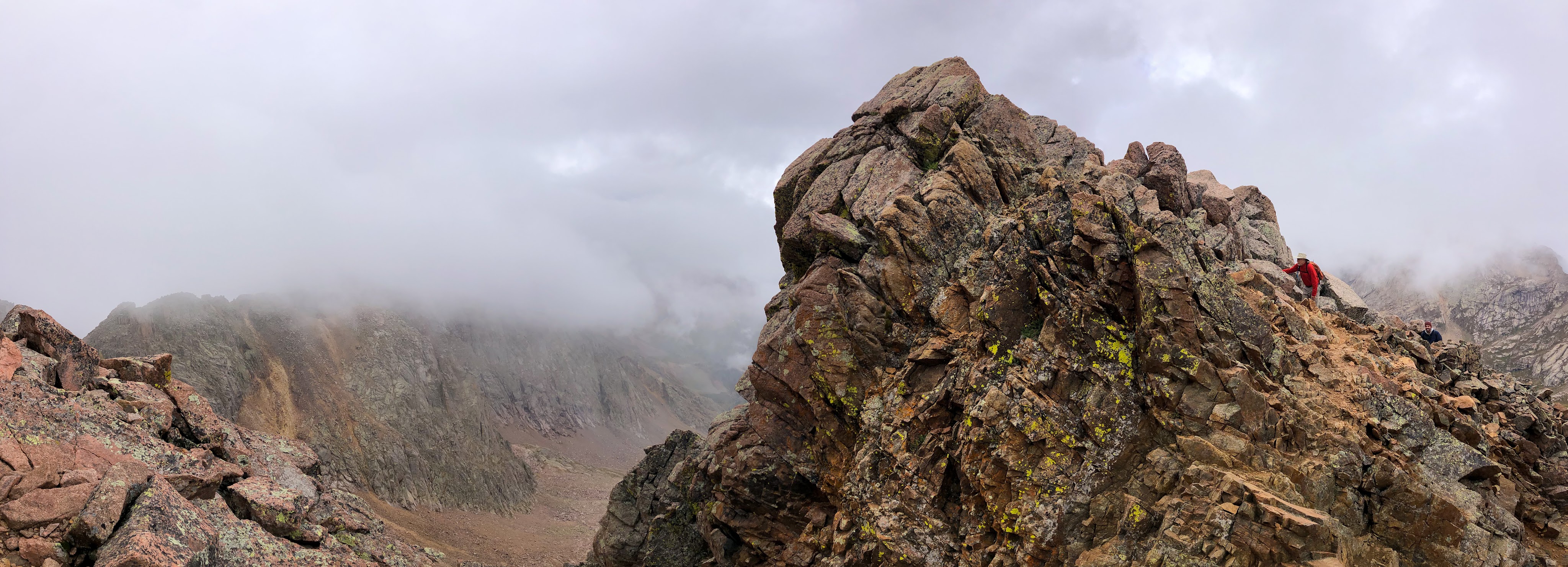
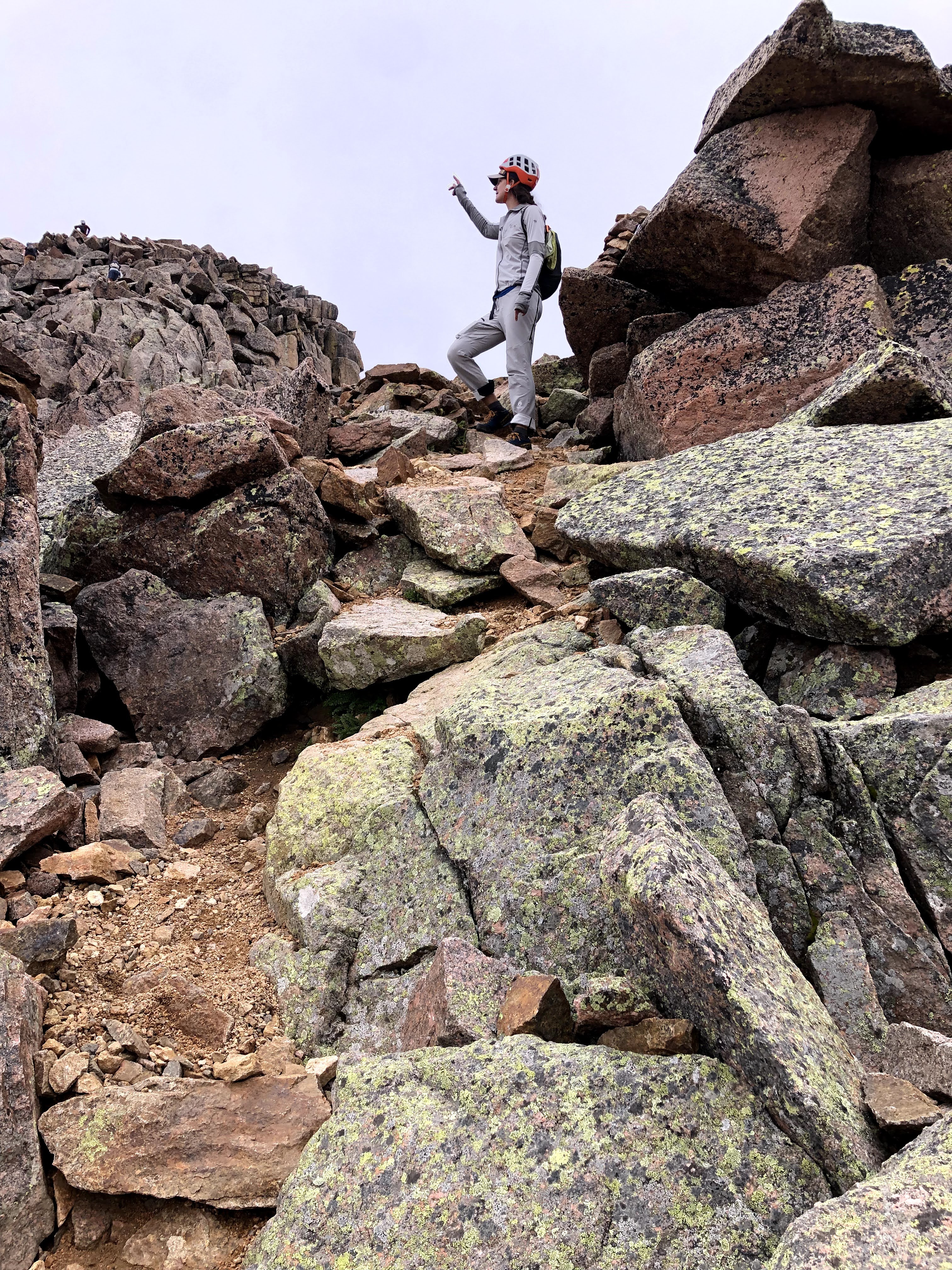
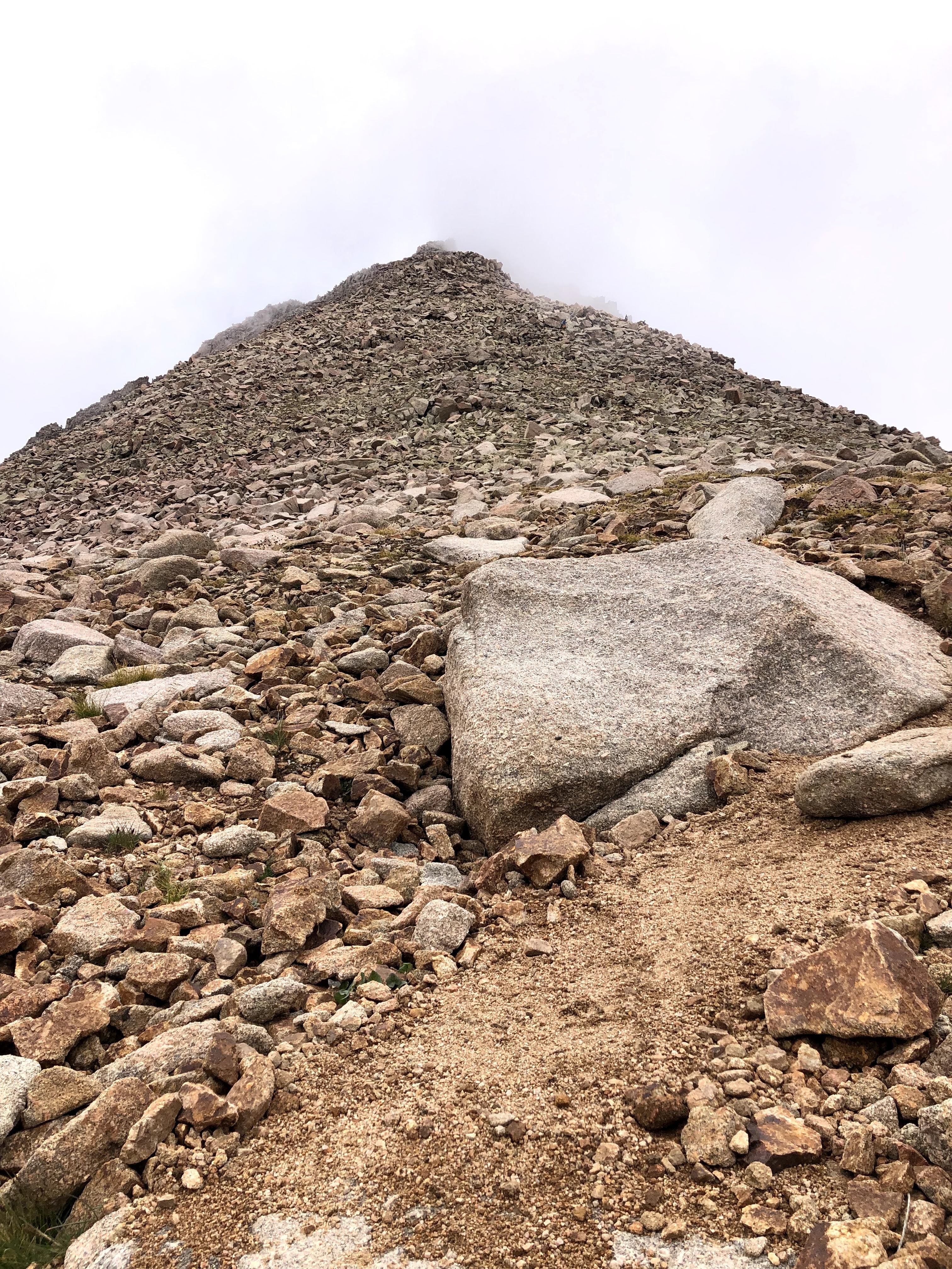
Topped off and with the sun still out we struck out for Wyndom. At this point the route to Sunlight and Wyndom were the same, but once we got around the lake, and up to the first shelf then we diverged and entered the first scree field. Now, for anyone who has not hiked through scree fields, it’s a lot of rocks. Big and small rocks. The trail leads right up to it, and the entry is usually marked by a simple rock cairn, and you should be able to spot the next one from the current one. Every winter, the previous season’s cairns get destroyed, so someone has to re-build them. Usually there are plenty of people who do this, but they don’t always agree what the best routes are. So it isn’t unusual to find more than one path, and in the case of Wyndom there were at least two paths. Which one is better? That may depend on which one utilizes the most non-rock sections. In reality you can chose any path on the scree as long as you angle up towards the correct destination. Scree is stable enough, and if it shifts it doesn’t shift much. Bigger rocks are more stable than smaller ones, but many times its the smaller ones that move you along. However there are some sections usually where there is dirt, and if the scree trail follows these it is a little easier going. I started on one set of cairns, but when I couldn’t see where the next one was, I dropped to a lower set that appeared clearer. In this manner we ascended to the saddle where we rested for the final push.
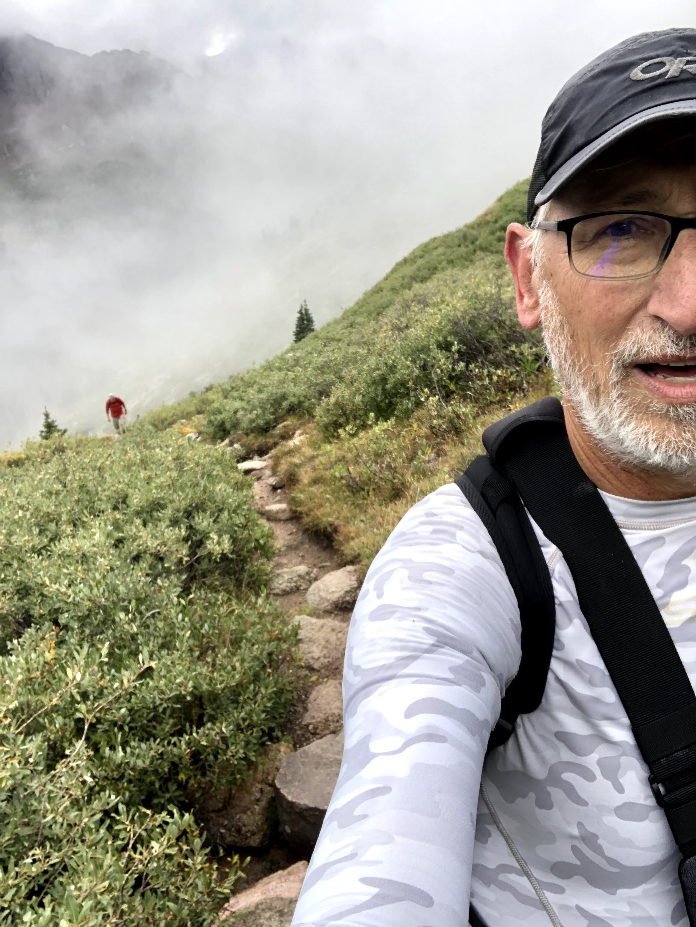
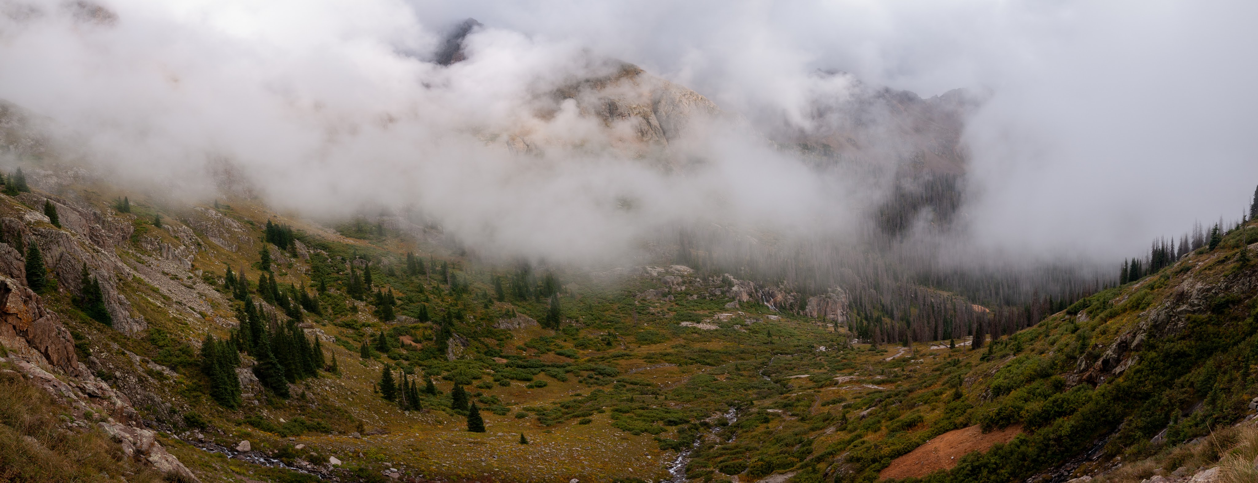
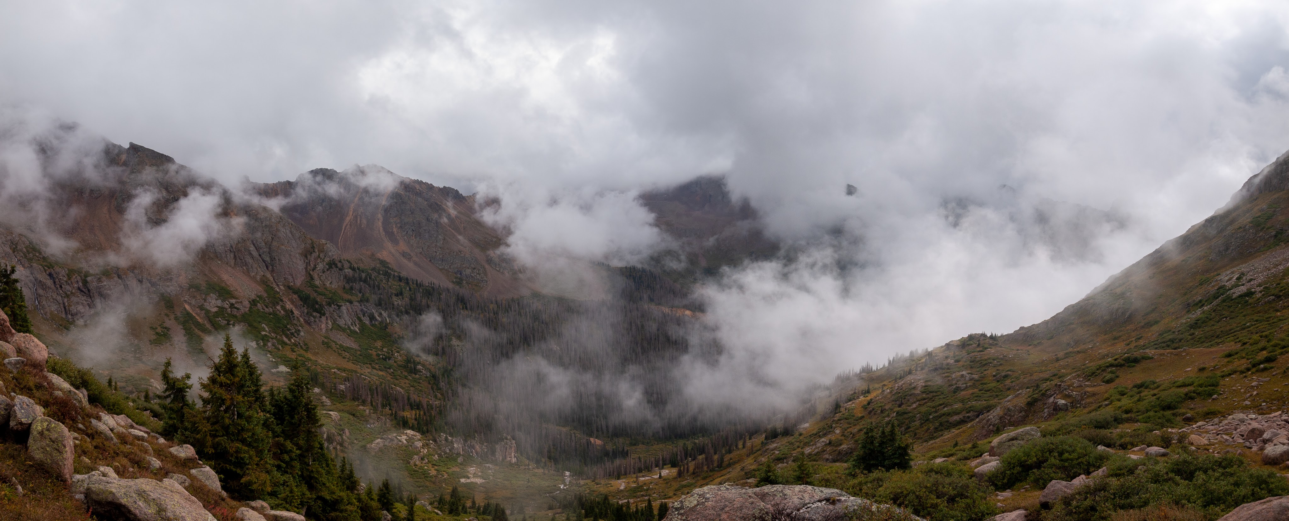
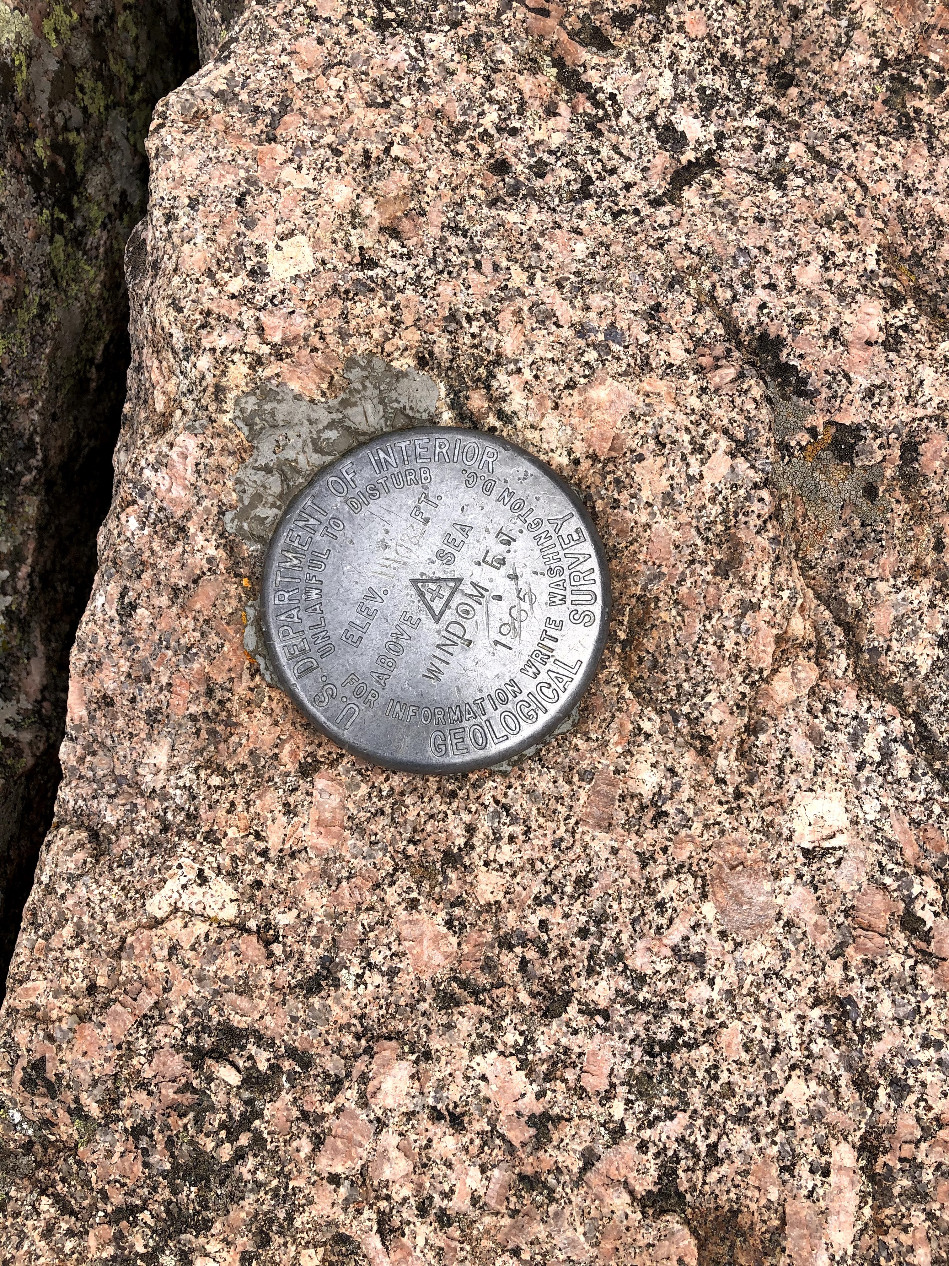
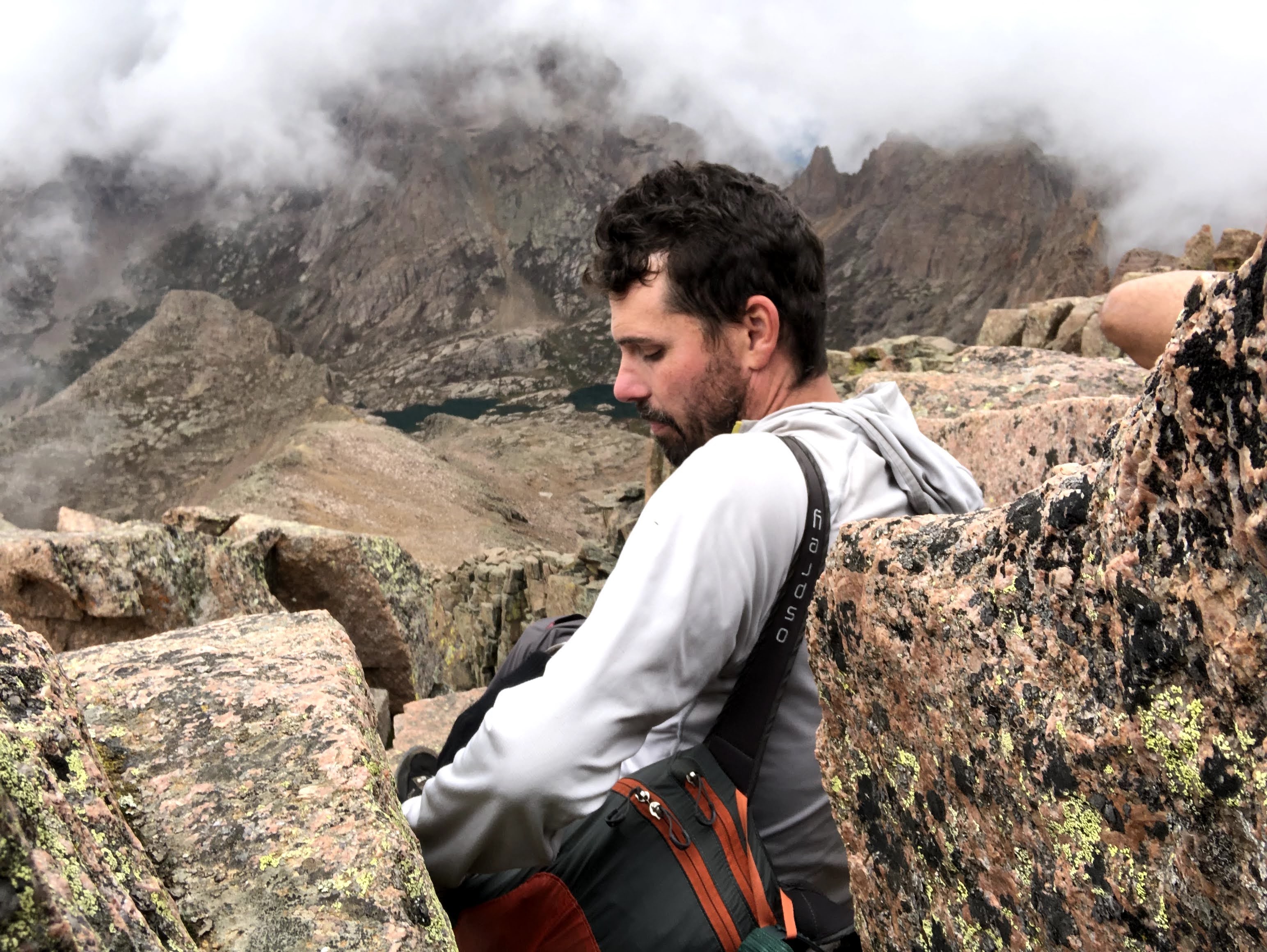
Kevin and I got there first, followed by Jim and Dan, and Paul was a little further back when it began to look like the clouds were gathering more and more, and with the breeze, we couldn’t wait for Paul. We gave him some direction where the cairns were, and afterwards we started up the spine. There was a long ascent on the spine, and then the trail edged around to the North side of a false summit where we hit a sunny shelf. Again, it was me, Kevin, Dan, and Jim. Kevin and I reached the shelf first, and Kevin sat down. I didn’t think that was a good idea, but we were at around 13,800′ and the longer Kevin sat there, the less likely I thought it would be that he would keep going. Dan arrived next and stood next to me, and then Jim, seeing Kevin sitting, sat himself. The two of them looked at each other and decided they had climbed far enough. Dan and I looked at each other and continued on for the final push. We actually had to drop off the shelf into a tight saddle and then climb around the South side and up to the summit which we reached around 1:30 in the afternoon. There were three young men there when we got there, and Dan and I managed to find purchase on a few rocks to sit and enjoy the view, when the view came into focus. More clouds are rolled in, and while we weren’t in clouds, our view of the basin was obscured more than a few times. We sat up there for about 10 minutes shooting the breeze with the other summiteers, and then we all decided it was time to get down.
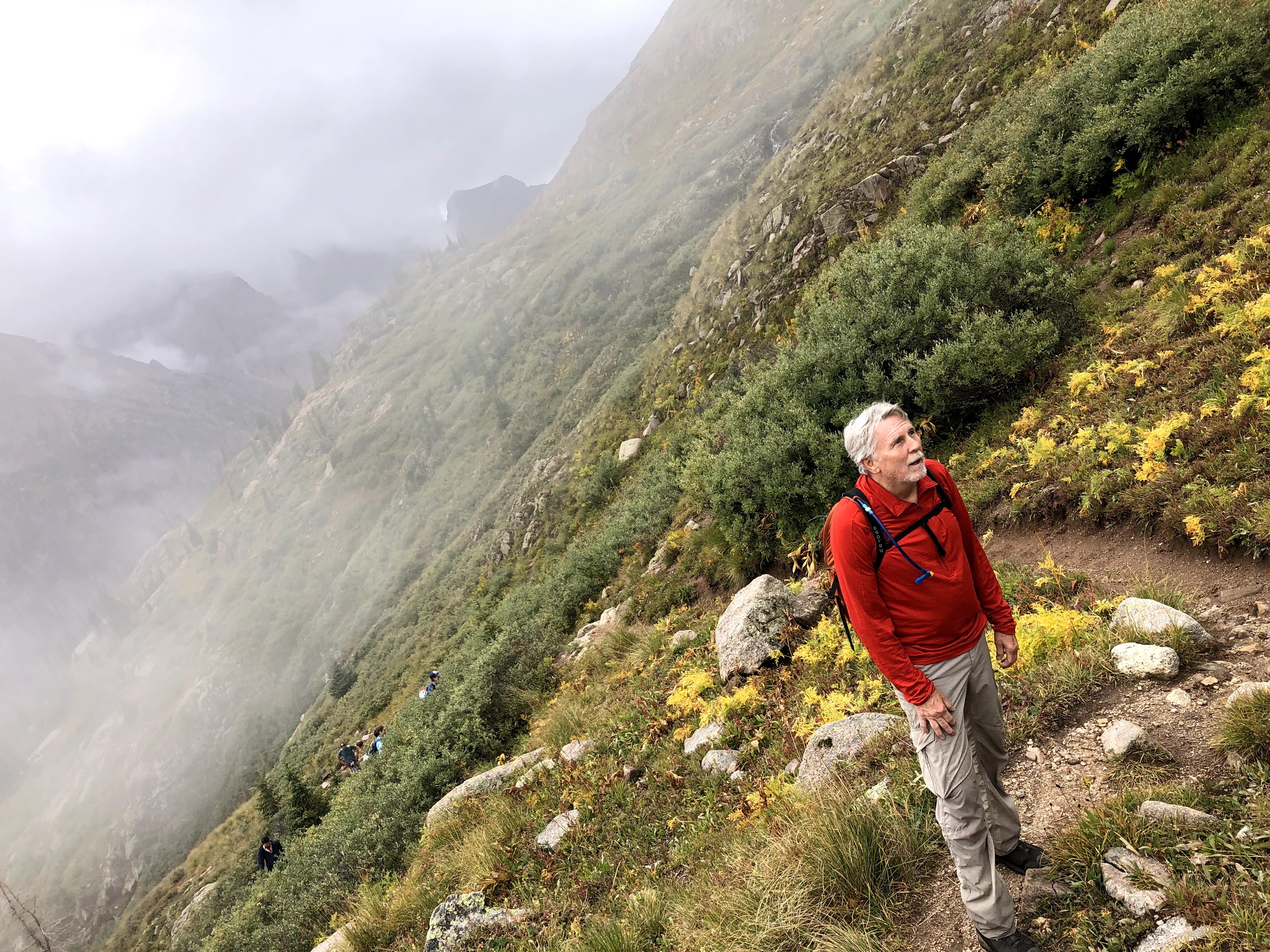
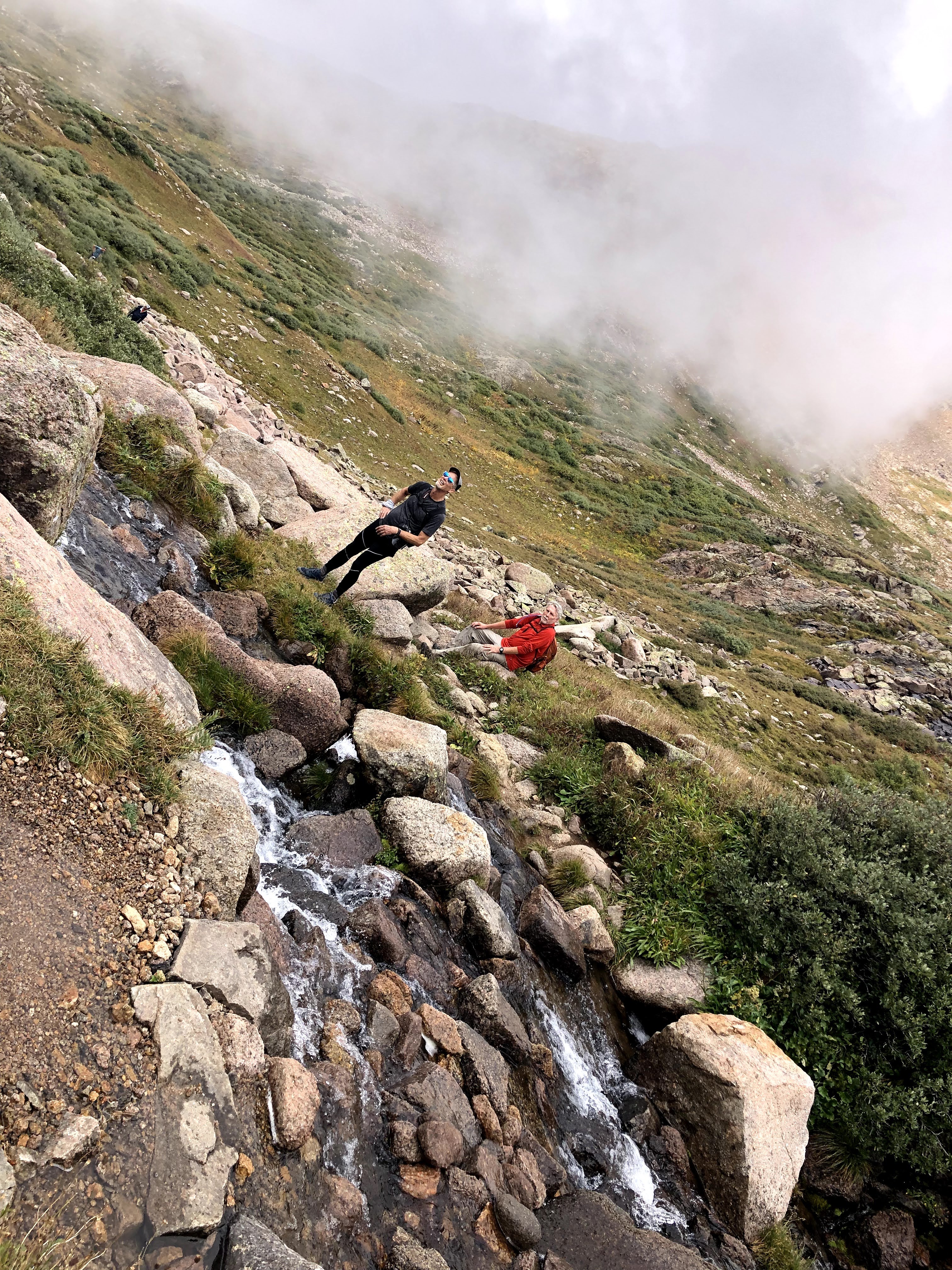
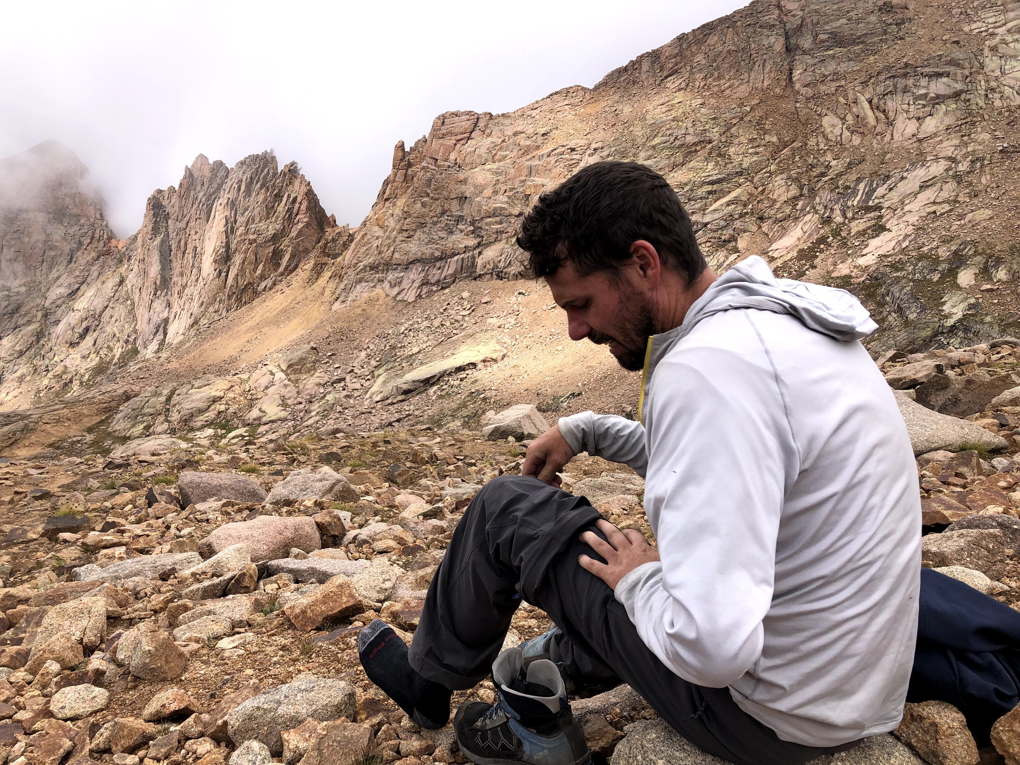
It was on the way down when we ran into Paul who was on his way up. He had not given in to the temptation to stop, and left Jim and Kevin, who he said had already started their descent. At this point I was in down mode, and should have turned around and accompanied Paul back to the top. I could also have advised him to turn around as the weather appeared to be turning and we were going to get some rain at the very least. However, I didn’t say anything of the sort, and wished him luck. I did tell him truthfully that he was almost there, and Dan and I continued down. Back at the tiny saddle it was Dan that remembered we had to climb up and out on the Northwest side of the saddle. I had taken a look on the South side and though it did look passable, I deemed it just a little too risky and followed Dan. Dan was correct. Soon we were rock to rocking it down the cairns and before long we were back at the big saddle. As we sat there, we could see a cloud rolling up and into the basin between Sunlight and Wyndom, and we just knew that cloud was bringing some weather with it. However, I wasn’t going to leave the saddle until I saw Paul coming down, and so we sat, and we sat, and we donned our warmer layer, and we put on our shell, and then the rain started to fall. At one point, still with no sign of Paul, we could no longer even see the top and just hoped that it would clear again. It was actually sleeting a bit as well. Fortunately for us the ground was warmer than freezing, so we didn’t have ice to contend with.
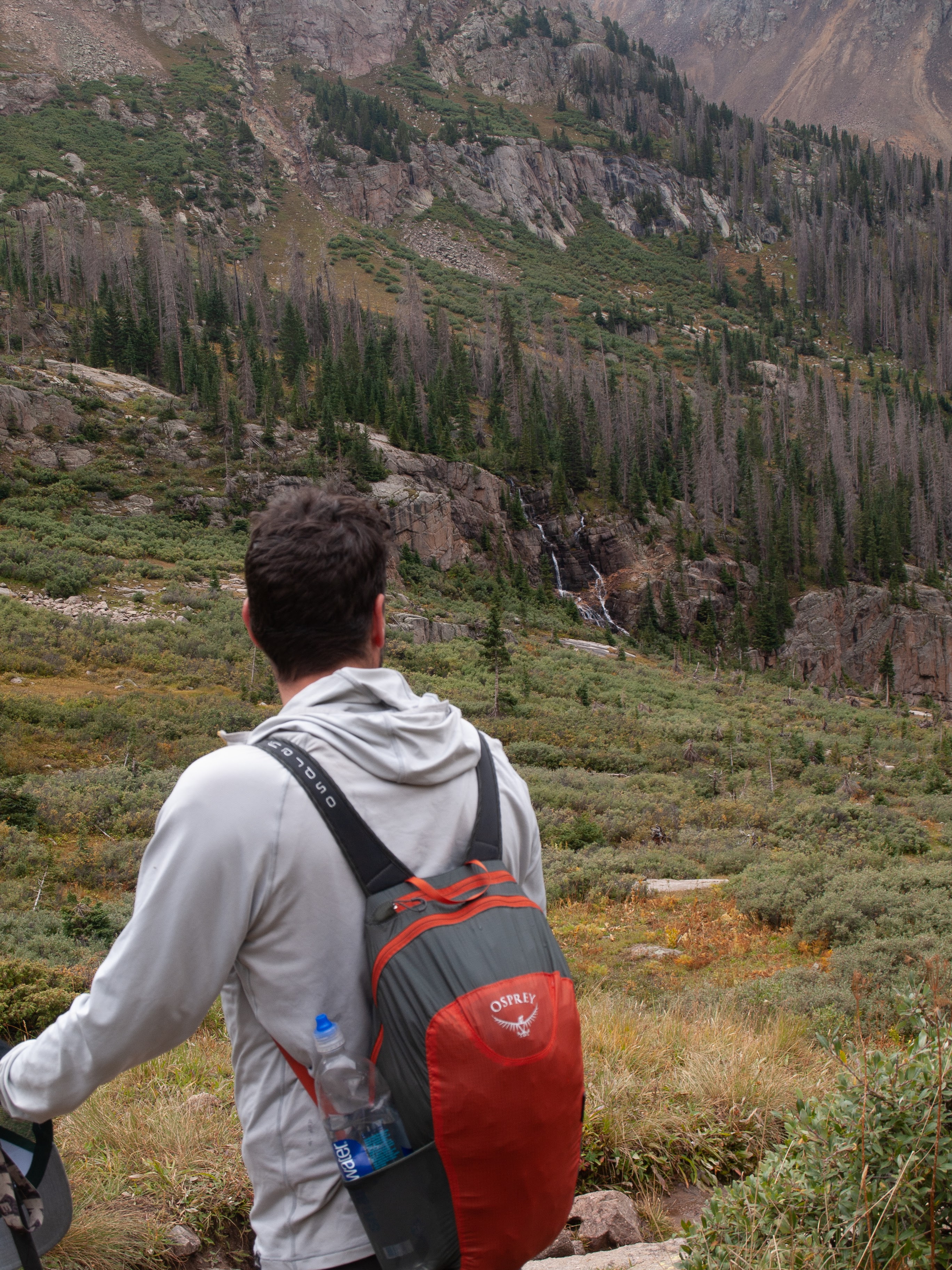
After ten more minutes I was considering going back up when Dan spotted Paul working his way down. By the time he reached us, Dan and I had sat there for about 30 minutes, and we didn’t let Paul rest a second before we started down the big scree field to the next shelf. It rained/sleeted all the way down, and at some point my screen was too wet to work, so no more pictures, and it was impossible to use it to see where we were. I did have my Garmin device, but the screen is pretty tiny, and though I used it for navigation on the ascent, I hadn’t found the feature that simply reverses the route, and then gives a track for descending. My bad. We made it down to the large basin floor, and then I got confused by what I saw. The name of the lakes is Twin Lakes, and when I looked down I saw what I thought was the second lake, and my memory from the first lake was there was a trail from one lake to the other, so let’s just descend to the lake and we are good. Wrong! There are actually two higher bodies of water that feed the lower lakes, and it was these that I saw, and soon we were on the edge of a descent that was going to get steeper, and it just didn’t feel right. Dan, again came to the rescue and insisted that we go back. Paul and I agreed, and we walked back whence we had come and then we spotted the giant rock cairn that marked the correct route, as well as a couple of other descenders, and though it didn’t look like the reverse of our ascent, it was exactly the reverse of our ascent, and soon the real first of the Twin Lakes came into view where Jim and Kevin were awaiting us.
The weather broke, and the sun shone through again, and we took some time to water up, eat some food stuffs, and rest before the long descent back to the Chicago Basin. We all talked about our own experiences up top and how Kevin just felt it when he sat down that he had gone far enough, and Jim seconded his relief to see that Kevin was going no further, so he too had audibled. I ate up almost everything I brought with me, as I was running on empty the last 30 minutes, and so with everyone topped off we began the descent back down to the trail junction. This was a lot easier to follow and all looked very familiar, however this is where it became apparent to everyone that we were only hiking up here once. I don’t recall who said it first, but I think Dan was starting to voice some issues with his knees when we were about halfway down, and I think all of us concurred that we didn’t see ourselves doing this again tomorrow. Maybe I was reluctant to concur at just that moment, but I think I was just being difficult. By the time we reached the junction with the main trail again, I knew in my own head that I wouldn’t be going back up again. I had reached the junction first and there were two hikers sitting on a nearby rock that I chatted up. I don’t remember their names, but like everyone in the basin they came to climb and were just relaxing now.
It was almost a relief to climb again! Reaching the trail junction only meant that we were on the main trail again, but remember, we were camped high in Chicago Basin so we still had about 500′ of elevation to gain back to reach our tents. Over the wide creek on a bridge of branches, up a few switchbacks, past the tailings of an old mine and the ruins of an old shack until the telltale signs of our camp came into view. It had been a long day for a day hike, but the sun was out, and we took the opportunity to string up some drying lines and get some of our wetter things a little drier. It was also approaching dinner time, and we needed water so we took care of that task and as we were sitting around awaiting a boil, we got to talking about the next day. If no one was going to hike another 14er, then maybe it would make sense to simply pack up and hike down out of the Chicago Basin and grab the first nice site we saw along the river. That would leave us with a super easy hike to the train, and the conductor did say that if we were there on the Northbound leg, we could ride the trail to Silverton. The simple act of just outlining this option was really enough to cement that as the only option for the day, so when we went around to gain agreement, it was nothing but thumbs up.
The light was getting really nice when a small group of mature backpackers much like ourselves (maybe not Dan) came up the trail to settle into their high camp, so we wouldn’t be alone this evening. They had one or two dogs as well, so there was a little extra volume coming from their site. They might have asked us where the water was, as they came up from the lower basin, so the nearest water in that direction was far. They were relieved to find it was only another 50 yards up the trail from their camp. With hot water ready, we all had to choose which of our last two meals to have. Do we choose our favorite for tonight or do we choose the meal we have been avoiding all week. For example maybe we each had duplicates, and maybe didn’t prefer the first instance of a particular meal, and so we just kept choosing something else. Do you want your last meal on the trip be the one you liked the least? These are important decisions. I decided I want to enjoy my last meal on this trip so I chose the meal I had been avoiding.
I have gone through some phases when it comes to backpacking dinners. On these kinds of trips it’s always just-add-boiling-water dehydrated meals, but which meals? I eat Vegan now, so that narrows down the choices considerably, but there are a lot more boutique brands out there now. Backpacker’s Pantry, and Mountain House are the old time big names, and when I started these adventures Alpine Aire supplied us with all our needs. Since then there is GoodTo-Go out of Maine, which actually makes some pretty decent meals, though they are rather expensive. Even Patagonia has some “Chef Quality” meals available. When I started these adventures, I simply picked all the meals and ordered them and had them ready to pick up at a local REI, however now I am just telling everyone how many to get, so they can get their own. Most of my meals on this trip were GoodTo-Go but I had two Katmandu Curry meals from Backpacker’s Pantry and it was this meal that I wasn’t crazy about. It wasn’t terrible, but I just didn’t really desire my remaining one, and as it turns out, everyone else that had that meal felt the same.
With dinner done, and the light fading we retrieved our now dryer stuff, and everyone turned in for the night. With no fire, it gets cold camping out at almost 11,700′ of elevation in early September. It sleeted on us earlier in the day. A warm sleeping bag is preferable to shivering.
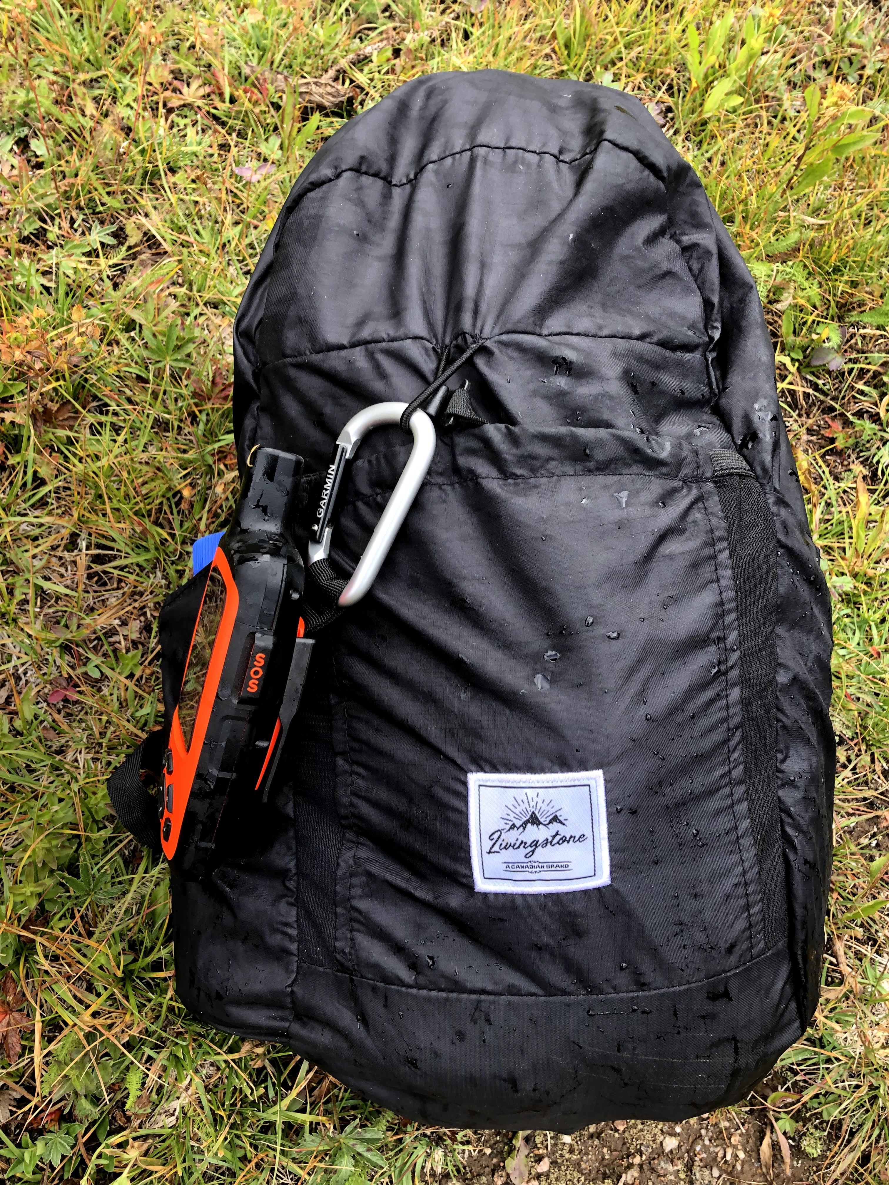


The rain made it impossible to use my phone any longer, and I wasn’t going to use the Olympus either, so no more images :(.

[…] 14er was made, that made today and easy choice. If you have read any of these posts, for example this, or this, then you know that the conductor on the Durango Silverton Historic Train told us that […]