
NY AT #1
April 13, 2014 § Leave a comment
On The State Line Trail
One of my friends socialized a Thompson Park flyer which advertised several (many) shuttled hiking trips that would cover the entire AT in New York in small 6-8 mile chunks doable by most people in a single day. I said, “Well that is a lot of chunks! Who has that kind of time?” and I set about to design an equivalent set of hikes that could handle it in 5 chunks.

Susie was very excited about this hike
Problem was that none of us were still in our 20’s and knocking out 20 miles including the long drive and shuttle car placement would be no easy task. For the first leg, I had actually only planned on 17, but that really didn’t include the 2 mile access trail to get to the AT from Greenwood Lake, nor did it account for my rough sketching of the trail in google earth plugin. Had I known that MapMyHike could handle the route plan, I could have laid down something that was more manageable. Actually, even laid out it still says only 17 miles, however it felt like it was going to be more like 20. I am not sure the charting tool tells the truth.
On the AT
So the idea was to hike from the parking area at State Line Trail at the border of NY/NJ Greenwood Lake, to Elk Pen where the AT enters Harriman State Park. It was a nice idea in my head. The day began cool and overcast with Andy Shoneman assuring us that it would hit 80F today. We dropped off 1 vehicle at Elk Pen and drove to the starting location on some pretty winter fucked up sections of 17m. For those who don’t know, there are a lot of 17’s in NY and this one is 17m.
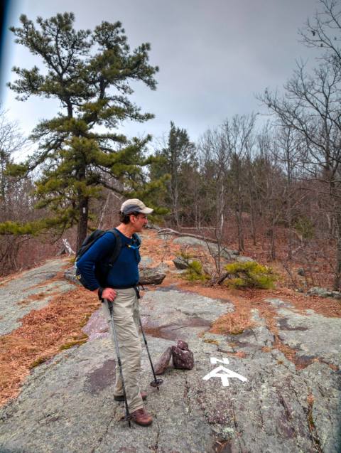
The highest point on the AT in NY
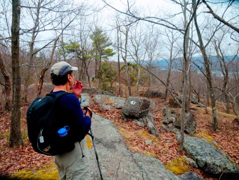
We got our start, and bounding up the hillside we made the ascent without issue. Everyone seemed to be in decent shape. This section of the AT, though up on the ridge, is by no means flat. It is up and down over rock scrambles. An hour of this, and the bounce in our step was a little less pronounced. Add to that we hadn’t cleared Greenwood Lake yet. Our most optimistic estimate had us finishing the hike 1:30 to 2, and I was already pretty sure that was not achievable.

A traditional woods scene along the AT
Needless to say, as the day wore on and we did get chunks of the trail behind us, it was pretty clear to me that by the time we stopped for lunch we were ready for a rest. Each micro stop prior to that got a little longer, and I had to keep pushing to get us to the Wildcat Shelter for lunch.

Creek Cross
After lunch it was a different story, and I started thinking about what our options were. We had cars in two locations, so we either hike to one of them (closest), or pick one of the road crossings and call a cab. To be honest, I wasn’t in favor of the cab option, but I could read the writing on the wall. We decided on the cab option and left the trail at Mambasha Lake, a really pretty smaller lake with small cottages around, and big houses on the hillsides. This lake flooded heavily when Hurricane Irene came through in 2011.

One of many creek crossings
In the time it took the cab to arrive, I feel like I could have finished the hike, retrieved the car and picked my friends up, but in hindsight I know that they wouldn’t have let me go off alone, and though the last bit of trail wasn’t terribly difficult, when your legs are heavy and your heart is tired, a badly placed step becomes more and more likely. So we sat on a wall in front of a house and waited, and waited, and…..

Obstacle to the best view
The cab driver wasn’t used to picking up hikers, and when I told him where we wanted to go, he didn’t have any idea where that was, even though it was only a few miles away. Fortunately he did know where Route 17 was, and he got us there quickly and I got him the rest of the way.

Can be done without the ladder
Relieved we were to be at the cars again. Cab paid and gone, we all shed our heavy boots for lighter footwear. Crocs, sandles, flip flops, anything but big heavy leather boots. I can’t recall whether I had a cooler with a six pack in it on this hike. That cooler would become a goal in all future hikes.

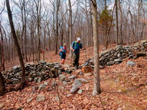
Andy and Susie are next up
Needless to say, that for all future hikes, Andy was given charge of laying out the end points. I blew the trust of my companions, and would whatever route distances they came up with. Looking back, this was a very challenging section of the trail. About half of it was walking up and down an exposed granite seam that had climbing and descending often. Most of that lay along the section from the state line all the way until the trail turned East, but there were some nice sections of unimpeded woods walking.

Overcast but beatiful
The reality was that we weren’t in the best of hiking shape at the time, and this distance was a lot to pull off for the first hike. I write this more than a year later with the knowledge of all the other hikes that came after this, and we were definitely a little green on this trip.
An old stone wall in the woods

Another fine view

Warwick Mountain stream
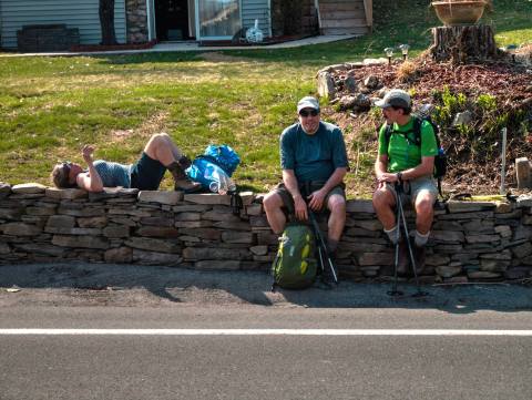
Waiting for a cab.

Leave a comment