
Weminuche Wilderness 2021 – Day 2 A Two Pass Day
December 7, 2021 § Leave a comment
It’s been awhile since I last climbed the Continental Divide under my own power. I crossed it as a bus passenger in June, but that doesn’t count in my book. We were in the Pacific drainage when we both started and ended this day, but we hiked in the Atlantic drainage for a short while, which meant that we had two passes ahead of us. I can’t find a name for the first pass, and maybe there is a definition of “Pass” that I am unaware of that this first “Pass” doesn’t meet, but I feel like if I cross from one side to the other, say from one valley to another, that is a pass. The second for our day would be Hunchback Pass. A real name.
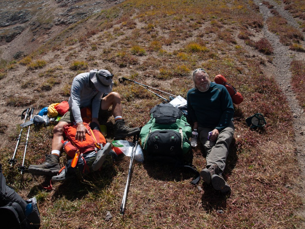
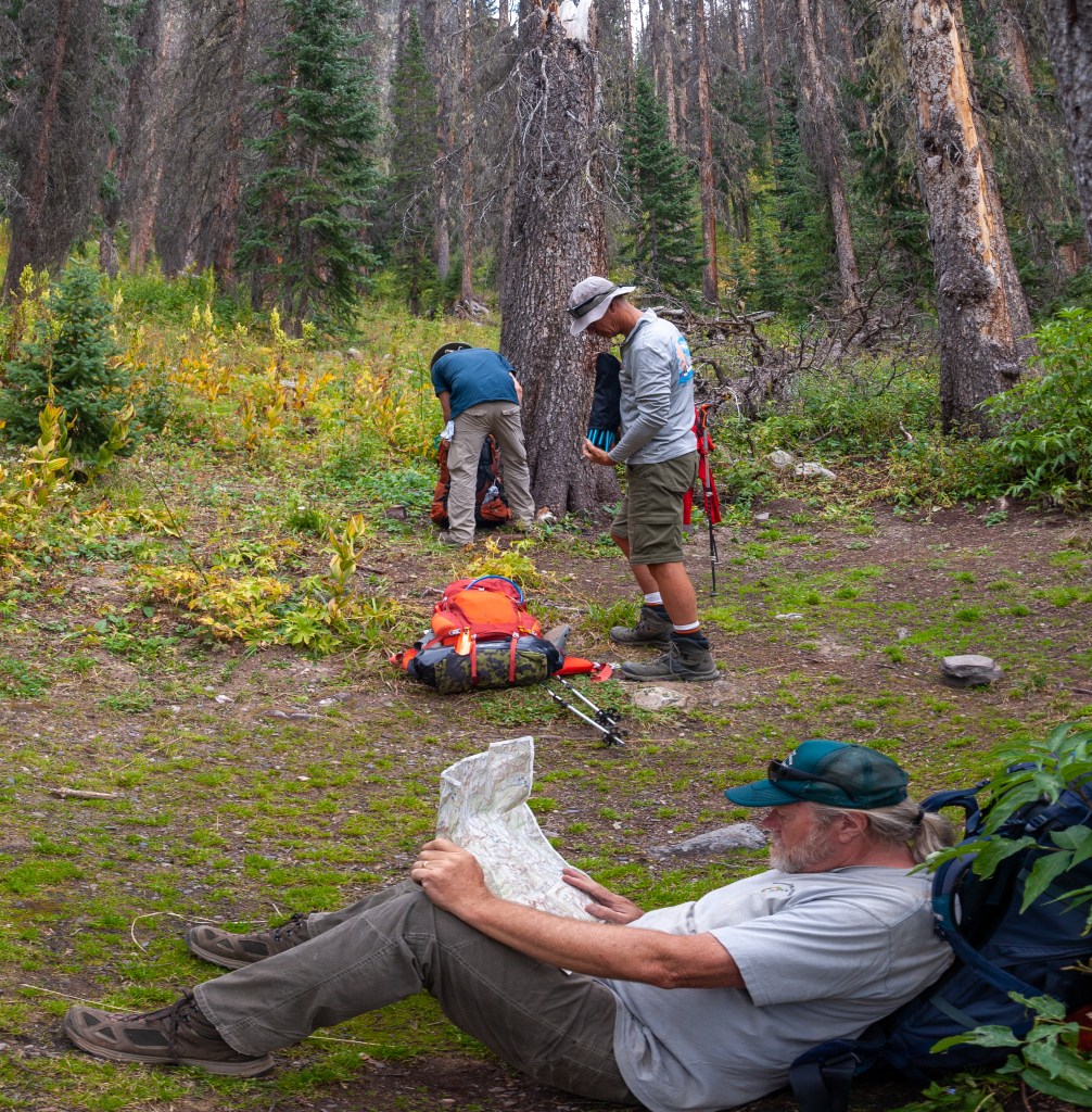
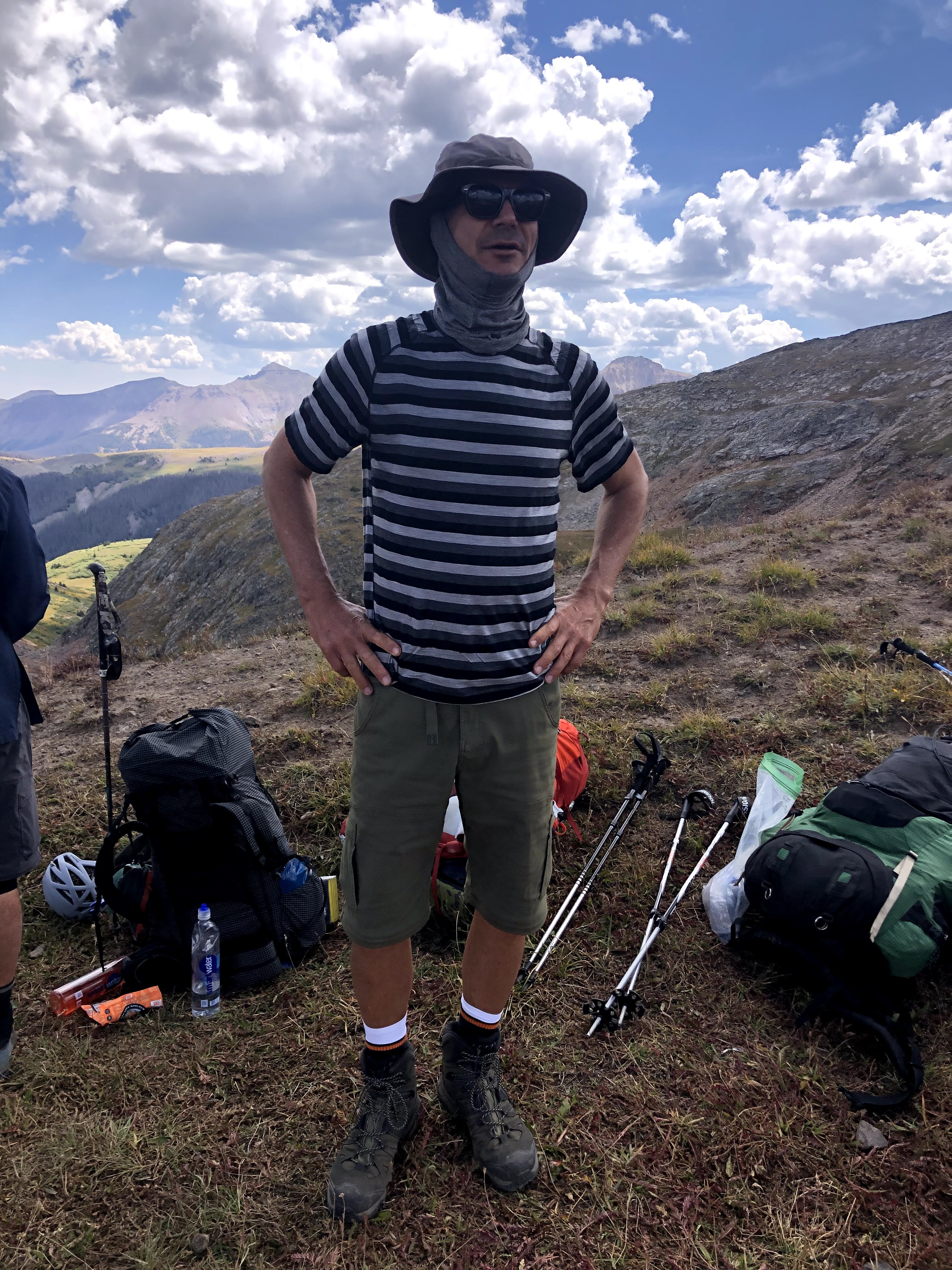
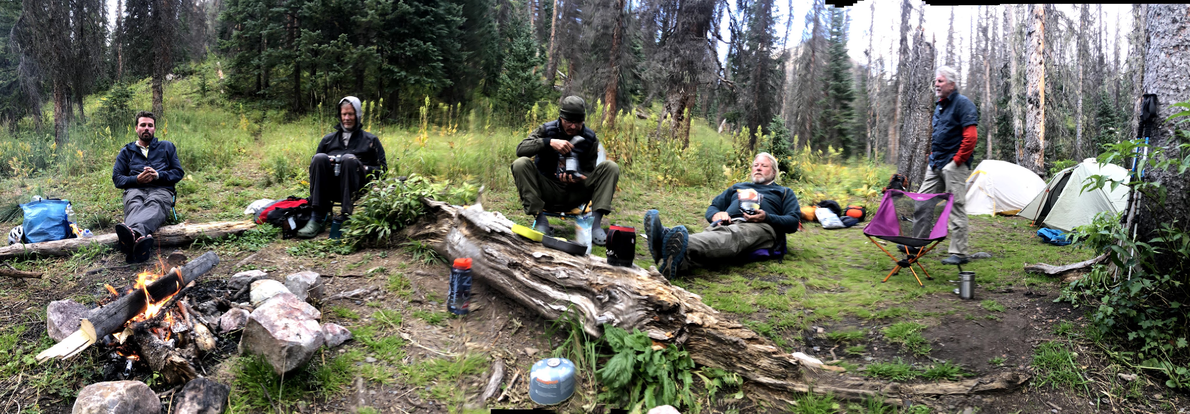
I wish I could say I slept well that first night, but I did not. At 62, maybe it’s simply I will never sleep well again. It could be possible there is something I am doing wrong, but the real culprit is my prostate. My PSA numbers might be clean but that doesn’t mean my prostate isn’t larger today than it was 30 years ago, or even 10 years ago, and that means that when/if I am asleep, then I have to get up to take care of business, and then the task of trying to fall back asleep becomes a harder chore. Enough of that talk. I believe I was up at least twice, and it could have been three times, but more likely I just lay in my bag until it was light enough to get up. We were deep in the valley, and wouldn’t see the sun for a couple of hours, but we could see its affects on the mountains towering over us. I was not the first up, that honor almost always goes to either Jim or Kevin. Walt and Paul rolled out consistently fighting for last. In all my trips with Kevin, he doesn’t waste time in the morning, and my first sighting of him is with his Jet Boil between his legs, getting his breakfast going. On this trip he didn’t have his stove, so he was patiently waiting for me to get my act together. If Dan was up earlier than me, then Dan would have something going.
It was a big day today, and so I didn’t let anyone sleep in. Get up, eat, and let’s break camp and get going. This was our first breakfast and this trip, instead of having all the ingredients in separate bags that in the past, required us to “find” all the ingredients before we could start breakfast. This year, everyone combined or parceled out their own ingredients from the master supply, so as soon as you had your own food bag, you were good to go if you had hot water. When you only have to bring the water to 191 degrees, boiling water goes a wee bit faster when you are near 11,000′, and so we had hot water for all soon enough. Coffee at 191 is easier to drink as well! May not stay hot as long, but who is taking their time? We have trail to hike!
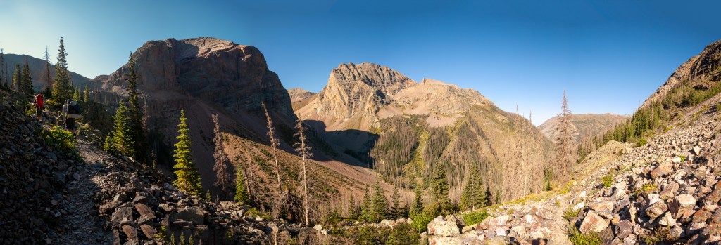
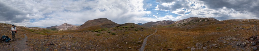
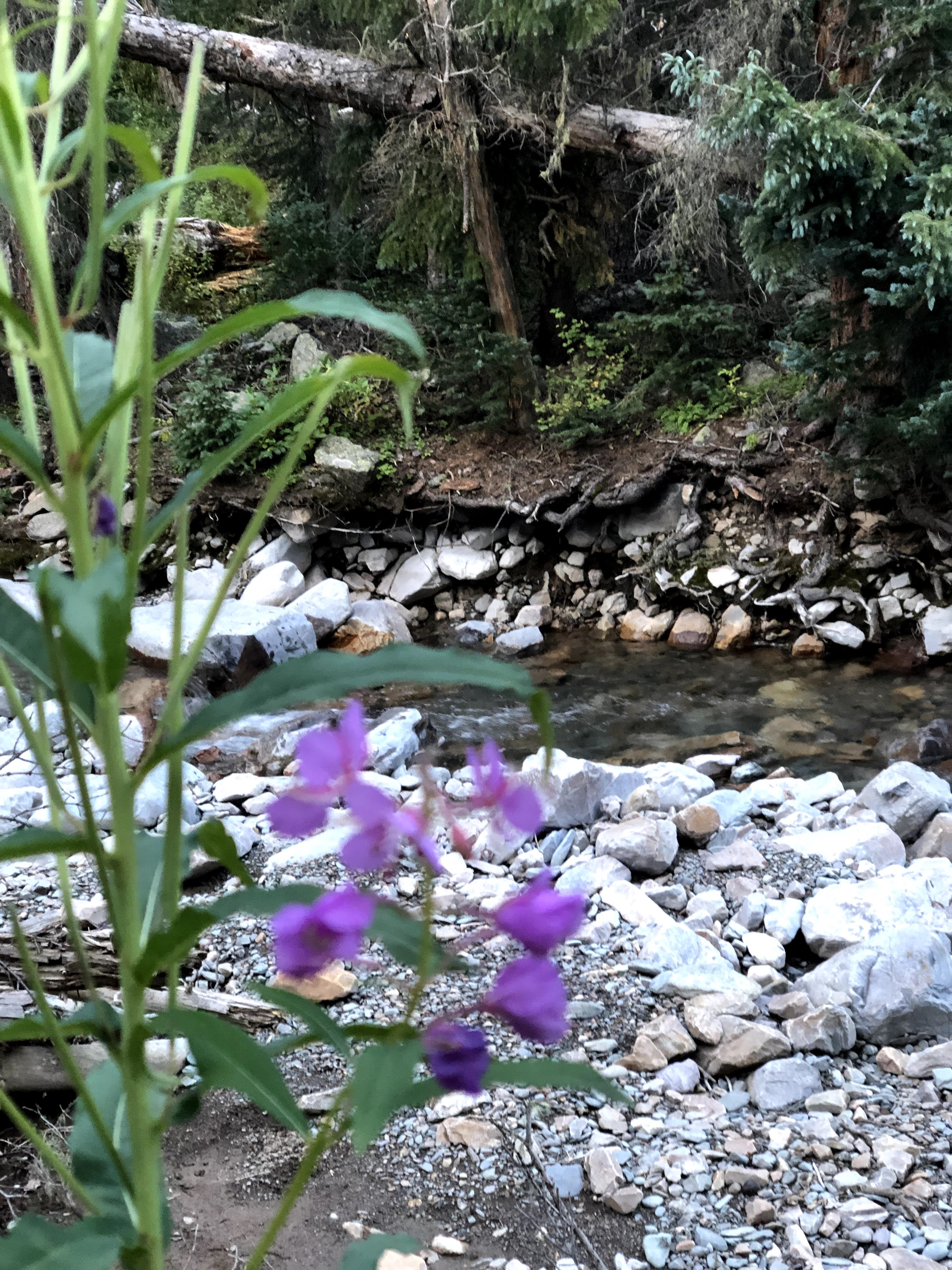
After the usual amount of bodily function talk, and camp broken down, we were all loaded up and ready to hike. We used up every last drop of Dromedary water, and those who wanted a lot had a lot. I had my liter and I was good to go. Our site was as clean, if not cleaner, as when we had arrived, and with that, we set off. Since we had sent those ladies up the trail the previous night, I thought we might see them for a morning greeting, but their camp seemed empty, or they simply were sleeping in. It could also be that they deemed the morning right for a dip in that cold pool I hiked to the previous afternoon, but that is all speculation. They were probably just asleep or being lazy about their day. Soon they were forgotten, and just as soon, we broke out of the trees, and the landscape really opened up. We could even see far enough ahead to see our first pass.
I forgot about a woman we ran into the previous day. She was descending, and she was smoking up the trail. To the best that I can recall, she started that morning on Johnson Creek, and to put that into perspective, we weren’t planning on Johnson Creek for another two days. She was carrying ultralight, and if you saw her legs, then you wouldn’t be surprised to find that she was a trail angel who came out often and trekked these long stretches to offer up information to anyone who wanted it. Besides confirmation regarding fires, she gave us advice concerning The Chicago Basin that we would probably act on. That was since we were coming in high off of Columbine Pass, if we didn’t mind being 500 feet higher than the rest of the campers, then we would probably find that we would have that part of the basin to ourselves. If you spend all day hiking up from the train, who in their right bind is going to hike 2 more miles to gain another 500 feet? Not many is the answer.
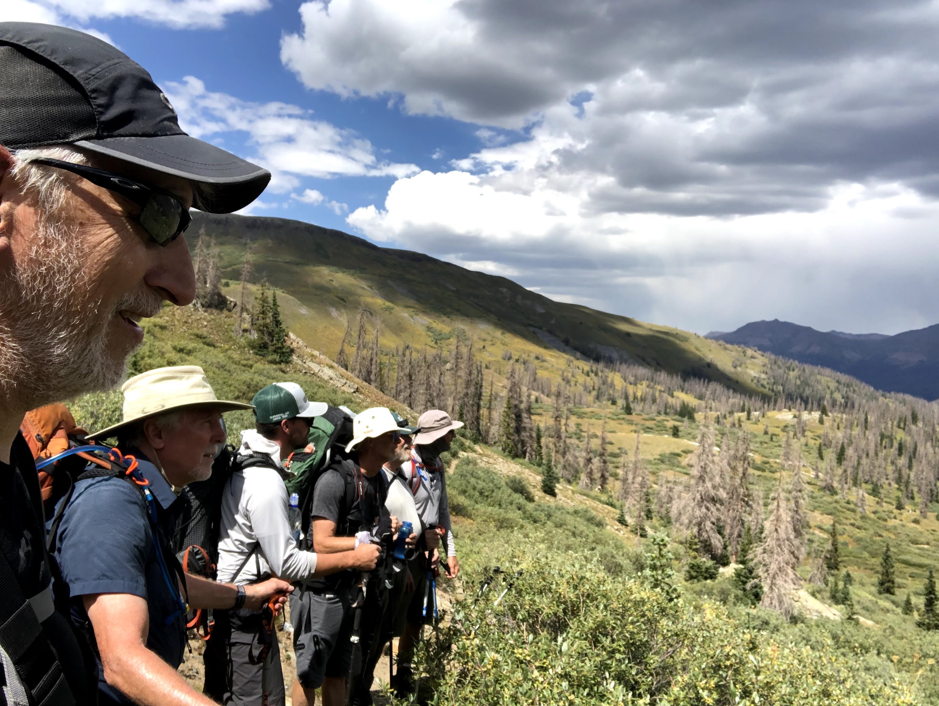
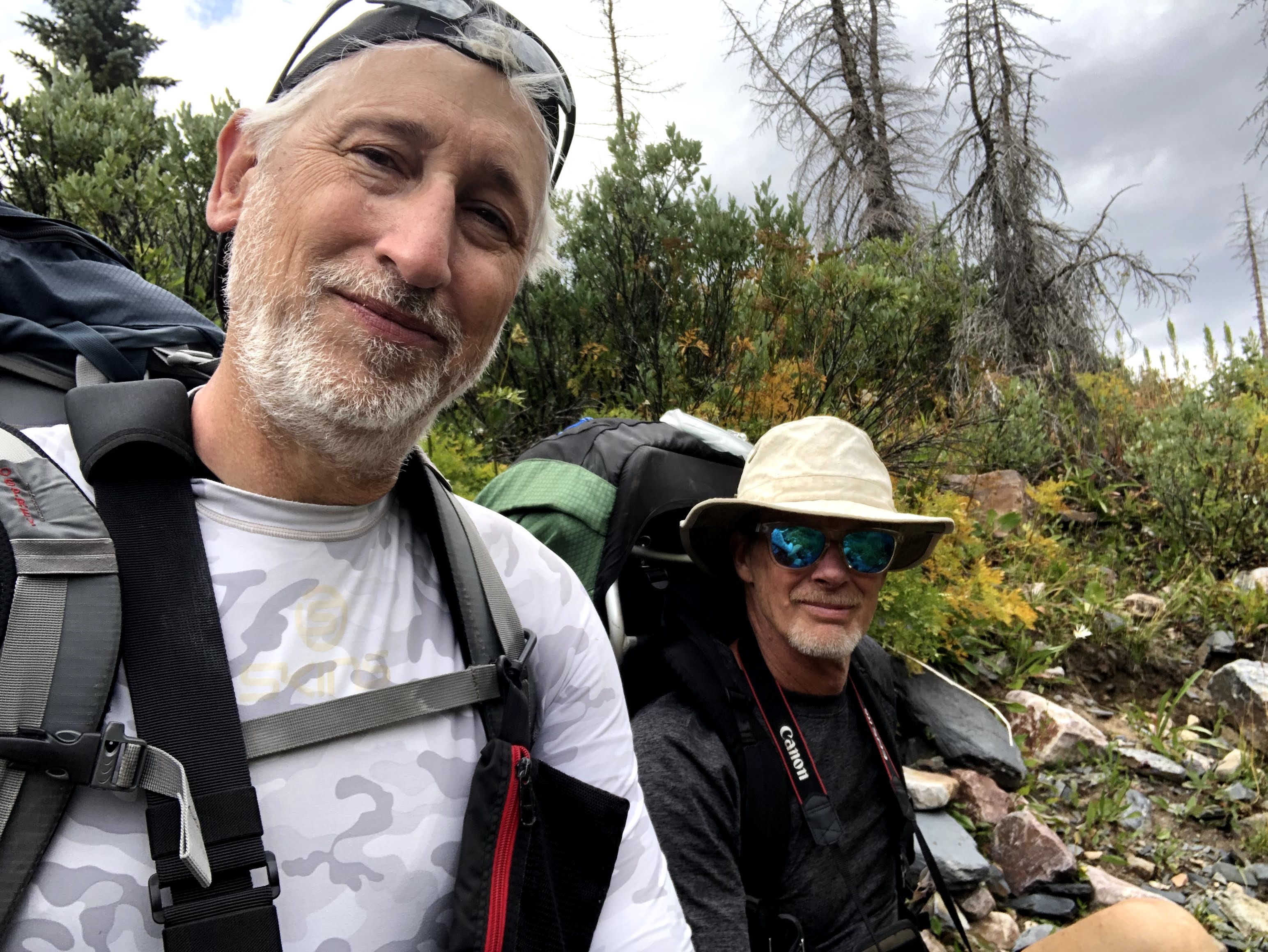
On this day we also ran into David Fanning, a photographer and frequent Colorado Trail hiker, on his way, again, to Durango from Denver. I think I had read that we were intersecting with the Colorado Trail while on Elk Creek, but it just didn’t stick with me until I stopped to talk to David. This was David’s fifth traverse of the Colorado Trail and his comments were that though the trail is very beautiful everywhere along it, the San Juan Mountains are still his favorite for their grandeur and beauty. His parting words “Enjoy the switchbacks” left me wondering what he meant by that. Did we have some killer switchbacks ahead, and he was simply warning us? I didn’t know, and I probably should have called out to find out what he meant. He seemed an easy going dude, so I decided he meant well, and maybe we were in for a treat.
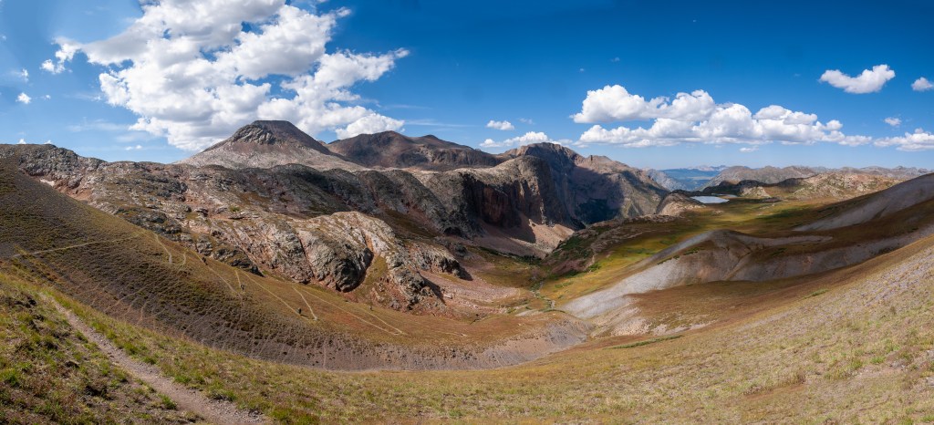
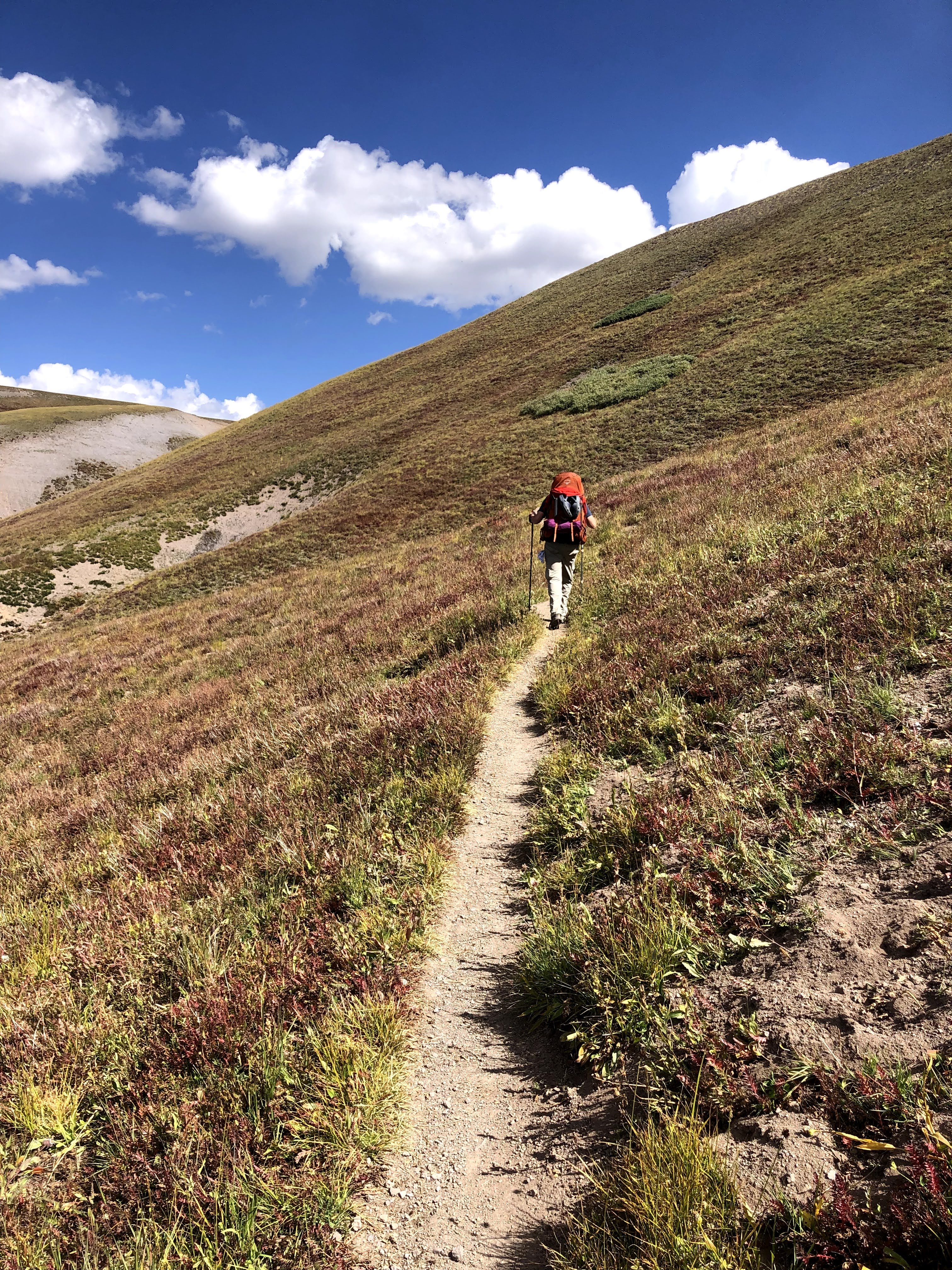
The higher we climbed the more the land opened up, and the more often we had to turn around to see the full majesty of the Western View.
Camp 2
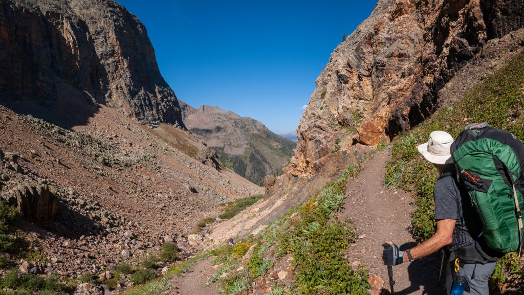
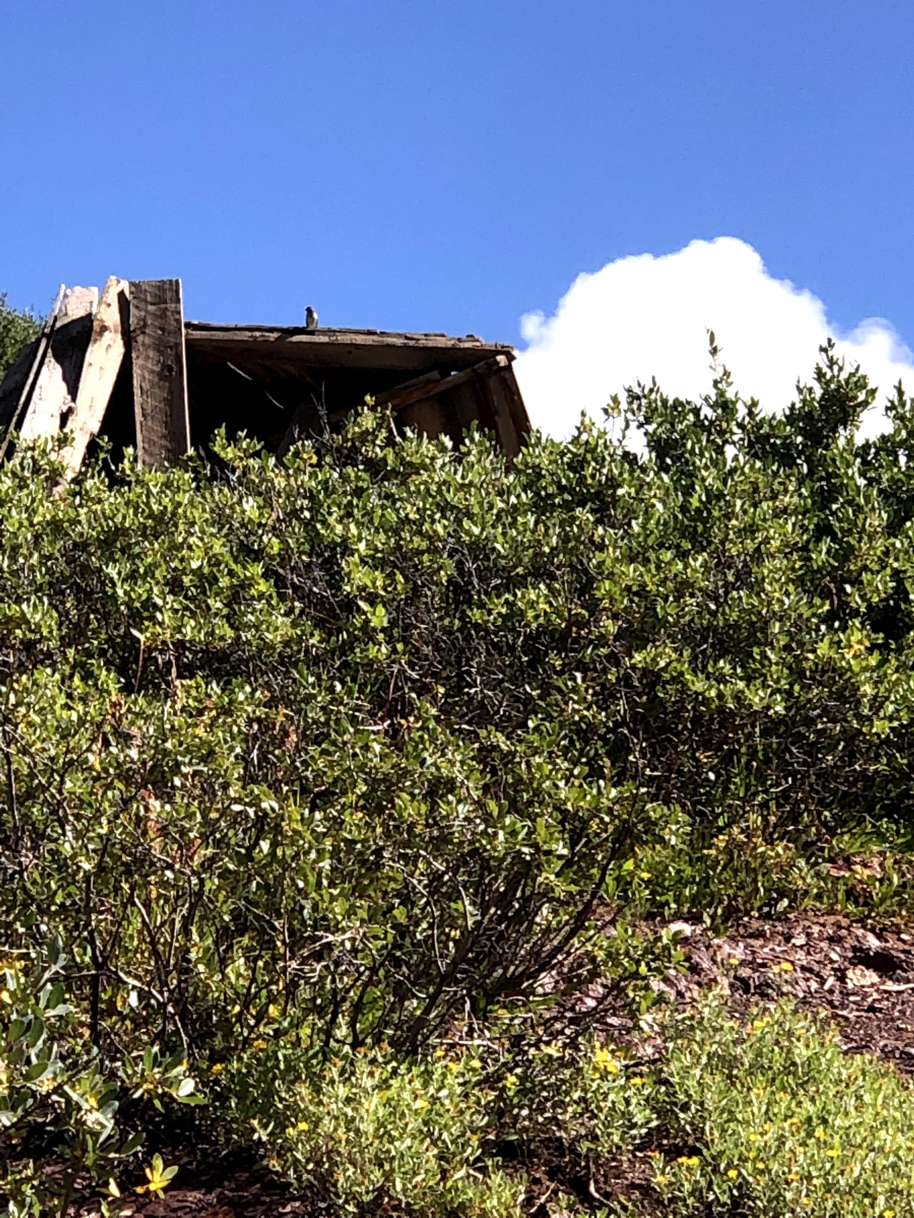
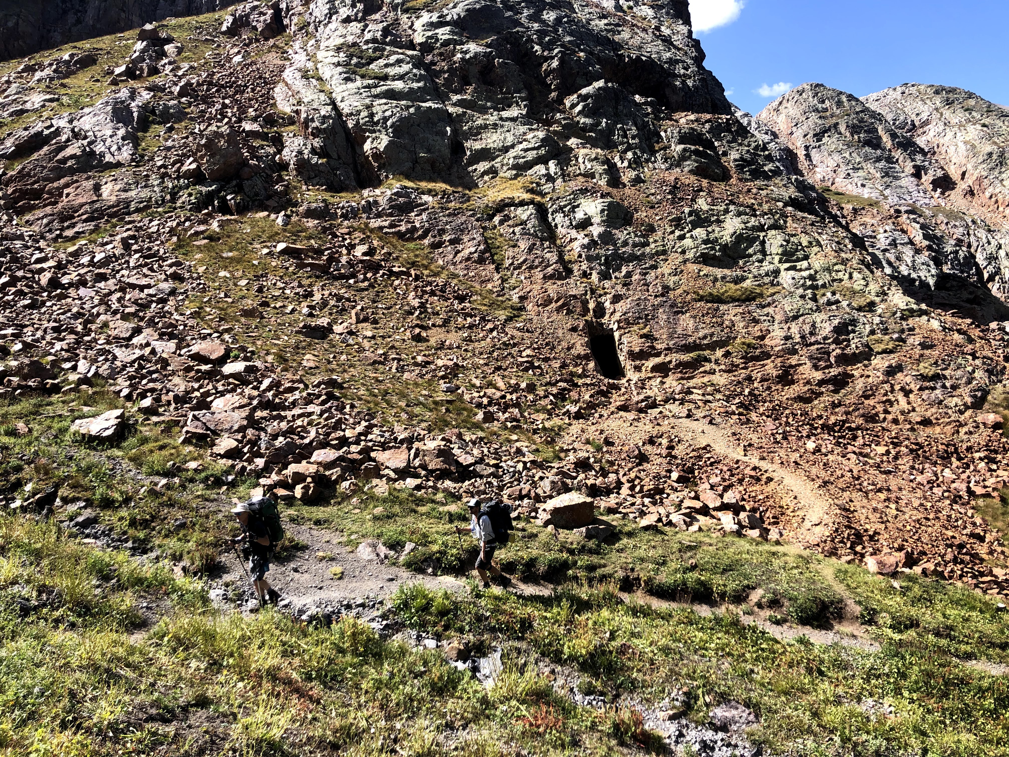
Once we were above the tree line we reached an old Miners cabin that was in quite a state of disrepair. Whether anyone still mines up here or not I don’t really know, but this cabin was far from livable. It was pretty far from even standing. We gathered for a break and the final assault on the top, which we could see, and to our surprise we could see people on the switchbacks. From our locale you couldn’t see the switchbacks, but the longer we sat there and observed, when you see hikers going one way, and then that same hiker is going the opposite direction, that can only mean one thing.
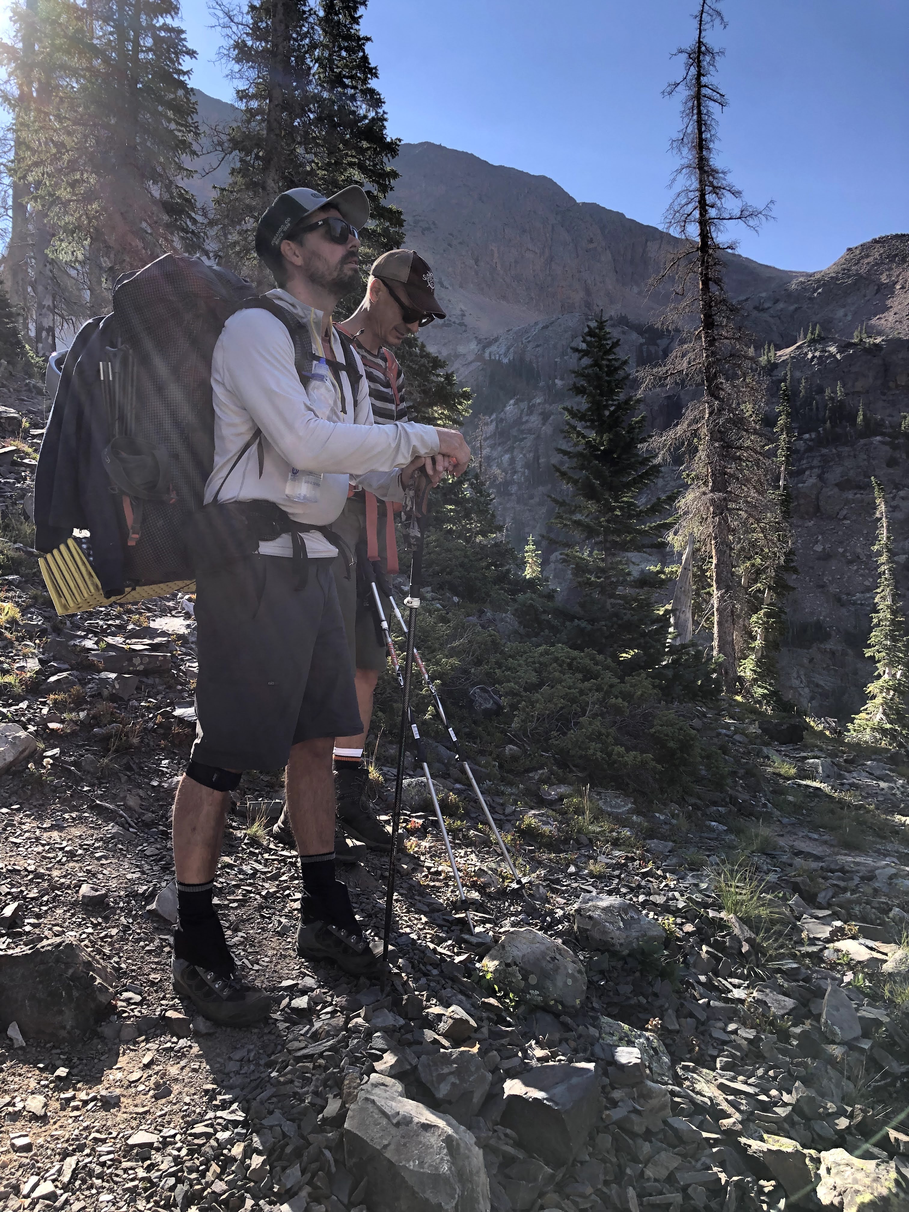
From here to there didn’t look all that far, but when the land is opened up like this, distances are hard to gauge. One thing that wasn’t difficult to see was that we were still going up, at least another 400-500 feet. Before setting off, one of the hikers on the switchbacks had achieved the acme of the pass and at the same time Paul caught up to us at the refuse pile that was the cabin, and just like I always do when the last person catches on, I started up the climb. Have to keep moving forward.
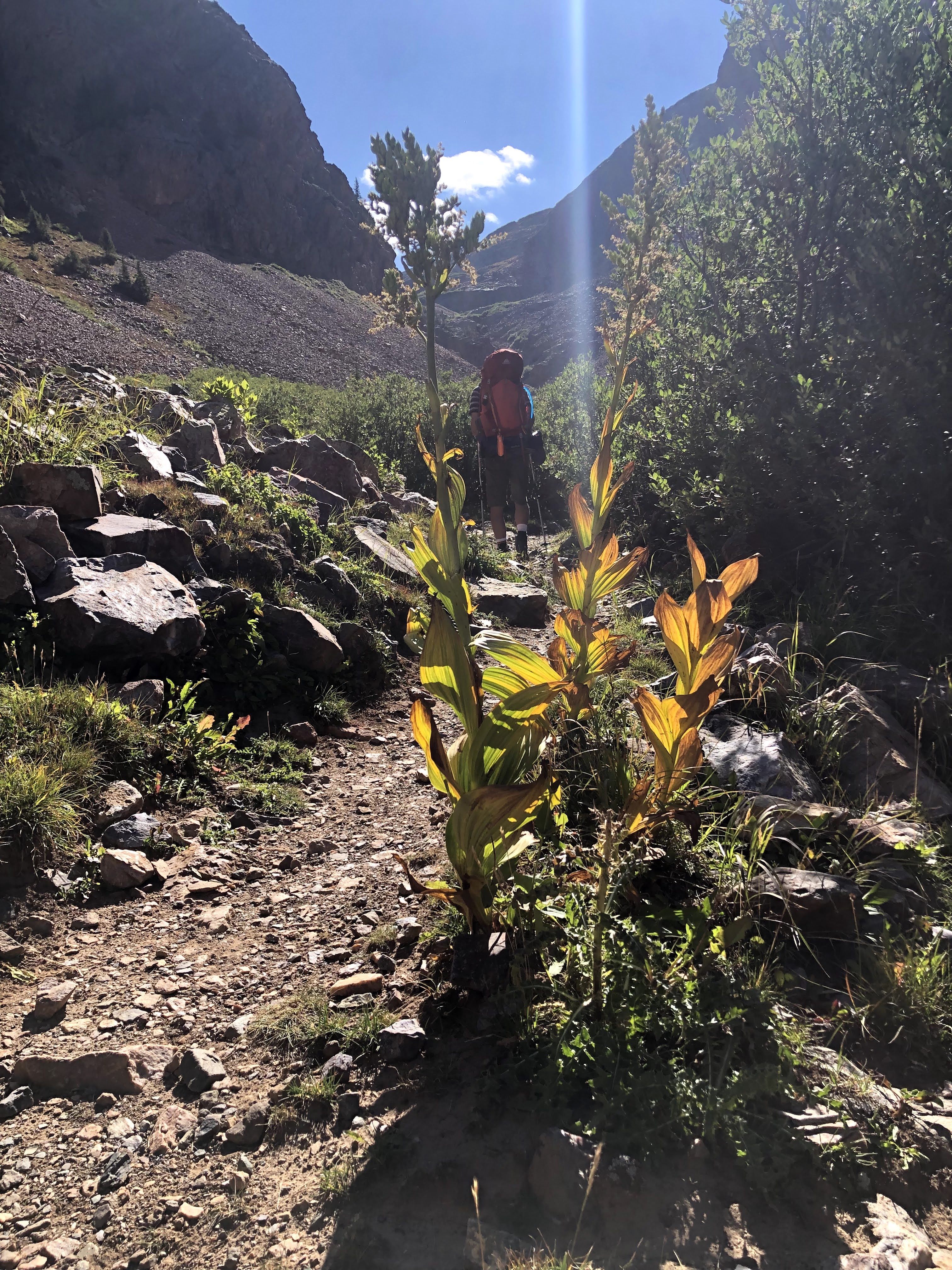
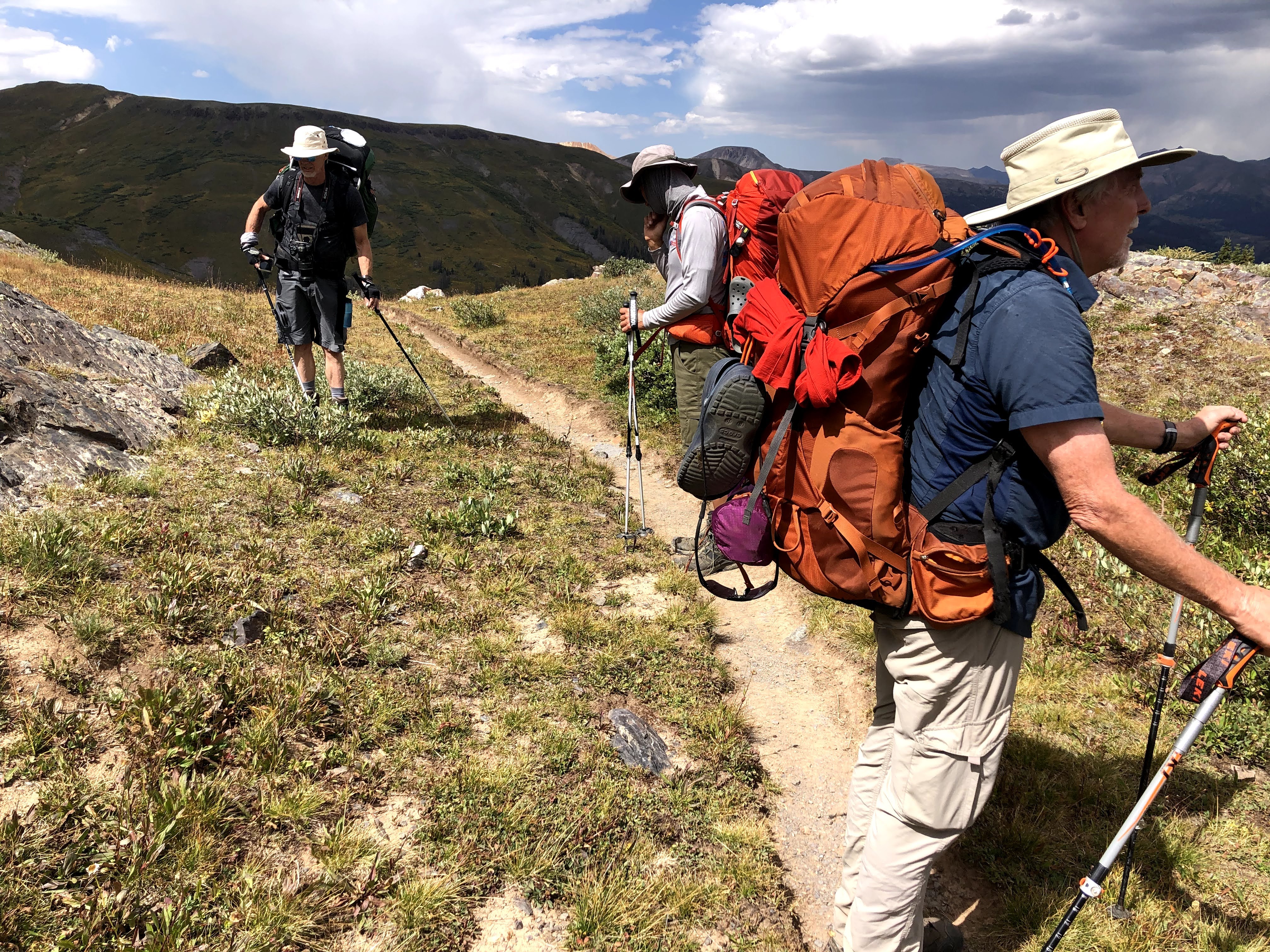
Just before I hit the first switchback, though as I recall it wasn’t clear exactly where the trail was going to go, I passed the first of two holes into the side of the mountain. How much ore did the miner take out of that hole? How far in does it go? On the outside the only thing that was crystal clear was 6’4″ people didn’t come high into the mountains to begin digging a hole into the rock. Tiny people did that. Smaller people dig smaller holes. Once I crossed this cut in the trail, then the switchbacks revealed themselves, previously hidden by the grasses on the hillside, and then the beauty of “Enjoy the Switchbacks” emerged. They were nice easy-peasy jaunts back and forth across the grassy incline all the way to the top, and since you were now hike perpendicular to the overall direction of travel, you now had the full splendor of where we had been available with just a slight turn of the head, as opposed to stopping to turn around. Those switchbacks were a definite high point of the trip. There was just one slight problem. I call it a problem, but really I was just over-reacting, but when I looked back at the miner’s cabin, Paul was still sitting there. I haven’t hiked enough with Paul to know what his habits/limits are, so I was throwing around ideas in my head for why he hadn’t started to move yet, and Kevin, who was with me was also concerned. I won’t harp on this too much, but we asked two descenders to ask Paul to raise and cross his poles if he was okay, and to wave them back and forth if he was having issues, and though it took time for them to descend, I waited for them to get there, and Paul raised and crossed his poles, and Kevin and I resumed our ascent. Below us, scattered among the switchbacks were Dan, Jim and Walt all moving forward. Shortly afterwards, Paul left the cabin, and was soon into the switchbacks himself.
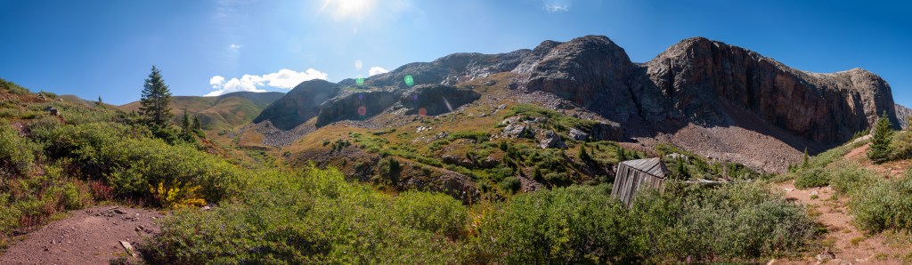
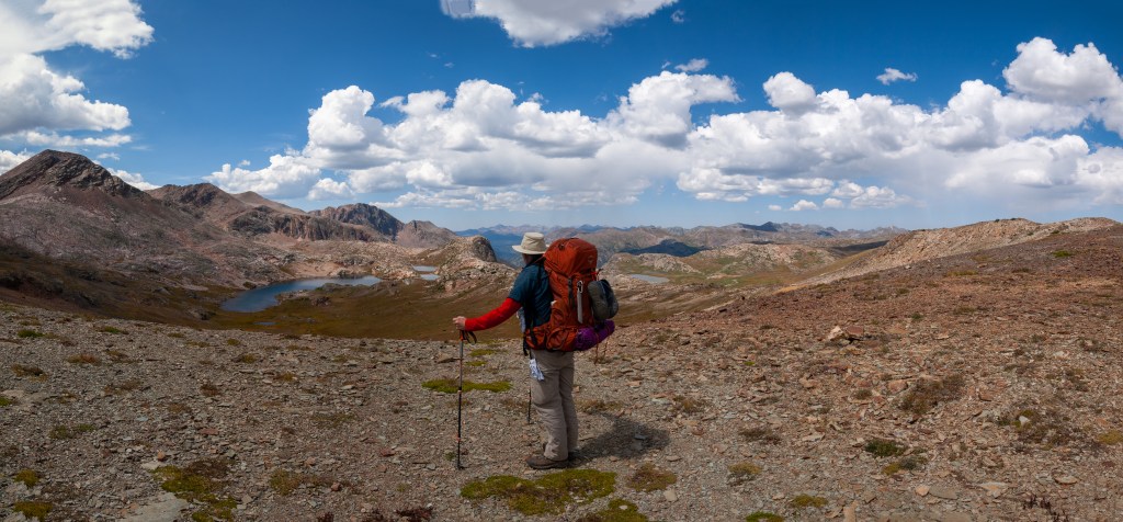
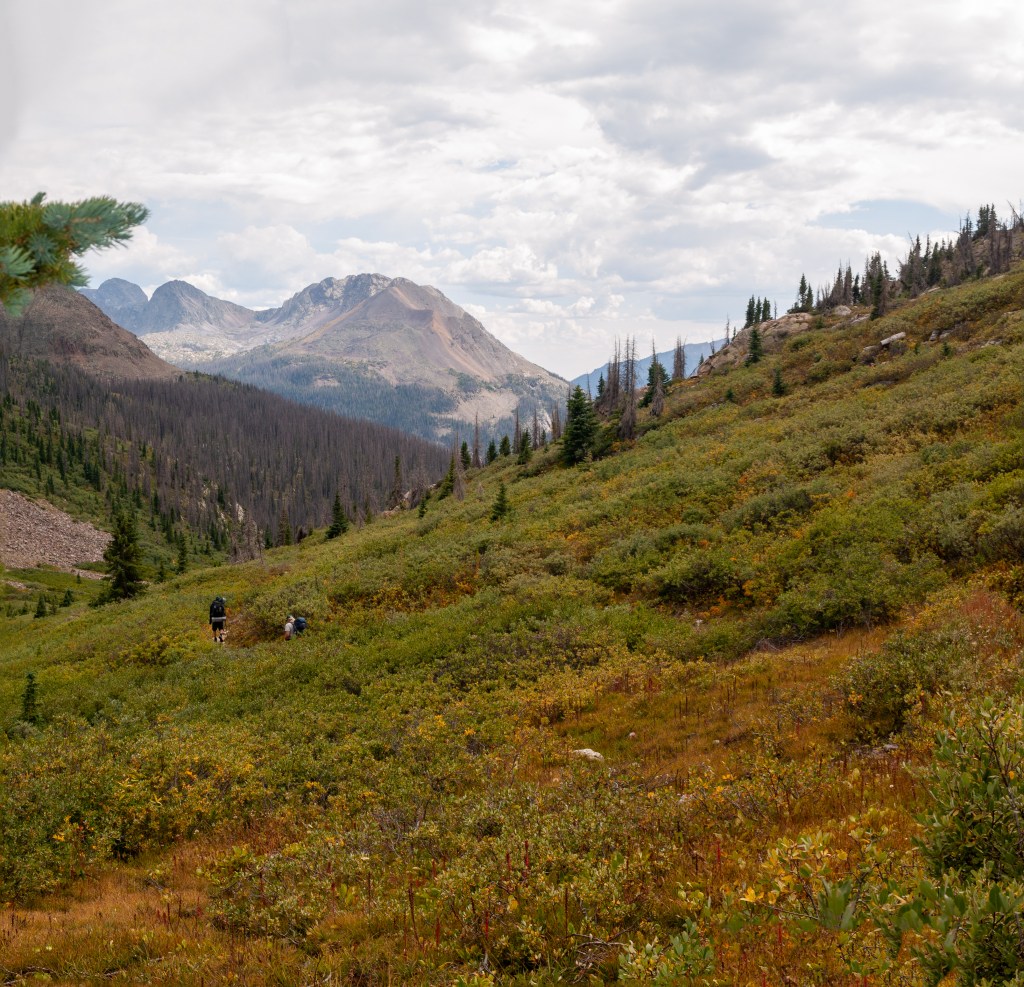
Upon the top, which is relative of course, we sat in the saddle and awaited everyone to regroup. The sun was out, it wasn’t too windy, and the view was a 360 view. From here we can look from the Pacific Basin to the Atlantic Basin and back again. Love the Continental Divide. We took sustenance, and drank our water and then discussed which way to go. There was a choice. The Colorado Trail, which we were still on, turns North to intersect the Continental Divide Trail (CDT) in about half a mile or so, where we would turn South on the CDT, or we could head South on a connector trail that ascends first over another saddle at 12,600 before dropping down to high lake, where we then follow a road (I am using that term liberally here) down to the CDT. When Paul arrived he told his he was feeling better now, that he didn’t get enough for breakfast, and he downed an energy bar at the cabin and now is still hungry so he broke out his powdered humus and we all sampled the next great thing in backcountry cuisine. That way of making Hummus is pretty damn delicious, and as I write this I am two days from another backpacking trip and I still haven’t purchased any powdered hummus yet. In addition, I finished 4 days on the AT a couple of weekends ago, and I forgot about the hummus for that as well!.
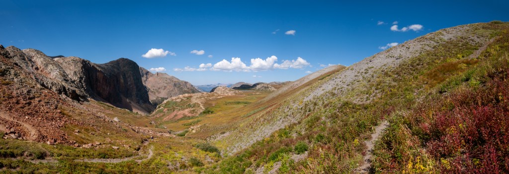
We went for the connector choice, and climbed another 300′ where we got a good look at El Dorado Lake and our descent destination, Kite Lake. I had originally planned El Dorado as a second night, but harbored reservations concerning high elevation storms and the zero protection offered there. So now it was simply a view along the way. We espied some 4-wheelers, or off-roaders down at Kite. The “road” to it can only be handled by rugged vehicles, and from what we could observe, that is exactly what these folks owned, or rented for their excursion. We met them on our descent when they decided to go for a hike.
We grabbed some water at the exit to Kite Lake, and then wandered down the “Road” until it intersected the CDT. It was about this time that I started to wonder whether we had taken too long to get where we now stood. Weather was a brewing, and the brew didn’t look very inviting, but it seemed like we might just make it over Hunchback Pass and be off the heights before it rolled in. It wasn’t all that far to the top of the pass, but you just couldn’t tell what or where the weather was going to do/go. All we could do was proceed, and with somewhat tired legs we ascended. Fortunately, the grade was pretty easy going, and Hunchback is one of those extra-wide expansive saddles. If it wasn’t for the jumbo-sized rock cairn I think we would have walked right past it and not known we were back in the Pacific drainage. I got to the top first and then waited on all my charges, and sent them all along the way to get off this mountain in case the weather did rear the head we all feared. The last two up were Walt and Paul, and together we started down.
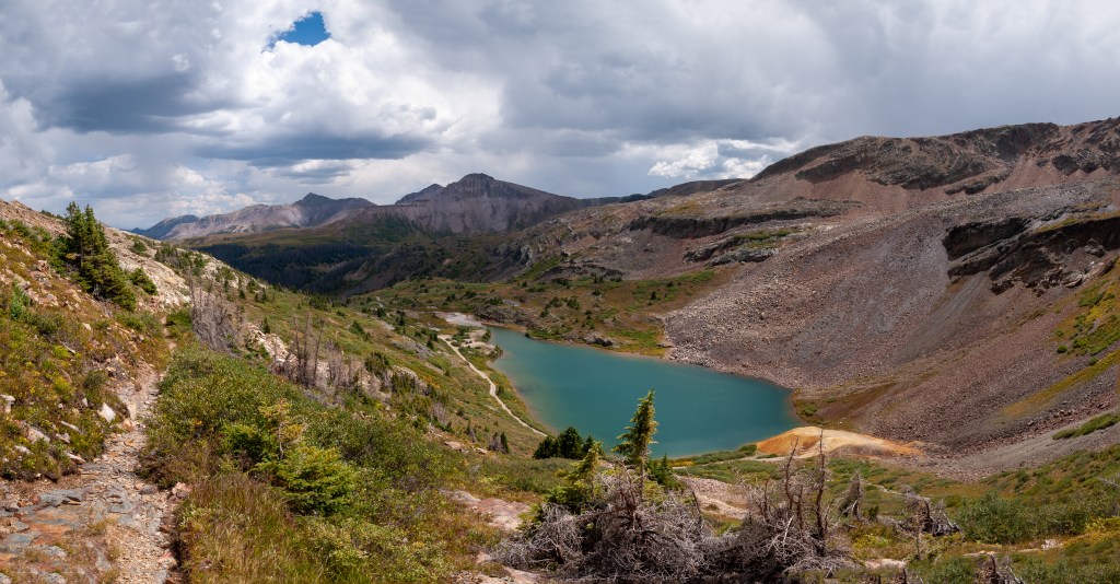
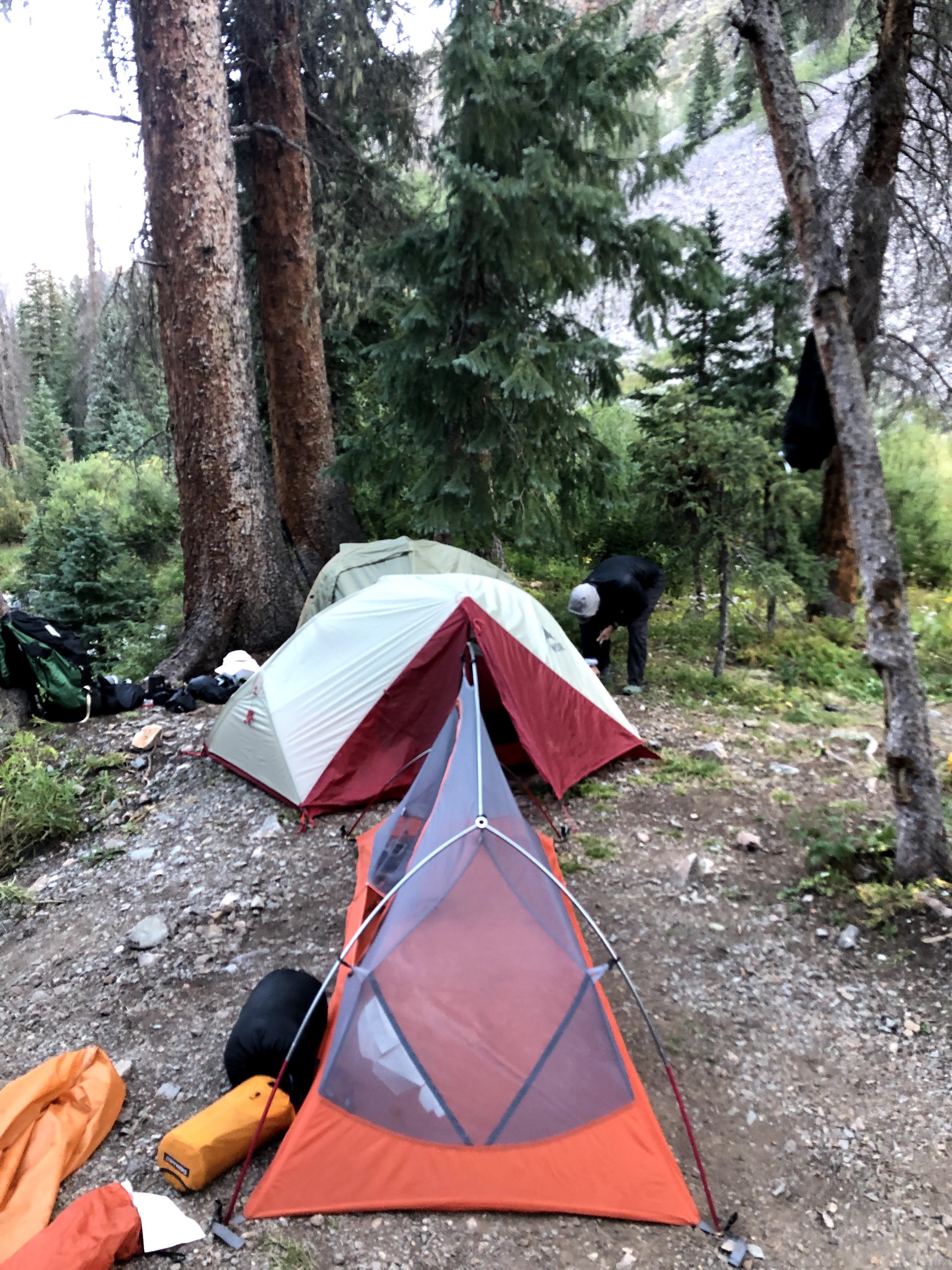
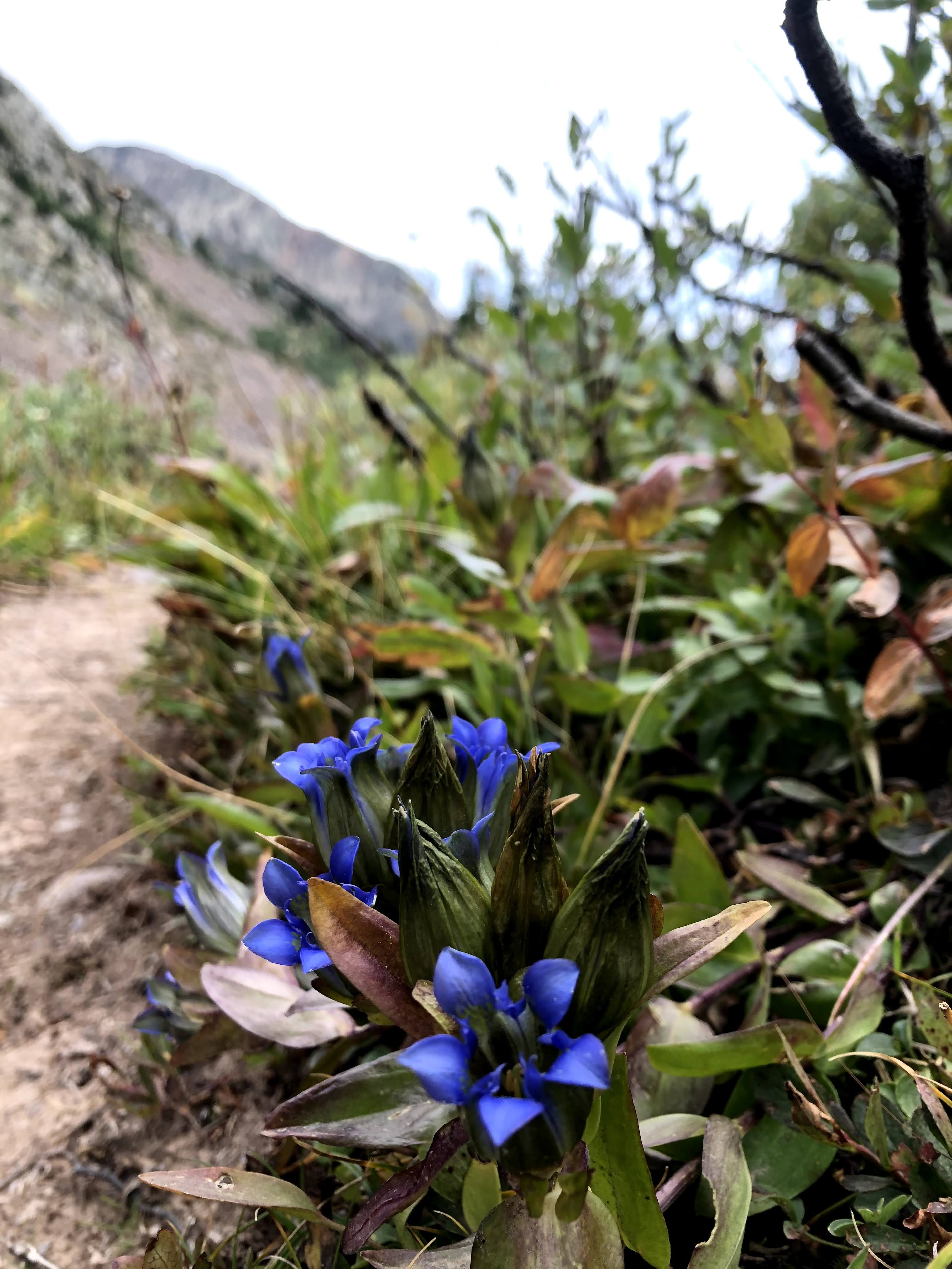
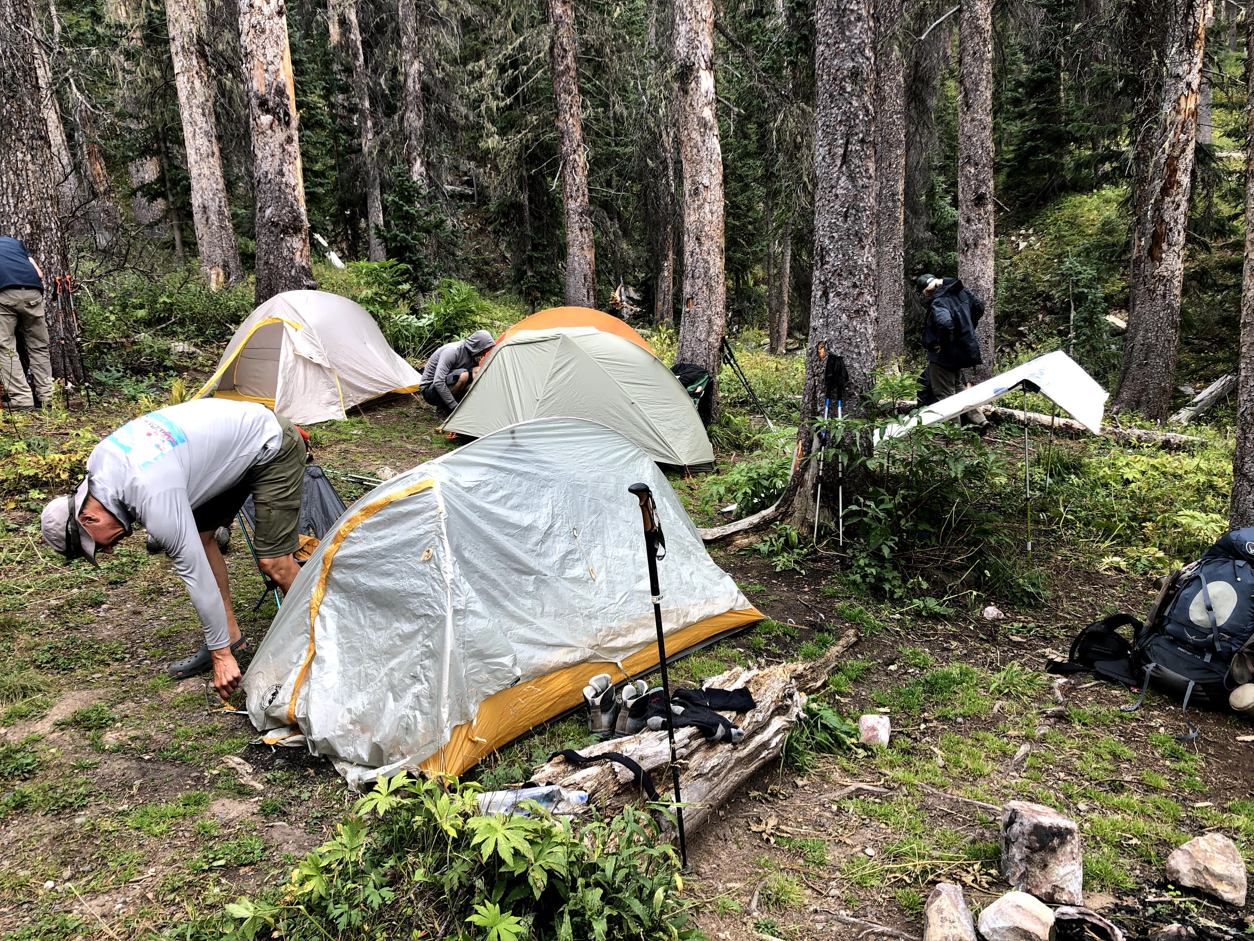
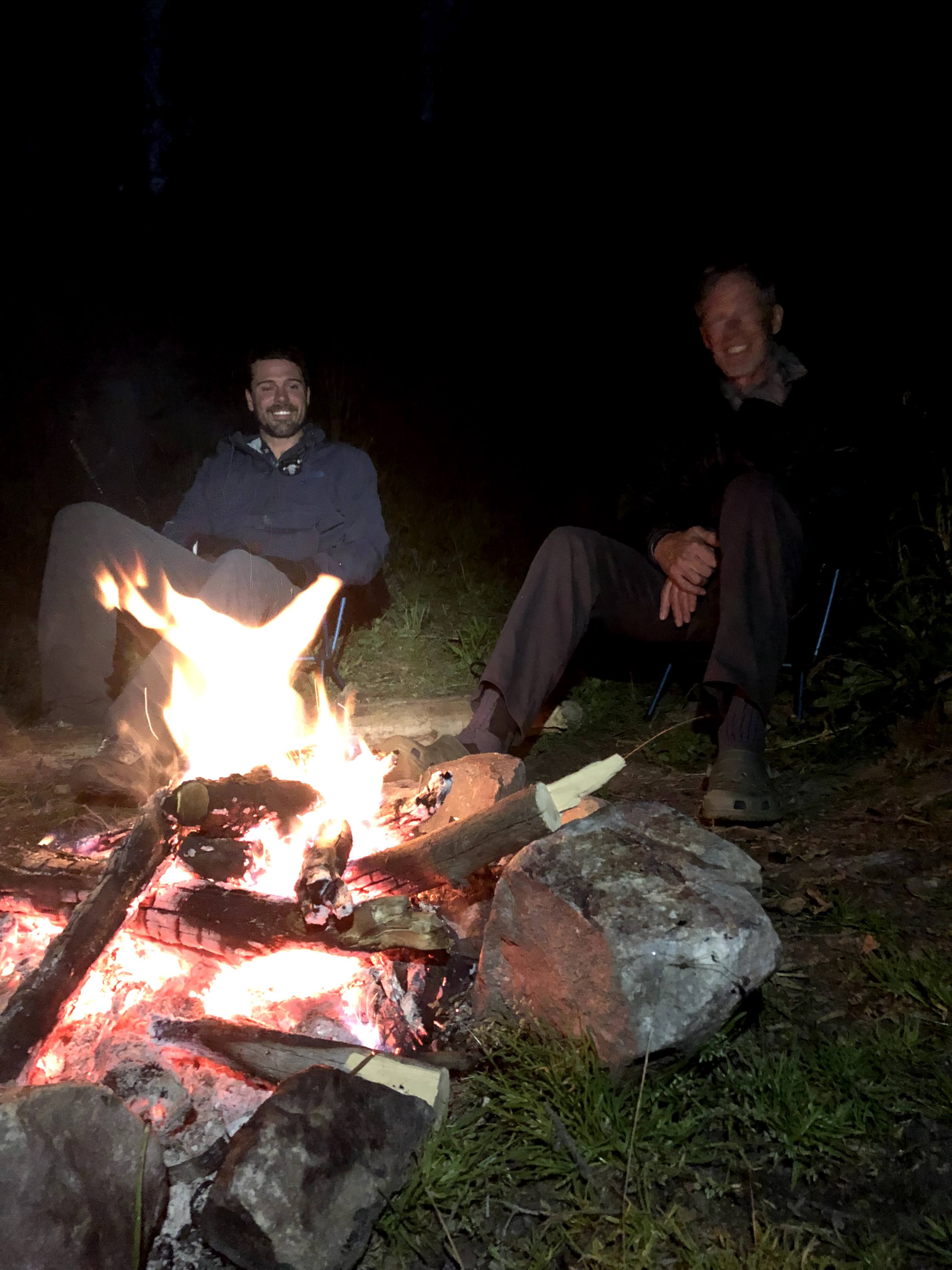
Our goal for the day was to find an established site inside the tree line. I think it would be one of those “We will know it when we see it”, however as I stopped for pictures, I was the last in our party, and I do recall that I passed through a very nice site that they had decided wasn’t right. I think what they thought was there was probably a nicer spot a little further down, and maybe it wasn’t apparent just how far water was. I found them a short while later at a site that wasn’t as nice as the last one, but had easy access to water, and plenty of level camp sites. Walt already had a fire going when I arrived, and after we did a little gathering, that fire was a decent blaze and we set down to enjoy the rest of the evening and discuss our options. The plan, that is the plan I made with inputs from previous trips, was to spend two nights here and day hike the next day. We were on the Vallecito between the CDT and Rock Creek and there was a nice loop trail that included a section of the CDT that has been described as “The Jewel Section of the CDT” (Sorry, no references) through Ute Lakes. I was very much interested in this, but though I plan these adventures, I exercise the full democratic ideal as they play out, and if the general consensus is to do something else, then that is what we will do.
What we were discussing was, that instead of spending two nights here, and then 1 night somewhere up Johnson Trail on the way to Columbine Pass, we use the next day to find a nice spot at the confluence of Johnson and Vallecito creeks, and then we use the next day to get as high up Johnson as we could so our assault on Columbine would much easier/shorter. Before we all turned in that is exactly what we decided to do. Both days would be easy going days, instead of one grueling. Another advantage is that doing it this way would have us settling in before other groups, or hiking pairs, so we would probably have our pick of any camp sites, where as if we pulled in late afternoon after a tiring day, and the only large site was taken, then that would suck. So, we let the fire die down, spread it out, covered it in rocks, and turned in for our second night in the Weminuche Wilderness.


Leave a comment