
Mid Fall Long Weekend New Jersey AT Hike
November 30, 2021 § 3 Comments
I was preparing a Purple Carrot dinner when the first group text came in.


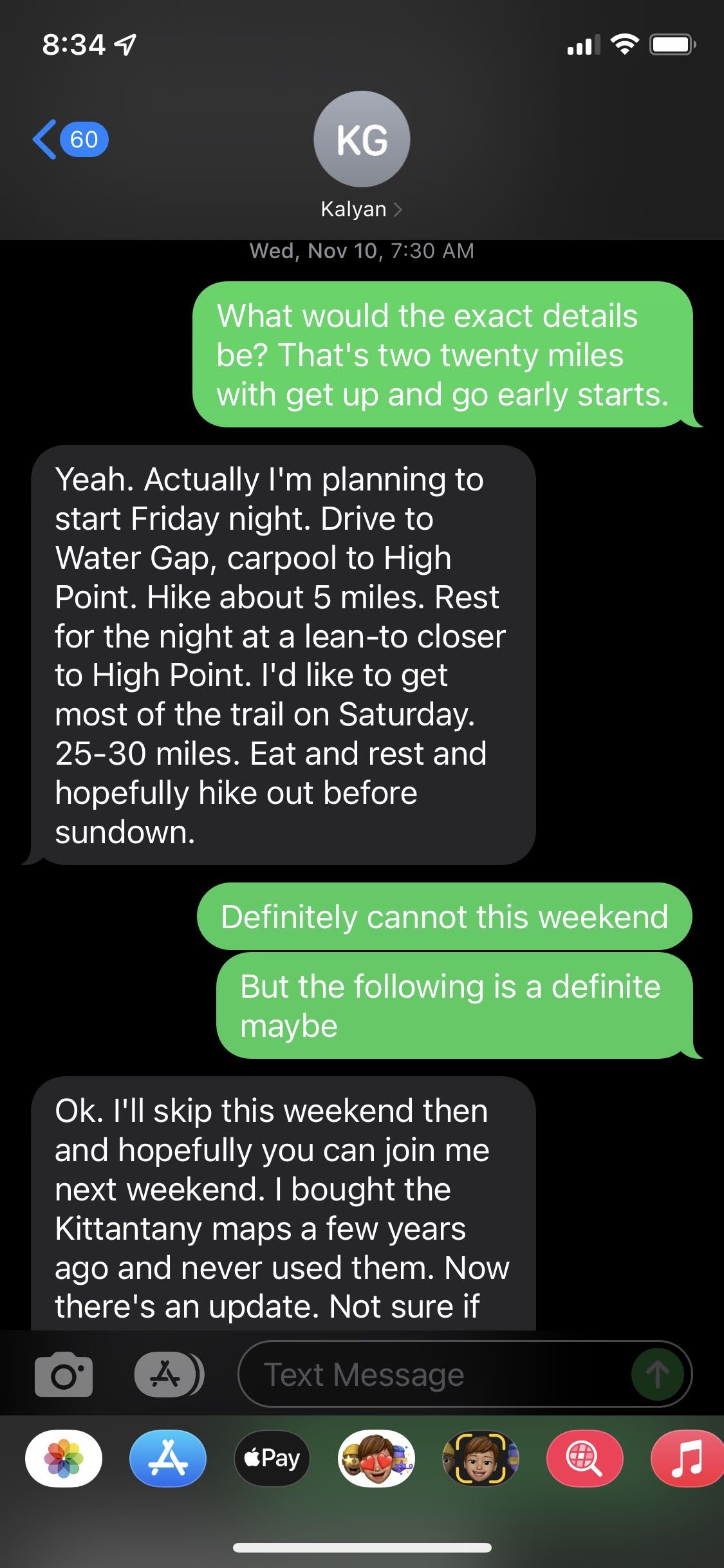
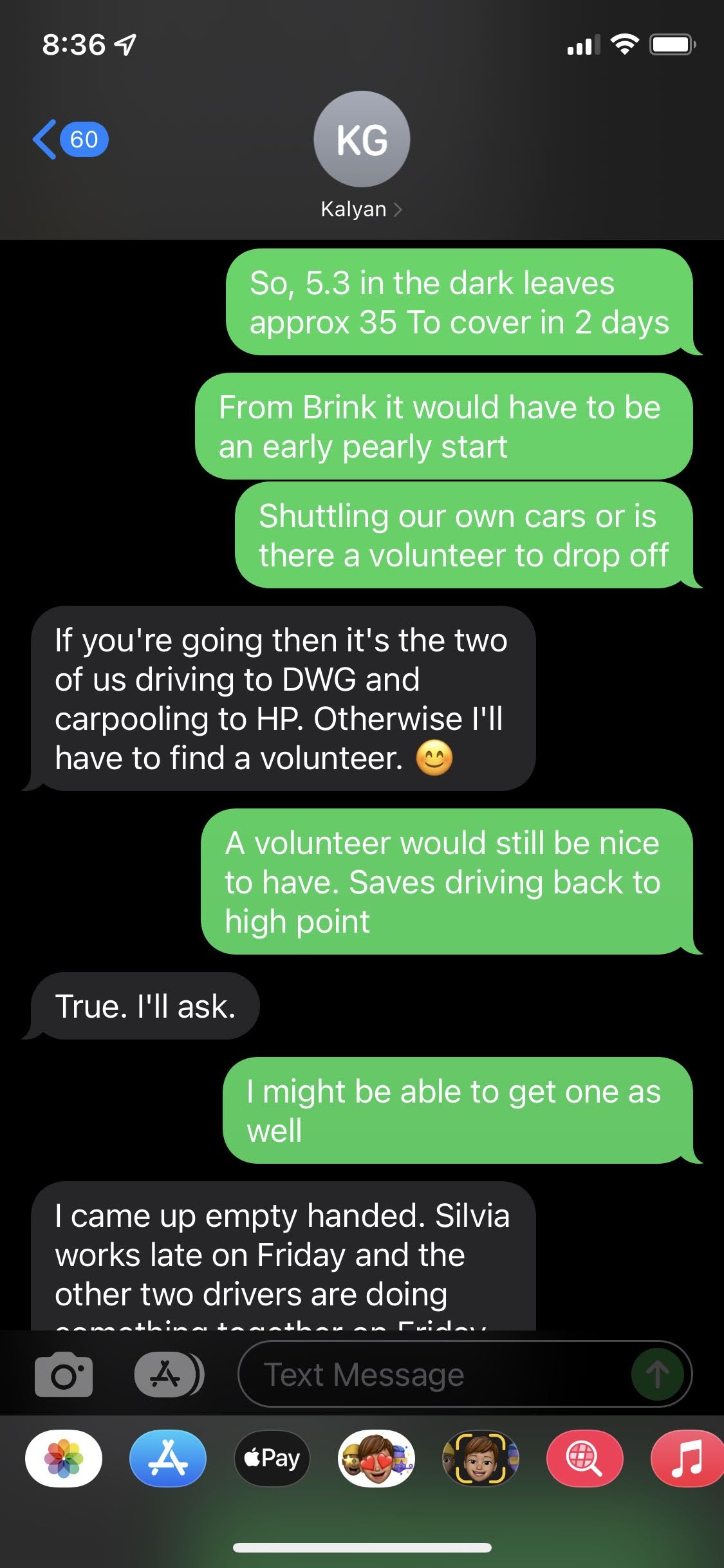
And so, I found myself committed to a very aggressive “weekend” hike with my friend Kal. Kalyan deserves a page entirely to himself, but let’s just cut to the chase and say, that when Kal has something he would like to try, it is usually something that requires a very aggressive commitment, and Kal will be thinking that anyone who joins him will “run” along with him. So, if you “run” the AT, then 40 miles in two days with a Friday night hike in is probably very possible. However, this is the AT in NJ along the Kittatinney Ridge and if there is one thing that 250 million years of erosion have produced, it’s a lot of rocks. This is a very rocky trail, and rocks, en masse, are very tiring to walk on all the time. Rocks covered by leaves are even worse. Anyone who has read my posts and seen the images of me, probably can figure out that I am not running on the trail, though Larry Butler once said “Eric? He’s a cruiser!”. My gait is large, and step is quick, but engaging into a trot on the AT just isn’t going to happen with me. So, that means these aggressive goals have to be achieved at whatever my fastest walk is. The total distance is actually 40 miles, and with a 5 mile nighttime hike in that leaves 35 to cover on Saturday and Sunday. Technically that is doable. Even for me.
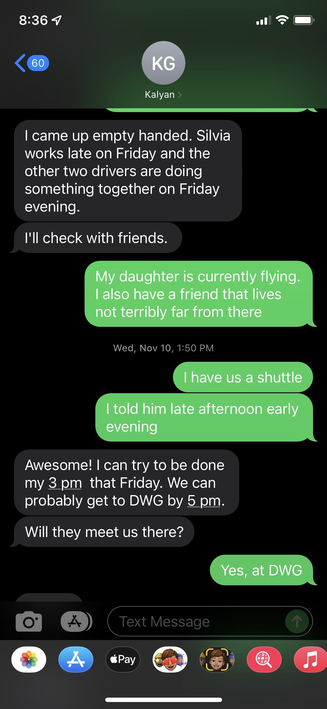
One concern I had was after an exhausting weekend, the thought of having to drive all the way back to High Point to retrieve a shuttle car before being able to drive home just seemed daunting, and I wanted to utilize any resources we could find to alleviate that burden. Fortunately our search didn’t last long as my friend Paul lives in the Bedminster area, and when queried was enthusiastic to step up and help. I am still writing up my Weminuche experiences, and you will find Paul referenced in those posts.
The next concern was personal, as I hadn’t really done all that much since I returned from the Weminuche in early September. I wasn’t even riding my bike all that much, so I had lost some fitness, and I certainly didn’t have the legs that took me to the top of Mount Windom. At least my suggestion that we do it the weekend of 20th was met with approval, so that gave me time to jump on the bike a few times to work my lungs, and an opportunity to get into Hartshorne a couple of times as well. Just to get the legs working.
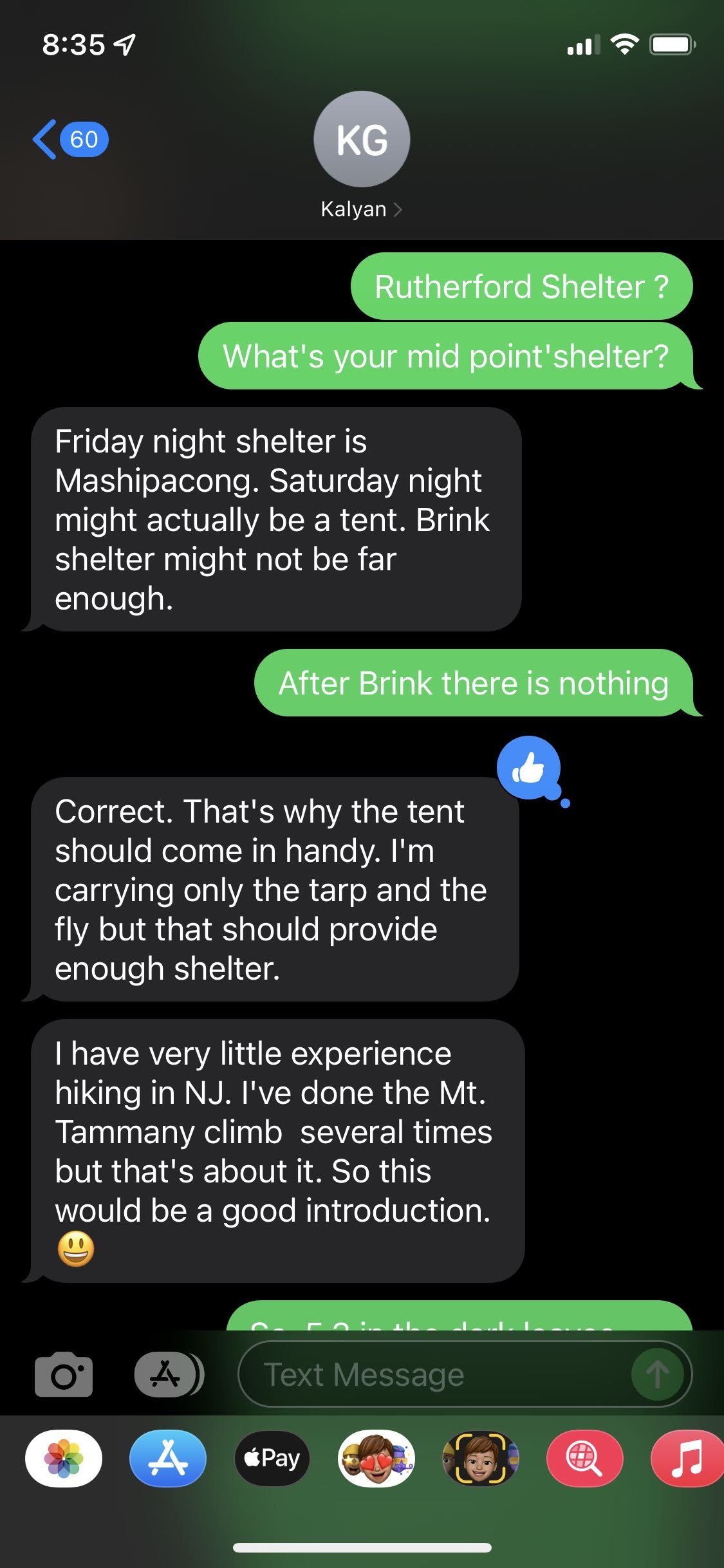
I wasn’t too concerned with a night hike in the first night. My friend’s Jed, Mike and I often start Hartshorne in the dark by headlamps and though we aren’t carrying 35 pounds on our backs, we get along fine, and what Hartshorne lacks in rocks it makes up for in roots, so footing is important. My concern was the second day. Kal’s own goal was to make it to Catfish Pond, which is where the AMC Mohican Center is and would amount to a 25 mile day. Yes, that is right. In the second week after moving back to Eastern Standard Time, the only way to knock out 25 miles is to either start in the dark, or finish in the dark. If, and that is a big “If”, we could do it, then it would mean 10 out on Sunday, and we would make it home by supper time. The more realistic goal would be Crater Lake, the halfway point at 17ish miles depending on where you camped. Mike Barris and I camped there in 1996 or 1997, and I have since re-evaluated whether we did anything wrong. See, that is in a section of NJ controlled by Delaware Water Gap National Recreation Area, and they have signs at every entry point that state something like “Camping is for Thru-Hikers only yada yada yada”. At that time I interpreted “Thru-Hiker” a little to literally as an End-to-Ender thru-hiker. The reality is we were thru-hiking the AT in NJ, and so we were allowed to camp at Crater Lake, and Kal and I would be Thru-Hiking, and so we also would be allowed to camp there.
Friday arrived, and even though I sent Kal my address, in Ocean, he went to my old residence in Little Silver where he called me from to note his mistake and that he was on his way now. That was 3:30PM, so we were already getting a later start. This would be the first time I was a passenger with Kal driving, and I noted immediately that he drove a manual transmission Suburu. While we were talking about that I got a call from Shawn’s Auto in Red Bank that my own manual transmission Audi S4 was finally ready to be picked up. Replacement transmission 😦 . Ouch! Anyway, when we hiked the Devil’s Path a few years back I was afraid to let Kal drive my truck, no matter how tired I was, and it didn’t take long as a passenger before I was glad I was buckled in and I had a driver’s side airbag. Kal is a weaver, and I guess his Sub is a little under-powered, so I asked often if he want me to shift him into 6th gear to give the engine a break.
Traffic was heavy everywhere! The Garden State, Route 280, and Route 80 (of course) all the way to Netcong, but then it finally eased up and we arrived at 6PM and awaited Paul who showed up about 15 minutes later. I was starting to feel a wee bit hungry, and so I mentioned that if we saw a Burger King I could grab an impossible whopper, and the Kal noted he was hungry as well and desired Thai food. Route 94 in western Jersey and Kal thought we might come across a Thai place! Ha! In Newton 94 has to negotiate the town square, and what did we see at one of the corners? A Thai place. We parked, and went in for a sit down meal, so that meant we wouldn’t be getting on the trail until almost 9 PM. After dinner we finished the drive up, and though I thought we would start from the AT Parking lot, since we weren’t leaving a vehicle, I had Paul drive us right to the trail crossing on Route 23. There was a slight breeze, felt by all in the open area of the parking lot, but we loaded up quickly, thanked Paul, said our good-byes, and hit the trail. As soon as you enter the woods, the breeze dies.
It would be 5+ miles to Mashipacong Shelter, and we were going to get there very late. At 3 miles there is the Rutherford Shelter and we could make decision there as to continue or stay there, but that would be made on the trail. This beginning kind of overlaps with my first Winter backpacking trip that I made with my very good buddy Chris and his brother Jeffrey way back in January 1978. I believe the trail has since been re-routed, and so we weren’t exactly following the same tracks, but still is was very much the same situation. We arrived at night, though then there was 6 inches of crusty snow on the ground, so it was actually easier then, than it was now where all the rocks are covered with leaves that do not support your foot, so foot placement was very important. Fortunately my headlamp was bright and lighted the way ahead very nicely, and I never really felt like there was an issue. The AT is pretty easy to follow, however when the rocks are there it isn’t so obvious at times, and the need for seeing the next trail blaze becomes important. There isn’t really a danger of “losing” the trail, just the pain in the ass issue of stepping off it and wondering whether you “missed” a turn. Usually you should be able to see the next blaze from an existing blaze, and if you can’t then turn around to make sure you see one going in the other direction. This section of the AT had more than a few places where we just had to push on an extra 200 yards before the blazes picked up again. A little more trail maintenance is needed in this section.
I think I should say here that I was hiking in my La Sportiva boots, while Kal was hiking in Sandals with toe socks, and so by headlamp, I was able to make better time, and so I stopped often to await Kal as he caught up. On one of those occasions, he was carrying a small brown ball. How he even saw it is beyond me, but what he had was used leaf wasp nest. A wasp lays her eggs on the leaf, and injects an enzyme into the leaf flesh which causes the leaf to “ball” up and protect the eggs. The leaf stays attached to the tree, and in the Spring the eggs hatch, the larvae gain some initial nutrition from the leaf’s interior, and then they open an escape hole and emerge to become the next generation. The leaf eventually drops to the ground, and Kal found one. I see here that they are called Oak Apples, as they occur in Oak trees, and they remain green until the leaf eventually dies.

I was the first one to reach the shelter and noticed that we would not be alone. Two tents were erected, and there were three sleeping bags in the shelter already, but clearly enough room for two more. Sweet!! I really did not want to set my tent up that night. We tried to be quiet, but really you can only be so quiet while you: unpack; inflate sleeping pads; pull out sleeping bag; stub toe (Fuck!); hang pack; Convince Kal his food HAS to go into the bear box; Insert self into bag; snuggle in (Sleeping pads make a lot of noise); breath heavy; Sneeze; Snore. We managed to only awaken everyone at the shelter.
The next morning I was awakened by the Jehovah’s Witnesses (funny, they didn’t tell me ((white guy)), but they asked Kal if he had found Jesus when they were alone with him. I don’t know why they didn’t ask me. I could have told them he could be found in the New Testament on page 4! Anyway, they started a fire, which of course, was not permitted in/on State Forest land AND it was clearly signed on the shelter, but if you are a dedicated disciple of Jesus, what the fuck. Personally, I am not going to be the one to break the rules, but since they did, I wandered over and warmed my hands a few times, and chatted them up. An older fatherly skinny white male gentleman sort, a much younger slightly beefier man with a hint of l
Latino origins, and two young women. I am guessing that one was the daughter/granddaughter of the older gent, and the other was with, or simply travelling with the other dude. There was no JW exchanges with me. That was all Kalyan, who being of Indian/Calcutta descent must have looked more like he needed the guiding ways of Jesus more than I did.
The other three people were possibly thru-hikers. Bones was for sure, but the other two may just have been out here to support Bones. You see, Thru-Hiking is not something you do with a friend. It is something you do alone, and at times, friends join you along the way. Why? If you have never done this kind of thing, it may be hard to understand, but think of it in terms of any shared vacation you have ever done with anyone. How exactly did that go? Do you think you could have tolerated each other for 6 months day in and day out? Probably not. If you ever read Bill Bryson’s book “A Walk in the Woods“, then you will understand. So, Bones was the thru-hiker, and the other two came out to spend the night with him. Bones was Flip-Flopping the AT, and was in the middle of his Maine to Harpers Ferry leg of the flip-flop. Google it.
With our coffee drinks drunk, and our nightly fast broken on rehydrated granola, we set off South on the AT and said our fare-thee-wells. If there is one thing I know about thru-hikers it is this: They move really fast, so I fully expected to see Bones at some point that day. However, when you consider his friends came out to spend time with him, this wouldn’t be a normal day for him. He was going to chill with his friends and leave only when they were ready to leave, and so we may or may not see him again. We were no slouches on the trail, but we didn’t have thru-hiker legs, so Bones could catch us without really trying.
The immediate section ahead of us was the North side of Sunrise Mountain, a vista staple in Stokes State Forest that has attracted thousands of sunrise worshipers over the years. On the trail, we are already on the ridge, so it’s mainly the slight undulations common with a ridge, and something else. Rocks. Not just a rock here and there, but long sections of the trail where you have to make a choice: foot plants between the rocks, and when you place your foot between the rocks, then inevitably your weight shifts and a rock or twenty dig into your foot; ride the tops of the rocks. If you are still in possession of decent balance skills and you have pretty strong ankles, you can ride the tops of the rocks, but to do this you really have to scanning ahead for all your foot placements. The idea is to keep moving forward, and not spend all that much time on any one rock. It’s like skiing moguls. This requires, at least I think so, decent soles on your feet. Of course the lighter your pack, the lighter your step, so while I was riding the tops and doing fine, Kal was doing so in his sandals, but keep this in mind. His pack is 5 pounds lighter than mine, and Kal is 60 pounds lighter than me (or more). I am going leave it as an exercise to those inclined to figure out the pressure force on the boot/sandal sole imparted by your average pointy rock surface. Look, some of the rocks are easy-peasy, no-brainers. Those are a joy. It’s the smaller rocks that present the issues. What is the point of this discussion? It’s that all that takes a little something out of you the trail persists.
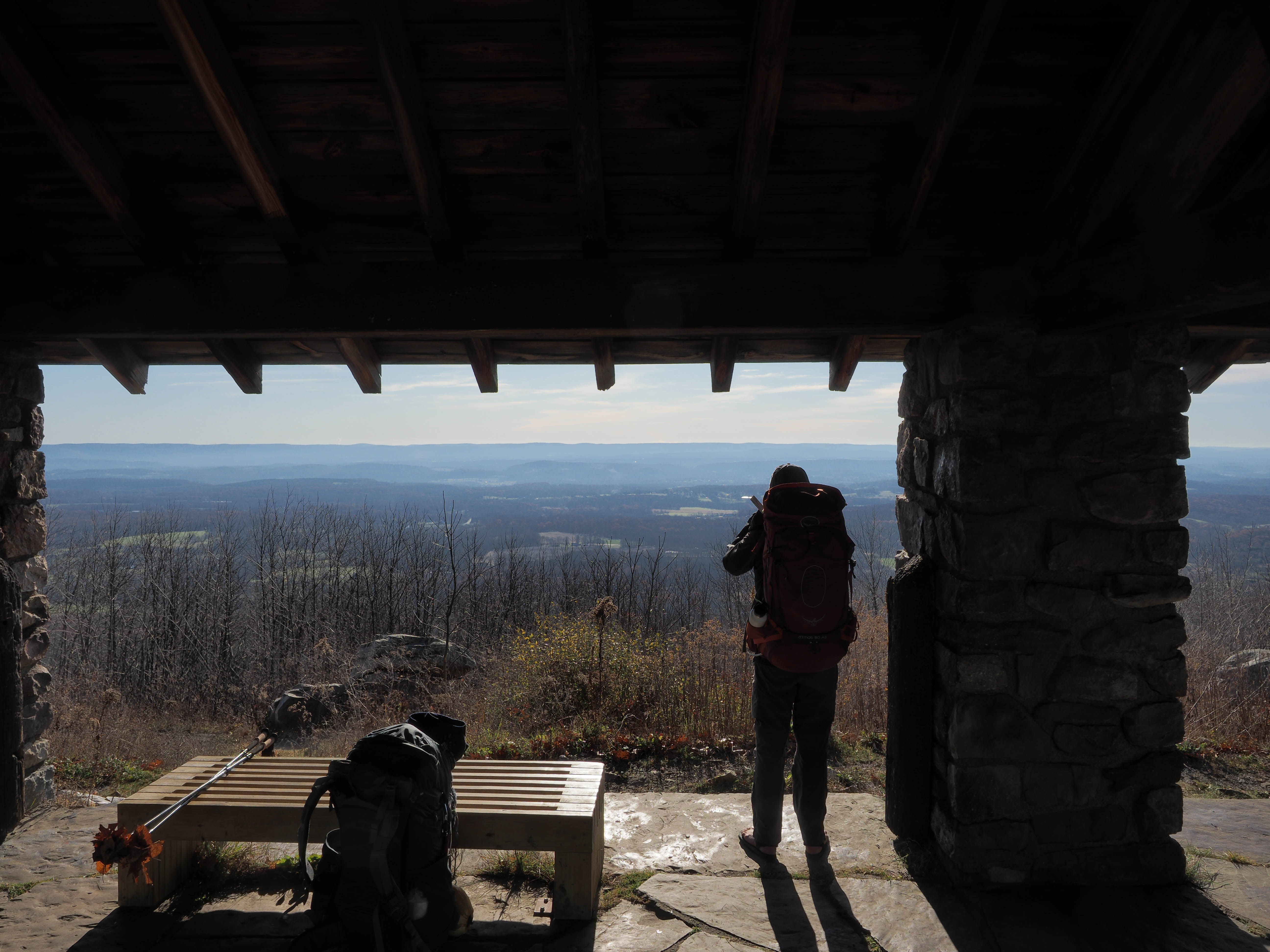
We reached the pavilion on Sunrise Mountain, long after sunrise and perhaps long after anyone who came up for the sunrise had retreated back to their warm cars. As one might expect, Sunrise Mountain offers a wide open expansive view of the East. On a really clear day the tops of the Manhattan skyline might be visible in some parts of the sky. There are ridges to the East to block most of the view, but that said, it is a spectacular view. We grabbed a few shots and continued on to Culver’s Gap a.k.a. Route 206, still about 2.5 miles away. Most of that is continued ridge walk, but at the end, the trail drops quickly down to the Sunrise Mountain access road, and then it’s a level walk out to 206. Before we got there we happened upon a large group of young people of Asian origins. Taiwan specifically, all Rutgers students, all out for a Saturday outing. We met the first group on the ridge just before the trail drops, and we chatted up the two at the back of the group who answered our questions, while we answered theirs. Afterwards we passed slower pairs who always asked “How far behind are we?”, until we were off the ridge and we came across the second wave, who must have been in different vehicles, and got separated. We told them they were about 30 minutes back of their friends and on we went.
Back to the tithings of the trail. Did I not mention those? I did describe how hard the trail was on the feet, and so, the trail exacts tithings of your feet for using the trail. At first, it isn’t much, but with every step taken, certain repeatable actions take shape. Those actions affect portions of your foot, for example in a boot, you need to figure out what parts of your foot need the most support. One support is to arrest any ability of your ankle to move independently inside the boot against the boot. That is a sure blister. However to arrest, then a tight lace is required, and even with your ankle arrested, an average hike is going to be 30,000-40,000 steps. Our goal today would have been 50-60k, so that creates tender spots. Another tender area is where the smaller toes compress into each other, and the slightest pointy toe-nail eventually rubs raw the skin of the toe it rubs against. Dropping down to Route 206 I could feel two of these tender spots: the inside of my left heel, and the two smaller toes, also on the left foot. The toes weren’t so bad, but I was getting anxious concerning the heel, and though I would rather have waited until we climbed back up onto the next ridge and found a nice sunny locale, I found a nice rock to sit on and did some foot maintenance just after we crossed Route 206. Btw, in 1996 when I did this section of the trail there was an operational bakery where the trail crossed 206, but unfortunately has been out of business for many many years. Mike and I enjoyed delicious fresh Jelly donuts in 1996, and this time Kal and I just tried not to get hit by a car.
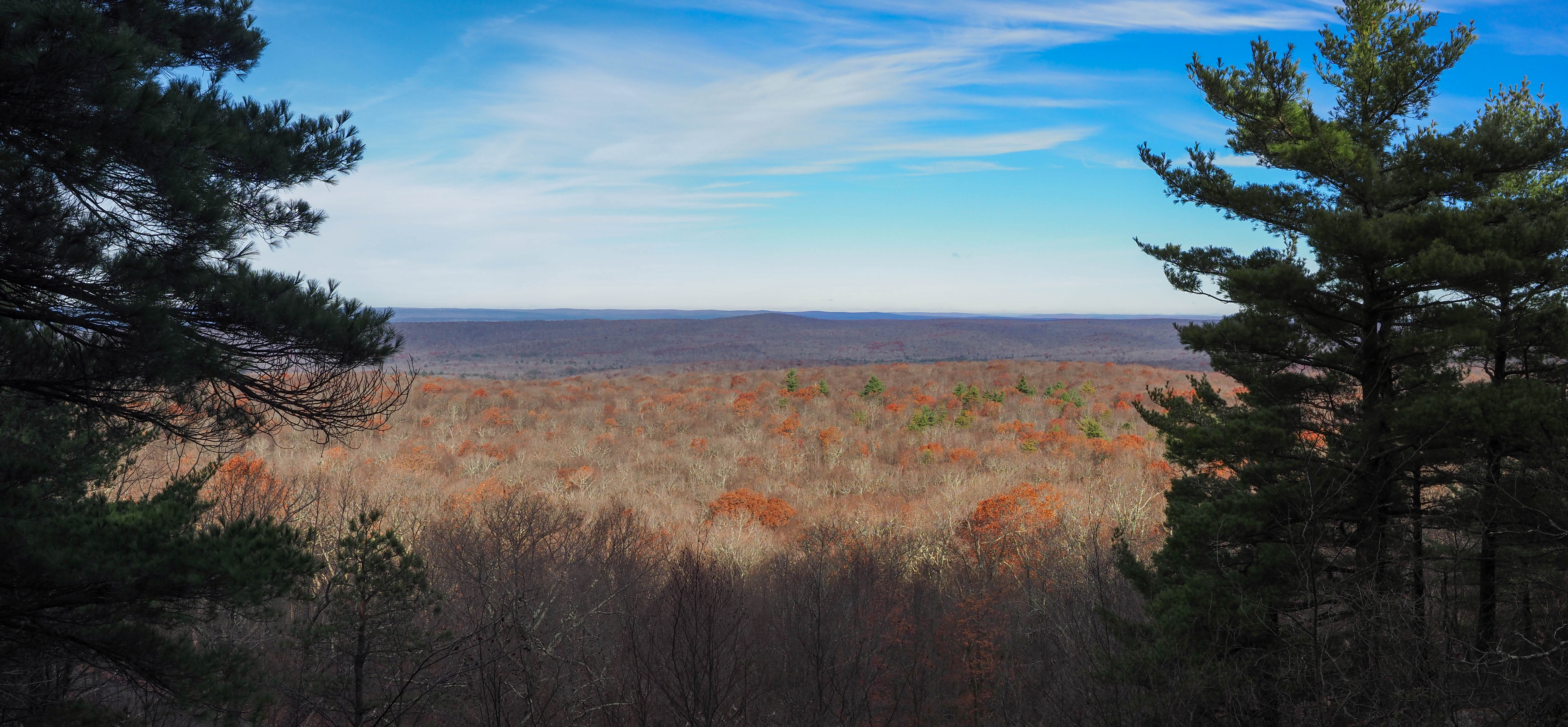
With my feet attended to we climbed to the ridge, to look out over the lakes of Culver’s Gap. Of course there was Culver Lake in our sights on the North side of 206, and now our eyes took in Lake Owassa on the South. There is a large open expanse of rock where the Sun shines brightly and would have been a warmer foot maintenance location. From here South the trail oscillated between open rock, and strewn rock and continued to be very hard on my feet. At one point I curled my toes together to see if that provided some relief, and to my surprise that instigated an acute burning sensation from my “ring-finger” toe, and that was not a good thing. I surmised that removing my boot may reveal blood, but I couldn’t go on further without addressing this issue quickly. Another delay to attend to my feet was taken, and fortunately when I pulled back the sock there wasn’t any blood, but the inside of the toe was pretty raw. I pulled out my first aid kit, and began looking through for the needed care. I took care of my previous issue with the simple application of duct tape, the medical wonder that solves many faults. I would need more this time and found what I needed in some cotton wrap. I cut a piece long enough to wrap around my pinky toe, and then around my ring toe and then I cut a piece of bandage tape to secure that. With my sock and boot reapplied, I took some sustenance in the form of mushroom jerky, and we proceeded.
I was already pretty sure that Catfish pond was not going to happen, so at that moment I was shooting for Crater Lake, however my legs were feeling every little increase in elevation. The spring that was in my step was long gone, and with tired legs I was making little errors here and there. Tired legs don’t walk on top of the rocks anymore, so I was walking between the rocks, and relying on my poles to catch any weight shifts that occur when a planted foot is not quite what the planting foot thought anticipated. That also takes its toll.
There is another tax on the brain created by GPS drift. Depending on the quality of your GPS device, you get drift. A smartphone uses both it’s GPS chip as well as the cell towers to pinpoint the location, however when you aren’t near the cell towers, low-signal means more battery, and so I usually set the phone in Air-Plane mode, thus denying the phone that error correction mechanism. This leads to GOS drift, where the accuracy of each reading is compromised, and so when you have a tool like Strava tracking, that drift tends to inflate the covered distance. The amount of inflation depends really on how long the phone is in Airplane Mode and how often you stand around in one location. So, with those two long stops to attend to my feet, the drift added at least 2 miles of coverage that we really didn’t cover. What does that mean? It means that when I pull out the phone and see what we have covered, Strava says something like 14 miles, and the brain says, “Well Crater lake is only 3-4 miles more”, but then you look at the map and you see that Crater Lake is 6 miles from Brinks Road, and you are still 1 mile from Brinks road, and then the brain says “Hmmm. You seem pretty tired. Can you even make Crater Lake?”
When we reached Brinks Road, that is exactly what I started to ask my self? Looking at the map we could see that between us and Crater was Blue, Bird, and Rattlesnake mountains. Granted that we are on a ridge, though at Brinks Road, we dropped a bit into that gap, my legs were saying to me they were almost done. It was 2PM, and we still had 6 miles to Crater where there was not a shelter, so it would be tent setup. That might be in the dark, and then we have to find a water source, which could very well be the lake. The other options was .2 miles down Brink Road was the Brink Road Shelter. We talked it over, and when Kal conceded that he too was tired, then it was settled. We hiked down and were the first to arrive. Brinks was not the Brinks that Chris, Jeffrey and I utilized in 1978. This was a new and improved Brinks, and it was very nice, however there was a big sign on the shelter that said “No Open Fires”, and so my heart sank because that meant unless someone else came along to break the rules, we weren’t going to be the rule breaker. We settled in, and found the water supply about .2 miles down a blue-blazed water trail. It was fresh out of the ground!
With water, we returned and got our stoves setup to make an early dinner. It was at this point we started to discuss our options now. We were still 25 miles from the car, so unless we knocked out 25 miles on Sunday, we would need to spend another night and hike out Monday morning. We could potentially finish at the AMC Mohican Center and get a ride to the car. All that could be decided the next day. On the plus side we didn’t utilize our Friday dinners so we could stay an extra night. In the meantime, we enjoyed the afternoon, chatting away, and each eating half an avocado that Kal brought. It turns out it was ripe enough to eat plain, and that is what we did. It was very tasty indeed. I pulled out some Bourbon I had packed in and we enjoyed a few “pulls”. With daylight fading we re-hydrated our dinners, and enjoyed them immensely: me my white navy bean and kale vegan stew; Kal his pork Pad Thai. With dinner done, we set about to get ready for bed. It was dark now, we didn’t have a fire, and there wasn’t anything else to do. We secured everything and turned in.
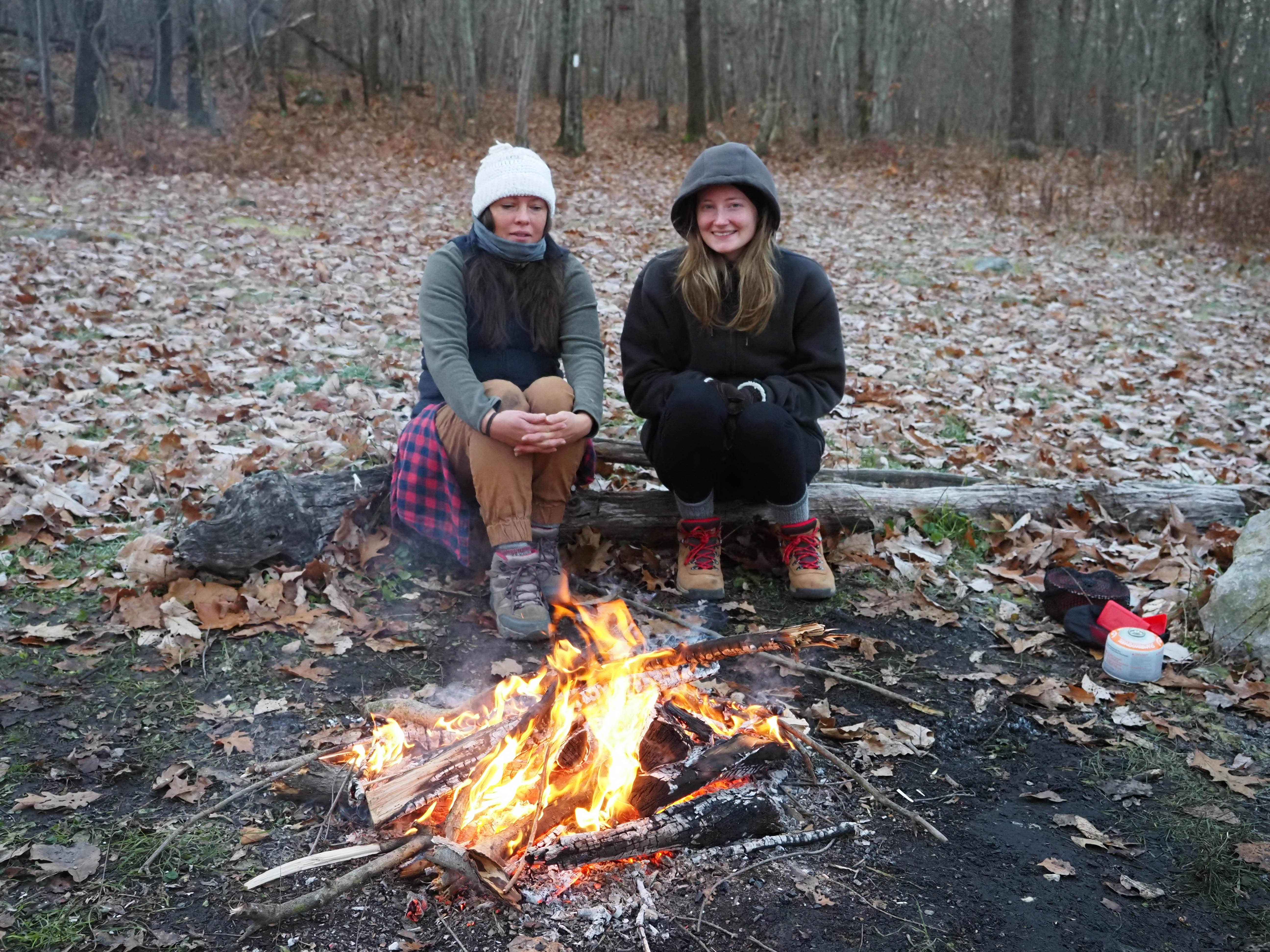
We were joined about an hour later by two dudes and a dog that had hiked in for the night from Culver’s Gap. The one dude set out his pad and bag, and the other set himself up between two trees using his hammock, and then they quickly set about getting a fire started. That is right. Rule breakers. As I was in bed already, the prospect of extracting myself from my cocoon just sit around the fire dimmed into non-existence. However, while they were warming themselves, another person came along, who in the morning I figured out was Bones, and so we were five at Brinks for the night.
Morning came and I was the first to stir and get up. Other than 4 extractions to take care of business, I had been in bed for 15 hours and I was ready to get moving. Besides we had a big day ahead. Kal arose and together we moved our shit out of the hut and down to the picnic table to pack up and leave the others in peace. We coffee’d again, and broke our fast on granola, and with business out of the way, we hit the trail, again with a spring in our step.
Blue, and Bird came and went very quickly and soon we were upon the rocky climb of Rattlesnake. At the top would be a fire tower, but along the way it would just be the rocks. Too cold for any Rattlesnakes to make an appearance as I am sure there is a very good reason the mountain bears that particular name. We found a couple of dudes at the fire tower. I wouldn’t say they were your typical hikers, but they were out for a walk, and we chatted them up a bit. They were interested that we had been camping out and indicated they would look into that. We continued, and before 2 and half hours had elapsed we arrived at Crater Lake. I don’t think we would have made it in that time frame the previous day, so I was not, and still am not sorry we called it early the day prior. On this day though we were moving along nicely. It wasn’t long after this that Bones caught us up, and passed us like we were standing still, his goal for the day being the AMC Mohican Center.
As it turned out, it wasn’t all that long before we saw Bones again. He stopped not too far up the trail to take his shoes off to give his feet a rest, and to be honest that is when I asked all my questions. Some of my queries came at the shelters, but here in the sun with a nice vista in front of us was an opportunity to quiz him some more. He confirmed Mohican as his destination, and we departed, sure that we would see him again.
I should not that as this day wore on, it was clear that something was moving in, however neither I nor Kal took the time to see what exactly was moving in. I was moving along pretty well, and was actually flirting with the idea that if we made it to Sunfish Pond, we could stop to eat dinner, don the headlamps, and maybe knock the rest of this out and be home before midnight. At that moment, I felt like this was possible. We were both feeling decent and we were knocking the miles out. It all really depending on the trail. We had a very nice section of fairly level, but extremely not-rocky terrain where we just cruised along. I knew from history that the section that hugs Sunfish is extremely rocky, but that was later.
Bones caught us again, and this time Kal set off in pursuit to see how long he could hold Bone’s pace. Me, I simply went into my long stride mode and was moving along fine until I failed to lift one of my feet enough to clear one of the rocks. At that moment, both of my were planted behind me and there was no time to move them ahead of me. Ahead of me at that moment was a trail full of rocks, and the upper part of my body was already moving faster than the lower part. I was in forward face-plant freefall. Until, that is, I reached to my left for a 4 inch tree which I tried to grab, without success, but then physics inserted itself into this equation as that action create a force which began to rotate my body along the head-to-toe access so that by the time I hit the ground, I was facing backwards and fell on my pack. The tree I grabbed ripped a bit of hand flesh, and I knocked both my elbow, and knee, but I was okay. More important, my face was ok. My elbow hurt like fucking hell, and my left hand was bleeding, but I was good. I reasoned myself out of stopping to care for my wounds, and walked on. I have to insert a correction hear. That whole scenario with Bones passing us, and my accident actually happened the first time he passed us. Because I got to the Orange Mohican Center trail before both Bones and Kal, and after Kal caught up, we were discussing our options when Bones arrived. As a through hiker, he didn’t want to take the side trail, so instead went ahead and would backtrack from where the AT crosses the access road to the center. I convinced Kal to continue that way as well with the hope that we could still reach Sunfish Pond.
After coming down off the ridge, we checked the time and to get to Sunfish Pond would take 2 hours, and there was only 1 hour of daylight left, so we decided that was it for the day, and walked the .3 to the Mohican Center, unsure whether we would get a tent site, or not. There was a sign on the office door indicating that the “manager” was over at the tent sites and would be back soon, so Kal and I entered the main hall, found two large sofas, dropped our packs, and gave ourselves freely to the comfort of the sofas. They felt very nice. We sat there for 30 minutes when the care taker/manager arrived and greeted us.
CT: “What can I do for you gents?”
Me: “I don’t suppose we could get a room?”
CT: “Are you Through Hikers?”
Me: “We are Through Hiking New Jersey.”
CT: “Well, then its 31.90 a night each”
Me: “That works for us!”
And so we avoided having to pitch our tents. Though the deli was closed, we ordered up two Mango smoothies, and each took a day-old brownie to munch. The Smoothie was quite tasty, but as with most smoothies, if you drink it too quickly you get that ice-pick-in-the-forehead pain. At least Kal did :). The CT was going to close the office for the night. He gave us our key and directions to the cabin, but before he left Kal got him to get a couple of towels for the showers. The showers were there in the main center, and you either needed your own towel, or you could get one for $3, but the dude just gave them to us. I, however was not interested in a shower. I probably should have, with my injuries, but I just wanted to get to the cabin, and unpack, so I left Kal and did just that. It was another .2 down the road past the boat launch to Catfish Pond, but was easy to find as we were the only cabin tenants, and Larch was the only cabin with the lights on. Easy Peasy!
Once inside I went to work on my injuries with a few alcohol swabs, and one butterfly bandage for my elbow, which was still bleeding. If you are wondering, the answer is “Yes!”, and both shirts had huge blood stains. Fortunately, the Band-Aid was enough to staunch the flow, and that was that. I left the cuts on my hand open, but clean. My knee was okay.
By the time Kal arrived I had boiled water, and eaten my dinner, and then Kal walked through the door soaking wet. It would seem that after his shower, he got a second shower walking to the cabin. What this told me was that our decision to NOT continue that night was a wise one and instead of hiking in the rain in the dark, we were cosy and warm with a bed to sleep in. Kal was wet, but he dried off quickly, as it was dry air in the room, and it was getting warmer due to the space heater that was running full blast. I checked it to see what it was set to, and that was 80F. Crikey! We didn’t need 80F, so I dropped the setting to 66F, and after Kal got himself settled in we talked for a bit, and then did lights out for the night. It was early still but not as early as the previous day.
Up at dawn and it was Monday, a workday for me, though it would take quite the effort to get to work! I was going to be a wee bit late. We were out of breakfasts, so I ate an energy bar, and finished off Kal’s brownie (Moister than mine was), while he cooked up his last dinner for breakfast. We left no trace, and returned the key at the desk and we were on our way again. Back on the trail we were climbing to the last ridge section, and when it came to rocks, this section did not disappoint. With the spring in our step we navigated the rocks just fine all morning. While it wasn’t raining, everything was still wet from the previous night’s drenching, and the clouds still hung low in the sky and depending on where you looked, they hung even lower on the various waterways.
Mount Tamminy was in our Southern view at every vista as was the Yards Creek Reservoir. From this angle on the trail, Tamminy doesn’t look right. When you drive through the Gap it always seems like it extends to the South, but here we are espying it as an Eastern extension. That is what it looks like at least. The AT swings to the West of that and then descends to the Gap with Tamminy on its left. First, however we had to get to Sunfish Pond. The question I wasn’t ready to answer was this. Take the AT on the pond’s Western edge, or the longer way around to the East. It was longer, but may actually be shorter. The problem with a tough section of trail is that you just don’t remember how bad it really is until you are well into it again, and that was the mistake we made this time as well. Once you get 100 meters in, the thought of backtracking what you just suffered through is outweighed by the commitment to just get it out of the way. Fortunately for all the rocks, it is a beautiful section of the trail. The pond is a real landmark. I think you could actually drive up to it in the 60’s, and plenty of hippies did until the area was added to the national register and made into a National Treasure after the planned dam project was shelved forever.
There must have been either an insect infestation, or a fire, as there were a lot of dead trees and cleared areas up there and most of the early part of the descent. We were in the last segment now, and though it wasn’t all downhill, it was generally downhill. Yes, there were still plenty of rocks. After passing each of the designated backpacking camp sites for the Worthington State Forest section, we were by ourselves this Monday morning. With the weekend past, it was unlikely we would see anyone, but to our surprise we passed a couple going the other way. The male, a young big male, was very much in the obese range and was sweating up a storm trying to keep up with the much skinnier Woo man, who must have said something along the lines of “Dude! If this is going to work, you are going to have to lose some fucking weight. I know this easy peasy trail in New Jersey …” and here they were.
Before long the cascades of Dunnfield Creek could be heard, and as mentioned earlier, we were now on the other side of the Mount Tamminy ridge, so it was now to our left, and we could just spot the “easier” access to Tamminy coming down that ridge. The hard way to the top of Tamminy is a ball-buster steep ascent right out of the parking lot which feels like (at least it felt that way 40 years ago, the last time I climbed it) you are constantly going to fall backwards if you aren’t careful. However, the views are incredible. I might need to hike that once again.
The car was just where we had left it, and after a very lame attempt my Kal to imply that I had the keys, we threw our shit in and took off in search of food. We were both pretty hungry and it was lunch time. It took almost 4 hours to cover the 10 miles out and it was just after noon. I would have taken anything at that point, and though there was a Truck Stop of America diner a couple of miles East on 80, we set our sights on the Chester Diner on 206. In Chester of course. As we were approaching the 206 exit, I noticed a place called “The Asian Diner” one exit further along, and after consulting their menu we called an audible and headed there. It was part of a “Quality Inn” franchise on Route 46, and it was open. On a Monday! I think that is what “Diner” implies. A diner with a beer menu as well! Score! Sated, we hit the road and after a lot of traffic again, Kal dropped me off at Shawn’s Auto Center in Red Bank where I was re-united with my Audi S4 and my not-so-new-but-working-better-than-the-one-I-had Texas transmission. Once I got home, I cleaned up quickly and got to work. It was a workday after all!


“The next morning I was awakened by the Jehovah’s Witnesses (funny, they didn’t tell me ((white guy)), but they asked Kal if he had found Jesus when they were alone with him. I don’t know why they didn’t ask me… Anyway, they started a fire, which of course, was not permitted in/on State Forest land AND it was clearly signed on the shelter, but if you are a dedicated disciple of Jesus, what the fuck.” – Big Bird
LMAO!!! Oh.My.Fucking.Goodness, too funny!!!
Since I am most familiar with closer to west coast/western U.S. wilderness areas, and this post helped give me a peak into what things are like in your neck of the woods. Thank you!
Glad you’re working on your Colorado post and still planning on sharing.
Wishing you many more blessed adventures! – MM
[…] backpacking trip and I still haven’t purchased any powdered hummus yet. In addition, I finished 4 days on the AT a couple of weekends ago, and I forgot about the hummus for that as […]
[…] get another weekend trip into the woods when I answered a call to arms from my friend Kal, and we hiked a long section of the AT in New Jersey. I did kind of hint that anyone that wanted to join in this was welcome, but […]