
High Uintas Wilderness – Day 2 – Even after a change in plans, a change in plans
October 15, 2014 § Leave a comment
I didn’t start taking pictures until we were really ready to leave, so it simply appears like someone took care of all the morning chores in camp and all we had to do was lift our packs and go. Of course, that isn’t really how it works.
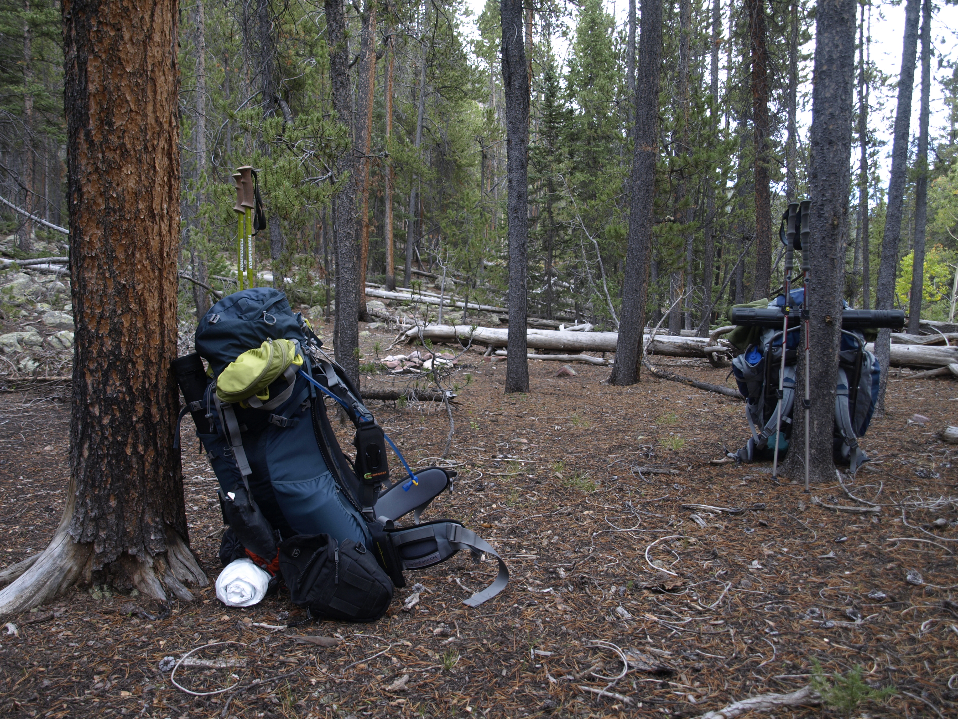
The camp is clean and the packs are packed. Larry and I were the first into camp, and the last to leave.
Waking up on a backpacking trip usually happens multiple times throughout the night. “Crap, I have to take a pee! Shit! It’s still night, I wonder what time it is. Can I hold it? No! Shit got to get up!”. This repeats many times throughout the night, so that by morning when the dim light of dawn is filtering into your sleeping area you realize that you were up what seemed like half the night, and you simply want to pull the sleeping bag up over your eyes, but then you also realize that until anyone gets up, no one gets up, so I usually try to be the first to get up and move around to make a little noise and let the others know that morning has arrived.

Andy is ready for a full day ahead.
For most of us, as the number of days increased, our individual need to find the cat-hole trowel and scamper off to the call-of-nature converged on the moment that you decided to get out of bed. Getting out of bed really means, extracting your upper body from your warm and comfortable sleeping bag, sitting up enough to aid the process of putting some clothes back on, affixing proper camp footwear (Crocs for me!), and then emerging from your shelter. Every morning except one, we all emerged into a cloudless light blue sky, where the sun, though above the absolute horizon way in the East, was no where near our local horizon. So it was usually cold. This morning wasn’t as cold as our previous trail head morning, though we were technically higher in elevation, but it was cold enough to require putting all your layers back on.

We are still very much in the trees, and expect to be most of the day.
Depending on your queue location for the toilet trowel, you usually would consider starting to pack up your big items, but that really depends on what kind of night it was. Some nights the dew point left remnants of moisture embedded in your sleeping bag, and all over your tent and rain fly, so perhaps it is prudent to wait for the sun to clear the eastern ridge and get your items to dry a little bit. Usually we can get the fire going a little bit but it isn’t enough to dry big things. It isn’t necessary to have a big fire like in the previous evening, but something to warm the hands and give your core an added warmth boost. Also it needs to be small enough that it is easy to ensure that we put it out completely. It turns out we did not rekindle the fire this morning, so we didn’t have to do anything with the fire ring when we left. If we had to put the fire out, we would have doused it heavily with water, and then once doused, we would have stuck a good sized branch, fat end down, into the middle of the fire ring. This is our insurance policy, so that if there were a fire in the area, afterwards when they search for the source and find our fire ring, they will know when they pull the stick out that our ring was not the source.
One of our little rests seemed like an opportunity to get higher than my friends.
Hot water is needed for breakfast and coffee, so someone fills the two pots, and ignite the two stoves to get that process moving forward. Almost everyone is looking first for their cup of coffee. We carry freeze-dried coffee on these trips, and we have a mixture of Starbucks Via (The best in my opinion), Organic Coffee that doesn’t look too different than the old tasters choice our parents used to keep around before they figured out what real coffee was, and some shit my brother-in-law brought along that he loved to drink. Keep in mind, that not too long after the first couple of sips of coffee, you might need to re-insert yourself into the toilet trowel queue.

Decent HDR shot of Yellowstone Creek.
Breakfast has always and forever been oatmeal-based on any trip into the woods. Okay, sure Jeff (Larry’s brother in law) would bring eggs and hard boil them, but that is an exception! We used to simply bring Quaker Oats instant oatmeal packets. Apples and Cinnamon, Maple and Brown Sugar etc, but now we usually buy bulk and simply lay out ingredients. Those ingredients are:
- Quick Oats (Not regular rolled oats, we just need hot water)
- Granola to add some crunchy texture
- Craisins to add some fruity taste
- Brown Sugar for the sweet tooth
- Candied Pecans because I love candied pecans.
- Dried Milk because some people like a creamy milky taste to their oatmeal
- Any other dried fruit that gets brought along. In our case this time that was nothing else.
We don’t want anything that has to be cooked, hence the quick oats. Hot water is the only need.
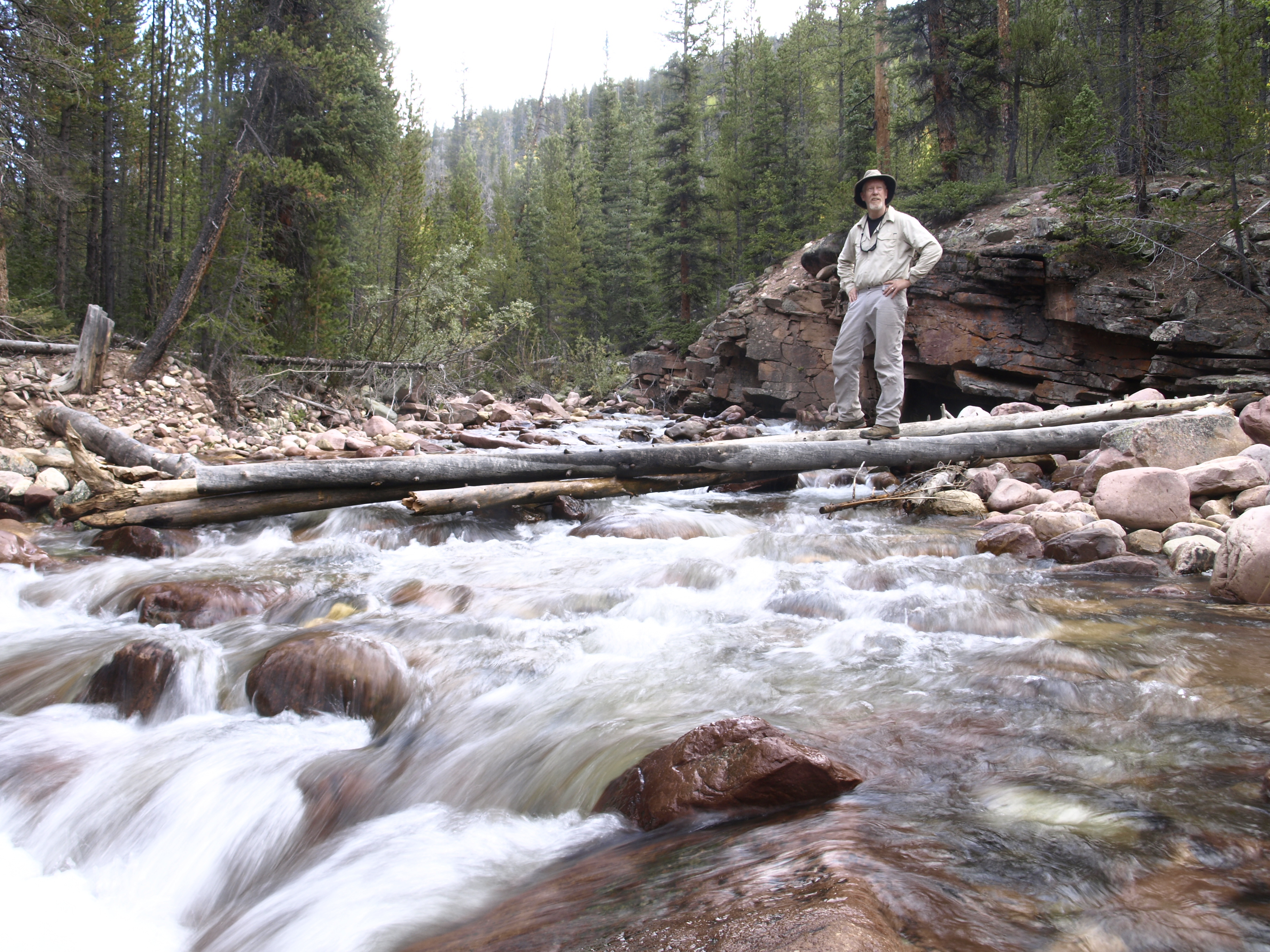
If we had chosen to hike into Garfield Creek Basin, this would have been the crossing point.
Mix all that together in your cup or bowl, and add hot water to a level just below the surface and stir. If you have patience, you can let it set awhile to thicken up and allow the quick oats to get to their desired starchiness, but you do have to remember that we are camping at almost 11,000 feet where the water boils at 192F, which is 20F cooler than at sea-level, so you don’t really have too much time to wait before the product really starts to cool off, and who really likes eating cold oatmeal?
If you are lucky, your coffee hasn’t been completely consumed, and is still warm at the very least, and you can enjoy a nice meal, sitting by a small fire, with your ass comfortably ensconced in your camp chair, engaged in the typical “What will today be like?” conversation.
Larry and I spent a lot of time hiking together.
When that is over, clean-up is easy. A 1/4 cup of hot water added to your bowl/cup is enough to allow you to dissolve any starch clinging to the sides, and your finger always works well as a scrubbing device. Once the sides are all clear, we come to the point where a decision has to be made. Personally, I simply raise the bowl to my lips and drink. It is after all, simply hot water, and oatmeal residue, and I can always use the hydration. Also, keeping a camp clean means, leaving little for the rodents to find. If there aren’t any rodents, then there aren’t any snakes. This time of year, we might have been past the snake threat, but really it is all connected, and we need to do our part to keep the area safe for others. The other option is to simply dump the waste into the fire or walk down to the creek and rinse your bowl out there.
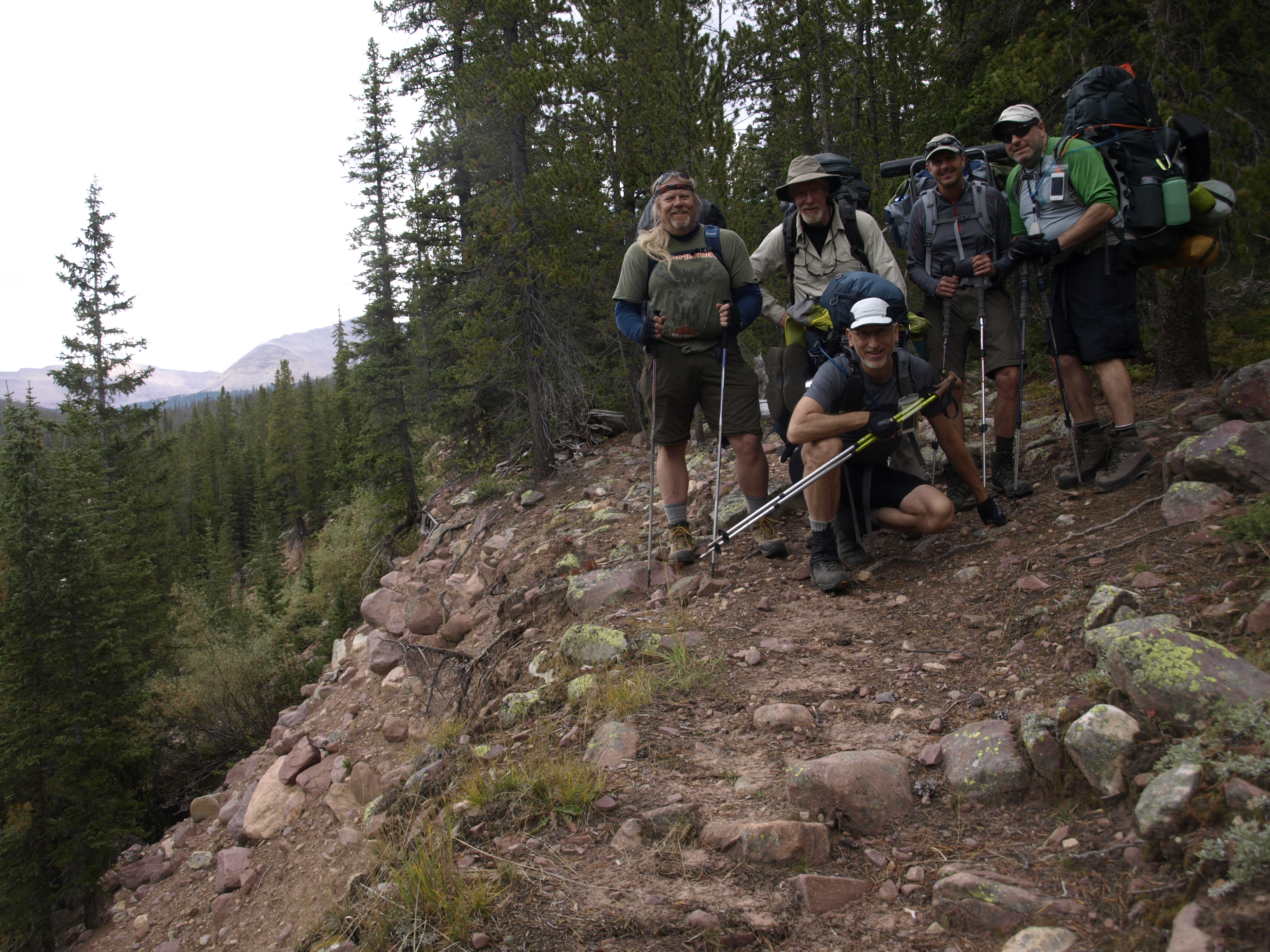
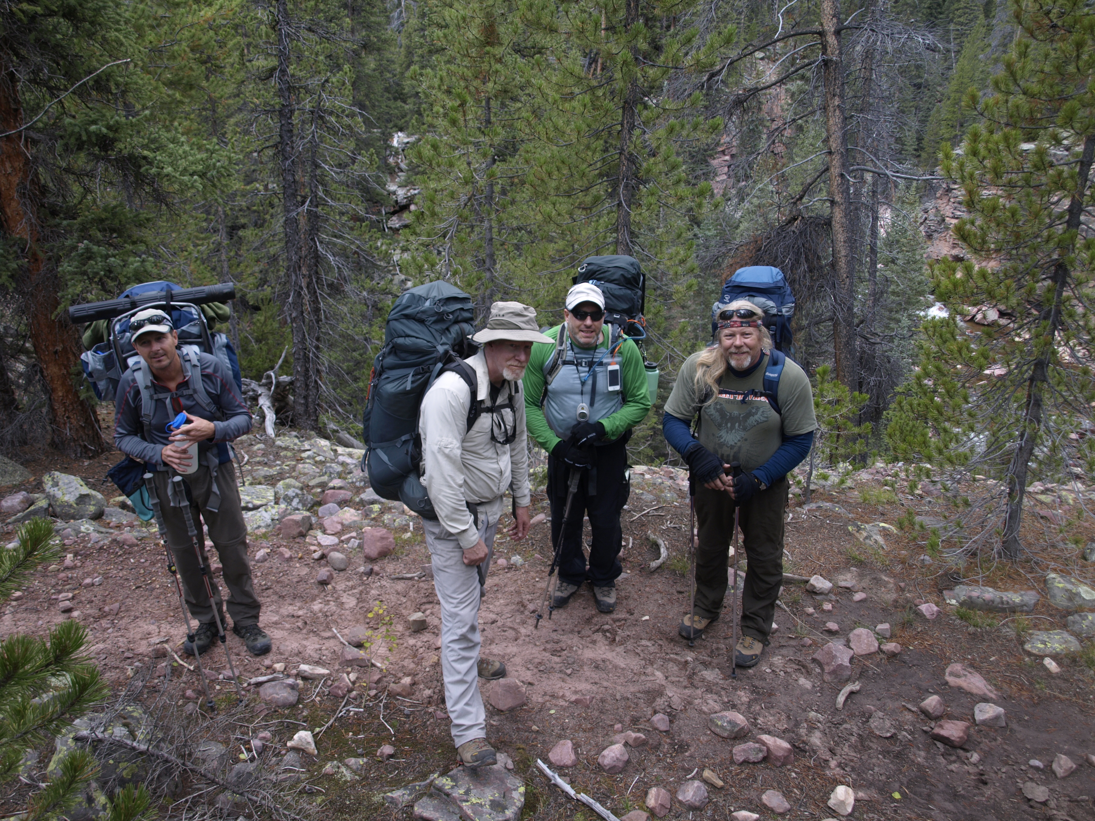
Group picture. Unfortunately the sky is over-exposed. It would seem the operation for bracketed multi-frame shots conflicts with the operation for timer-based or remote-based firing of the shot.
With breakfast consumed, the sun is likely nearing an appearance point above the eastern ridge, and activity commences to get camp completely broken down and our backpacks re-packed. If the sun is needed, we move those things into the sun to dry out, and we start to get everything else together. We could always simply pack up damp, and dry out later when we make our next camp, but that little bit of moisture can add weight to your day, so 15 minutes of dry time can make a difference.

Crossing Milk Creek is a dry operation, assuming you don’t slip off a rock into the water.
Packing up means breaking down your camp furniture (chair) into its stuff sack; deflating your Therma-rest air pad, rolling it up and stuffing it into its stuff sack; Returning your dry sleeping back to its stuff sack; Adorning yourself in your desired attire for the day and returning all the other clothing to your clothing compressible stuff sack; Gathering your food items into their stuff sack; Returning your pack cover to its stuff sack. Pack the cook pots in their stuff sack; Pack anything else that has a stuff sack into its stuff sack.
At this point you have everything stuffed, and ready to pack into the backpack. It is always best to have the heavy stuff higher and closer to your back so that it is easier to lean forward. You don’t really want it low where it can easily cause you to lean backwards, lose your balance, and fall. So I pack my empty dromedary bag first, then a layer of my cook set, my two fuel canisters and anything else I can stuff into that layer. Atop that I lay my clothing sack lengthwise and rain shell stuff sack, and then I add food, and any stuff sacks I can fit into the bag. On the outside, I attach my rolled up tarp, and anything else in a stuff sack, as well as my Crocs, my sierra cup, my rolled up food line, and my camera case. For me personally, I attach my camera to my front right shoulder pad and affix the safety line, and assuming I took the time to put my hiking boots on (That would have allowed me to attach my Crocs to the outside of the pack), I am ready to go.

Crossing Yellowstone however is a wet one. Remove your boots and socks; tie the boots together; hang them around your neck and cross the creek. If you have crocs or some other water proof alternative camp shoe then having that one your feet makes the crossing a lot safer.
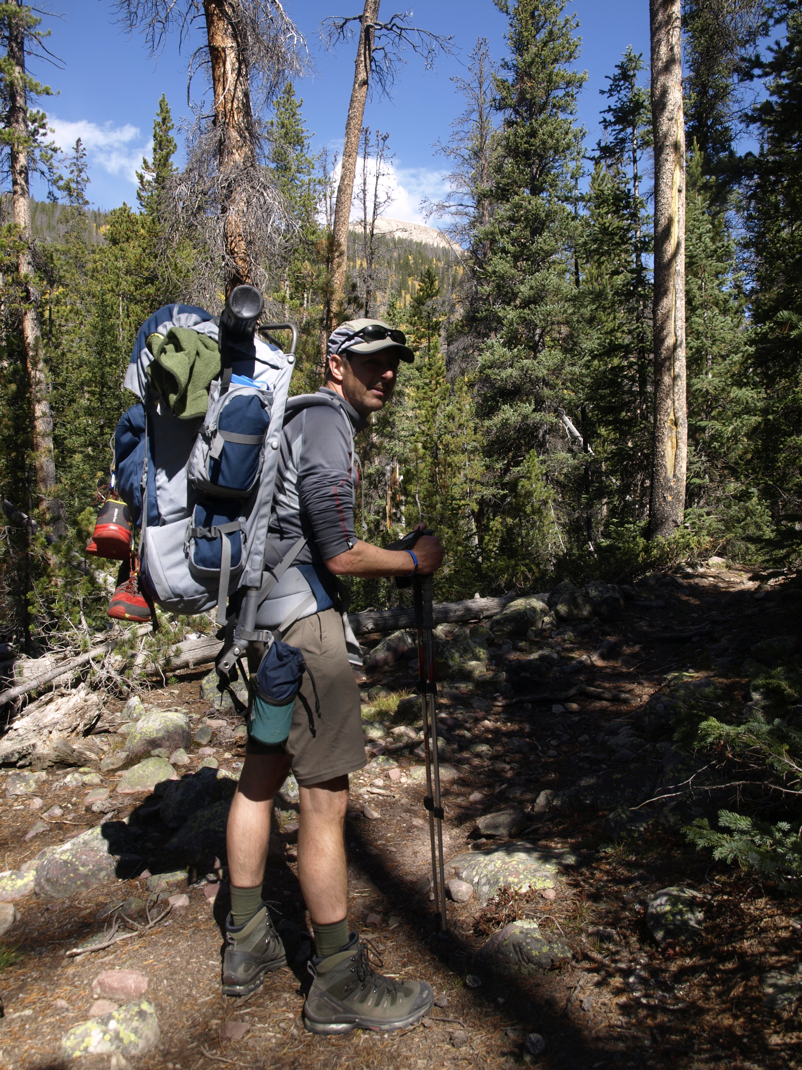
It’s the second day of our journey. It is right to say that everyone is feeling the effects of the previous day, as well as the altitude. Andy seemed to suffer more than the rest of us, so we decided to lighten his load a little by giving him the active fuel canisters, and I took all the beer concentrate he was carrying.
We hadn’t decided yet, though we were reasonably sure, that our track for the day would not be the original track first planned for day 2. The destination was Tungsten Lake, an above the tree line lake just on the west side of Tungsten Pass. There were two ways to get there: the original plan which would take us up Garfield Creek and into Garfield Basin, or we could simply continue up the Yellowstone and hang a left onto the Highline Trail and hike over Tungsten pass to the Lake. The end elevation was the same, however, the Garfield Creek ascent looked to be pretty steep. That assessment was based on how closely the grade lines appeared to be on each of the maps we looked at. Tungsten Pass was not that high above the surrounding basin on both sides.

On the other side, dry your feet off, put your socks and boots back on and resume.
Once you add the contingency element, it was pretty clear which way we would go. The contingency element is this: we failed to make our original destination the previous day. Since we definitely want to be in a position to hike Kings the next day, if we failed to make our destination then choosing the Yellowstone route leaves us in a place from which we could launch our day hike, and it would leave us with an easier next day that would bring us back down the Yellowstone to the Bluebell Pass junction.

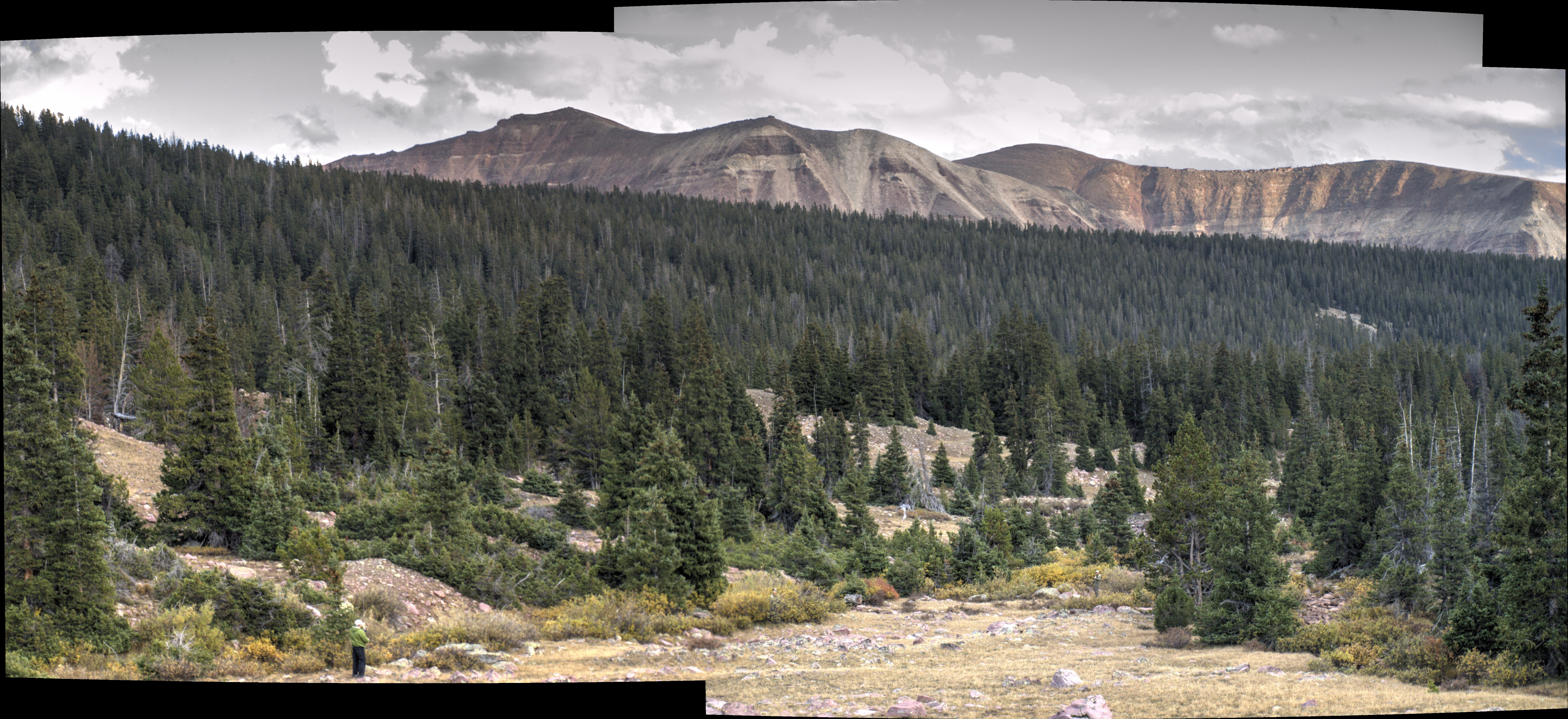
I first shot this pan shot exposed for the sky.
We didn’t have to make a firm decision until we reached the trail junction, so we put it off until then. We didn’t really have all that much time to mull this over, as technically we were a mile or less from this decision point, and it didn’t take us all that long to get there. The anti-climatic conclusion we reached was to continue up the Yellowstone and we will see where we are when we are ready to end the day. Already thought is being placed into a new plan.
It should be noted at this point that the entire first day was traveled without contact with anyone else. No one on their way out, and no one overtaking us. We seemed to be it. It wasn’t long after passing the Garfield Creek junction before we crossed paths with Ranger John who was on his way out from an 8 day session in the back country. His work schedule is 8 days on, and 6 days off. We chatted him up, exchanged our details, heeded his advice and asked him what lay ahead. John informed us that we would probably cross paths with a horse group soon, and that we had one or two stream crossings ahead. Crossings that can be accomplished without removing boots aren’t mentioned, so this meant we had at least two crossings to do in our bare feet. News to us though upon the reflection of a closer examination of the map, we really should not have been surprised by this information ;).

Making progress and the light getting much better on the day.
We did encounter the horse folks before we made it to the next trail junction. Walt may have been in the lead and called back to us that horses were approaching, and we all made our way off the trail to give the horses the full path. Turns out it was three men on 4 horses, one being a pack horse and the other three bearing their human burdens. We chatted a bit, but we didn’t chat long. Whether they were hunters, or a guide and two people being guided, we didn’t find out. One guy did have a rifle in a saddle holster but it didn’t look like a hunting rifle. It looked like a “If we need something, we have this rifle” kind of rifle. We parted ways exchanging supportive travel wishes to each other and we continued. We didn’t see anyone else until Anderson Pass the next day.
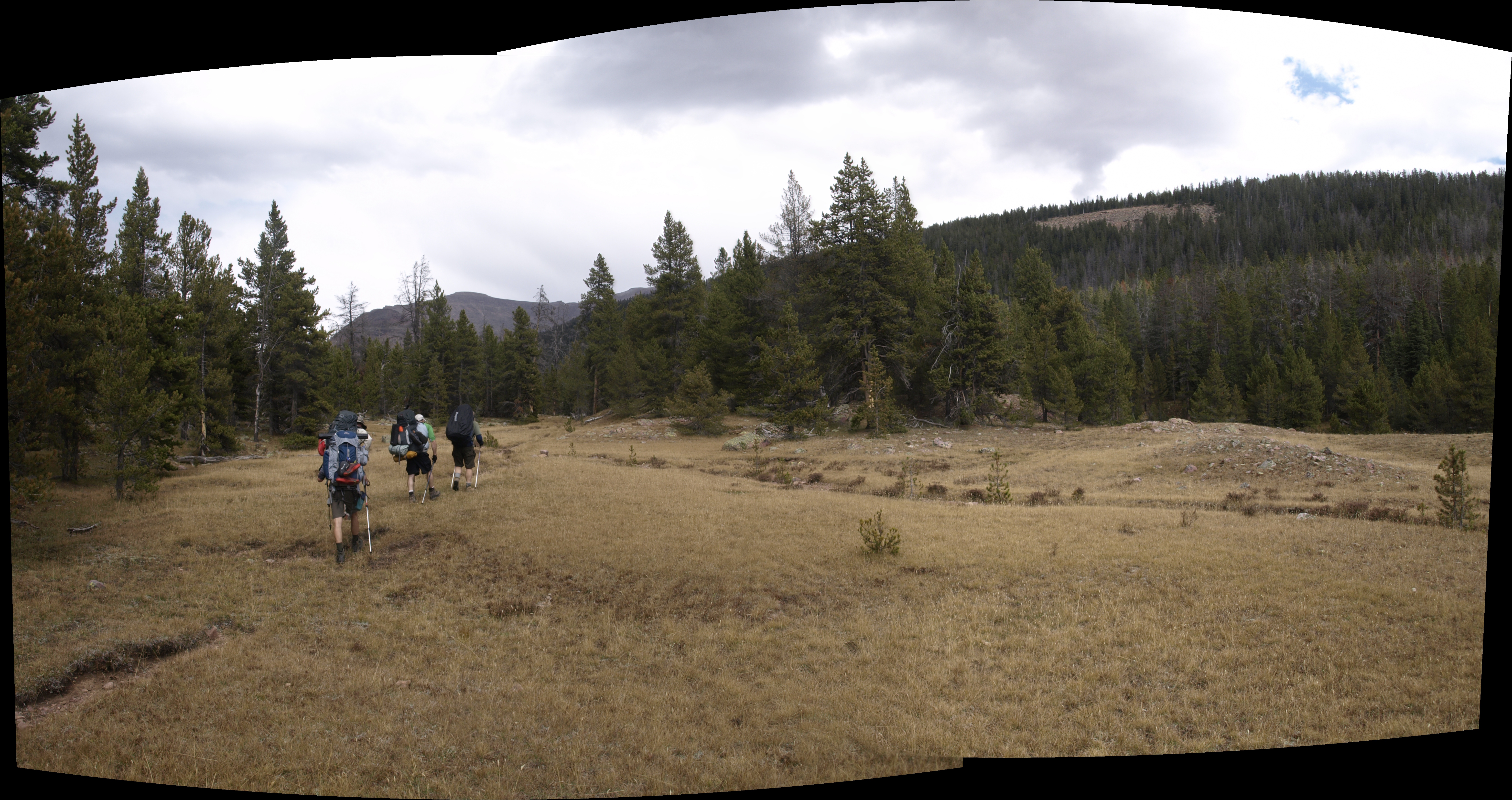
The terrain is starting to open up a lot.
Hydration is key to this activity, but you do need to stop for food at some point. I am not sure of the physiological requirements, but I think it is safe to say, that we would not consume enough calories to supplement the ones we were burning, yet we don’t stop often to eat or even snack. So when the emptiness in your stomach makes itself apparent, you start to fixate on finding a decent place to take off the packs and relax for 15 minutes. We achieved the next trail junction, and the map said Milk Creek would be joining the Yellowstone soon, so we marched on to this intersection to utilize the expected open space serene environment for our lunchtime nourishment.
More on lunch in another write up, however there are still two subjects to cover in this story: The stream crossings, and finding a camp.

Walt demonstrating that the end of the day is near and desired.
We had dined on the south side of Milk Creek, the drainage from that portion of the basin that we would tackle in another two days, and it appeared to split into two main channels, neither of which seemed to have dry crossing options. Dry crossing options are logs across the creek, or dry rocks protruding at just the right locations across the creek. This first branch doesn’t appear to support a dry crossing, but it also doesn’t seem like we need to remove our boots. We all are wearing Goretex lined boots, so unless the water goes up and over the edge of our boots we should stay dry when we purposely place our boot into the water. In addition there are rocks that lie just beneath the surface of the water. So nearly exposed that you seem certain to gain good purchase upon it, yet, slick as grease most of them are. So, I build the suspense, but really it is simply trial and error before someone finds a clean way across and then we all file through, however it should be noted that there is a difference in the stride length of all parties involved, and an experience level as well. If you have crossed a lot of streams you become acquainted with the process of choosing a line and maintaining your balance by straddling the creek on two rocks. You don’t hold up and try to keep both feet on one rock, unless that rock is big enough and stable. Also you pay attention to where others place their feet, and if they didn’t fuck up, then put your feet there as well. The gist of this dialog will be captured in the text for a new reality TV show: “Crossing streams with Andy“.

An HDR panorama in the area of our camp site. Larry and Andy fishing the creek.
We also had to cross Yellowstone, and that was much wider and there were no dry crossing options. The way across was to remove the backpacking boots. Most of us had camp Crocs, and they are plastic, and have holes in them, and they have a little ankle strap, and they are perfect for crossing streams. Walt had flip flops, and Larry had light weight sneakers, so bare feet was their only option. Procedure is to drop your pack, remove your boots and socks, tie the laces together, affix alternate footwear if you have it, re-hoist your pack on your back, hang your boots around your neck, grab your poles, and cross the stream. Once you have decided to wet your feet, it is not advised to walk on top of rocks until the last moment, rather, simply immerse yourself in the experience and cross. With Crocs on you need to angle your feet upstream, so as not to create a situation where the flow of water wants to rip the shoes from your feet when that foot is not resting on the creek bed. Follow these steps and a safe crossing is virtually guaranteed. There were no incidents.
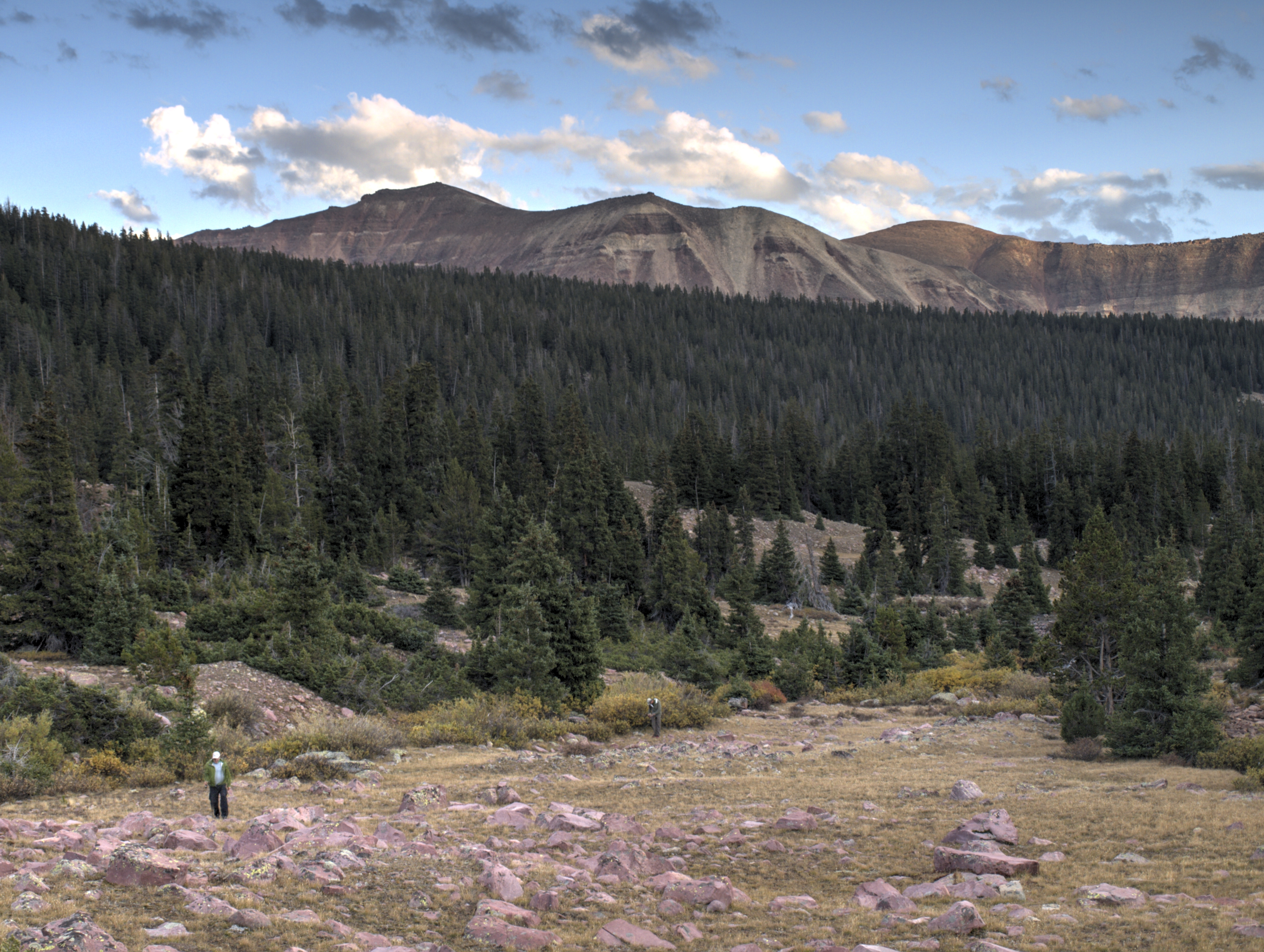
I processed this pan shot for some sky detail. That was not the color of the sky. I should just turn this one into a Monochrome image.
As with the previous day, as the day worked its way into mid to late afternoon people started to think about the next camp site. Tungsten Lake was out, and now we were heading for a side creek crossing coming in from the W, after which the trail bears NW and moves away from the Yellowstone. The map showed flatter ground, and perhaps we could find an existing fire ring. So onwards we pushed.
A fine afternoon in the High Uintas.
The qualities of a leader. Recognize that the people looking to you can always be pushed a little further, but that there is a limit to just how far they will go. That became apparent when we started to see places along the trail as it opened up, that could be camp-able, but as a leader, we weren’t at the point where I felt we needed to be. With a look at the map, and locating myself on my iPhone map app, I can pick the point to take Larry and scout ahead. We left the others, and traveled about half a mile to the stream crossing where even Larry resisted crossing, as he felt there was a decent spot behind us. I pushed on across the creek where the terrain immediately opened up. I didn’t really want open, because really you want some place where you can get a little wind protection. That was when I spotted an area between two mounds that each supported a copse of trees. Add to that the space between the mounds converged like the interior of the letter V, and at the crux of the V were two rocks and charcoals. Bingo! Fire Ring. That was our spot for the next two days.

Leave a comment